TR Replies
Nice! maximusj and I did it in two days, the other way, July 1-2 2017. Did you end up with good skiing going N-S? S-N lets you ski 5 fall-line "runs", but has the obvious disadvantages of a low, shwhacky start and having more sun on the ascent than the descent.
We also stayed at White Rock Lakes and it was very windy!
We also stayed at White Rock Lakes and it was very windy!
Yep, that makes sense now!
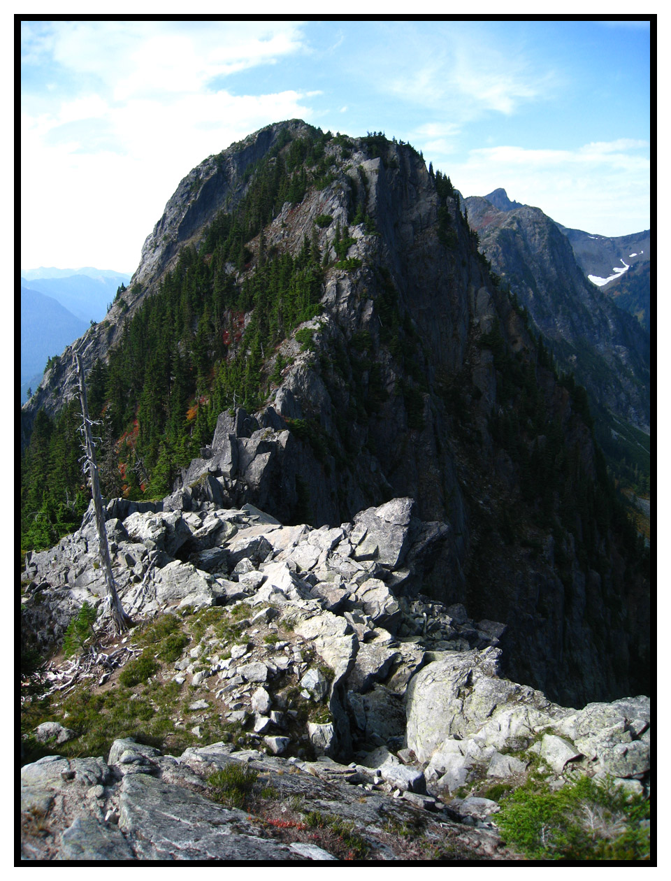
Sauk's a cool zone that doesn't seem to get much traffic, despite its good access.
Thanks for the TR!
Sauk's a cool zone that doesn't seem to get much traffic, despite its good access.
Thanks for the TR!
Run down to Annette is getting thin in sections but would gamble it has another 2 weeks -maybe more if weather stays cool
I thought with all this sunny warm weather the Silver window was likely opening up. How long do you think the descent down to Lake Annette will hold. That is such a great steep descent! Maybe with more normal temps returning this week, it will hold snow til next week when I can get it!
Thanks for the report. I'm not going this year. I've busted my butt too many times dragging heavy gear up a nasty trail, to a nastier bolder field - for maybe one run on hard snow...Skinnable snow, and probably youth required...
Zap, thanks for the report, we were in the area the day before fishing season, and they had just finished opening the road, twenty foot drifts along the road! We were just checking out the country on our way to Twin Lakes. It looked like no end of any kind of skiing you wanted.
and who should I run into but Jake the Brit!
If this ever happens again, immediately turn right around and make other plans.
If this ever happens again, immediately turn right around and make other plans.
Thanks for the trail update too. Super helpful.
I only skiied the main face (i guess it's a face?) on the west side of the saddle. I did not go directly up from the road, I took the trail for roughly ten minutes from the trailhead, to the far side of the face, and then went straight up to the saddle. Basically cut the switchbacks on snow. I was able to ski from the saddle to roughly the same elevation as the lowest point of the trail. There were more dirty snow fingers that continued on a bit past that elevation, but it was all pretty sl...
Nice to see you in the right spots as always!
Well that was an adventure! I always “think†about bringing a chainsaw...
Nice work!
To confirm I understood correctly, you only skied the main face you climbed up from the road? How far down was the snow continuous, and did you ascend directly from the road up the avy chutes and skip the trail entirely? I've only been back there in the winter so just wondering how much 'shwacking is involved with less snow.
To confirm I understood correctly, you only skied the main face you climbed up from the road? How far down was the snow continuous, and did you ascend directly from the road up the avy chutes and skip the trail entirely? I've only been back there in the winter so just wondering how much 'shwacking is involved with less snow.
Excellent video and looks like a great day. Only thing I could have asked for would have been a little bit shorter shorts. Loved the 'Murican flag fanny pack. Please let me know where I can get one myself.
Some ski pics from Noah. Close to 4,000' of unreal skiing, spiraling clockwise from E through S, before putting the skins back on. Too fun!! :)


Great energy guys and funny vid. Keep em coming
that's rare area to be going. Great to see!
Great directing. You captured the emotion of joy! Very very good job on making that video!
As of Cinco it was great. Might require a more agile step now with the warm weather. Lower right entrance is "platformesque", so should be room to take a step and get back in the game.
Help us groom it and keep it awesome.
Cinco midday Nash was one of the best Nash runs of the season, truth be told. Hoping for a partial lap with kid on back today, we'll see. Go get it.
Help us groom it and keep it awesome.
Cinco midday Nash was one of the best Nash runs of the season, truth be told. Hoping for a partial lap with kid on back today, we'll see. Go get it.
Anyone know if the route from the top into upper international still goes (without any rock band to jump)
I wish I had a good answer. I don't think the summer trail will be in. Boston Basin approach may be in if you don't mind fighting your way up that trail. I think both the ramps on the direct should hold snow. If you can drive to the parking lot you would know soon enough.
Good to see persistence paying off.
Aesthetic line, beautiful area.
Aesthetic line, beautiful area.
Thank you for the report; nice effort! So if the direct route isn't an option after this coming warm weekend, any idea whether the summer trail is hikable (around the cliffs)?
Points for a good try and overall sufferfest quotient.
Yes! I scoped that out one fall! glad to know how it works. Thanks for sharing!
Excellent day, strong effort. In 2009 Snowbell and I camped 2 nights at the Eldorado saddle and Summited Dean's Spire, Austera, Primus, and Eldo. Alpine amazing-ness!
author=Snowboy1811 link=topic=41904.msg165029#msg165029 date=1557349503]
Wonderful pictures. Has me dreaming of hitting Eldo later this month
I wouldn't wait long. It's pretty good coverage at the moment. A nice transition from dry hiking to skinning at the end of boulder field #1. Schmoo abounds.
Wonderful pictures. Has me dreaming of hitting Eldo later this month
author=Jason4 link=topic=41904.msg165001#msg165001 date=1557157289]
We followed your tracks from Sharkfin Col to Moraine Lake. I figured we were a couple of days behind you based on the condition of the tracks. It made for easier route finding. Way to push it into the Isolation Traverse as well!
Thanks! Glad our tracks were useful.
Adding some more photos:
4. Moraine Lake bivy
5. Skiing the NE Face of Eldorado...
Nice. But that would be Conga Line
Thanks for the report! I've been wondering about the snowline on a couple of those mountains (Adams and McLoughlin), so it is nice to get some recent info. Also funny the reply about North Cascades and McLoughlin - from the couple times I've been to McLoughlin, I've come to think of it as having some challenging bushwhacking/navigation, but guess it is all relative. I'm probably just a bit lazy, in preferring the (mostly) straightforward climbs up S Cascades volcanoes to the...
We followed your tracks from Sharkfin Col to Moraine Lake. I figured we were a couple of days behind you based on the condition of the tracks. It made for easier route finding. Way to push it into the Isolation Traverse as well!
Seanboy..... As long as the body holds out and the motivation is there..... The cool trips I read about here help. Thanks.
Mamie Peak from the east. I did some serious exposed scrambling to get across this thing.
Old TR Here
Being up on the summit amid some seriously nice granite is what finally inspired me to develop some pitches on the south face.
Old TR Here
Being up on the summit amid some seriously nice granite is what finally inspired me to develop some pitches on the south face.
Wow ..so cool and impressive...thanks for posting!!!
There is significant snow after about a half mile. And the open slope traverses above the creek are treacherous as usual, very firm snow surface in the morning. The big creek crossing is still well-bridged by snow.
how's the approach up the comet falls trail (long enough of a dry hike to justify sneakers)? how's the creek crossing just before comet falls? thanks in advance for the info - probably heading up that way soon.
Sounds like quite the trip, what a nice itinerary!
I have to laugh about the McLoughlin bushwhacking experience. I've skied it twice and have both followed the PCT (trip #1) and done the "direct" route (trip #2). I recall thinking how pleasant the bushwhacking was compared to the steep jungle crap we have in the Cascades. In any case, it is truly a beautiful mountain (very Fuji-esque) and like you, I've never seen another person while out there, e...
I have to laugh about the McLoughlin bushwhacking experience. I've skied it twice and have both followed the PCT (trip #1) and done the "direct" route (trip #2). I recall thinking how pleasant the bushwhacking was compared to the steep jungle crap we have in the Cascades. In any case, it is truly a beautiful mountain (very Fuji-esque) and like you, I've never seen another person while out there, e...
Thanks again.
As far as gear, at times I wished I'd had ski crampons, but since neither of my partners have them, I left mine at home. We still skinned some pretty steep, icy slopes, but the ski crampons would have let me/us relax a bit more.
Dan had an edge start to blow out on the 5th day; seemed to be a freak thing and it was near the tip of the ski in the rocker area, so it wasn't too significant.
I skipped bringing down booties and initially though...
Thanks for the icicle back story Frank really enjoyed that! From where I stood It definitely looked like the best job at Alpental that day.
Really appreciate the picture tele-skier! and caption, funny looks like heaven
and no offense taken at all Lowell, thanks for the safety elaboration--that was the impetus for the this post in the first place. Many good mountaineers have succumbed to the cornice so it's always worth mentioning. And elaborating on. Right before...
Wow! Awesome. What a trip. The photos are fantastic. Surprised you went that deep without a tent. I liked the photo showing an ice axe lashed to a ski pole. Great report.
Thanks for the update and the memorializing of two great spirits.
Lowell - I had a similar experience on the NW ridge of Arrowhead, and took it as a haunting and sobering but very cheap lesson in cornice avoidance. I was quite surprised at how far onto what seemed like solid ground (with rocks and even bits of trees sticking out here and there) the thing broke, and boy howdy did it go down the lee slope fast and hard. I can still picture all the tree tops down there doing...
Lowell - I had a similar experience on the NW ridge of Arrowhead, and took it as a haunting and sobering but very cheap lesson in cornice avoidance. I was quite surprised at how far onto what seemed like solid ground (with rocks and even bits of trees sticking out here and there) the thing broke, and boy howdy did it go down the lee slope fast and hard. I can still picture all the tree tops down there doing...
That slope off of Sherman is very steep. Contemplated it a few times, only seriously the trip when we skied the Talum off of Sherman.