TR Replies
Very nice. I'm glad to see you found the sun. I was on Ellinor teaching some young men some mountaineering skills yesterday and we had light rain down low and large flakes of snow on the mountain. The skiing was actually quite fun. I'm glad the clouds sheltered the already warm snow from the sun. It sounds like the Tatoosh range was a smart choice.
Nice Peter,
We are so lucky to have so many fun things to do so close to where we live. :D
Gary
We are so lucky to have so many fun things to do so close to where we live. :D
Gary
Glad to see you are still getting out! Thought you might have hung up your skis after the garden started to grow..... ;)
Gary
Gary
author=T. Eastman link=topic=24919.msg105284#msg105284 date=1338150482]
Sounds like the name of a law firm!
Agreed,,,,,,,,,,,,,,,,, one of the ambulance chasing variety ;)
Gary
author=telemack link=topic=24919.msg105281#msg105281 date=1338144192]
.. We summited Plummer again for more verrtical. Skiing Plummer's Helper I got knocked down by a big pinwheel I couldn't quite stay ahead of.
...
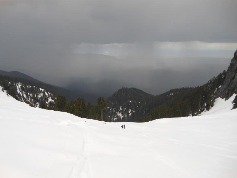
TATOOSH IN MAY
Drive skin boot
Summit turn boot
Turn cornice chute
Gawk graupel hoot
Sweat summit mush
Chute slide push
Traverse drive night
Skied just right
Peter,
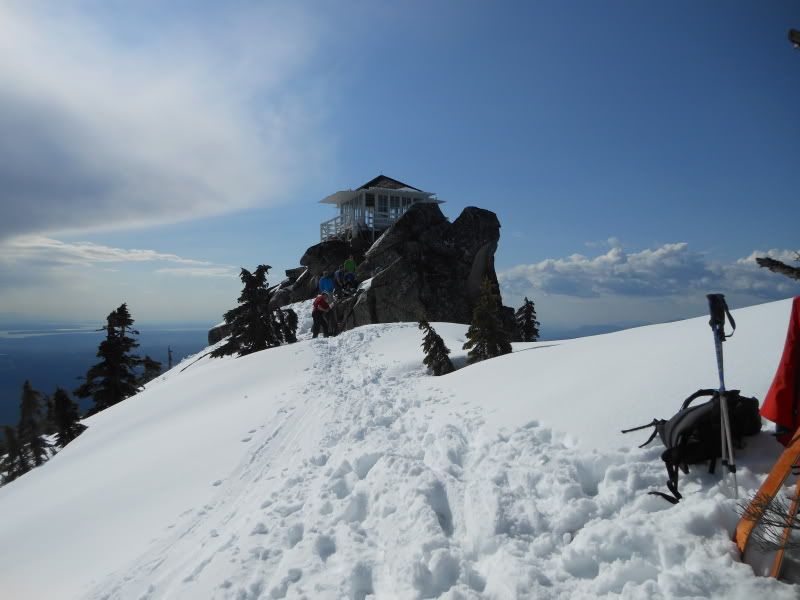
Thanks for the trip and a well-worded report. Adding a pic of Silver Peak from distance for those interested in snow condition, and an action shot.
Thanks for the trip and a well-worded report. Adding a pic of Silver Peak from distance for those interested in snow condition, and an action shot.
Skied Zig Zag on 5-27-12 and found very smooth conditions. Unfortunately the weather blew in on our descent and we were forced to ski 25-50 turns and wait for the next sucker hole to open up. Not the 3800 feet of wide open arcing turns I imaged on the ascent, but all in all a good way to spend a Sunday.
Looks like you're having some fun Tony. Let's finally ski together when you get back.
author=runcle link=topic=24923.msg105320#msg105320 date=1338220251]
Weren't those incredible thunderheads building over Olympus etc. Thanks for the skin track.
Couldn't make out the tunes on your MP3 player :)
Here is the video
http://www.youtube.com/watch?v=XQqD4NMRJPA
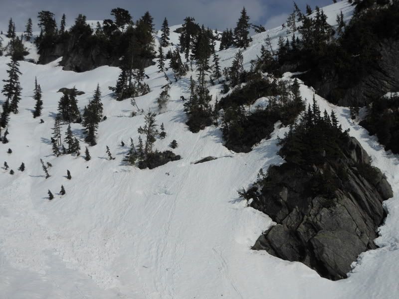
Scott, no protractor needed for this trip. I was a little shocked and disappointed Jake didn't use the protractor to check the slope angle of Eric and Dan's Black Peak descent. That would have been good information to confirm.
It's a great winter tour too. I was able to start skinning at the last flat area before the snow slope leading to the crest.
Nice Tony. Sounds like a good trip so far. Such a rad area.
Weren't those incredible thunderheads building over Olympus etc. Thanks for the skin track.
Couldn't make out the tunes on your MP3 player :)
Couldn't make out the tunes on your MP3 player :)
I love that tour, winter or spring, great views. How far did you have to walk on dirt from the end of the road?
Yeah, I thought up this trip when I was trying to decide whether I should put together a team for Ski to Sea. Gotta say, this was waay easier to plan! It helps to have a big trailer for all that gear.
Cycling on Hwy 2 is not too bad, there is some semblance of a shoulder most of the way except for some bridges. And you see stuff you never notice when driving! Like the big Biker memorial close to the Lake Wenatchee turnoff.
Cycling on Hwy 2 is not too bad, there is some semblance of a shoulder most of the way except for some bridges. And you see stuff you never notice when driving! Like the big Biker memorial close to the Lake Wenatchee turnoff.
Seems like you should've taken a fishing pole along
Route update: From the Rainier Climbing Blog, the Ingraham Direct 2012 conditions received a very surprising update today, worth posting here for future reference:
May 27:
The ID made a comeback this weekend with 5 parties using the route to reach the summit. Snow accumulation from earlier in the week ranged from little to upwards of 2 ft, which m...
Silas, what is your day count for the 2011/2012 season?
Whatever it is, I am both impressed and envious.
Whatever it is, I am both impressed and envious.
That is amazing ski.......it gives me vertigo just looking at the pictures!
Hey Scott, how was the ride down? Nice pics 8). I have hiked/climbed that route and vowed to come back and ride it, but haven't yet. Did you cross the logs at the lake outlet or skin the lake?
Hey Telemack and Jason, thanks for the tips on what to check out up there, we had a great time visiting the saddles and scoping out some future trips.
That line through "Denman's Demon" was pretty bold. Looking up at you guys from the bowl, we weren't sure it was going to go. Nice job getting after it.
We were hoping you guys decided to take the higher route back to the car as opposed to following our track down low. Those cliffs and the creek are bad...
Nice I like that ski route for a good day trip. Wanted to do that last week, but opted for the Cayuse/Crystal tour. Thanks for the report, Sounds like the snow is starting to consolidate a bit in the North Tamanos chute. I did a solo on that chute a couple years ago where the moat was a good 4ft gap and as wide a pair of skis.
I found that just left of the low saddle at Gov ridge (edge of the rock wall) was the best route down and back rather than all the slide alder on the right. IMO.
I found that just left of the low saddle at Gov ridge (edge of the rock wall) was the best route down and back rather than all the slide alder on the right. IMO.
Thanks for a thorough bit of reporting once again, Amar.
Super glad you and Elliott joined Bobby & I at the last minute.
Super glad you and Elliott joined Bobby & I at the last minute.
Great party and the perfect place to enjoy a thunderstorm! Thanks to Jeff for the BBQ and Brauts, and to everyone for helping me get some good shots. My TR at NWH.

cool trip! those Oly's sure hold the (earned) goods. thanks for the report.
pretty cool trip!
Was planning on doing something simular on the wet side. Kind of scared of biking down hwy 2 though.
Was planning on doing something simular on the wet side. Kind of scared of biking down hwy 2 though.
Wow...
that looks intense!
Looks like you guys skied it prety darn well too! Bravo!!
that looks intense!
Looks like you guys skied it prety darn well too! Bravo!!
Yowza!! Incredible in every sense - looks like it might be the hardest ski descent in the state so far (and Dan would know), along with fantastic pictures. You've got to write this one up for publication. Thanks for sharing.
Ferous Wolvineerians
Awesome, never thought I'd read that again. Thanks for the blast from the past Double Dr. Gust.
Wow, a TAY/TGR collaboration - rare animal indeed! Too bad I was chained to the computer.
And some video...
http://www.youtube.com/watch?v=9fDTTrViAAE&feature=colike
http://www.youtube.com/watch?v=9fDTTrViAAE&feature=colike
Update on Conditions From May 26: Good snow coverage the entire way with very little if any new snow from the systems earlier in the week. The skin up to Blue Lake Col was very firm in the AM. Ski crampons would be helpful if you've got them. Possible to skin all the way to the col, although some were booting up. Great ski off the south side of the col at around 11AM and easy traverse and skinning up to the second pass. The descent off that requires a bit of a tricky entry as usual an...
Glad you could make it! Always a pleasure to ski with the Freebird.
The pow was still there today (conditions were pretty much exactly as Amar described), though the weather is definitely on the downhill slide. Waited about 30 minutes for a whiteout to clear before heading down, and it was raining when I reached the parking lot.
The work on the new trail has made this trip far easier. Yes, being higher up a south slope means earlier melt-out, but it's back to being a direct, smooth hike like it was before the blowout. Cheers to the NPS!
The work on the new trail has made this trip far easier. Yes, being higher up a south slope means earlier melt-out, but it's back to being a direct, smooth hike like it was before the blowout. Cheers to the NPS!
Thanks Jeff, Jim, and everyone else for sharing your backyard with us!
Here are some pics from the day...
http://www.facebook.com/media/set/?set=a.469326209751323.125835.100000218445455&type=1&l=dbeb85bf63
Here are some pics from the day...
http://www.facebook.com/media/set/?set=a.469326209751323.125835.100000218445455&type=1&l=dbeb85bf63
Thanks Amar, Jessie, and Bobby for another fabulous tour! What a perfect way to start the holiday weekend!! :D
That's my favorite traverse in the Olympics unfortunately I've only ever hiked it. Thanks for sharing!
awesome shots and awesome trip - thanks for putting stuff together amar!
B
B
- some nice pics ! p.s. I' ve cut my skins before, with walking across rock sections
The human lightening rod aspect was a little unnerving for those few brief moments....
I was the snowboarder that leapfrogged your group a couple of times. Of the fourteen times I have ridden Interglacier, this was my favorite as the snow conditions were fantastic.
Oh, and thanks for setting the skin track near the top.
Oh, and thanks for setting the skin track near the top.
If you guys want more pictures:
https://plus.google.com/photos/106101518970868714832/albums/5746865761096139441?authkey=CJix19mC_vfszwE
https://plus.google.com/photos/106101518970868714832/albums/5746865761096139441?authkey=CJix19mC_vfszwE