TR Replies
There were three guys on the summit drinking beers when I got there. Turns out one of them got lost in the fog on the way down:
Sailor Found on Mount Adams
http://www.kitsapsun.com/news/2009/jun/08/sailor-found-mount-adams/
Sailor Found on Mount Adams
http://www.kitsapsun.com/news/2009/jun/08/sailor-found-mount-adams/
author=Robyn link=topic=13583.msg56697#msg56697 date=1244523460]
In addition to saving my day, he also was able to help a group with a flat tire pry their stuck wheel off with the giant crowbar for his truck; he is hereby nominated for Dad of the Year.
Hi Robyn! That would be me who your dad halped. I was too flustered with the tire changing to ask you any questions about your trip, sorry for being so rude. We had ski stuff in our...
Great skiing out there eh? nice to have a bit more consolidation.
We camped one drainage west of morrison creek at 6100' and were able to pretty easily join the south side route, slogging to the summit a little after noon. Camping where we did worked out pretty well, maybe not a time saver but we thought well worth it too. - thanks to last week's TR poster for suggesting the morrison creek descent.
We camped one drainage west of morrison creek at 6100' and were able to pretty easily join the south side route, slogging to the summit a little after noon. Camping where we did worked out pretty well, maybe not a time saver but we thought well worth it too. - thanks to last week's TR poster for suggesting the morrison creek descent.
author=natefred link=topic=13591.msg56718#msg56718 date=1244579447]
Telemack, were you with the Kitsap County contingent in the Honda Element?
Yea, 'twas us. I thought we'd see you too. Did you go up the South Climb and summit? If so you musta been ahead of us all day.
Telemack, were you with the Kitsap County contingent in the Honda Element? If so, good to meet you and your gang. We were surprised we didn't run into you again, we must have camped just below and maybe to the west of you.
We also ran into Michael on our descent near Morrison Creek and he came out with us to the road. Energetic and enthusiastic guy, I'm sure we'll be seeing him around!
We waited till a little after 1:30 to ski SW chutes and it was creamy corn hea...
We also ran into Michael on our descent near Morrison Creek and he came out with us to the road. Energetic and enthusiastic guy, I'm sure we'll be seeing him around!
We waited till a little after 1:30 to ski SW chutes and it was creamy corn hea...
author=scottb505 link=topic=13487.msg56266#msg56266 date=1243871984]
Thanks for the beta, kristys. Did you hike up the summer trail to Cascade Pass or skin the gully?
We skinned and post-holed up the gully.
Are those a pair of Factor's Chris is wearing.??????
If so did he leave them behind.???
See Random Tracks re pair of Factors left on Adams.
Bad luck with weather.
If so did he leave them behind.???
See Random Tracks re pair of Factors left on Adams.
Bad luck with weather.
We hiked into to Ruth the weekend before on May 30th. We reached the summit in about 4 1/2 hours from the car. Most of that time was crossing avy debris or re-finding the trail after crossing debris. We switched from running shoes to skis just below Hannegan pass. The ski down was great corn. We skied down into the head of the valley and traversed back up to our running shoes.

lake of the angels is a great place to camp and fish ......in july.........and you can still ski 200 v/ft
Cool trip guys. Too bad about the vis, there are some beautiful vantages above the lake. Stone and Skok were on my list this season but I didn't make it out there in time. Next year.
Robyn, I think that I met your folks at a party a few months back. Your dad was speaking very proudly of you and your success racing mt bikes. It's good that he was available to come to your rescue. I know of no better role than to be a hero to your little gir...
Robyn, I think that I met your folks at a party a few months back. Your dad was speaking very proudly of you and your success racing mt bikes. It's good that he was available to come to your rescue. I know of no better role than to be a hero to your little gir...
I would say that by next weekend there will be sections of booting in the Source Lake Valley and bare sections on the slope between Source Lake and what I would call Snow Lake Pass(?).
Melakwa and Snow Lakes were mostly solid snow and no problem to cross yesterday. We crossed Snow Lake along the looker's right side of the lake in the photo. The issue soon will be getting to them if you wish to do so on skis.
There were interesting melting patterns in the snow in Snow L...
Melakwa and Snow Lakes were mostly solid snow and no problem to cross yesterday. We crossed Snow Lake along the looker's right side of the lake in the photo. The issue soon will be getting to them if you wish to do so on skis.
There were interesting melting patterns in the snow in Snow L...
Team member #2 here, filling in a few more details...
1) The road is blocked not only by snow, but a fallen dead tree. Bring a chainsaw or chain for moving it if you think you'll get there before the Forest Service (or unless you have very high clearance)
2) I predict the road is less than 50% skinnable by the end of the week
3) Highly recommend ripping the skins at the first major downhill on the way in (a narrow snow-machine track thru trees), then booting the next ridge wh...
Shake it, shake it Sugaree! Nice report....just skied the line left of Monitor on Saturday, and wondered about the areas over to the right you mention. Identical thoughts about turning around early too....until we got above the cloud cover!
Thanks for the update and report of that area. Any clue about whether the lake is still able to be crossed?
Thanks for the conditions report Garth!
Looks like a good option for the weekend.
-Dave R
Looks like a good option for the weekend.
-Dave R
author=Spencerhutch link=topic=13583.msg56686#msg56686 date=1244514069]
PS. Its pretty funny seeing the looks you get trying to hitchhike with an ice axe sticking out of your pack.
Haha--oh, the car troubles, much more eventful than the adventure itself! Broke the key off in the ignition, then started it with a pocket knife, only to discover that it wouldn't go...very fast. Made it to Lena Creek campground averaging under 10...
oops photo of Snow Lake from near Chair Peak Lake.
Thanks for the report. I'll probably be looking to do a one day push up that route this weekend.
Well as could be imagined there weren't to many pretty pictures to be had but here is what I got.
http://www.flickr.com/photos/spencerhutch/sets/72157619383325979/
This was definitely a good use of my weekend, taking into consideration that I got less than 3 hours of sleep last night and took 3 finals today. I felt like I could barely walk from test to test. Although an adventure is an adventure and I'm gonna take all that I can get!
PS. Its pretty funny seei...
Nice work! That steep "trail" approach certainly makes the turns well-earned (especially when carrying overnight gear up there!). Bummer the weather/visibility wasn't better, but glad to hear good turns were had on the east face of Skokomish (Skip and I couldn't really see anything while skiing the upper portion of that face in a white-out).
Pictures do not a trip report make! Thanks for the conditions update.
FYI. Kurt and I headed up there this morning to find the gate closed. We stopped at the Ranger Station to inquire. Evidently there is a culvert problem and a hole in the road that they feel could cause a collapse in the road just beyond the gate, hence it will be closed this week but may open by the weekend.
author=qanuk link=topic=13569.msg56617#msg56617 date=1244392972">
The slide in this picture looks similar to one that our party crossed in Indian Creek (southeast of Glacier Peak) a week ago (click thumbnail below).

Lots of big avys on south side too.
Seemed like Mordor to me.
Seemed like Mordor to me.
I'm guessing the south side of Ruth Creek is melted out and full of slide alder, so not apt for cross country travel? Too bad about Ruth. It's got to have one of the best view:climb ratios of anywhere in the Cascades.
Thanks, Keith. I was trying to capture what it is like to be there and so used just the natural sounds. The views on that tour are so incredible. The fantastic weather helped!
--Eli
--Eli
author=Keith_Henson link=topic=13557.msg56573#msg56573 date=1244237836]
Very high quality video. Felt like I wanted to be there real bad. Nice
Hey, Kristoffer, looks like you were having fun. When do I get to tour with you?
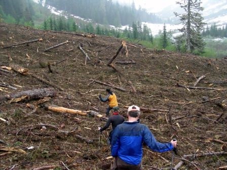
Was in there yesterday 6/7 messing around. The valley is absolutely hammered with avi debris! I've never seen anything like it. Sometime over the winter every single avi path on the north side of the valley must have ripped with 100+ year force ripping out old growth trees from waaay up the sides of some of avi paths.
As stated the last mile of road is buried in logs, debris and snow up to 30' deep the trail is not much different.
Well worth checking out if...
As stated the last mile of road is buried in logs, debris and snow up to 30' deep the trail is not much different.
Well worth checking out if...
author=silaswild link=topic=13572.msg56645#msg56645 date=1244438553]
Wow Ron! Either there was massive melt the past 48 hours, or you took a more interesting route than we did on Silver?! Hope you had fun and did not feel misled by my trip report, honestly we had only one spot to ski across brush and it was only three feet.
Naw, Silas, your conditions report seemed pretty much spot on to me...
We only had that one "brush ford&...
author=Big Steve link=topic=13572.msg56650#msg56650 date=1244474018]
How high up can one drive?
Couple hundred yards short of where the PCT crosses the road at Windy Pass.
Also there's a couple of minor washouts where one might nervously inch across in a lower clearance vehicle.
It was nice to see that you guys got up. Nice Job, Kristoffer!
Skiing by braille, with 50' visibility added a nice touch on Larrison Ridge :)
~Jeff
Skiing by braille, with 50' visibility added a nice touch on Larrison Ridge :)
~Jeff
Wow Ron! Either there was massive melt the past 48 hours, or you took a more interesting route than we did on Silver?! Hope you had fun and did not feel misled by my trip report, honestly we had only one spot to ski across brush and it was only three feet.
Joe, nice photo. Your graphite wax seems to be wearing off.
Ron, I like the technique you have for brushing off the pollen. I've crossed that brushy section over the years. I actually have it as a waypoint. ;)
Ron, I like the technique you have for brushing off the pollen. I've crossed that brushy section over the years. I actually have it as a waypoint. ;)
author=Scotsman link=topic=13570.msg56624#msg56624 date=1244414654]
Good call.
Just proves the old adage" you don't know until you go!.
Definitely a good call,
Sorry we couldn't join you guys, we spent the weekend volunteering for the North Olympic Discovery Marathon, a great local event.
These pictures are from an 18" powder day in the same area in March, 2007. It is a great area, glad yo...
Looks like a great spring Olympics trip, your optimism was certainly rewarded...I looked up at the clouds and decided to go on a road ride and I was the one that got rained on. Just goes to show!
author=blitz link=topic=13555.msg56607#msg56607 date=1244330260]
Gary and Jan,
that is wonderful fun!
bridge is open now, will need to get out there before it is all gone!
Alisa
Thanks Alisa,
We'll keep you posted on the opening of the Deer Park road. We will definitely be making a trip to Elk Mountain once that happens.
Gary and Jan
Nice!
Ron just told me he doesn't cover a lot of ground these days...
Ron just told me he doesn't cover a lot of ground these days...
You passed us as we were applying WD40. We had our skis so slick that Ron was schussing over bare spots.
I thought that would be a long day, but it looks like a great trip. Nice work, and a well written report.
So just to clarify the road is passable to almost the end of the road? Which is not what the NFS site says. Sorry you had to abort.
The pollen wasn't too bad . Plenty of trees. Go figure.
Good call.
Just proves the old adage" you don't know until you go!.
Corn is in short supply this season.
I just came back from Chinook Pass and it wasn't corn but it was pollen saturated crap that was sticky even on the steepest stuff!
Just proves the old adage" you don't know until you go!.
Corn is in short supply this season.
I just came back from Chinook Pass and it wasn't corn but it was pollen saturated crap that was sticky even on the steepest stuff!
Thanks Silas, I thought that was it. Victor and I skied it early April last year, it's looking mighty thin and steeper now.
Thanks for the report. Sorry you had to waste the time.
author=Lisa link=topic=13565.msg56605#msg56605 date=1244321706]
I like the look of that thin line behind Eric
The exit can be brushy this late in the season. See http://www.metatropo.com/reports/twinlakescouloir051307.shtml