TR Replies
Nice! great to hear Dave's back on skis again!
Olyski, if you PM me I can give you numerous tour ideas
These are really cool shots, nice work! I was checking out the Whistler coulies on Sunday from across the road and pondering just how much snow was still in there. I was last up there ~5 yrs ago and those lines off the back were really enticing. But no leather boots for me.
now with pics.
GaryJan, I had hoped the squall would be short and it would be clear and cool overnight... just didn't happen. Optimistic reading of the weather report.
stay tuned for lucky number 5
GaryJan, I had hoped the squall would be short and it would be clear and cool overnight... just didn't happen. Optimistic reading of the weather report.
stay tuned for lucky number 5
author=alecapone link=topic=20972.msg89726#msg89726 date=1306952927]
the joke is probably because it was skied by some guy in the 50's wearing home made skis with nothing but sinew and hiking boots.
now that would be impressive, being as SR 20's ribbon cutting wasn't until 1972... and given that sort of an approach, seriously, no joke. :)
cartoons about mountaineering... wow! funny...&...
Do you have some route info for these tours? I may be headed there next week. I am somewhat familiar with the Teanaway, but more in the Beverly/Bean/Standup creek areas.
also, in 20 years when splitboarding technology makes our gear antiquated, trevor can always pull the "I rode that 20 years ago in soft boots and strap on binders..." card
really, who cares as long as you are having fun?
really, who cares as long as you are having fun?
the joke is probably because it was skied by some guy in the 50's wearing home made skis with nothing but sinew and hiking boots.
Wasn't trying to imply you guys where claiming anything, nor detract from the fact that it is a great looking line. Just being silly. 'it's not a complete trip...."is from this humorous video...
http://www.xtranormal.com/watch/6234547/first-ascents
(note, I have no clue who made this)
Wasn't trying to imply you guys where claiming anything, nor detract from the fact that it is a great looking line. Just being silly. 'it's not a complete trip...."is from this humorous video...
http://www.xtranormal.com/watch/6234547/first-ascents
(note, I have no clue who made this)
wow! way to get the family out. What a bunch of troopers!
Very inspiring. Time to get my 7 yr. old out touring... pm me if you have any out-grown gear gathering dust in the closet...
Very inspiring. Time to get my 7 yr. old out touring... pm me if you have any out-grown gear gathering dust in the closet...
As far as I can tell if a tree falls in the woods, it fell. No more and no less completely, even if documented on the interwebs.
The human factor on the other hand may say "The joke used to be that all of the Hwy 20 lines were skiied by 3 pinners back in the late 70's." Not sure why this is a joke or even why it's no longer a joke ("used to be"). Sounds plausible to me. Whistler would be fun even on wooden planks and a couple...
author=Chuck C link=topic=20987.msg89714#msg89714 date=1306941232]
You can add St Helens to that travesty list as well.
Speaking of which, when I skied St Helens several weeks ago we saw a group of around a dozen snomos inside the snomo free wedge on the south side. My buddy and I confronted this group and talked to a couple of them. We encountered the totally ignorant attitude (and the rest didn't stop). "I'm just...
Way to get out guys.
Rule of thumb. If you can see it, it's been skied. If you can see if from somewhere you are skiing, it's most likely been skied as well.
as always though, it's not a complete trip until it's been reported!
Rule of thumb. If you can see it, it's been skied. If you can see if from somewhere you are skiing, it's most likely been skied as well.
as always though, it's not a complete trip until it's been reported!
welcome back Marcus!
Dogs don't like lemonade, but seem to love them type of condtions.
Dogs don't like lemonade, but seem to love them type of condtions.
Love your persistence... and lemonade.
author=Lowell_Skoog link=topic=20987.msg89699#msg89699 date=1306904189]
This might not be your personal opinion, but it IS mine. Snowmobiling on Mt Baker is a travesty.
You can add St Helens to that travesty list as well.
author=Salal link=topic=20990.msg89667#msg89667 date=1306881611]
requiring bushwack, waterfall, downclimb stuff.
Sounds like fun!
Glad you finally got your ski boards up on hibox.
Great trip Amar, Daves, Stephanie and Kat! And nice write up Amar- lots of respect for your thoughts and the way you express them.
Wow! As always Amar great trip and photos. We tried this exact route last Saturday in pretty poor weather; turned around at 8200 in a complete white out. Glad to see someone got the goods.
The road is definitely an added challenge to this route, with over 2 miles of flat, mushy snow to skin/ski down after the long hike.
The road is definitely an added challenge to this route, with over 2 miles of flat, mushy snow to skin/ski down after the long hike.
author=Scotsman link=topic=20987.msg89701#msg89701 date=1306905792]
Well as Lou Dawson says in his Wild Snow blog when commenting on the criticism to his son Louie's snow mobile assisted skiing on Mt Baker.
Quote}
But I’d agree with anyone that shared use is something we’ll be refining over coming years. Meanwhile, with the vast quantities of legal Wilderness we have, we already have plenty of un-shared use and I for one appreciate it — as I do...
author=Lowell_Skoog link=topic=20987.msg89699#msg89699 date=1306904189]
+1
This might not be your personal opinion, but it IS mine. Snowmobiling on Mt Baker is a travesty.
+2
Well as Lou Dawson says in his Wild Snow blog when commenting on the criticism to his son Louie's snow mobile assisted skiing on Mt Baker.
Quote}
But I’d agree with anyone that shared use is something we’ll be refining over coming years. Meanwhile, with the vast quantities of legal Wilderness we have, we already have plenty of un-shared use and I for one appreciate it — as I do the areas where we can share, and sled, and drive, etc. etc… End Quote.
If it's OK...
author=Amar Andalkar link=topic=20987.msg89695#msg89695 date=1306903204]
Thinking logically on the issue (this is NOT necessarily my personal opinion), the legal snowmobiling area on Baker is already much too large. This appears to have been a huge erroneous misguided giveaway to an inappropriate, highly-polluting, special-interest activity with a powerful political lobby when the Mount Baker Wilderness boundary was set in 1984. If any adjustments need to be m...
author=Scotsman link=topic=20987.msg89685#msg89685 date=1306891884]
The wilderness boundary lines obviously were demarcation lines marked on a map rather than accommodating the natural topography. They come to an apex on a steep slope.
Wouldn't it make more sense to rearrange the boundary lines so that the sledders had a natural flat place to stop such as where Amar has marked on his map ( and they seems to be stopping anyway) That way they can...
Sorry to hear the weather spoiled your plans. We observed the building storm from the Mt. Angeles area as the day progressed on Sunday. If snow conditions in Royal Basin were anything like what we found on Angeles, it might not have been the best weekend to attempt a big line on Deception.
Hopefully the 5th time will be a charm. ;)
Gary
Hopefully the 5th time will be a charm. ;)
Gary
Glad to see you back out in the mountains Marcus.
Looks like you had the best two partners a guy could ask for on a character building trip like this! ;)
Gary
Looks like you had the best two partners a guy could ask for on a character building trip like this! ;)
Gary
Everything was solid above Myrtle, but I may have oversold the "skiable terrain" we were in -- we mostly just climbed up through the trees to try to find something we could point downhill on and move without poling...
Right on. I too have the night trains (the old lightening bolts and wolf head ones) but only as resort skis. I had thought about using the tahoes or belafontes as a touring skin with dynafits.
Thanks for the feedback.
Thanks for the feedback.
Nice Marcus
With a little enthusiasm, all things are possible... eventually.
We attempted a quick slot trip and while the weather was fine (mostly filtered sun), we turned around when the upper slopes turned into a shooting gallery. As we transitioned through the recent freezing level from last week, we first saw a slow wet slide started from warming rock. We thought, no problem, stay well below the start zone and we have time to react. As we rounded the c...
The wilderness boundary lines obviously were demarcation lines marked on a map rather than accommodating the natural topography. They come to an apex on a steep slope.
Wouldn't it make more sense to rearrange the boundary lines so that the sledders had a natural flat place to stop such as where Amar has marked on his map ( and they seems to be stopping anyway) That way they can finish their legal trip at a place where it makes sense and provides a natural stopping point rather t...
Wouldn't it make more sense to rearrange the boundary lines so that the sledders had a natural flat place to stop such as where Amar has marked on his map ( and they seems to be stopping anyway) That way they can finish their legal trip at a place where it makes sense and provides a natural stopping point rather t...
Good to know it's not just us! We were planning on crossing earlier but ended up going to Myrtle when we realized that weather/time wasn't on our side this time -- we just wanted to get to a known geographic location :)
Blitz, we had a full kit -- we would've been pretty cozy if we'd had to bivy, with our stove, big puffies, bivy sack and two tarps. Figured it was a good day to take a little extra insurance. It's all training weight an...
Blitz, we had a full kit -- we would've been pretty cozy if we'd had to bivy, with our stove, big puffies, bivy sack and two tarps. Figured it was a good day to take a little extra insurance. It's all training weight an...
Great effort. I have a similar fail on almost the same route a few weeks back. I crossed the creek much earlier and head up slope to enter the NW Col which offered more vert than continuing to Myrtle tho more of a traverse. I miscalculated the time of the approach in almost the same way and had to call it before heading up for the summit. The mid fork is a character builder.

awesome pic .. we almost headed out that way for 2 nites .. but the forecasted t-storms scared us off .. nice work steve
Nice effort! I've been thinking about this area the last couple of weeks. Did you come in from east of Rachel Lake? I can't remember where the official trailhead is... I've been thinking about the Lake Lila/Rocky Run approach.
Here's my pix: https://picasaweb.google.com/TrevorL.Williams/WhistlerMtnLibertyBellNorthCascadesMay2011#
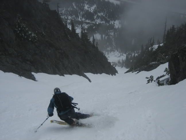
gee marcus, your backpack looks like it is full of all kinds of stuff, a regular mary poppins tote :D. welcome back!
Here is a link to some more photos. Including a few on the way up Whistler. All were shot with my android phone so quality is a little lackluster.
https://picasaweb.google.com/108365037500696236927/WhistlerMtWestCoolyAndLibertyBellArea?authkey=Gv1sRgCKDBz_CDhfiHVw#
https://picasaweb.google.com/108365037500696236927/WhistlerMtWestCoolyAndLibertyBellArea?authkey=Gv1sRgCKDBz_CDhfiHVw#
She was a total trooper and had a blast -- kept up with me full-tilt-boogie going down, barking all the way, but she was pretty wiped by the end.
Yeah the picture of the down trees would have gotten me stoked for getting firewood, probably not skiing. ;)
I think your pooch says it all in the picture.
Where's the machete?
I think your pooch says it all in the picture.
Where's the machete?
Nice work, guys. Was eyeballing those couloirs while heading up towards Liberty Bell to ski part of Madison Ave and Early Winters Couloir on Monday... those two lines are for sure on the future hit list.
Excellent trip report. I was on the rescue yesterday and we went up to 7,900 to check crevasses. Saw your tracks. It was obvious your snow conditions were better on Monday then on Tuesday. We had a death grip on our skis coming down.
I like your comments on the crevasses there are a lot of them lurking just under the surface so please don't just blindly travel the glaciers thinking everywhere is safe.
I agree with your comments about the snowmobliers...
I like your comments on the crevasses there are a lot of them lurking just under the surface so please don't just blindly travel the glaciers thinking everywhere is safe.
I agree with your comments about the snowmobliers...
Nice TR! I spotted Whistler Mtn. about 10 years ago from the top of the Blue Lake Col and thought what an awesome line that would be. Glad you got it. I especially like the photo looking down at the options...reminds me of Mt. Superior in Little Cottonwood Canyon. Would be interested in seeing a photo with your route up and down.
Thank you for taking the time out to educate the sled-heads. I've found *education* is the key. Be nice, leave a positive impression so folks *want* to change not rebel.
Yeah, lemonade slurpees for all!
:D
:D
E gad... good to see that you are slowly breaking in. ::)