TR Replies
Just to give an idea of how poorly I felt, I actually sunburned my tongue. The next time I suffer I'll remember to do so with my mouth closed :)
Thanks Mo-money for the great time...

Thanks Mo-money for the great time...
Knowing how much both of you love doing TRs, Brad & I were betting we'd never see this TR. I correct my comments - great report!
Way to go Becky, Pete and Andy !!
Glad you got such purrfect finger conditions !
Nice. Sounds like a really fun trip.
author=Jason_H. link=topic=13448.msg56005#msg56005 date=1243395761]
Here's a shot of south sister from just before you went.
Dang! Now I wish we did hit the Prouty - looks like the chute was it pretty good shape.
Stugie - BT looked sweet. Wish we would have hit it. Buell did 3 separate lines on it on Sunday. I'd like to go back this weekend and hit the crater bowl.
Way to go guys! Sweet camp photo. Love it.
if this is the best narrative your darrington education is capable of please at least post up your 3 pictures. nice job guys!
South Sister looked good! Wish I could have gotten up it, but middle sister had to do.
Here's a shot of south sister from just before you went.

Here's a shot of south sister from just before you went.

There must be so much more to this story! Amazing. Way to get your snowboard back there. I am impressed!!! Challenger was one of my best ski trips ever...even with all the work.
Very nice pics there Jim. Glad you could make use of our tracks - what a beautiful country. Pretty lucky to still ski to the lake ayeh?
Thanks for the info.
This ski/mountain stufff can be taxing when living at sea level....
This ski/mountain stufff can be taxing when living at sea level....
We were wondering who made those lovely tracks. It looked GREAT! I'm pretty sure this photo was taken in the vicinity of where y'all camped, on the divide between the Wilson and VanTrump like Telemack suggested:
Becky, you're not alone in your troubles with altitude ;) Monika and I turned around at 13000' on Saturday over on the Tahoma due to a combination of conditions (to...
Becky, you're not alone in your troubles with altitude ;) Monika and I turned around at 13000' on Saturday over on the Tahoma due to a combination of conditions (to...
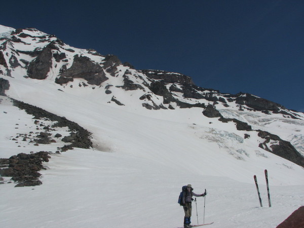
Yes, there are several nice little campsites with rock walls already built up lookers left of the Finger and the Thumb on the divide at around 9200' (I don't have Smoot in front of me so can't say for sure that's what it's referring to). We left camp a little after 4am and had great cramponing conditions in the Finger. Sadly, my recurring problems with altitude prevented us from summiting on Sunday (thanks to Pete and Andy for being willing to turn around with me), but...
author=Pete A link=topic=13429.msg55884#msg55884 date=1243216999]
Swinging out onto the Nisqually at around 12k provided a direct and straightforward route on the glacier with very few crevasse crossings.
Pointed skis downhill at 11:30am
It was a great weekend in many places!
A few questions:
Is the WilsonGlacier/Van Trump Divide the place marked in the Smoot volcano guide as having sheltered cam...
Amar, Kyle and I went up Ingram Direct Sunday morning, leaving Paradise at 2:30am or so. We watched the sunrise at Camp Muir and continued up the climbers route, reaching the summit at noon on Sunday.
Kyle posted a picture of the copter rescue that occurred shortly after we arrived at the summit. We hung out for an hour or so and made a descent down Nisqually glacier then across to Fuhrer Thumb then back across the glacier, skinning out above the Paradise parking lot.
F...
Kyle posted a picture of the copter rescue that occurred shortly after we arrived at the summit. We hung out for an hour or so and made a descent down Nisqually glacier then across to Fuhrer Thumb then back across the glacier, skinning out above the Paradise parking lot.
F...
Great trip Pete. Brenda and I had wanted to do that tour for a while. Here's a few photos that I took.


I'm thinking of journeying up that way and possibly have a 'go' too/or at least a good recon... Could use all the beta any one can put up....thanks........
I can really relate to the one in the brush! Isn't it nice that we forget those parts, but the groovin' in the alpine stays etched in our brains for years? You have inspired my lame-limerick muse:
I went up with Snowbell to Eldo
The steep trail and talus were helldo
The ski mountaineering
Was truly endearing
But boy does my Capilene smelldo
I went up with Snowbell to Eldo
The steep trail and talus were helldo
The ski mountaineering
Was truly endearing
But boy does my Capilene smelldo
We had those same rock bullets at ~7 in the morning last Thursday also. Kind of exciting/scary. We didn't make it up though (it was a 1-day attempt, so I'm not to bummed). Going to try again this Thursday. Did you guys stay on the cleaver about, to the climbers left of the ice-fall (kind of along the Wapowaty cleaver) or did you jog right underneath them to then ascend to summit? Was the Wilson still showing any more than a just few signs of crevasses?
Whoa Bro! Erosion happens.
The pollen has been tolerable on our tours E of the crest, e.g. Dragontail via Asgaard on Sunday and BD Tour on previous Sunday.
Has anyone tried Hertel's Spring Solution wax? Hertel claims that it is formulated to glide when pollen-fouled. I bought a brick of it last spring, ironed it in a couple pairs of skis, but never gave it a good test because, IME, pollen was not a problem last spring.
Congrats on the route and great conditions! Appreciate the update....
Homemade pack -- very cool! I like it! (I lack the sewing skill and equipment for that level of dedication to build from scratch, though I have also decorated/repaired some of my own gear with similarly bright cloth and/or duct tape.)
I day tripped Porcupine/Cutthroat a few years ago, and we started out like you describe you were thinking about - in a big pullout near where Porcupine Cr goes under 20. On the way up it seemed like it was going to be a nightmare to descend that way but all in...
I day tripped Porcupine/Cutthroat a few years ago, and we started out like you describe you were thinking about - in a big pullout near where Porcupine Cr goes under 20. On the way up it seemed like it was going to be a nightmare to descend that way but all in...
Nice pics and report. I was one of the folks that skied the face on the 21st, following a couple of other folks that were on their way down as I neared the top. Should have headed up a few hours earlier, as conditions were getting a bit unstable, and I caused a few of the slides shown in your pics. Learned a valuable lesson though since I peeled off a gnarly hunk of flesh off my right hand while getting caught in a slow, small, but never the less heart palpitating avy.
A rectangle of plexiglass with nice sharp corners (aka "scraper") and a green scotchbrite pad seemed to do the trick pretty well for me this weekend, though the pollen I accumulated was not the stickiest stuff I've ever seen, so YMMV.
Looked like the fresh wax job under the pollen was pretty intact when the deed was done.
Looked like the fresh wax job under the pollen was pretty intact when the deed was done.
Actually I have been making my own packs for a while. I will grant you that they are rather colorful but why not. They make me easier to find after falling into tree wells and so forth ;D.
author=Ride_fly_bike_live link=topic=13435.msg55941#msg55941 date=1243346899]
Anyone got any ideas on how to get that crap of the bottom of the boards?
Best bet for cleaning bottoms is to wax and scrape. The wax adheres to the pollen and pitch and scraping removes it all. Cleaners, including citrus, do the job but dry out the p-tex and it may never fully recover.
Welcome, welcome, Welcome...and remember...most problems in life can be solved with elevation gain and those sweet turns that come after...
author=Ride_fly_bike_live link=topic=13435.msg55941#msg55941 date=1243346899]
Anyone got any ideas on how to get that crap of the bottom of the boards?
Green Scotch-Brite pad and some elbow grease.
Nice trip! That W aspect of BT is sick looking! Still waiting to go hit lines on that. Looks like you guys were in the same vicinity we were earlier this season. Way to nail the summit and tear it up!
author=powski3 link=topic=13449.msg55956#msg55956 date=1243354560]
Did you guys have a Volvo with UW stickers? If not, I left a note on a random car that will have no idea what I was talking about.
Oddly enough, Brian does own an old Volvo with UW stickers, but that's not what we were driving.
author=powski3 link=topic=13449.msg55956#msg55956 date=1243354560]
Didn�...
Thanks for the tracks guys, we were up there for 3 days last weekend and you did some perfect route finding.
Hmmm, a clever trip report with no pictures? You guys just sat around at camp and drank beer, didn't you?
:)
Great job -- way to get in there early. That's such an excellent line. Good reminder re: spring avy activity as well. It's not consolidated quite as thoroughly as it usually is, this year.
:)
Great job -- way to get in there early. That's such an excellent line. Good reminder re: spring avy activity as well. It's not consolidated quite as thoroughly as it usually is, this year.
Jim- The road is about 75% covered with snow..a little melted out on the switchbacks but I think it will at least be another three weeks or so.
Unfortunately I also failed on the camera. Turns out there was a piece of paper stuck on the shutter that ruined all the skiing pictures. A few of the ascent turned out though that I can throw up here later. Didn't realize how far west the Chutes put us, probably took me a good hour of skinning to traverse back to the ascent ridge where we camped. Thanks for the water refill at the top though, I might have been in trouble without it.
For people skiing the...
For people skiing the...
I think you guys passed me. I was riding my MC up the road.
We were up there on Monday. Drove in on Rd 9070,got just past Mill Creek crossing before having to walk it. Continuous snow past second hairpin. Maybe another week or so before you can drive to that point. Bring your scraper! It is the worst pollen I have ever encountered.
Seems plausible.
I just looked at some pictures I took Friday afternoon from a similar angle from the Knoll.
It's pretty clear that rock close to the top of the face separated and came down, also triggering the slide below. Water seeping in from the top, freezing/contracting then expanding seems likely.
Saturday morning surface snow was firm early on, softening quickly.
Does anyone know/think it got cold enough to freeze on Saturday night? My guess is that is did and the expansion of the ice finally won out over the strength of the rock..
The pics were taken right around 2-3:30 on Sunday. It must have broke Sat night/Sunday morning!
The pics were taken right around 2-3:30 on Sunday. It must have broke Sat night/Sunday morning!
author=Jim Oker link=topic=13435.msg55904#msg55904 date=1243276871]
Wow - that's an impressive bit of rockfall there. I don't recall seeing that happen up there before - looks like an interesting event.
On Saturday we were looking at that face while eating lunch from the knoll, commenting about how the wall that ran from the snow up to the summit had been in the process of cleaving off in recent years...
Wow!!!
We were up there Saturday morning from about 10:00 am, leaving the area around 1:30 pm.
My guess is that must have come down some time later in the afternoon?
We could hear falling rock from the same location.
While these were small and isolated incidents and we had stayed clear of that area.
We were up there Saturday morning from about 10:00 am, leaving the area around 1:30 pm.
My guess is that must have come down some time later in the afternoon?
We could hear falling rock from the same location.
While these were small and isolated incidents and we had stayed clear of that area.
A steel scraper, resolve and citrus cleaner will do the trick. Good luck... not fun.
Here's what it looks like from 6,500 feet! If you look closely you can see our tracks!
Fun day, glad we hit it up!
Anyone got any ideas on how to get that crap of the bottom of the boards?
Fun day, glad we hit it up!
Anyone got any ideas on how to get that crap of the bottom of the boards?
Nice tour and photo selection. Snowbell and I were in the Eldo area this last weekend; TR coming soon. Beautiful weather in "The Alps of America".
Wow, nice work. That is a scary sound to wake up to...ice falls/avalanche careening down near your campsite. Glad you guys got some decent corn turns. Can't wait to see the pics!
mtj and BigRed, nice meeting you guys! What a trip, and great pics! We had such great views from tent-side and a perfect night on a volcano! Glad you guys had a great trip -- you were right about the Squak oversoftening. Coming over the rollovers near the ice fall we found a few areas that looked to be sagging a bit TOO much... Such a perfect weekend! The bootpacker en route (Andres from Portland) looked like he was starting to posthole deep by the time he was...
Re: pic #1. Not sure I have ever seen so many different colors sticking out of a backpack before. Festive! Is that a Cirque Du Soleil tent maybe? ;)
Brad's MOSS tent
Wait a minute - Brad has a Moss tent? I don't think he ever mentioned that to me!
Great pictures, especially of the Mossillac, or the Mosscedes Benz, or the BMossW.
I see Brad was pretty well covered up head to toe - It's a shame that he has such delicate skin. Maybe he should stick to something like spelunking. ;D
Glad you guys had such a great time - very exciting! Thanks for the entertaining TR.
Welcome to TAY... er, as a poster. Nice picture!
Whats not to love?? Welcome to the darkside young jedi.