TR Replies
author=Jonn-E link=topic=30859.msg129298#msg129298 date=1393253916]
Yep, Theodolite by Hunter Research. It's a great tool that I use often.
https://itunes.apple.com/us/app/theodolite/id339393884?mt=8
Thanks. Picked it up and I like it.
Awesome Johnny. Looks like a fun day. Thanks for sharing the video.
author=TLock link=topic=30848.msg129396#msg129396 date=1393342336]
If I lived in Bend, I'd be asking you specifically to keep it off line...I understand all the great camaradarie in sharing, but respect people's backyards...
Isn't Todd Lake about as big a secret as Tumalo Mountain?
Sounds like a fun day riding the Rampart edge of danger! ;) Glad you knew where the edge was!
author=TLock link=topic=30848.msg129396#msg129396 date=1393342336]
If I lived in Bend, I'd be asking you specifically to keep it off line...I understand all the great camaradarie in sharing, but respect people's backyards...
Whoops, I think you are on the wrong site! I know that you're not supposed to feed the trolls, but I couldn't resist.
It's about time some folks built a BC kicker and got rad!
If I lived in Bend, I'd be asking you specifically to keep it off line...I understand all the great camaradarie in sharing, but respect people's backyards...
Nice one. I've heard the legends of the trees in stevens. I'll have to get out there some day. Thanks for the detail on the report. As always, fun to check out your photo stream on flickr.
Rad photos Ben, and Leyland! Thanks for coming out on my Bday
Here's the video from our shenanigans
https://vimeo.com/87535482
Here's the video from our shenanigans
https://vimeo.com/87535482
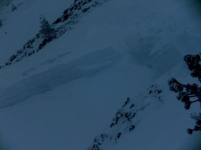
It's the Platt Lake/Granite Lookout TH, hiked past the GL fork until after the last switchback, then took off upward through the trees. Pretty popular for snowshoers/skiers when the avy danger is high, or too stormy in open. We skied a little too far into alders as shown in a pic above.
author=Skier of the Hood link=topic=30848.msg129170#msg129170 date=1393108186]
Not really too much more to add about this trip. Higher elevations were beat up by the wind. The alpine slopes on the northwest face of Mt. Bachelor had enormous wind sculptures on it. The only visible slides were on a small lee slope leading up to Broken Top and an old small slide in one of the chutes we skied. The slides on the small slope leading up to Broken Top appeared to be...
which approach do you use? GP TH? or Ollalie lake? or??
Beauty - Gotta love big trees.
I can't add too much to the snow pack observations. But I can say tons of fluffy fun to be had below 5k yesterday!
author=kamtron link=topic=30882.msg129252#msg129252 date=1393205900]
How were the cornices on the exit chute/bootpack?
there were no cornices to deal with on the route at all.
Powder skiing in the trees was awesome yesterday! There was widespread loose snow sluffing of the new storm snow (6-8" deep by 2 p.m.) on slopes steeper than 35 degrees. We did several laps and then called it around 2 p.m. when the loose snow sluffs started becoming increasingly difficult to manage. Also, the trees became "sluffed out" more than skied out, so once the good skiing had sluffed off it was time to go home!
Interesting that NWAC forecasted...
Interesting that NWAC forecasted...
Yep, Theodolite by Hunter Research. It's a great tool that I use often.
https://itunes.apple.com/us/app/theodolite/id339393884?mt=8
https://itunes.apple.com/us/app/theodolite/id339393884?mt=8
How'd you get that cool picture with slope and direction info? Is that an app on your phone?
two days later:2-23 Jamie and I looked in from the top. On the way there, we saw this crown in a popular run off of the Microwave ridge called "last tree" (intentionally triggered by patrol with explosives)
We poked in to the top of Stemilt Basin and sawed off a small cornice to see if we could trigger something; no result. Then...
We poked in to the top of Stemilt Basin and sawed off a small cornice to see if we could trigger something; no result. Then...
We had a great ski through the woods, up high below the false summit was icy and windblown though. We were a bit west of the other two groups, and the skiing in the trees and glades was fun.
It was great to see you again Jim, it has been many years since we skied together with Charles. Perhaps we'll do so again.
And it was great to meet you Charlie, you and Susan were fast on the FS road while skating! Even with the new fishscale skis I had you still beat me. (D...
It was great to see you again Jim, it has been many years since we skied together with Charles. Perhaps we'll do so again.
And it was great to meet you Charlie, you and Susan were fast on the FS road while skating! Even with the new fishscale skis I had you still beat me. (D...
That is crazy considering your last post.
author=jwplotz link=topic=30884.msg129260#msg129260 date=1393211249]
As a TAY community we're going to have to come together on a uniform spelling of "Blewett".
Is it not spelled "Bluetah!"
Thanks everyone - went to Zig Zag today - toured at tree level and then up through the sastrugi to upper rim across from Mississippi Head (hidden from view in the photo). Then accessed the lower canyon via the ridge you can see in the upper right of my tracks. The upper canyon was good but down in the trees of the lower canyon (from where this photo was taken) I hoped it would still hold fluff but was greeted with warming muck and soft slab. Stability was good, no pinwheels, no cornices have...
Never mind - it was named after Edward Blewett - an old miner. I'm sure he knew how to spell his own name. I will work on it. ;D
I live 15 miles from there and I still get it wrong. I think it is Blewett Pass but a sweat there are some other spellings that I've seen. Irregardless - good snow - you should be here!
Today skinned up to Illumination saddle. At 11 am skied back over to the groomed skin track across choppy sastrugi. There were a couple pockets of wind-deposited powder on the track, and a surprising number of people schlepping uphill (despite high winds and poor snow quality). Sticky rain crust down low.
Overall, sucky survival skiing, but good to get out with mates and beats a day at the office.
Overall, sucky survival skiing, but good to get out with mates and beats a day at the office.
As a TAY community we're going to have to come together on a uniform spelling of "Blewett".
How were the cornices on the exit chute/bootpack?
2/22/14 NE aspect ~5600 elev and below skied well being protected from the sun exposure. On the tour in exposed aspects had a light breakable crust, hard and windblown but the same was heavy muk on the way out. After a few yo-yo's we left about 1:30pm. Snow was consolidated powder no failures on pit tests (CT30, ECTX). ~1 meter of new snow down to the prior weekends rain crust.
North aspects at and below treeline skied really good on Friday. South aspects on Saturday at and above treeline were mediocre at best.
great photos, leyland!
it seems like it's been awhile since i've spent an afternoon hanging out at a kicker. but with the slightly unstable snow keeping me away from any big BC lines, the crowds keeping me away from the resort on weekends, and work keeping me away from the amazing, best of the season midweek resort days... it seemed like the best way to take advantage of the copious pow we've been blessed with lately. and if i needed any extra motivation, there was le...
it seems like it's been awhile since i've spent an afternoon hanging out at a kicker. but with the slightly unstable snow keeping me away from any big BC lines, the crowds keeping me away from the resort on weekends, and work keeping me away from the amazing, best of the season midweek resort days... it seemed like the best way to take advantage of the copious pow we've been blessed with lately. and if i needed any extra motivation, there was le...
Thanks and that all makes sense. I did a dawn patrol with another 4-6 on top of what you all described well which would put it 100 inches or so down there.
I am not as good at math as some but I have a correlation I am working on that goes something along the lines of skiing in trees the same age as me plus the the Avvy rating and new snow total.
I am not as good at math as some but I have a correlation I am working on that goes something along the lines of skiing in trees the same age as me plus the the Avvy rating and new snow total.
I don't think I was standing on the pre-storm layer. The bottom of that pit was ~150 cm down, with a thin icy crust 120 cm down. Our best guess was that the pre-storm level was the impenetrable snow Susan found with a probe at 220 cm. There's a lot of new snow.
I believe he was standing on the pre-storm(s) layer or thereabouts in that photo. Definitely made one think about the fact that IF a slide started, how big it could be (along with pondering spatial variation and the relevance of any one or two pits to one's decision-making for the day...). The snowpack struck our group as being fairly unusual - not a pattern that we'd seen often enough for us to feel great confidence in "green light" type indicators. Fortunately, the c...
Wow how far down did those pits go? Did the one in the picture get reach the pre storm layer?
I am just curious and have been relying on pole tests and low angles myself.
I am just curious and have been relying on pole tests and low angles myself.
Nothing wrong with being on the safe side of course, but we found similar pit results to yours (5ft of consistent dense snow, zero CT results and picked the whole isolated column up as a single block) and were therefore comfortable moving up onto steeper and more open slopes. Agreed about the surprising density and lower ski penetration only a couple days after the storm cycle.
Nice running into you guys, and the other crew. Kind of a festive ridge-top gathering. Turns out I've skied with everyone who was up there in one place or another. We also chose very mellow glade-and-meadow lines. The snow skied fast enough that this was still good clean fun. Breaking trail felt a little more tiring than the depth of ski penetration would seem to indicate - it was kind of funky how I'd sink down into the somewhat stiff upper layers. Still, easier breaking than many pow...
We toured through the Kendall lakes and can echo your observations. Topped out on the ridge to check out the chutes, but we weren't going down them today. On our second lap form lake 3, we spotted 1 or 2 people above us on the ridge, who must have climbed the steep, open south-facing slopes to get there. I think they skied down those, too, because we saw no sign of them.
Otherwise, not a soul around, although we did find a bunch more tracks on our exit.
Otherwise, not a soul around, although we did find a bunch more tracks on our exit.
Interesting, you skinned over from the Outback I assume. It would be interesting to take a look at the top after a hike to Microwave. I rarely ski that lower stuff and usually head up and over the bench before I get to that open slope that the ski blaze dumps you out on. I think the folks on snowbikes weren't too far from that spot.
the pic with the helmet is a classic!
Across the street from Alpental. I think its in the guide book.
Thanks for the report! Is this directly across I-90 from West?