TR Replies
We were up on Earl Sun 5/14. We came from the Navaho side on the second day of an overnight trip. Did you all notice the thousands of lady bugs gathered in clumps on the rocks at the summit? That's the first time I've ever seen that on a summit, but I hear it's fairly common.
Congrats on completing the trip! You picked rather difficult conditions, but stuck it out.
This week has given us the first sustained bout of really high freezing levels of the spring. There was a good crust last Saturday, but everything has turned pretty slushy this week. I expect that conditions will be much better for traverses like this after the cooler weather comes through this weekend. Although it would extend the season, I'd just as soon not see much new snow at this poin...
This week has given us the first sustained bout of really high freezing levels of the spring. There was a good crust last Saturday, but everything has turned pretty slushy this week. I expect that conditions will be much better for traverses like this after the cooler weather comes through this weekend. Although it would extend the season, I'd just as soon not see much new snow at this poin...
congrats on pulling off the traverse! sorry to hear about the car....and that the long traverse out needed skins...yuck.
when I talked my friends into doing 'watsons' two years ago we had to stop repeatedly for redbull and coffee on the way home and finally gave up, sleeping at a reststop for about three hours. hard to do any kind of driving after an epic long day like that.
I'm hoping to do it again in a couple weeks, though my buddies and I already have pl...
glad to hear that the snowpack doesn't seem to be a knee deep pile of sludge with the warm temps.
get a good view of Stuart? think its still got enough snow to be a worthwhile ski this weekend?
I should've gone last weekend, but other mountains were calling up around Hwy 20.
get a good view of Stuart? think its still got enough snow to be a worthwhile ski this weekend?
I should've gone last weekend, but other mountains were calling up around Hwy 20.
The ski wasn't as smooth as expected
Hey, what can you expect from moguls? ;D
Upper and Lower 'Nash corned up at 7am. And nobody was there from 5:45 to 7:15. Imagine that.
Great TR. It makes me long for climbing trips in the Sierra Nevada. Thanks for the photo's ... I hope to retire in Bishop.
Nice report... what a bummer to climb all that way up to just get rotten snow. We had really hot temps on our trip in the Sierra as well and even up at 11,600 feet one night, it barely got below freezing. We did manage to find corn but it was high up... the 2000 feet coming off Trail Crest on Whitney made for great turning. Skinning around, particularly near rocks and trees we found loads of rotten soft snow that just gave way under any weight. Lots of punching through.
The snow is, in fact, melting fast. On the traverse around Mt. Young, which we did around 11,200 feet the entire way, there was sparse coverage in areas and a lot of spots that looked like they would be melted out in 1-2 weeks. Not sure how much longer this tour will go without lots of taking the skis on and off the pack.
author=allyson link=topic=4725.msg20049#msg20049 date=1147649881]cass descended in sweet tele style, k wu always looks good, and me...well, let's just say we're glad i was the one videoing it all. ;)Allyson don't kid yourself :), who was the one that skied down from the Crystal Fest with a Bar-bee-Q strapped to their pack and did not fall or even bobble once. Besides, you've just switched over to the other side and are doing fa...
Nice trip. It is amazing how warm it has been in the Sierra and the snow is melting fast below 9500'. We were in Onion Valley over the weekend and things were soft below 12,000. Glad to hear plan B was an enjoyable adventure.
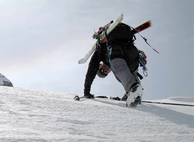
Wonderful photo. Now let's see a skiing shot! Cool you got that direct line like Sam did. Maybe that'll motivate me to do it early some year.
Wow! Great pic... makes me feel like I'm there. A little shot of adrenaline at work.
We were able to ski the direct face down through the rock bands, it actually looked better then the gully to skiers right. I doubt the snow in the lower rock bands will last much longer , at least the small patch we used anyway.
Here is one from climb up

I'll try to post some other pics later tonight.
Here is one from climb up
I'll try to post some other pics later tonight.
AlpineRose, that was us, nice to chat with you for a little while. We especially like that route to avoid all the commotion of the Muir snowfield. Glad you were able to enjoy that same solitude and the great corn. See you on the mountain again sometime :).
author=kam link=topic=4725.msg20128#msg20128 date=1147826299">
um, i get a different result...
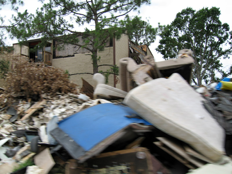
You could have picked a worse place, for example Gretna, Louisiana last weekend . . . only mountains there were from piles of garbage hauled out to the street in front of vacant buildings!
I have a route photo in the "Route Photos" section of this site...
Way to get out there. I plan on a 9 day hike through this area later in the summer. Maybe next year I'll have to make that a ski :)
Way to ski a great route, OH. Definitely a classic. If OH doesn't have any pictures and it's all right with him I could post one. Pretty sure Sam could too.
Sam, I also want to ski it again. But later in the season. It makes a good Independence Day celebration descent...
Sam, I also want to ski it again. But later in the season. It makes a good Independence Day celebration descent...
Hey, Mad Dog and Ron,
I think it was you two we met on the Paradise Glacier. We were the party of three on our way to Anvil Rock for our own corn fest. You remarked this was your favorite route. It was our first time on this particular route. And it was a good one indeed.
I think it was you two we met on the Paradise Glacier. We were the party of three on our way to Anvil Rock for our own corn fest. You remarked this was your favorite route. It was our first time on this particular route. And it was a good one indeed.
Cool - sounds like a really fun trip! My wife was up on the Sulphide on Sunday with two friends and mentioned two skiers coming up form the North side...she also talked about the traffic jam on the summit and decided to pass. I saw a photo of the crowd - pretty impressive....
Any photos ;-)?
Any photos ;-)?
:D Glad you enjoyed yourself on the NF. I love that route and have been meaning to ski it again.
Were you able to ski down the direct face through the rock bands or did you have to head skier's right down the usual gully onto the lower face?
Were you able to ski down the direct face through the rock bands or did you have to head skier's right down the usual gully onto the lower face?
Nice work Charles,
Thanks for the thorough (as usual) conditions report.
Williams Lake is one of our favorite base camps (aside from Aug '04 when we spent half of our 8 days tent bound in the pouring rain), though we haven't gotten the four of us in there on skis (yet). We've been anticipating the closure for a couple of years now with mountain bikes at the ready. Pedal, hike, ski,...
-Dave R
Proud work!
Any photos? How early was early for the start?
Any photos? How early was early for the start?
Nice ;D. Though I didn't know that Virginia was this high in altitude ;-)
author=allyson link=topic=4725.msg20049#msg20049 date=1147649881]
...oh, and kam--we all agreed that the views kinda reminded us of virginia... ::)
um, i get a different result...

but thanks for calling me on your lunch break up there...
Here's a few more pictures from Shuksan:
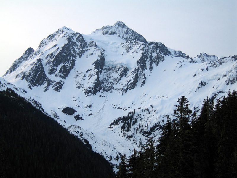
Shuksan in early morning light
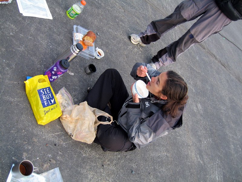
Petit dejeuner aux parking
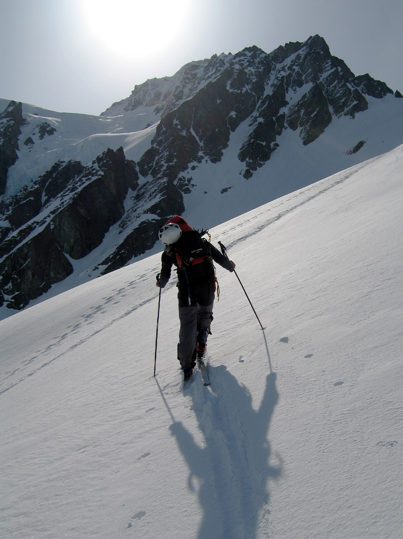
Michael skins on the lower White Salmon
Booting Winnie's Slide
Shuksan in early morning light
Petit dejeuner aux parking
Michael skins on the lower White Salmon
Booting Winnie's Slide
Right on! Sounds like a great adventure. Glad to hear that you had good snow. I was down there a week before you and and things were melting like crazy.
Thanks for sharing. That's a great area. I'm a little bummed that we'll be losing the rapid road access we have now (well protected as it is by the rocks and fear-inducing puddles (complete with theories on how to approach the puddles on nwhikers.net) - I've gotten in a few long weekend style late-summer backpacks up to Ivanhoe/Williams area that were awesome and suprisingly empty of people considering the season and weather we had. Oh well, soon my lazy bones will need longe...
Patrick,
It sounds like you headed right, up the steep slope a 1/4 mi short of Comet Falls where the trail crosses the stream(and the bridge used to be)?
Was that very technical? It looks pretty nasty.
-Gus
It sounds like you headed right, up the steep slope a 1/4 mi short of Comet Falls where the trail crosses the stream(and the bridge used to be)?
Was that very technical? It looks pretty nasty.
-Gus
Nicely done. That's a good amount of terrain to cover in that amount of time. I did some July turns up that way last summer around La Bohn Gap during a backpack trip with my son. We stood at the base of Hinman, but his short legs were pretty tired by that point so returned to camp at Williams Lake. It's going to become much more remote once that gate closes. Beautiful place with lots of room to explore. I want to head in their again via Necklace Valley.
That looks great!
Thanks for the report...
Thanks for the report...
author=Robie link=topic=4729.msg20089#msg20089 date=1147743989]
It is truely disgusting that Jeanette never makes a bad turn!
Thanks Robie and Doug, but you should have been there when I was learning, all those "bunny" hills might as well have been the Nisqually Chutes ;). Maybe that's one advantage of learning to ski when you get "older," you hate to fall down, it's harder to get up ;).
Nice run. I think you picked one of the best line combos Pilchuck has to offer. I think thats the SE chute you rode. It doesn't seem like a "gunsight" to me, but it is a chute and and it faces SE. Maybe gunsight comes off of the summit ridge to the north??? That chute, in combo with the "pilchuck hemispheres" (in your first picture) is pretty fun....I was a little late and missed skiing with everyone I knew! Damn!
I tried to post this TR but it would allow me because the same trip was already posted so I decided
that instead of trying to trick the server into believing its a different post I decided to just add it to this post ( I felt that the info could be valuable to other mounteneers)
So I had heard of this old abandoned ski resort called Mt Pilchuck that had a lookout tower on top that had amazing views of the cascades, Olympics and the Puget sound so I decided that I had to go check...
"Be civil and respectful, avoid personal attacks - that is the norm here;"
It is truely disgusting that Jeanette never makes a bad turn!
I just hate that.
It is truely disgusting that Jeanette never makes a bad turn!
I just hate that.
author=jonthomp link=topic=4733.msg20085#msg20085 date=1147742685]
It seems so hidden from most vantage points. From where did you pick it out?
I think it's mostly visible from the summit of Sahale actually... so lots of folks see it.
Toby- Cool to see you up there yesterday! I'm glad the good corn held-up despite the warming temps!
Wickstad- Great meeting both you and your wife!
Definitely a fun morning out in the sun and corn! and "back in town" in time for Mother's Day dinner!
Unfortunately, my mom doesn't have too fond of memories of skiing Pilchuck (back when the lifts were in operation)...something to do with my dad leading her down the infamous "Funnel"...
author=Jason_H. link=topic=4733.msg20072#msg20072 date=1147727200]I bet CJ couloir looked good.
In the morning, yes. Returning in the afternoon it still looked good, but only photographically; a big, wet slide had cruised out of it a fair ways into the valley.
Hey, Phil, we were all curious how you found this route. It seems so hidden from most vantage points. From where did you pick it out?
Heya Patrick- Glad to hear your out harvesting the corn this spring! Sounds like it was a great tour! I still have to get up to Van Trump Park one of these years 8)
Nice pix Kenji. Like minds almost think alike. Was out there 24 hours before you doing the loop. NE run from the notch was sublime. Probably saw my uptrack from lake. Not to hijack this post but for loopers run down Bryant Couloir won't last long. Moat forming in narrow part.
Great area.
Great area.
We were there on Sunday the 14th. at the bottom of Madison Ave at about 10:30. Nice corn snow the entire way, and no remarkable temperature differential that day.
Our route was intentional. I read an old TAY trip report, can't remember who posted it, or when, but he described the birthday tour in reverse, and included the extra loop around Copper Mt. I liked the addition - extra mileage, solitude, and new views. We contoured around Copper Mt. with a minimum of altitude loss,...
Our route was intentional. I read an old TAY trip report, can't remember who posted it, or when, but he described the birthday tour in reverse, and included the extra loop around Copper Mt. I liked the addition - extra mileage, solitude, and new views. We contoured around Copper Mt. with a minimum of altitude loss,...
Hi Jessica- The book says the trailhead is 4.5 miles from the highway, so I'd estimate we were 4.25 miles up the road (just a few hundred yards from the trailhead). A Subaru had a run at the snow covered road, but they were high centered and very much stuck. Kinda funny, but when we came around the corner where they were stuck, it looked like a prison gang hard at work with all those shovels and snow flying! (we sheepishly offered to help!)
On photo ops... plenty here. We co...
On photo ops... plenty here. We co...
Cool! Nice to see someone else experiencing the Magic ;)
Looks like a great day...
Looks like a great day...
So Clem, was your route over Copper Pass planned or a case of, as Scotsman puts it, "the blind leading the blind?"
We erred over there following the obvious skin track, then realized it was incorrect (for the B-day Tour) and cut back to COL2 by going up the valley.
I'm still very much learning the ropes of my Garmin E-trex Vista and often find that it will seem to point in most every direction at some point when using the "Go To Waypoint" function...
Wish I could post more pictures here, but when I get time I'll make a web page and put up a set, then post the link.
Like Jon said it was a fantastic day - perfect weather, great snow, and just enough challenge to make it spicy - all in one of the most beautiful places on earth. We filled a lot of memory cards!
First picture is taken from the pass looking over at Jon and Jeff traversing the basin over to the climb - the couloir isn't visible, but is behind and pa...
Thanks Tony.
How far up the road could you drive?
Great photos, too.
Jessica
How far up the road could you drive?
Great photos, too.
Jessica
Nice show you two. Those last two shots of J-Nette are showing some sweet form.