TR Replies
A friend skied it this past weekend and said they parked at the Morrison creek campground
It's good to see Helmstadter is back in action. Always inspiring rarely imitated.
i don't know. leuthold was actually plan A for me on that day, but i switched last minute because I thought it would need more time to soften than my window allowed. given what i saw on south and east facing stuff, i'd be surprised if it wasn't in really good shape tho.
author=Lowell_Skoog link=topic=38570.msg156101#msg156101 date=1496208230]
I think this is to be expected when a deep snowpack is warmed rapidly before it has a chance to settle and consolidate.
Do you think this is an effect of greater snowpack creep, or that the bridges over such obstacles fall apart in the first warmup?
author=tabski link=topic=38570.msg156099#msg156099 date=1496200650]
Heck yeah Dan, nice one. That upper berschrund feature is looking lots different than in past years.
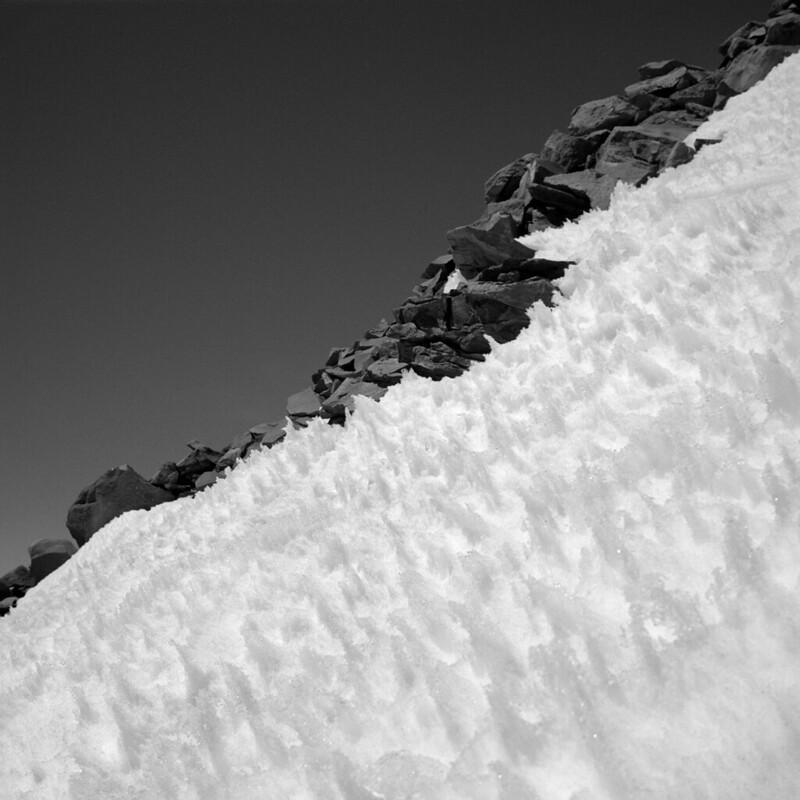
Does anyone else feel like bergschrunds, cracks and moats are very large this spring despite a good snow year?
X2. I was hoping to ski the Diller Headwall on M Sister and there were big-ass schrunds under ever possible exit, way bigger than past years.
What altitude was snow line? Or alternately, how many miles did you walk on road before reaching the summer TH?
author=tabski link=topic=38570.msg156099#msg156099 date=1496200650]
Does anyone else feel like bergschrunds, cracks and moats are very large this spring despite a good snow year?
Based on the photos I'm seeing, yeah.
I think this is to be expected when a deep snowpack is warmed rapidly before it has a chance to settle and consolidate.
Heck yeah Dan, nice one. That upper berschrund feature is looking lots different than in past years.
Does anyone else feel like bergschrunds, cracks and moats are very large this spring despite a good snow year?
Does anyone else feel like bergschrunds, cracks and moats are very large this spring despite a good snow year?
The blue route is GOld! including going up Golden gate. I'll have to try the purple route next time.
http://www.turns-all-year.com/skiing_snowboarding/trip_reports/index.php?topic=21052.0
http://www.turns-all-year.com/skiing_snowboarding/trip_reports/index.php?topic=21052.0
The one time we climbed Boston from Sahale in ~September, getting onto the uppermost reaches of the Boston was easy. I just don't have any insight into how broken-up it might be to wrap around to that saddle from Sharkfin Col. It looks possible from maps/satellite images.
On the other hand, when we were on Sahale two weeks ago, the east side of the Sahale/Boston ridge had some amazing cornices hanging above the Davenport Glacier, which might complicate any escape to the Quien Sab...
On the other hand, when we were on Sahale two weeks ago, the east side of the Sahale/Boston ridge had some amazing cornices hanging above the Davenport Glacier, which might complicate any escape to the Quien Sab...
author=tabski link=topic=38564.msg156084#msg156084 date=1496180713]
Any opinions out there on reversing Sharkfin col to return to the Boston Basin side, from the Boston Glacier? From the Boston Glacier side I remember seeing a gully potentially easier to ascend just east of the Sharkfin col, leading to ridge and ramps downclimb-able back onto the Quien Sabe... Quite the barrier for sure.
I vaguely remember traversing Sharkfin col...
yeah nice -- and timely -- report Charlie!
like Jeremy, I've also descended to the Boston Gl via the higher col/notch a bit east of the typical Sharkfin rap. No raps when we skied it three years ago tomorrow. So, if there's enough snow to ski it, expect that climbing it wouldn't be too bad when carrying the gear one would carry for this traverse. It was pretty steep, and wove through some minor cracks. Our ascent from the Q Sabe side was mellow on snow. I think Jer...
like Jeremy, I've also descended to the Boston Gl via the higher col/notch a bit east of the typical Sharkfin rap. No raps when we skied it three years ago tomorrow. So, if there's enough snow to ski it, expect that climbing it wouldn't be too bad when carrying the gear one would carry for this traverse. It was pretty steep, and wove through some minor cracks. Our ascent from the Q Sabe side was mellow on snow. I think Jer...
Great beta photo, Charlie. That'll be helpful for future parties!
Drew...Years ago I reversed Sharkfin Col from the Boston after a failed attempt on the NW side of Forbidden. Haven't met anyone else who has done that...so not really recommended. It was mid summer and felt like 5.8 with mtn boots and crampons on. It took OK rock gear, but was loose and bulgey and was way more serious than the other side of Sharkfin. I've gone up and over the alternate col you mention, bu...
Drew...Years ago I reversed Sharkfin Col from the Boston after a failed attempt on the NW side of Forbidden. Haven't met anyone else who has done that...so not really recommended. It was mid summer and felt like 5.8 with mtn boots and crampons on. It took OK rock gear, but was loose and bulgey and was way more serious than the other side of Sharkfin. I've gone up and over the alternate col you mention, bu...
Good one!! Heard that is an awesome shot...Sylvain s had grat thing to say about it!!
Btw..any idea how runneled leotholds c is..
onlly time i did it pretty much a non issue...just a tad at the dog leg.
Btw..any idea how runneled leotholds c is..
onlly time i did it pretty much a non issue...just a tad at the dog leg.
Yeah I was comparing those two routes a couple weeks ago. Seems as if the route described in Volken's book is much better suited for non-skiers as it involves so much flat traversing.
I put together some GPXs on caltopo for reference: https://caltopo.com/m/C47B
The blue/purple routes seem to be much more desirable for a skier...
I put together some GPXs on caltopo for reference: https://caltopo.com/m/C47B
The blue/purple routes seem to be much more desirable for a skier...
I skinned up up lower I and about halfway up upper I, but booted the rest of upper I when the skinning got too sketchy. Even at 9AM Sunday, it was warm enough that steep sidehill skinning was a real pain. I only saw the entrance to upper I from below, but it looked a bit sporty - with either a scramble or mandatory air. Lower I was probably the best skiing of my trip.
Thanks for sharing, sounds like a real adventure.
Any opinions out there on reversing Sharkfin col to return to the Boston Basin side, from the Boston Glacier? From the Boston Glacier side I remember seeing a gully potentially easier to ascend just east of the Sharkfin col, leading to ridge and ramps downclimb-able back onto the Quien Sabe... Quite the barrier for sure.
Any opinions out there on reversing Sharkfin col to return to the Boston Basin side, from the Boston Glacier? From the Boston Glacier side I remember seeing a gully potentially easier to ascend just east of the Sharkfin col, leading to ridge and ramps downclimb-able back onto the Quien Sabe... Quite the barrier for sure.
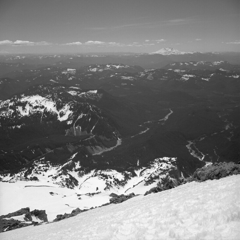
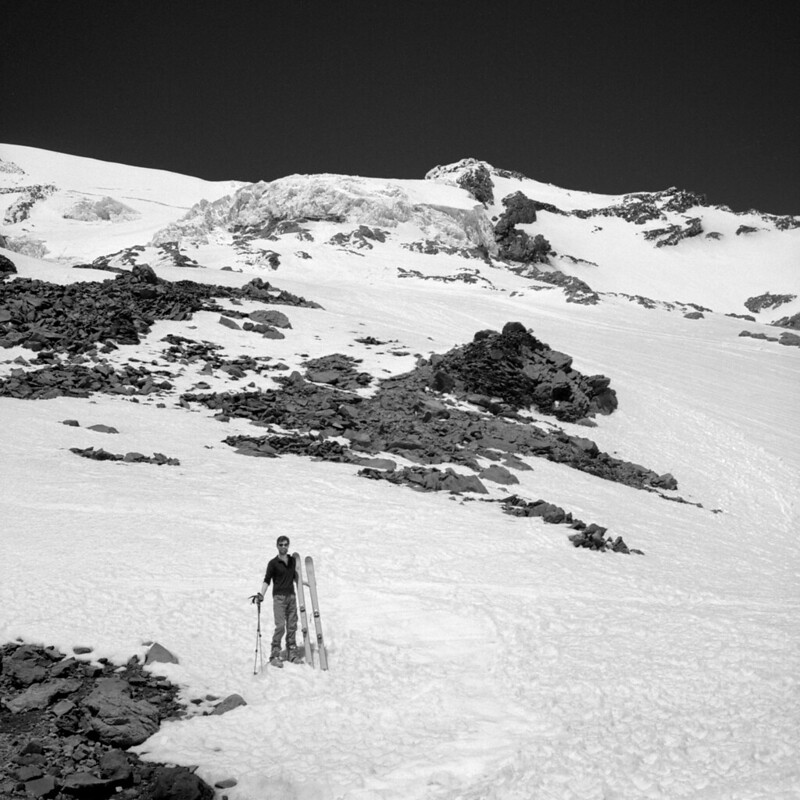
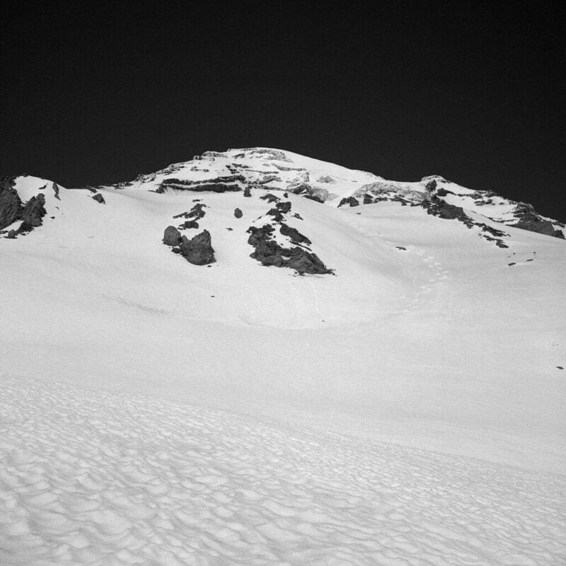
Here are a few images from our Sunday May 28th venture
https://www.flickr.com/photos/11723786@N06/albums/72157684342200946
As Jim mentioned we did not follow the summer hiking trail and passed it, staying straight on the old cat track of the abandoned ski area, folks call this the "winter route". We were skiing about 10 min walk from the parking lot, but as Jim mentioned the snow is melting very quickly.
Here are a few interesting links about the histor...
Also, regarding the descent to Moraine Lake: we took the route down the green snow finger in your photo and were then able to walk/scramble down to the lake without a rappel and careful route finding (the snow finger above the lake in this photo -- some of the photos in the old TR aren't displaying, but they are available by clicking):
http://www.one-times-one.com/misc/trip_reports/forbidden/moraine_lake_valley_skin.jpg
http://www.one-times-one.com/misc/trip_reports/forbidden/moraine_lake_valley_skin.jpg
Nice report and good info about conditions in the area. FWIW, we were able to easy skit around the south side of Moraine Lake during our 2008 trip. It was a mix of boulder hoping and traversing across low angle snow slopes. Tedious but easy.
http://www.turns-all-year.com/skiing_snowboarding/trip_reports/index.php?topic=10555
http://www.turns-all-year.com/skiing_snowboarding/trip_reports/index.php?topic=10555
Thanks for the report. We were originally planning to do the Forbidden Tour the same time you two did, but instead opted to wander around the Eldorado/Klawatti area. On the way in (around 1pm on the 27th) we met two guys coming out of the Forbidden Tour down the boulder field, who I believe said the crux of the tour was the approach. I wonder how much melt there was since they started.
We were the three sitting on the ground in the Eldorado parking lot eating Cheez-I...
We were the three sitting on the ground in the Eldorado parking lot eating Cheez-I...
Given that the USGS quads for Mt.Hood show a far more glaciated mountain than we currently have, prior to doing this trip I kind of nerded out wanting to have some maps that would show just when exactly we were on crevassed terrain - I took the satellite images and USGS maps available side by side on Hillmap and made composite maps in photoshop all around the mountain. If anyone would like to download them, they are available here:
https://goo.gl/photos/QRZsqQy1MrzXqe8HA
<...
https://goo.gl/photos/QRZsqQy1MrzXqe8HA
<...
author=sprice link=topic=38554.msg156052#msg156052 date=1496109139]
So back to the 7:07 time. (!) What is the vertical total, since you drop down to the start of liberty ridge?
Total vert gained 11,222 over 21 miles according to GPS
author=Scottk link=topic=38562.msg156066#msg156066 date=1496162973]
Beautiful area. One of my favorite trips ever. We exited via White Pass and Indian Creek, which might add another day, but it has a trail and is free of slide alder and creek crossings.
Thanks Scott! We checked out your post before the trip and it inspired us!
Beautiful area. One of my favorite trips ever. We exited via White Pass and Indian Creek, which might add another day, but it has a trail and is free of slide alder and creek crossings.
Looks super good. Coverage really is all-time for late May. I'm glad that my beta was useful!
Nice TR and beautiful photos! Spring/summer weather is finally here!
"We caught up to what appeared to be a father and 2-son team who already had their harnesses on with dangling ice screws."
^ reminds me of La Graving... https://youtu.be/Tpqi4E7OLPs
"We caught up to what appeared to be a father and 2-son team who already had their harnesses on with dangling ice screws."
^ reminds me of La Graving... https://youtu.be/Tpqi4E7OLPs
I went up Thursday and was delighted with the conditions. I figured there would be a crowd on the weekend.
So back to the 7:07 time. (!) What is the vertical total, since you drop down to the start of liberty ridge?
d
d
We did Emmons this weekend. Here's the timeline of the rescue:
Saturday night, after various flybys, 2 park rangers were dropped off at the Winthrop saddle then descended to the accident site.
Sunday morning, around 9-10am, a 3rd ranger was dropped off at the accident site via short haul.
2nd flight, ranger and victim were short hauled out.
3rd flight, gear was short hauled out.
4th flight, the 2 park rangers were short hauled out and d...
That would make sense. Someone else told me that they had earlier seen what looked like a litter hanging from the line, but at that point none of us had a vantage point to see where it had come from. What I saw later looked like a person with no litter.
author=jakedouglas link=topic=38554.msg156041#msg156041 date=1496071519]
This may have been one of the helicopter trips I saw, but the article says that accident occurred at 12.3k and I'm nearly certain that I saw them haul someone from the summit area.
My guess is that some of the rescuers climbed back to the summit while the victim was flown to the hospital and were extracted (and inserted) there because of the safer LZ
We were up there yesterday, and did veer left into the opening with lots of tracks before the summer trail crosses the creek (aka "the winter route"), and got onto continuous snow very shortly after that. Pretty much top to bottom skiing save for that little bit at the bottom. But it is definitely melting fast - the difference at the bottom at the end versus beginning of the day was quite noticeable.
This may have been one of the helicopter trips I saw, but the article says that accident occurred at 12.3k and I'm nearly certain that I saw them haul someone from the summit area.
flying machine for skier injured by crevasse fall
http://www.seattletimes.com/seattle-news/injured-climber-plucked-from-crevasse-on-emmons-glacier/
http://www.seattletimes.com/seattle-news/injured-climber-plucked-from-crevasse-on-emmons-glacier/
author=joshc link=topic=38551.msg156027#msg156027 date=1496003034]
Ten minutes of walking on the snow-free summer trail got us to continuous snow. We started skinning here, but I wish we'd booted for just a few more minutes.
Thanks for the report, and welcome to the community. Glad you and your partner had a fun time on Pilchuck.
We were up on Pilchuck May 28th. It seemed like we had to walk on the summer tra...
Saw the reid from lolo pass the other day, very filled in. In my experience spring is a terrible time for leuthold's, given the runnel in the hourglass, but if you send it and it's smooth, let me know!
creek crossing didn't look bad directly ahead of the pile of trees left in the avalanche gully. But easier and fast was to head straight up the hill after the debris and boot or skin to glacier basin camp
Similar experience on the 26th. Lower trail was brutal, but corn on the Prow to 6k was off the hook.
No easy way to get to Glacier Basin, but it is worth the effort.
https://goo.gl/photos/yrBQRtRjgw1aatKr7
SFIV
No easy way to get to Glacier Basin, but it is worth the effort.
https://goo.gl/photos/yrBQRtRjgw1aatKr7
SFIV
Thanks for the tr! wy e is a hoot...btw, have you had a look at Leutholds c ...curious if anything out of the ordinary troubling when crossing the reed gl to gain lume saddle (on the decent...I ascend the old chute and ski leotholds in order to mimimize objective bombardment..)
Thanks for all the photos! Getting some serious 'fear-of-missing out' not living in the PNW this year. Great to hear about so many skiers on the north side, and that the guided sloggers, on the most revered guided trip in the country (?), got sloppy 9th's to a bunch of skiers' booter.
Thanks! So your saying there's a chance... :) Likely not due to the size of the sled community.
Guiding can be perceived in different ways. The skiers that used the sled for access in this thread could have most definitely used a guide that day! But more likely, they should have spent years getting to know the area, building skills and judgement through personal desire, drive, and experiences, then proceeded with caution.
Please join CFFR (if not already) for the greater good of...
The practice of responsible community, whether at your company, in your city, your country, or in the backcountry, follows a simple guideline:
Participate in the structure and organizations that determine policy. Voice our differences in those forums and leave the room, once participatory democracy has resulted in policy, honoring that policy. Sledders have a voice and rights. Wilderness must be respected by all on the honor system. Guides help people engage in backc...
Participate in the structure and organizations that determine policy. Voice our differences in those forums and leave the room, once participatory democracy has resulted in policy, honoring that policy. Sledders have a voice and rights. Wilderness must be respected by all on the honor system. Guides help people engage in backc...
Clearly, the sled community needs expansion of riding areas and a shift of the imaginary lines to include some fun terrain to ride with enough to last for more than a day. But, I fear the riding areas will continue to shrink, leading some to go beyond the imaginary lines and leave tracks in the snow, much to the dismay of people who think it should all be theirs.
IMO- "guides" are worse than sleds in the Wilderness!!! They introduce people with lacking skills into terrain a...
IMO- "guides" are worse than sleds in the Wilderness!!! They introduce people with lacking skills into terrain a...