
TR Replies
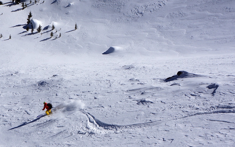
I finally skied Anthony Lakes for the first time this past December, sometime between Xmas and New Years. I had thigh high pow pow that day in Angell Basin (and I am not a midget)! I love the Elkhorns and Wallowas and hope others appreciate & respect their magic as much as I have.
Nice. We've taken 4 trips over there this year which produced 10 or 12 powder days. It's a bit of a drive, but not many alternatives this year short of trip to Vermont. The last time there we even bought the $199 special for new season pass holders for next year, and have already gotten a day's use out of it. We were in Angell Basin on Mar 2nd and noticed that slide. Long crown above a pretty obvious slide path that I doubt I'd ever ski. Pretty easy to avoid that side while c...
Nice Drew, most enjoyable read and memory trigger. Had one of my finest days in the mountains up there skiing a 3-fer many years ago with Monika.
Lizard must be skied to be enjoyed.
Lizard must be skied to be enjoyed.
Thanks for the report! Looks great, the Elkhorn's have been on my to do list, the snow looks better than anything I have skied in awhile.
First off, this is absolutely fantastic. There is more detail/clarity in this map than basically any other digital map I have found. I also like the color classifications of the terrain.
Not sure it you are working on it, but my only request would be to include more than just the Paradise/Summit corridor. Sunrise, Glacier Basin/Inter Glacier.
Great work, a very useful tool!
Not sure it you are working on it, but my only request would be to include more than just the Paradise/Summit corridor. Sunrise, Glacier Basin/Inter Glacier.
Great work, a very useful tool!
I climbed Chaval with my older brother and a friend in May 1983. No skis.
We approached from the Illabot Creek road by thrashing up through the woods to the ridge north of Jug Lake. I think we climbed near the vague streambed above the north end of the clearcut above the road, visible on the USGS topo map.
We traversed the basins above Jug Lake and bivied near Point 6356. On the second day we climbed the SE ridge of the east peak, the west ridge of the middle peak, and tra...
We approached from the Illabot Creek road by thrashing up through the woods to the ridge north of Jug Lake. I think we climbed near the vague streambed above the north end of the clearcut above the road, visible on the USGS topo map.
We traversed the basins above Jug Lake and bivied near Point 6356. On the second day we climbed the SE ridge of the east peak, the west ridge of the middle peak, and tra...
Excellent!
I made a foray in that direction years ago, got beat back by brush, never made it above timberline. Looks like your line is a better choice. That north facing cirque is attractive, a good motivation to take the steep mossy challenge from the illabot side!
Agreed that stomping directly down the creek makes a quick and fun exit, in dry season. Have you any more photos of the steeper bits in the trees?
I made a foray in that direction years ago, got beat back by brush, never made it above timberline. Looks like your line is a better choice. That north facing cirque is attractive, a good motivation to take the steep mossy challenge from the illabot side!
Agreed that stomping directly down the creek makes a quick and fun exit, in dry season. Have you any more photos of the steeper bits in the trees?
author=savegondor link=topic=33864.msg139911#msg139911 date=1425938006">
do you have gps tracks for this?
Hope this works! sloan track on Hillmap
Nice pic's - wish more were posting because that mountain is TRAVELED - accept by me this year :(
Well done - takes a lot of work to get to snow line on a year like this.
James. I'd say you are right. Not even possible. We skied pretty much as far as the snow took us which was about 4600
Wow, that's a long walk for Ruth in March! But it's beautiful in any season, well done getting it.
In the early summer we typically go down into the valley and survival ski as far as we can before crossing the creek and bailing up to the trail - looks like that's going to be not even close to possible this year.
In the early summer we typically go down into the valley and survival ski as far as we can before crossing the creek and bailing up to the trail - looks like that's going to be not even close to possible this year.
All skiing was done between 12,419 ft (Lake Peak) and 10,300 ft (bottom of Winsor Trail on low side of Ski Santa Fe parking lot).
This looks fun. What is the elevation for these N facing goodies?
'Round here the pow hides in the shade even more than elsewhere. Sunny aspect pic of yours truly from early in the day.

It was actually better today than the day it looked like this in the same area last month.
CIAO
It was actually better today than the day it looked like this in the same area last month.
CIAO
Thanks! The website says the road is OPEN but then goes on to say: "Road closed to vehicles at mile 2.5 (Goat Mountain Trailhead) due to landslide and water damage. Road snow free. Hannegan Pass Trailhead at mile 5.0. Status Updated:02/20/2015"
I guess the FS does not have the funds to keep information updated properly :(
I guess the FS does not have the funds to keep information updated properly :(
We drove all the way to the end of the road.... to the Hannegan Pass TH. There's a sign that says the road is closed due to road damage. But we found no road damage and just kept on driving. Not sure why the sign is there honestly.
Dan, what is the road status? Still closed at the Goat Mt. TH?
Thanks for the trip report.
Thanks for the trip report.
Silas, I should have known that if it is skiing, you are woven into the fabric, even in Aspen, nice work getting the goods in the world of Gucci!
I have not had even close to that run this year, and I am green with envy, nice work!
From tabski's post on eldorado to this one and many others it is clear this is a sacred and holy place. Awesome to share in the glory!
Beautiful thoughts and words.
author=Rowan Stewart link=topic=33884.msg140003#msg140003 date=1426217847]
Tele steeeze, yes!!!
When you going tele?
"The Adams Family..."
"... da da da da snap snap"
Great skiing!
"... da da da da snap snap"
Great skiing!
How did you make that track photo?
Edit: huh, looks like google earth with gps tracks. Image is good enough it tricked me
Edit: huh, looks like google earth with gps tracks. Image is good enough it tricked me
That looks like a fun way to tele! What a cool idea for the paddle and what great looking style in the way down. Makes my turn look like trash.
Thanks for the great post,wonderful video as well.
Nice work Jeff, love the sunset shots, and some of my favorite music!
Well said Drew. The human condition with its fragile grasp on time and space, is ominous and inconsolable at times. I like to think that if I were a ghost I'd be attracted to these mountains, such as on Eldorado. It seems logical then that Liz, who's cut of the same cloth as all of us, would be giving high fives and singing along with you guys throughout the day. Good luck finding your balance out there. The glaciers and rock, rivers and lakes, forests and slide alder (yeah, even them)...
Awesome jeff ..... thanks for sharing. Great trip, into a beautiful mountain zone. Feeling fortunate to be part of your video, well done. The clear days, in the cascades....does not get much better than that.
Good one.... great to chat in the parking lot.... I was glad to have 3 clear days in the cascades. Just enough time to finally get up Eldorado peak.
Thanks for the TR; it's one of my favorite tours too. FYI, technically I believe this is the Forbidden TOUR (as you said in your first sentence, but not in your title or in the video). The [Torment-] Forbidden Traverse is the rock climbing route from Torment to Forbidden.
Yea Andy. The Forbidden is one of my favs as well. Way to grind it out despite being sick. Great video Jeff! You used a classic by the Talking Heads. Good to see gen X using some of their elder's music.
Awesome pics Radka! Ives corn, Old Snowy ladybugs, flat slope kicker/Splitrocks/St Helens, Three Dot Chute, Blue Sky/B&W, Goat Lake, sundials and vapor trails! The last time I skied off C. Gilbert we had a Big Billie kicking rocks of the cliffs skiers rt. of the "glacier chute"! Oh, and stars! Fabulous night shot.........I'm thinking Cougar.
Great write up man. Love the beauty of the Alpine.
We saw your tracks, on our exit. Well played, living like Liz!
Great video, fun vibes!
Andy, great to see you guys in the parking lot. I blame the fatigue on those XXL Hummelpacks you guys were carrying. ;) I'd love to ski with Jason more often, but I don't think he knows what a day trip is! ;D
Andy, great to see you guys in the parking lot. I blame the fatigue on those XXL Hummelpacks you guys were carrying. ;) I'd love to ski with Jason more often, but I don't think he knows what a day trip is! ;D
I can't decide which trip was harder. Being sick for three days on this one or suffering on the 1 day epic. Either way, epic trip in the awesome North Cascades. Probably one of the most scenic and aesthetic trips I've experienced so close to home.
Looks like you had a great day in the mountains. We dragged our tired bodies up Eldorado after three days on the Forbidden tour 2 days later. Experienced my first brocken spectre as we descended the summit ridge. Can't help but think that my late uncle Petr and Liz were watching from above.