- Posts: 1272
- Thank you received: 0
Major storm cycle brings 4-8 ft of snow Jan 7-14!
- flowing alpy
-

- User
-

Less
More
12 years 5 months ago #211642
by flowing alpy
Replied by flowing alpy on topic Re: Major storm cycle brings 4-8 ft of snow this week?
southern california is just growing, no big deal.
b
b
Please Log in or Create an account to join the conversation.
- Amar Andalkar
-
Topic Author
- User
-
Less
More
- Posts: 635
- Thank you received: 0
12 years 5 months ago #211648
by Amar Andalkar
Replied by Amar Andalkar on topic Re: Major storm cycle brings 4-8 ft of snow this week?
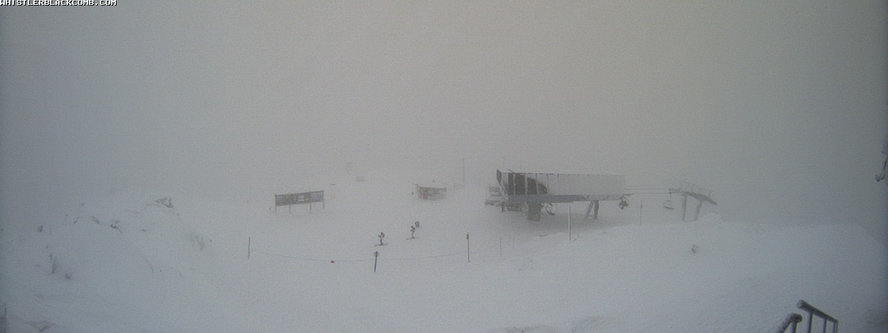
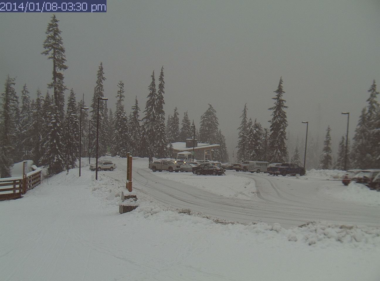
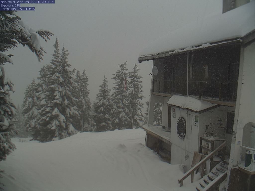
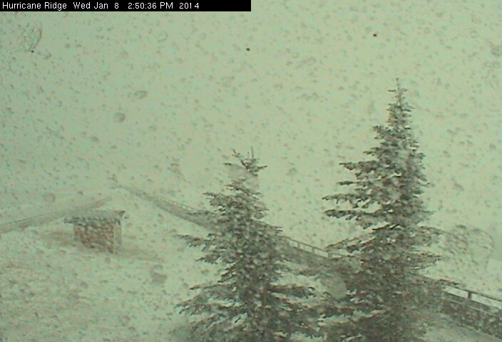
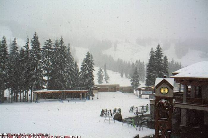
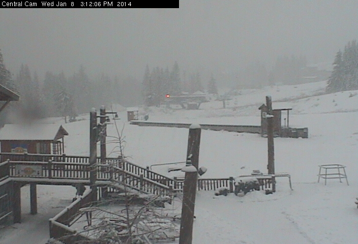
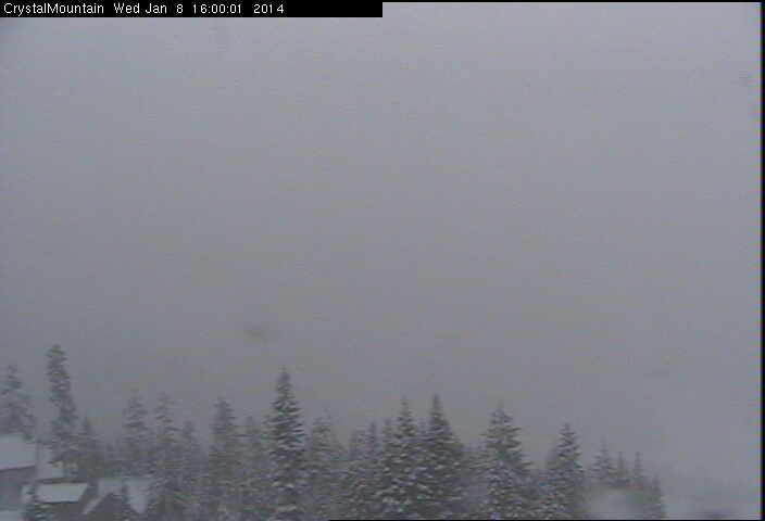
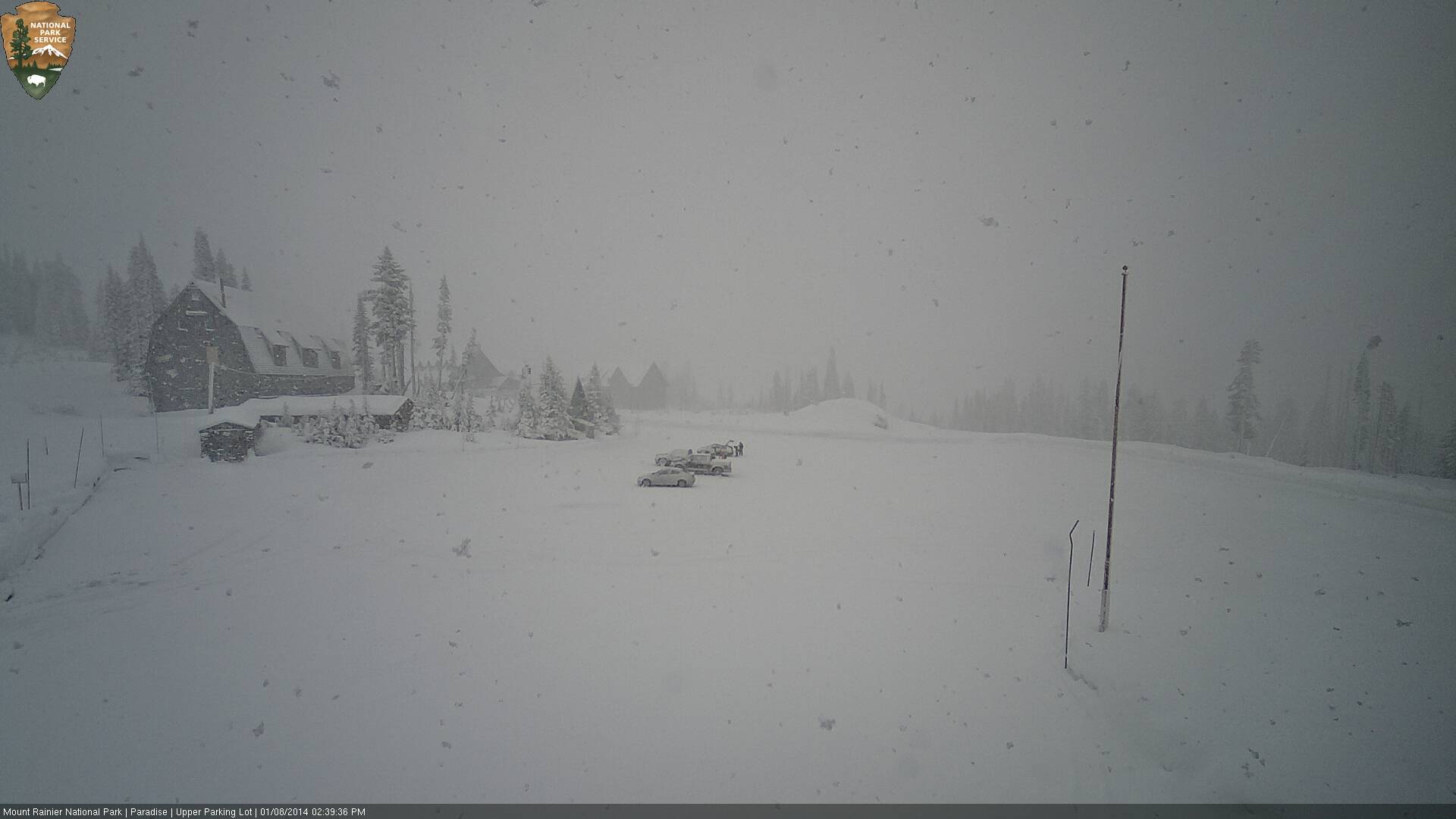
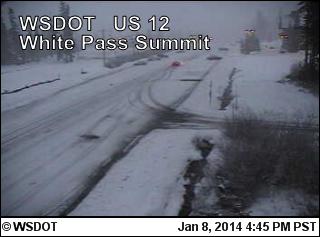
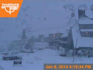
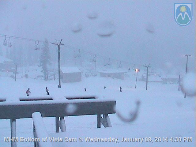
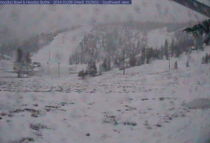
Maybe those snowless photos from California are just too depressing. Thankfully, it's currently snowing over a 600+ mile stretch of the Pacific Northwest mountains, extending from the Coast Mountains and BC Cascades, through the Olympics, Washington Cascades, and Oregon Cascades as far south as Crater Lake. Here are some much nicer SNOWY webcam images from today across that entire length:
BC:
Whistler Peak, 7150 ft:
Whistler Olympic Park, in Callaghan Valley near Mt Cayley, 2800 ft:
Mt Garibaldi, Brohm Ridge, 4900 ft:
WA:
Olympics, Hurricane Ridge, 5250 ft:
Stevens Pass, 4100 ft:
Snoqualmie Pass, 3000 ft:
Crystal Mtn, Gold Hills, 5000 ft:
Mt Rainier, Paradise, 5400 ft:
White Pass, 4500 ft:
OR:
Mt Hood, Timberline Lodge, 5900 ft:
Mt Hood Meadows, 5250 ft:
Santiam Pass, 4800 ft:
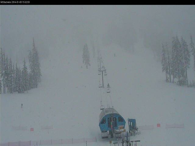
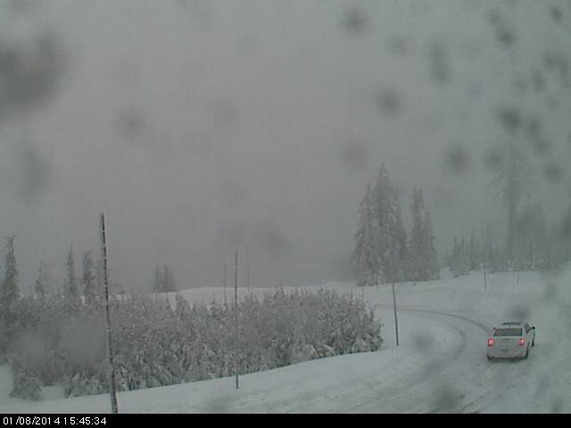
Mt Bachelor, West Village, 6350 ft:
Crater Lake, Rim Village, 7100 ft:
BC:
Whistler Peak, 7150 ft:
Whistler Olympic Park, in Callaghan Valley near Mt Cayley, 2800 ft:
Mt Garibaldi, Brohm Ridge, 4900 ft:
WA:
Olympics, Hurricane Ridge, 5250 ft:
Stevens Pass, 4100 ft:
Snoqualmie Pass, 3000 ft:
Crystal Mtn, Gold Hills, 5000 ft:
Mt Rainier, Paradise, 5400 ft:
White Pass, 4500 ft:
OR:
Mt Hood, Timberline Lodge, 5900 ft:
Mt Hood Meadows, 5250 ft:
Santiam Pass, 4800 ft:
Mt Bachelor, West Village, 6350 ft:
Crater Lake, Rim Village, 7100 ft:
Please Log in or Create an account to join the conversation.
- Amar Andalkar
-
Topic Author
- User
-
Less
More
- Posts: 635
- Thank you received: 0
12 years 5 months ago - 12 years 5 months ago #211666
by Amar Andalkar
Replied by Amar Andalkar on topic Re: Major storm cycle brings 4-8 ft of snow this week?
Update #3: 72 hours after initial post, models are still predicting totals of 4-8 ft (or more) of snow this week
Another day later, and 2 more subsequent runs of the UW WRF-GFS model at 12-hour intervals continue to show similar predictions for large snowfall amounts through the weekend. The higher-resolution 4 km model runs now cover the period through Sunday evening, and the consistency between subsequent runs means that it is very likely that the second heavier portion of this storm cycle will actually occur as predicted.
About 1-2 ft of new snow has already fallen as of Thursday morning, with the largest amounts on Mounts Baker, Rainier, Hood, and Bachelor thus far, but even Snoqualmie Pass has received about 1 ft of new snowfall, almost doubling the current snowdepth there at pass level. There was a lull between systems after midnight last night, but the next front is already upon us for additional snowfall into Friday morning, followed by another partial lull and then another sustained period of very heavy precip and snowfall from Friday afternoon through Sunday. Heavy rain may fall up to 6000-7000 ft Friday night, but snow levels should rapidly lower by Saturday morning with heavy snowfall throughout the day and on Sunday.
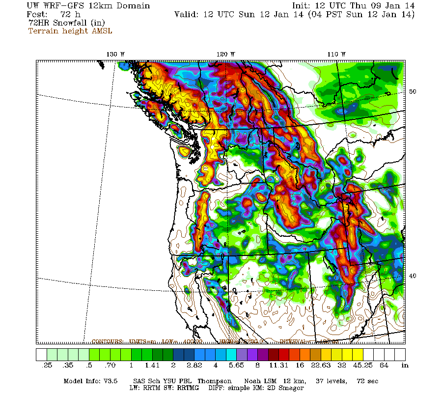
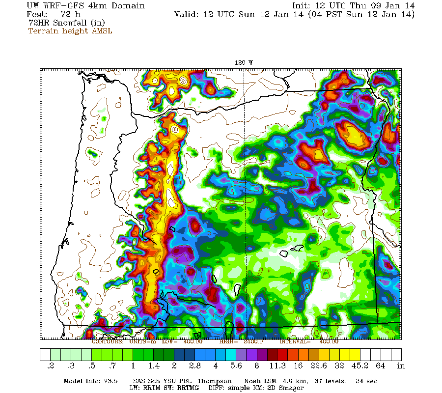
Additional snowfall during the next 3 days through 4am Sunday is predicted to be 2-4 ft over the west slopes and volcanic peaks of the Washington and Oregon Cascades, plus the Olympics (note the shift in time period compared to graphics shown in previous posts above):
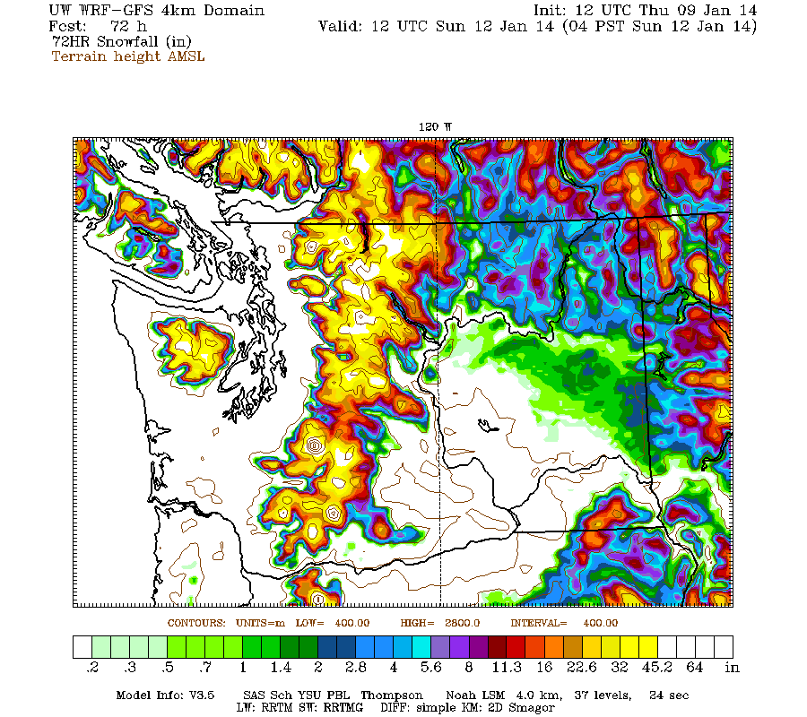
Higher resolution version of that, zoomed in on WA and OR:
The model shows another 2-4 ft of snowfall over the northern Washington Cascades over the next 3 day period though 4am Wednesday, the bulk of it falling on Sunday night and Monday, with much lesser amounts for the Olympics, southern Washington, and Oregon:
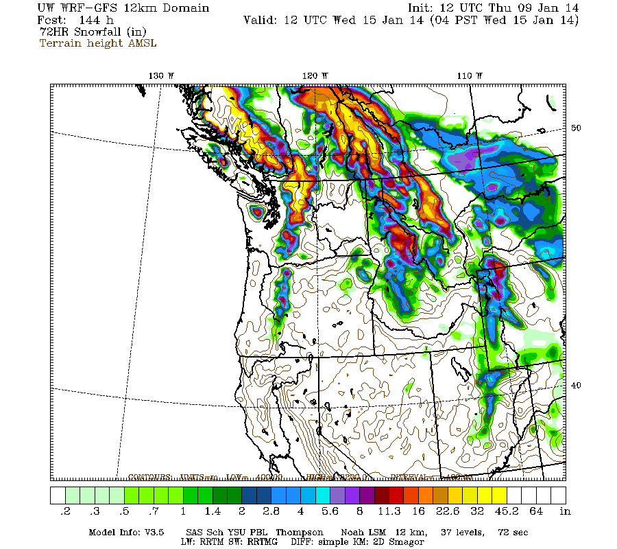
The real jackpot for this period appears to be the central BC Coast Mountains, roughly from the Homathko Icefield and the Waddington Range northwestward through Silverthrone Mountain and the Ha-iltzuk Icefield, with another 4-8 ft of snowfall over those 3 days. That region has probably received the most precip and snowfall of any part of the West Coast of North America during the last few months, even more than areas farther north like southeast Alaska and south-central Alaska. The persistent ridge of high pressure off the US West Coast has tended to push system after system directly into that portion of the BC Coast Mountains over the last 3 months, instead of allowing a large fraction of them to hit WA and OR as they normally would. Mountain snowpack in that region must be very deep already and well above normal, but unfortunately there are no snow measurement sites of any kind in that entire region, with the exception of two BC RFC snow telemetry sites (3A22P & 3A24P) located in the extremely rain-shadowed, low-snowfall region NE of the Homathko and Waddington ranges -- they barely record any snowpack even in normal years and are not at all representative of the snowpack along the crest of the mountains. That region is the most remote and least inhabited (not to mention the highest and most heavily glaciated) section of the entire BC Coast Mountains, with no roads at all crossing the range over the 250 mile stretch from Whistler (Hwy 99) to Bella Coola (Hwy 20), and no way to accurately know how much snowpack has accumulated up there this year, nor even what normal snowpack values might be.
Another day later, and 2 more subsequent runs of the UW WRF-GFS model at 12-hour intervals continue to show similar predictions for large snowfall amounts through the weekend. The higher-resolution 4 km model runs now cover the period through Sunday evening, and the consistency between subsequent runs means that it is very likely that the second heavier portion of this storm cycle will actually occur as predicted.
About 1-2 ft of new snow has already fallen as of Thursday morning, with the largest amounts on Mounts Baker, Rainier, Hood, and Bachelor thus far, but even Snoqualmie Pass has received about 1 ft of new snowfall, almost doubling the current snowdepth there at pass level. There was a lull between systems after midnight last night, but the next front is already upon us for additional snowfall into Friday morning, followed by another partial lull and then another sustained period of very heavy precip and snowfall from Friday afternoon through Sunday. Heavy rain may fall up to 6000-7000 ft Friday night, but snow levels should rapidly lower by Saturday morning with heavy snowfall throughout the day and on Sunday.
Additional snowfall during the next 3 days through 4am Sunday is predicted to be 2-4 ft over the west slopes and volcanic peaks of the Washington and Oregon Cascades, plus the Olympics (note the shift in time period compared to graphics shown in previous posts above):
Higher resolution version of that, zoomed in on WA and OR:
The model shows another 2-4 ft of snowfall over the northern Washington Cascades over the next 3 day period though 4am Wednesday, the bulk of it falling on Sunday night and Monday, with much lesser amounts for the Olympics, southern Washington, and Oregon:
The real jackpot for this period appears to be the central BC Coast Mountains, roughly from the Homathko Icefield and the Waddington Range northwestward through Silverthrone Mountain and the Ha-iltzuk Icefield, with another 4-8 ft of snowfall over those 3 days. That region has probably received the most precip and snowfall of any part of the West Coast of North America during the last few months, even more than areas farther north like southeast Alaska and south-central Alaska. The persistent ridge of high pressure off the US West Coast has tended to push system after system directly into that portion of the BC Coast Mountains over the last 3 months, instead of allowing a large fraction of them to hit WA and OR as they normally would. Mountain snowpack in that region must be very deep already and well above normal, but unfortunately there are no snow measurement sites of any kind in that entire region, with the exception of two BC RFC snow telemetry sites (3A22P & 3A24P) located in the extremely rain-shadowed, low-snowfall region NE of the Homathko and Waddington ranges -- they barely record any snowpack even in normal years and are not at all representative of the snowpack along the crest of the mountains. That region is the most remote and least inhabited (not to mention the highest and most heavily glaciated) section of the entire BC Coast Mountains, with no roads at all crossing the range over the 250 mile stretch from Whistler (Hwy 99) to Bella Coola (Hwy 20), and no way to accurately know how much snowpack has accumulated up there this year, nor even what normal snowpack values might be.
Please Log in or Create an account to join the conversation.
- davidG
-
- User
-
Less
More
- Posts: 764
- Thank you received: 0
12 years 5 months ago #211670
by davidG
Replied by davidG on topic Re: Major storm cycle brings 4-8 ft of snow this week?
The NWS forecast finally started agreeing with this model little more than a day ago - but then, it hasn't played out yet.. The
wind map
put up a couple weeks ago shows how BC is getting hammered. Still no love for the Sierra - actually it's getting serious from the San Joaquin through the Great Basin.
Please Log in or Create an account to join the conversation.
- Amar Andalkar
-
Topic Author
- User
-
Less
More
- Posts: 635
- Thank you received: 0
12 years 5 months ago #211686
by Amar Andalkar
Replied by Amar Andalkar on topic Re: Major storm cycle brings 4-8 ft of snow this week?
Update #4: 96 hours after initial post, models are still predicting totals of 4-8 ft (or more) of snow this week -- and they've been accurate so far!
Another day later, and 2 more subsequent runs of the UW WRF-GFS model at 12-hour intervals continue to show similar predictions for large snowfall amounts through the weekend. The higher-resolution 4 km model runs now cover the period through Monday evening, so basically to the end of the storm cycle, and ongoing consistency between subsequent runs means that it is very likely that the second heavier portion of this storm cycle will actually occur as predicted this weekend.
About 1-3 ft of new snow has already fallen during the 3 days since the storm cycle began early Tuesday, January 7, through Friday morning, with the largest amounts on Mounts Baker, Rainier, Hood, and Bachelor thus far, but even Snoqualmie Pass has received about 16" of new snowfall (with over 2 ft at the top of Alpental), almost doubling the previous snowdepth there at pass level. Total precip through noon Friday has been about 2.5" at Baker and Stevens, 3.5" at Snoqualmie, 3" at Paradise, 2" at White Pass, 4" at Mount Hood Meadows, and over 5" at Timberline on Hood. Snowfall amounts of over 4 ft were likely received at 7000 ft on Hood where the precip remained entirely snow, versus periods of mixed precip and extremely dense wet snowfall at Meadows and Timberline.
So the initial model predictions, for snowfall amounts up to 2-4 ft during the first 3 days of the storm cycle over the west slopes and volcanic peaks of the Washington and Oregon Cascades, have largely been verified. The persistent ridge did flatten and shift south, opening the door for westerly flow, and the expected frontal systems did come through as forecast with snow levels in the 2000-4000 ft range (4000-6000 ft in Oregon) as expected, with precipitation and snow totals roughly matching the predicted amounts. Substantial success thus far for the weather models! It's quite remarkable how much this type of numerical weather prediction has improved over even just the last decade.
There is another partial lull between systems now during the day Friday, followed by a warm front this afternoon and then another sustained period of very heavy precip and snowfall from Friday afternoon through Sunday. Heavy rain may fall up to 6000-7000 ft Friday night, but snow levels should rapidly lower by Saturday morning with heavy snowfall throughout the day and on Sunday.
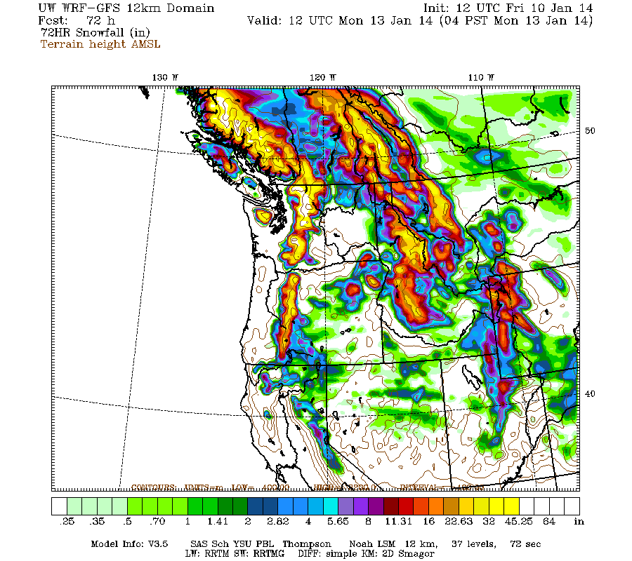
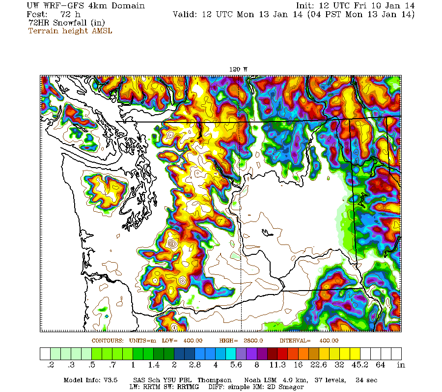
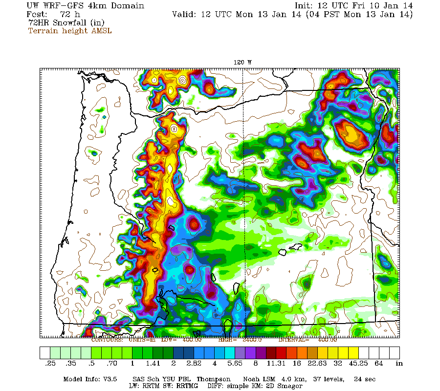
Additional snowfall during the next 3 days through 4am Monday is predicted to be 2-6 ft over the west slopes and volcanic peaks of the Washington and Oregon Cascades, plus the Olympics (note another 24-hour shift in time period compared to graphics shown in update #3 above):
Higher resolution version of that, zoomed in on WA and OR:
This loop shows how the model predictions for snowfall during the 3-day period through 4am Monday have evolved between 10 subsequent runs over the last 5 days, known in the jargon as D(model)/D(t). Slight changes in the details, but very consistent in the overall picture and maximum snowfall amounts:
www.atmos.washington.edu/~ovens/wxloop.c...2+v2014011312///+-st
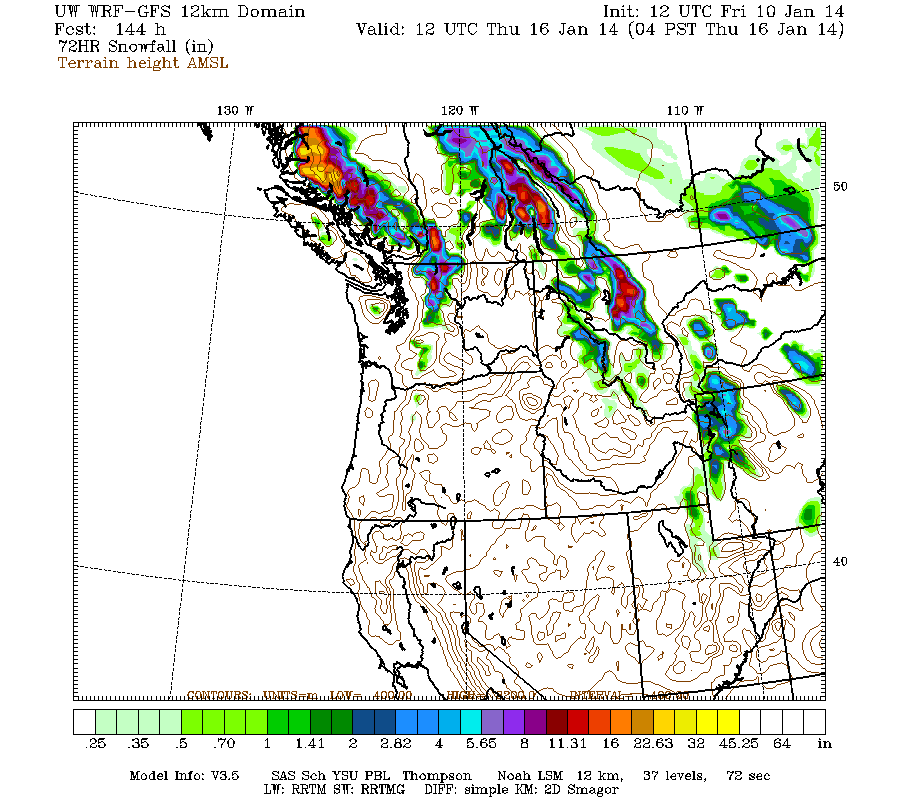
The model shows another 6-12" of snowfall over the northern Washington Cascades over the next 3 day period though 4am Thursday, almost all of it falling on Monday, with barely 1-2" more for the Olympics, southern Washington, and Oregon:
Unfortunately it looks like the persistent ridge of high pressure off the West Coast will rebuild northward during the early part of next week, bringing this storm cycle to an end. Details beyond that point are murky and very uncertain as of now.
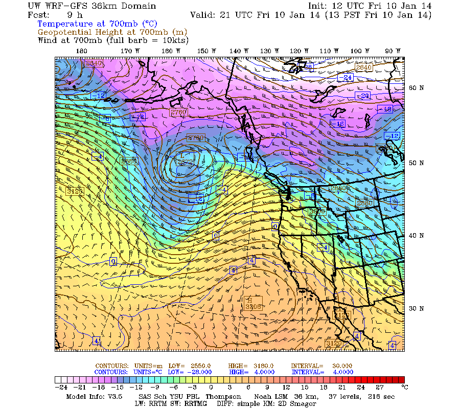
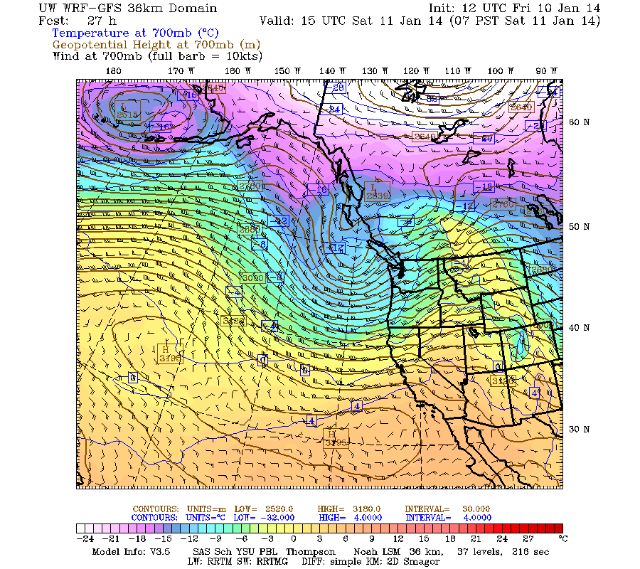
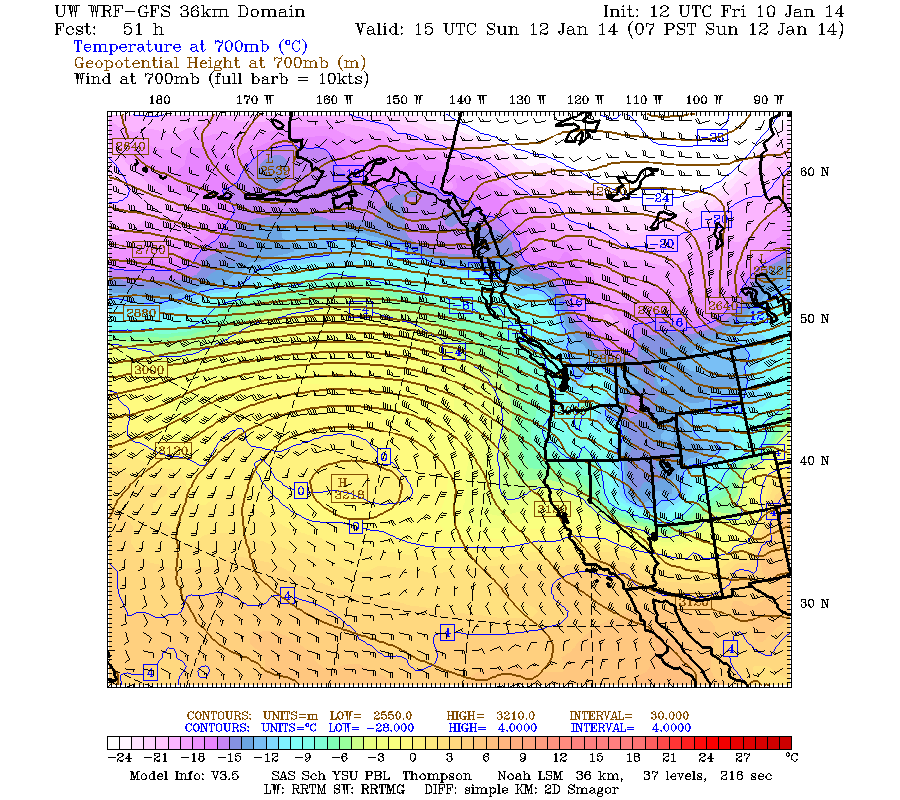
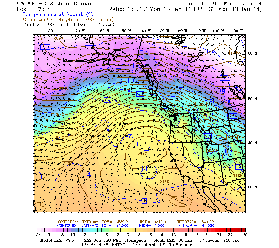
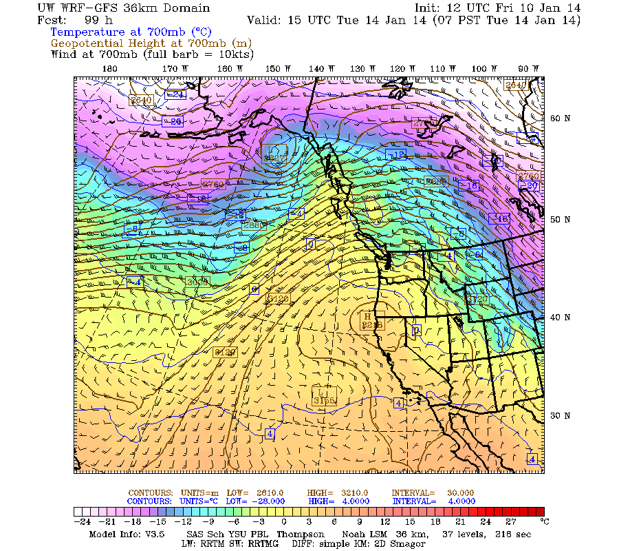
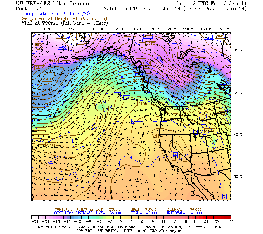
The broad overview of the 36 km domain provides a nice picture of today's incoming system, and the rebuilding ridge at the start of next week, especially using the 700 mb temperature, winds, heights loop. Here are some annotated frames from that loop:
www.atmos.washington.edu/~ovens/wxloop.c..._700t+2014011012///3
Now, 1pm Friday, strong low pressure system well off the coast, with leading warm front crossing the WA Cascades:
7am Saturday, strong low pressure system just off the tip of Vancouver Island, with trailing cold front crossing the WA Cascades, and snow levels plummeting:
7am Sunday, strong post-frontal WNW flow produces heavy orographic snowfall throughout Saturday and into Sunday for WA and OR Cascades:
7am Monday, the ridge is rebuilding off the coast, but precip continues to flow over the north end of it into WA, at rising snow levels:
7am Tuesday, the rebuilding ridge is shifting east onto the coast, and precip is now being deflected far to the north into the central BC coast:
7am Wednesday, strong ridge still in place over the US West Coast:
Another day later, and 2 more subsequent runs of the UW WRF-GFS model at 12-hour intervals continue to show similar predictions for large snowfall amounts through the weekend. The higher-resolution 4 km model runs now cover the period through Monday evening, so basically to the end of the storm cycle, and ongoing consistency between subsequent runs means that it is very likely that the second heavier portion of this storm cycle will actually occur as predicted this weekend.
About 1-3 ft of new snow has already fallen during the 3 days since the storm cycle began early Tuesday, January 7, through Friday morning, with the largest amounts on Mounts Baker, Rainier, Hood, and Bachelor thus far, but even Snoqualmie Pass has received about 16" of new snowfall (with over 2 ft at the top of Alpental), almost doubling the previous snowdepth there at pass level. Total precip through noon Friday has been about 2.5" at Baker and Stevens, 3.5" at Snoqualmie, 3" at Paradise, 2" at White Pass, 4" at Mount Hood Meadows, and over 5" at Timberline on Hood. Snowfall amounts of over 4 ft were likely received at 7000 ft on Hood where the precip remained entirely snow, versus periods of mixed precip and extremely dense wet snowfall at Meadows and Timberline.
So the initial model predictions, for snowfall amounts up to 2-4 ft during the first 3 days of the storm cycle over the west slopes and volcanic peaks of the Washington and Oregon Cascades, have largely been verified. The persistent ridge did flatten and shift south, opening the door for westerly flow, and the expected frontal systems did come through as forecast with snow levels in the 2000-4000 ft range (4000-6000 ft in Oregon) as expected, with precipitation and snow totals roughly matching the predicted amounts. Substantial success thus far for the weather models! It's quite remarkable how much this type of numerical weather prediction has improved over even just the last decade.
There is another partial lull between systems now during the day Friday, followed by a warm front this afternoon and then another sustained period of very heavy precip and snowfall from Friday afternoon through Sunday. Heavy rain may fall up to 6000-7000 ft Friday night, but snow levels should rapidly lower by Saturday morning with heavy snowfall throughout the day and on Sunday.
Additional snowfall during the next 3 days through 4am Monday is predicted to be 2-6 ft over the west slopes and volcanic peaks of the Washington and Oregon Cascades, plus the Olympics (note another 24-hour shift in time period compared to graphics shown in update #3 above):
Higher resolution version of that, zoomed in on WA and OR:
This loop shows how the model predictions for snowfall during the 3-day period through 4am Monday have evolved between 10 subsequent runs over the last 5 days, known in the jargon as D(model)/D(t). Slight changes in the details, but very consistent in the overall picture and maximum snowfall amounts:
www.atmos.washington.edu/~ovens/wxloop.c...2+v2014011312///+-st
The model shows another 6-12" of snowfall over the northern Washington Cascades over the next 3 day period though 4am Thursday, almost all of it falling on Monday, with barely 1-2" more for the Olympics, southern Washington, and Oregon:
Unfortunately it looks like the persistent ridge of high pressure off the West Coast will rebuild northward during the early part of next week, bringing this storm cycle to an end. Details beyond that point are murky and very uncertain as of now.
The broad overview of the 36 km domain provides a nice picture of today's incoming system, and the rebuilding ridge at the start of next week, especially using the 700 mb temperature, winds, heights loop. Here are some annotated frames from that loop:
www.atmos.washington.edu/~ovens/wxloop.c..._700t+2014011012///3
Now, 1pm Friday, strong low pressure system well off the coast, with leading warm front crossing the WA Cascades:
7am Saturday, strong low pressure system just off the tip of Vancouver Island, with trailing cold front crossing the WA Cascades, and snow levels plummeting:
7am Sunday, strong post-frontal WNW flow produces heavy orographic snowfall throughout Saturday and into Sunday for WA and OR Cascades:
7am Monday, the ridge is rebuilding off the coast, but precip continues to flow over the north end of it into WA, at rising snow levels:
7am Tuesday, the rebuilding ridge is shifting east onto the coast, and precip is now being deflected far to the north into the central BC coast:
7am Wednesday, strong ridge still in place over the US West Coast:
Please Log in or Create an account to join the conversation.
- BillK
-
- User
-
Less
More
- Posts: 151
- Thank you received: 0
12 years 5 months ago #211687
by BillK
Replied by BillK on topic Re: Major storm cycle brings 4-8 ft of snow this week?
Another slow day at the office?
Please Log in or Create an account to join the conversation.