Juneuary 16-26, 2014, Rainier, 10K to Bridge CORN!
1/16/14
WA Cascades West Slopes South (Mt Rainier)
26838
22
Juneuary 16, 2014, Mount Rainier, The Turtle to Nisqually Bridge via Van Trump Glaciers
Juneuary 17, 2014, Mount Rainier, Camp Muir to Nisqually Bridge via Nisqually Chute
Juneuary 20, 2014, Mount Rainier, The Turtle to Nisqually Bridge via Van Trump Glaciers
Juneuary 23, 2014, Mount Rainier, Camp Muir to Nisqually Bridge via Pebble Creek Gully
Juneuary 24, 2014, Mount Rainier, Camp Muir to Nisqually Bridge via Nisqually Chute
Juneuary 25, 2014, Mount Rainier, Camp Muir to Nisqually Bridge via Nisqually Chute
Juneuary 26, 2014, Mount Rainier, Muir Rock to Nisqually Bridge via Nisqually Chute
I originally wrote a combined trip report for just the first 2 of these days, but didn't quite finish it enough to post it before heading back for more runs this week. So I decided to just include the subsequent days too. I've never tried to combine 7 separate trips into a single trip report -- we'll see how it goes . . .
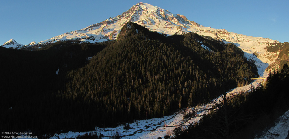
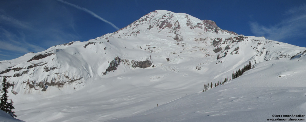
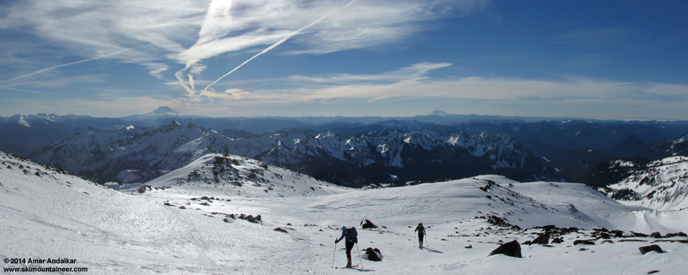
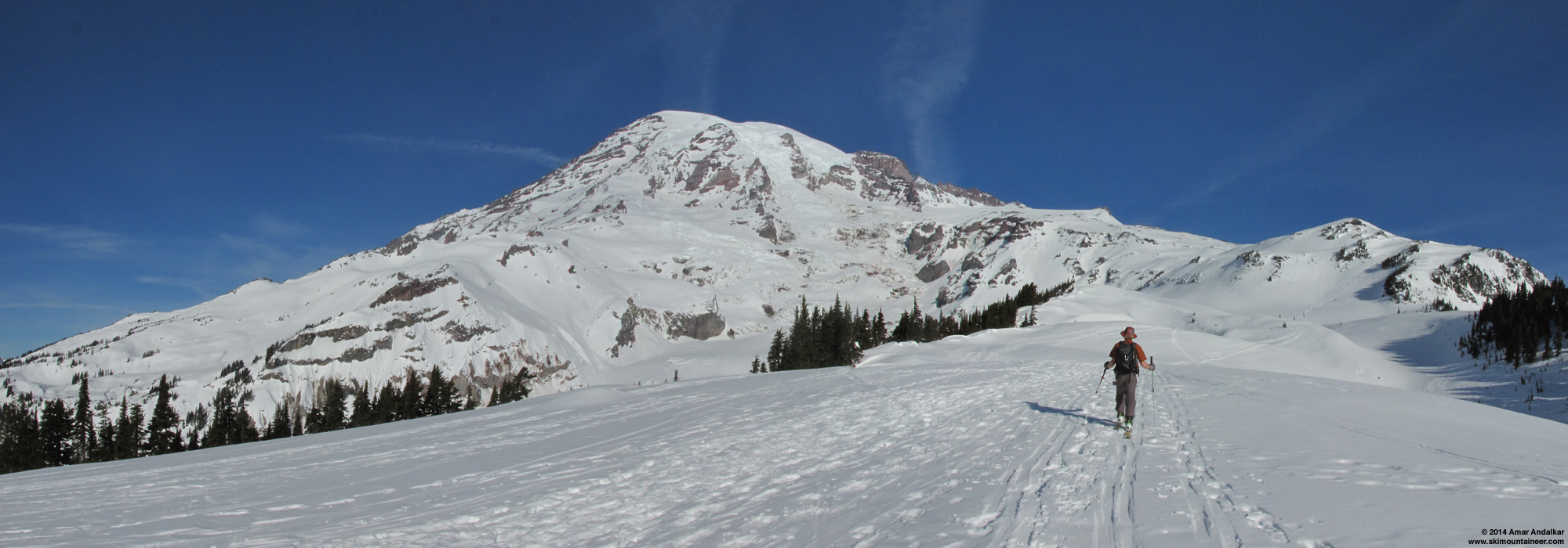
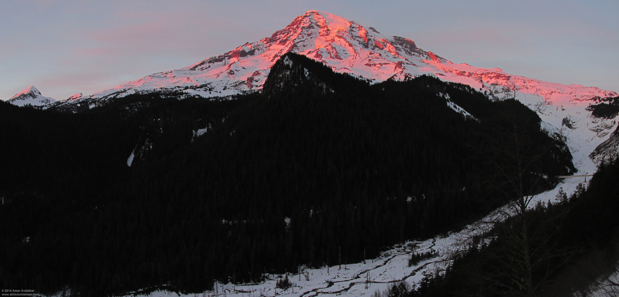
Two-shot panorama from about 4100 ft on the Paradise Road on January 24, showing the full sweep of terrain covered in this report:
The Turtle and Van Trump Glaciers at center, with the Muir Snowfield, Nisqually Chute, and Nisqually Bridge at right. (click for double-size version)
Taking full advantage of nearly 2 weeks of high pressure and sunny weather following the
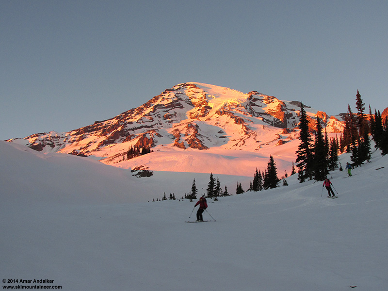
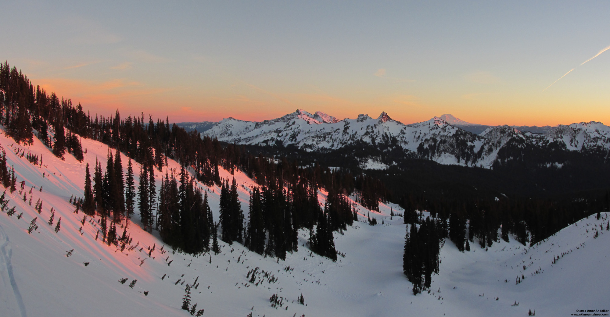
Skiing smooth corn at sunset on the Van Trump Glaciers, January 16.
I wanted to ski from the summits of Mounts Hood and Saint Helens and Adams and Baker too during this high pressure, instead of repeating runs on Rainier so much, but partners and freezing levels and access and circumstances did not come together for those other peaks. So it was back to Rainier by default again and again, where the goods were known to be great, resulting in the most concentrated period of ski mountaineering on a single mountain that I've ever done (in this case, only a single side of a single mountain). The freezing level also never quite rose high enough for me to be tempted into making a Rainier summit ski attempt this time, especially given that I already have a
Yours truly, carving high-speed arcs down smooth untracked corn in Nisqually Chute, January 17. (photo by Scott Larson)
I don't see any reason to complain about the ski conditions during the second half of January 2014, especially after the major storm cycle dumped 2-8 ft of new snow on the Washington and Oregon Cascades, finally building a reasonably deep snowpack for the first time this season. If you go to the right places (above treeline, especially on the volcanoes) and ski the right aspects (south and southwest) and right slope angles (steep enough to catch the low wintertime sun) during the mostly calm and sunny weather provided by the persistent ridge of high pressure, the snow conditions are truly epic and all-time spectacular now. This is not hyperbole, nor just trying to make lemonade out of lemons -- conditions are really ridiculously good, and have remained so for over 10 days (except for a couple of high-wind and cloudy weather days). By any objective standard, these are among the best January ski conditions on the south side of Mount Rainier (and by extrapolation, at higher elevations and above timberline on southerly aspects throughout much of the Washington Cascades and northern Oregon Cascades) during the last 18 years that I've been ski mountaineering. Don't miss out on this rare opportunity we've been granted, to venture comfortably way up high during midwinter and ski down in outstanding summerlike snow conditions, a much rarer opportunity overall than typical January powder laps down in the forest. (Most of this paragraph was written several days ago, while the present tense was still appropriate -- the window of opportunity is now closing, the sunny high pressure is on its way out, and the proper tense is now the past.)
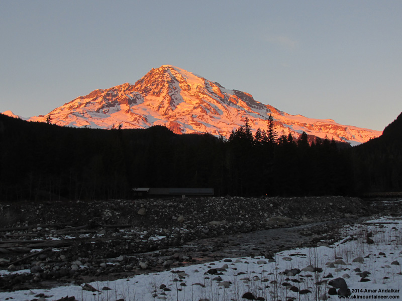
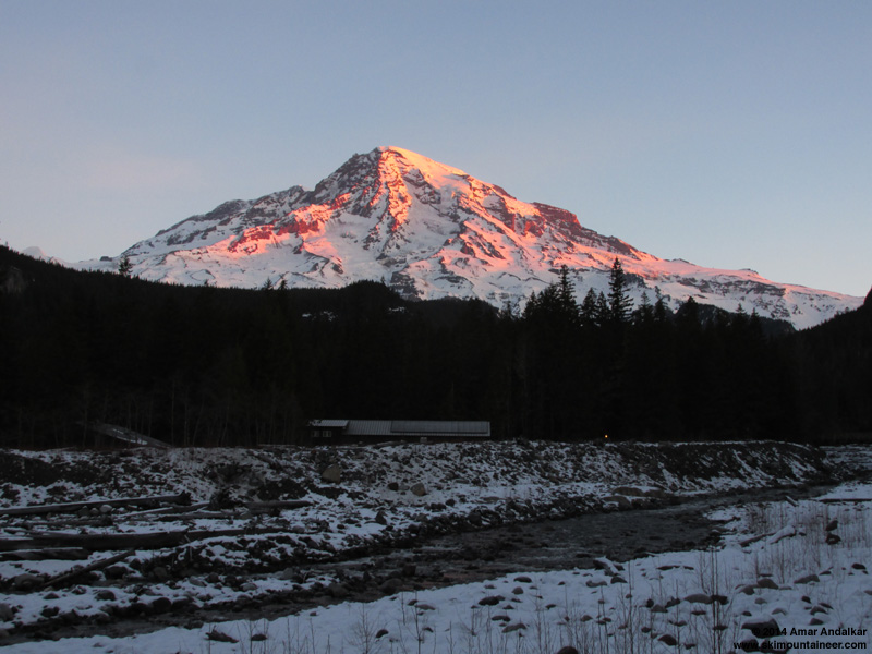
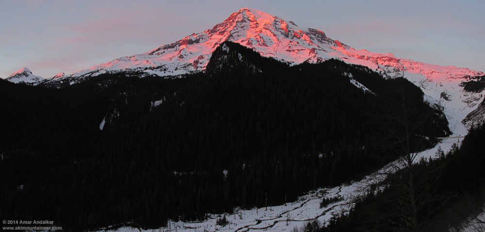
Sunset glow on the Mountain above the Nisqually River at Longmire, January 24.
Thanks to my ski partners on these trips (Carl, Tara, Jeff, Rory, Jameson, Kam, Paresh, Kane, Phil, Jeremy, Khanh, Tim, Stephanie, Josh, and Alisa), and also to the other skiers who joined me on an impromptu basis for the 4 Nisqually Chute descents (Scott, Jason, Adam, Ron, Julie, Allen, Megan, Cam, Jeremy, Allison, Jordan, Andres, Mic, Kevin, ... hope I got your names right, sorry if I didn't or forgot anyone).
The following tables and daily trip reports are intended to document a narrow slice and one skier's viewpoint of this extraordinary and rare period of summerlike weather and snow conditions in January in the Pacific Northwest.
[tt]
Summary Table of Ski and Weather Statistics: --- NWS Rainier Forecast --- ---------------- NWAC Telemetry ----------------
Free Air Free Afternoon Temperature Total Solar Paradise
Max Total Ski Ski Ski Weather Freezing Wind Muir Wind Muir Paradise Radiation Snow
Date Destination Elev Ascent Ascent Descent Partners Conditions Level at 10K Min-Max Lo-Hi Lo-Hi Muir Paradise Depth
(ft) (ft) (ft) (ft) (ft) (mph) (mph) (F) (F) (watt-hrs/m2) (in)
-----------------------------------------------------------------------------------------------------------------------------------------
[color=gray]Jan 14 Marmot Mtn Works Partly Sunny 9000 NW 45 19-34 27-38 28-34 1680 1431 102
Jan 15 Crystal Mtn 6870 -- -- 50300 Mostly Sunny 10000 NW 40 2-49 28-36 28-42 2124 2229 98[/color]
Jan 16 The Turtle 10500 5300 4800 6800 5 Sunny 11000 NW 25 4-31 34-43 39-65 2151 2274 96
Jan 17 Camp Muir 10100 4700 4700 6200 1(+3) Sunny 11000 NW 25 0-17 36-43 47-69 2402 2604 95
[color=gray]Jan 18 Marmot Mtn Works Mostly Sunny 10000 SW 30 12-60 33-38 39-50 2178 2391 94
Jan 19 Partly Sunny 8000 W 35 0-24 26-38 36-44 2351 2204 92[/color]
Jan 20 The Turtle 10500 5300 5300 6800 2 Mostly Sunny 10000 W 5 0-19 29-40 36-55 2354 2611 91
[color=gray]Jan 21 Crystal Mtn 6870 -- -- 55800 Mostly Sunny 9000 W 25 17-54 22-34 36-50 2081 2359 90
Jan 22 Mostly Cloudy 6000 NW 20 2-16 18-33 28-40 2409 1590 89[/color]
Jan 23 Camp Muir 10100 4700 4700 6200 2 Sunny 9000 E 20 7-33 25-32 30-45 2379 2704 89
Jan 24 Camp Muir 10100 4700 4700 6200 0(+5) Sunny 10000 SE 5 0-7 31-42 42-63 2376 2727 88
Jan 25 Camp Muir 10100 4700 4700 6200 4(+3) Sunny 11000 NW 20 0-6 31-47 40-52 2534 2817 87
Jan 26 Muir Rock 10188 4800 4800 6300 3(+3) Sunny 10000 NW 20 0-9 30-42 40-56 2539 2788 86
[color=gray]Jan 27 Crystal Mtn 6870 -- -- 46700 Mostly Sunny?? 9000 NW 15 0-11 23-31 37-42 1334 1269 85[/color]
-----------------------------------------------------------------------------------------------------------------------------------------
Ski Mountaineering Totals: 34200 33700 44700[color=gray](+152800 lift-served)[/color]
[/tt]
The "Ski Partners" column lists main trip partners (+ skiers who joined on an impromptu basis for Nisqually Chute descents).
The "Afternoon Muir Wind" column gives the range of wind speeds recorded between noon and 4pm, the critical time period for these trips.
The "Total Solar Radiation" column is the sum of the Solar W/m2 from the telemetry, which roughly gives the total sunlight for the day in units of watt-hours per square meter.
One interesting thing to note in this table is that the snowpack at Paradise has been settling at an almost constant rate of 1" per day throughout the 13-day period from January 15-27, after settling rapidly during the first day after the storm cycle ended on the 14th. During that entire period, no precipitation was recorded at Paradise either on the NWAC telemetry or the NPS daily manual measurements after the early AM hours of January 14, but webcam images of the Paradise parking lot reveal that about 1/2" of snow did fall sometime overnight prior to the morning of Wednesday, January 22, enough for the park to actually plow. The solar data shows that every day from January 15-26 ended up sunny or mostly sunny at Camp Muir, with similar conditions at Paradise except on January 22 when Paradise was in the clouds most of the morning while Muir was above them. The final day of the period on the 27th ended up much cloudier than forecast, with a thick layer of high clouds providing only filtered sunshine at either site all day.
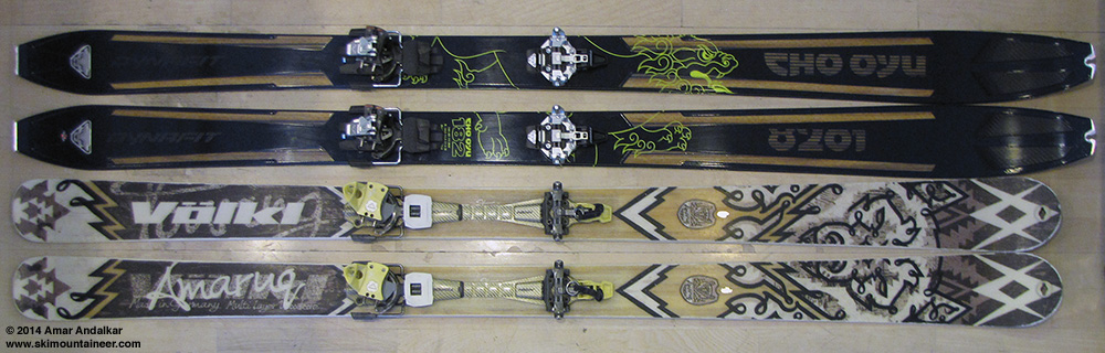
New skis: Dynafit Cho Oyu, 182 cm, 125-89-111, 3530 g (7 lbs 12 oz) with Radical ST bindings.
Old skis: Volkl Amaruq, 177 cm, 127-88-109, 4030 g (8 lbs 14 oz) with Vertical FT bindings.
[tt]
Equipment Table:
Date Destination ---- Skis ---- ---- Bindings ---- ---- Boots ----
--------------------------------------------------------------------------------
[color=gray]Jan 15 Crystal Mtn Volkl 7 24 Pro Marker (alpine) Garmont Adrenalin[/color]
Jan 16 The Turtle Volkl Amaruq Dynafit Vertical FT Dynafit TLT 5P
Jan 17 Camp Muir Volkl Amaruq Dynafit Vertical FT Dynafit TLT 5P
Jan 20 The Turtle Dynafit Cho Oyu Dynafit Radical ST Dynafit TLT 5P
[color=gray]Jan 21 Crystal Mtn Dynafit Cho Oyu Dynafit Radical ST Scott Cosmos[/color]
Jan 23 Camp Muir Dynafit Cho Oyu Dynafit Radical ST Dynafit TLT 5P
Jan 24 Camp Muir Dynafit Cho Oyu Dynafit Radical ST Dynafit TLT 5P
Jan 25 Camp Muir Dynafit Cho Oyu Dynafit Radical ST Dynafit TLT 5P
Jan 26 Muir Rock Dynafit Cho Oyu Dynafit Radical ST Dynafit TLT 5P
[color=gray]Jan 27 Crystal Mtn Volkl 7 24 Pro Marker (alpine) Garmont Adrenalin[/color]
--------------------------------------------------------------------------------
[/tt]
January 13-14, 2014, Mount Rainier, Paradise Digs Out from the Big Storm
The major week-long storm cycle ended on January 14, and the persistent ridge of high pressure off the West Coast quickly rebuilt northward. Wednesday the 15th was forecast to be mostly sunny but with high winds aloft, followed by a 2-day window on January 16-17 of near-perfect weather: totally sunny with 10-11000 ft freezing level and light winds even above 10000 ft, so I was planning to ski Mounts Saint Helens and Hood back-to-back on those days.
It wasn't clear if the road to Paradise would open on January 14, given that it had not opened since January 10 as the second half of the major storm cycle dumped 3-4 ft of additional snow, all of it sitting unplowed in the parking lot until the afternoon of January 13 when the first plows and snowblowers finally arrived:
[img width=1000 height=562]http://www.skimountaineer.com/TR/Images2014/east-2014Jan13-1409.jpg" />
Then the plows left by 3pm (budget constraints are restricting the park to only 1 shift of plow drivers per day), leaving behind a partially plowed lot and uncertainty about the next day's opening time. But the next morning, the plows arrived by 7am and quickly finished the job, opening the road to the public shortly after 9am.
[img width=1000 height=562]http://www.skimountaineer.com/TR/Images2014/east-2014Jan14-0751.jpg" />
[img width=1000 height=562]http://www.skimountaineer.com/TR/Images2014/mountain-2014Jan14-0756.jpg" />
First sunrise on the Mountain after the storm, January 14.
I probably should have gone up there just to ski around a bit, but expected the snow conditions to be marginal given the warming at the end of the storm cycle. Then later that morning, I heard that
View from atop Crystal Mountain of a pretty lenticular cloud adorning the Mountain and revealing the high winds aloft around noon on January 15.
I ran into Mr & Mrs Freebird on the gondola, skied a few runs with them, and decided to join their group on Rainier the next day instead of going to Saint Helens as planned (which was no longer skinnable from the trailhead). They were planning to ski the Turtle (a glacial remnant adjacent to Wilson Glacier and below the Kautz Ice Cliff) from Paradise with a car shuttle, and that sounded like a great plan to me.
[hr][tt]MOUNT RAINIER RECREATIONAL FORECAST
NATIONAL WEATHER SERVICE SEATTLE WA
342 AM PST WED JAN 15 2014
SYNOPSIS...AN UPPER RIDGE WILL GIVE DRY WEATHER THROUGH FRIDAY NIGHT. A WEAK FRONT MAY BRING A LITTLE PRECIPITATION TO THE AREA THIS WEEKEND. HIGH PRESSURE WILL STRENGTHEN AGAIN NEXT WEEK.
WEDNESDAY...BREEZY. MOSTLY SUNNY. FREEZING LEVEL NEAR 10000 FEET.
WEDNESDAY NIGHT...MOSTLY CLEAR. FREEZING LEVEL NEAR 11000 FEET.
THURSDAY...SUNNY. FREEZING LEVEL NEAR 11000 FEET.
THURSDAY NIGHT...MOSTLY CLEAR. FREEZING LEVEL NEAR 10500 FEET.
FRIDAY...MOSTLY SUNNY. FREEZING LEVEL NEAR 11000 FEET.
TEMPERATURE AND WIND FORECASTS FOR SELECTED LOCATIONS.
WED WED THU THU FRI
NIGHT NIGHT
SUMMIT (14411 FT) 15 16 18 17 17
NW 60 NW 45 NW 50 NW 40 W 25
CAMP MUIR(10188 FT) 31 34 36 37 38
NW 40 NW 25 NW 35 NW 30 NW 15
PARADISE (5420 FT) 47 36 45 37 53
W 5 CALM CALM NW 5 N 5
LONGMIRE (2700 FT) 51 38 48 39 56
SE 5 NE 5 NE 5 NE 5 NE 5
++ TEMPERATURES AND WIND FOR THE SUMMIT AND CAMP MUIR ARE AVERAGE
CONDITIONS EXPECTED IN THE FREE AIR AT THOSE ELEVATIONS.
++ TEMPERATURES FOR PARADISE AND LONGMIRE ARE THE EXPECTED HIGHS AND
LOWS. WIND IS THE AVERAGE WIND EXPECTED DURING THAT PERIOD.
EXTENDED FORECAST...
FRIDAY NIGHT...PARTLY CLOUDY. FREEZING LEVEL NEAR 11500 FEET.
SATURDAY...PARTLY SUNNY. FREEZING LEVEL NEAR 10000 FEET.
SATURDAY NIGHT...MOSTLY CLOUDY WITH A CHANCE OF RAIN AND SNOW. SNOW LEVEL NEAR 6000 FEET.
SUNDAY...MOSTLY CLOUDY WITH A CHANCE OF RAIN AND SNOW. SNOW LEVEL NEAR 4500 FEET.
SUNDAY NIGHT...MOSTLY CLOUDY WITH A CHANCE OF RAIN AND SNOW. SNOW LEVEL NEAR 5500 FEET.
MARTIN LUTHER KING JR DAY...MOSTLY SUNNY. FREEZING LEVEL NEAR 8500 FEET.
MONDAY NIGHT...PARTLY CLOUDY. FREEZING LEVEL NEAR 9000 FEET.
TUESDAY...SUNNY. FREEZING LEVEL NEAR 8500 FEET.
[/tt]
Juneuary 17, 2014, Mount Rainier, Camp Muir to Nisqually Bridge via Nisqually Chute
Juneuary 20, 2014, Mount Rainier, The Turtle to Nisqually Bridge via Van Trump Glaciers
Juneuary 23, 2014, Mount Rainier, Camp Muir to Nisqually Bridge via Pebble Creek Gully
Juneuary 24, 2014, Mount Rainier, Camp Muir to Nisqually Bridge via Nisqually Chute
Juneuary 25, 2014, Mount Rainier, Camp Muir to Nisqually Bridge via Nisqually Chute
Juneuary 26, 2014, Mount Rainier, Muir Rock to Nisqually Bridge via Nisqually Chute
I originally wrote a combined trip report for just the first 2 of these days, but didn't quite finish it enough to post it before heading back for more runs this week. So I decided to just include the subsequent days too. I've never tried to combine 7 separate trips into a single trip report -- we'll see how it goes . . .

Two-shot panorama from about 4100 ft on the Paradise Road on January 24, showing the full sweep of terrain covered in this report:
The Turtle and Van Trump Glaciers at center, with the Muir Snowfield, Nisqually Chute, and Nisqually Bridge at right. (click for double-size version)
Taking full advantage of nearly 2 weeks of high pressure and sunny weather following the
Skiing smooth corn at sunset on the Van Trump Glaciers, January 16.
I wanted to ski from the summits of Mounts Hood and Saint Helens and Adams and Baker too during this high pressure, instead of repeating runs on Rainier so much, but partners and freezing levels and access and circumstances did not come together for those other peaks. So it was back to Rainier by default again and again, where the goods were known to be great, resulting in the most concentrated period of ski mountaineering on a single mountain that I've ever done (in this case, only a single side of a single mountain). The freezing level also never quite rose high enough for me to be tempted into making a Rainier summit ski attempt this time, especially given that I already have a
Yours truly, carving high-speed arcs down smooth untracked corn in Nisqually Chute, January 17. (photo by Scott Larson)
I don't see any reason to complain about the ski conditions during the second half of January 2014, especially after the major storm cycle dumped 2-8 ft of new snow on the Washington and Oregon Cascades, finally building a reasonably deep snowpack for the first time this season. If you go to the right places (above treeline, especially on the volcanoes) and ski the right aspects (south and southwest) and right slope angles (steep enough to catch the low wintertime sun) during the mostly calm and sunny weather provided by the persistent ridge of high pressure, the snow conditions are truly epic and all-time spectacular now. This is not hyperbole, nor just trying to make lemonade out of lemons -- conditions are really ridiculously good, and have remained so for over 10 days (except for a couple of high-wind and cloudy weather days). By any objective standard, these are among the best January ski conditions on the south side of Mount Rainier (and by extrapolation, at higher elevations and above timberline on southerly aspects throughout much of the Washington Cascades and northern Oregon Cascades) during the last 18 years that I've been ski mountaineering. Don't miss out on this rare opportunity we've been granted, to venture comfortably way up high during midwinter and ski down in outstanding summerlike snow conditions, a much rarer opportunity overall than typical January powder laps down in the forest. (Most of this paragraph was written several days ago, while the present tense was still appropriate -- the window of opportunity is now closing, the sunny high pressure is on its way out, and the proper tense is now the past.)
Sunset glow on the Mountain above the Nisqually River at Longmire, January 24.
Thanks to my ski partners on these trips (Carl, Tara, Jeff, Rory, Jameson, Kam, Paresh, Kane, Phil, Jeremy, Khanh, Tim, Stephanie, Josh, and Alisa), and also to the other skiers who joined me on an impromptu basis for the 4 Nisqually Chute descents (Scott, Jason, Adam, Ron, Julie, Allen, Megan, Cam, Jeremy, Allison, Jordan, Andres, Mic, Kevin, ... hope I got your names right, sorry if I didn't or forgot anyone).
The following tables and daily trip reports are intended to document a narrow slice and one skier's viewpoint of this extraordinary and rare period of summerlike weather and snow conditions in January in the Pacific Northwest.
[tt]
Summary Table of Ski and Weather Statistics: --- NWS Rainier Forecast --- ---------------- NWAC Telemetry ----------------
Free Air Free Afternoon Temperature Total Solar Paradise
Max Total Ski Ski Ski Weather Freezing Wind Muir Wind Muir Paradise Radiation Snow
Date Destination Elev Ascent Ascent Descent Partners Conditions Level at 10K Min-Max Lo-Hi Lo-Hi Muir Paradise Depth
(ft) (ft) (ft) (ft) (ft) (mph) (mph) (F) (F) (watt-hrs/m2) (in)
-----------------------------------------------------------------------------------------------------------------------------------------
[color=gray]Jan 14 Marmot Mtn Works Partly Sunny 9000 NW 45 19-34 27-38 28-34 1680 1431 102
Jan 15 Crystal Mtn 6870 -- -- 50300 Mostly Sunny 10000 NW 40 2-49 28-36 28-42 2124 2229 98[/color]
Jan 16 The Turtle 10500 5300 4800 6800 5 Sunny 11000 NW 25 4-31 34-43 39-65 2151 2274 96
Jan 17 Camp Muir 10100 4700 4700 6200 1(+3) Sunny 11000 NW 25 0-17 36-43 47-69 2402 2604 95
[color=gray]Jan 18 Marmot Mtn Works Mostly Sunny 10000 SW 30 12-60 33-38 39-50 2178 2391 94
Jan 19 Partly Sunny 8000 W 35 0-24 26-38 36-44 2351 2204 92[/color]
Jan 20 The Turtle 10500 5300 5300 6800 2 Mostly Sunny 10000 W 5 0-19 29-40 36-55 2354 2611 91
[color=gray]Jan 21 Crystal Mtn 6870 -- -- 55800 Mostly Sunny 9000 W 25 17-54 22-34 36-50 2081 2359 90
Jan 22 Mostly Cloudy 6000 NW 20 2-16 18-33 28-40 2409 1590 89[/color]
Jan 23 Camp Muir 10100 4700 4700 6200 2 Sunny 9000 E 20 7-33 25-32 30-45 2379 2704 89
Jan 24 Camp Muir 10100 4700 4700 6200 0(+5) Sunny 10000 SE 5 0-7 31-42 42-63 2376 2727 88
Jan 25 Camp Muir 10100 4700 4700 6200 4(+3) Sunny 11000 NW 20 0-6 31-47 40-52 2534 2817 87
Jan 26 Muir Rock 10188 4800 4800 6300 3(+3) Sunny 10000 NW 20 0-9 30-42 40-56 2539 2788 86
[color=gray]Jan 27 Crystal Mtn 6870 -- -- 46700 Mostly Sunny?? 9000 NW 15 0-11 23-31 37-42 1334 1269 85[/color]
-----------------------------------------------------------------------------------------------------------------------------------------
Ski Mountaineering Totals: 34200 33700 44700[color=gray](+152800 lift-served)[/color]
[/tt]
The "Ski Partners" column lists main trip partners (+ skiers who joined on an impromptu basis for Nisqually Chute descents).
The "Afternoon Muir Wind" column gives the range of wind speeds recorded between noon and 4pm, the critical time period for these trips.
The "Total Solar Radiation" column is the sum of the Solar W/m2 from the telemetry, which roughly gives the total sunlight for the day in units of watt-hours per square meter.
One interesting thing to note in this table is that the snowpack at Paradise has been settling at an almost constant rate of 1" per day throughout the 13-day period from January 15-27, after settling rapidly during the first day after the storm cycle ended on the 14th. During that entire period, no precipitation was recorded at Paradise either on the NWAC telemetry or the NPS daily manual measurements after the early AM hours of January 14, but webcam images of the Paradise parking lot reveal that about 1/2" of snow did fall sometime overnight prior to the morning of Wednesday, January 22, enough for the park to actually plow. The solar data shows that every day from January 15-26 ended up sunny or mostly sunny at Camp Muir, with similar conditions at Paradise except on January 22 when Paradise was in the clouds most of the morning while Muir was above them. The final day of the period on the 27th ended up much cloudier than forecast, with a thick layer of high clouds providing only filtered sunshine at either site all day.
New skis: Dynafit Cho Oyu, 182 cm, 125-89-111, 3530 g (7 lbs 12 oz) with Radical ST bindings.
Old skis: Volkl Amaruq, 177 cm, 127-88-109, 4030 g (8 lbs 14 oz) with Vertical FT bindings.
[tt]
Equipment Table:
Date Destination ---- Skis ---- ---- Bindings ---- ---- Boots ----
--------------------------------------------------------------------------------
[color=gray]Jan 15 Crystal Mtn Volkl 7 24 Pro Marker (alpine) Garmont Adrenalin[/color]
Jan 16 The Turtle Volkl Amaruq Dynafit Vertical FT Dynafit TLT 5P
Jan 17 Camp Muir Volkl Amaruq Dynafit Vertical FT Dynafit TLT 5P
Jan 20 The Turtle Dynafit Cho Oyu Dynafit Radical ST Dynafit TLT 5P
[color=gray]Jan 21 Crystal Mtn Dynafit Cho Oyu Dynafit Radical ST Scott Cosmos[/color]
Jan 23 Camp Muir Dynafit Cho Oyu Dynafit Radical ST Dynafit TLT 5P
Jan 24 Camp Muir Dynafit Cho Oyu Dynafit Radical ST Dynafit TLT 5P
Jan 25 Camp Muir Dynafit Cho Oyu Dynafit Radical ST Dynafit TLT 5P
Jan 26 Muir Rock Dynafit Cho Oyu Dynafit Radical ST Dynafit TLT 5P
[color=gray]Jan 27 Crystal Mtn Volkl 7 24 Pro Marker (alpine) Garmont Adrenalin[/color]
--------------------------------------------------------------------------------
[/tt]
January 13-14, 2014, Mount Rainier, Paradise Digs Out from the Big Storm
The major week-long storm cycle ended on January 14, and the persistent ridge of high pressure off the West Coast quickly rebuilt northward. Wednesday the 15th was forecast to be mostly sunny but with high winds aloft, followed by a 2-day window on January 16-17 of near-perfect weather: totally sunny with 10-11000 ft freezing level and light winds even above 10000 ft, so I was planning to ski Mounts Saint Helens and Hood back-to-back on those days.
It wasn't clear if the road to Paradise would open on January 14, given that it had not opened since January 10 as the second half of the major storm cycle dumped 3-4 ft of additional snow, all of it sitting unplowed in the parking lot until the afternoon of January 13 when the first plows and snowblowers finally arrived:
[img width=1000 height=562]http://www.skimountaineer.com/TR/Images2014/east-2014Jan13-1409.jpg" />
Then the plows left by 3pm (budget constraints are restricting the park to only 1 shift of plow drivers per day), leaving behind a partially plowed lot and uncertainty about the next day's opening time. But the next morning, the plows arrived by 7am and quickly finished the job, opening the road to the public shortly after 9am.
[img width=1000 height=562]http://www.skimountaineer.com/TR/Images2014/east-2014Jan14-0751.jpg" />
[img width=1000 height=562]http://www.skimountaineer.com/TR/Images2014/mountain-2014Jan14-0756.jpg" />
First sunrise on the Mountain after the storm, January 14.
I probably should have gone up there just to ski around a bit, but expected the snow conditions to be marginal given the warming at the end of the storm cycle. Then later that morning, I heard that
View from atop Crystal Mountain of a pretty lenticular cloud adorning the Mountain and revealing the high winds aloft around noon on January 15.
I ran into Mr & Mrs Freebird on the gondola, skied a few runs with them, and decided to join their group on Rainier the next day instead of going to Saint Helens as planned (which was no longer skinnable from the trailhead). They were planning to ski the Turtle (a glacial remnant adjacent to Wilson Glacier and below the Kautz Ice Cliff) from Paradise with a car shuttle, and that sounded like a great plan to me.
[hr][tt]MOUNT RAINIER RECREATIONAL FORECAST
NATIONAL WEATHER SERVICE SEATTLE WA
342 AM PST WED JAN 15 2014
SYNOPSIS...AN UPPER RIDGE WILL GIVE DRY WEATHER THROUGH FRIDAY NIGHT. A WEAK FRONT MAY BRING A LITTLE PRECIPITATION TO THE AREA THIS WEEKEND. HIGH PRESSURE WILL STRENGTHEN AGAIN NEXT WEEK.
WEDNESDAY...BREEZY. MOSTLY SUNNY. FREEZING LEVEL NEAR 10000 FEET.
WEDNESDAY NIGHT...MOSTLY CLEAR. FREEZING LEVEL NEAR 11000 FEET.
THURSDAY...SUNNY. FREEZING LEVEL NEAR 11000 FEET.
THURSDAY NIGHT...MOSTLY CLEAR. FREEZING LEVEL NEAR 10500 FEET.
FRIDAY...MOSTLY SUNNY. FREEZING LEVEL NEAR 11000 FEET.
TEMPERATURE AND WIND FORECASTS FOR SELECTED LOCATIONS.
WED WED THU THU FRI
NIGHT NIGHT
SUMMIT (14411 FT) 15 16 18 17 17
NW 60 NW 45 NW 50 NW 40 W 25
CAMP MUIR(10188 FT) 31 34 36 37 38
NW 40 NW 25 NW 35 NW 30 NW 15
PARADISE (5420 FT) 47 36 45 37 53
W 5 CALM CALM NW 5 N 5
LONGMIRE (2700 FT) 51 38 48 39 56
SE 5 NE 5 NE 5 NE 5 NE 5
++ TEMPERATURES AND WIND FOR THE SUMMIT AND CAMP MUIR ARE AVERAGE
CONDITIONS EXPECTED IN THE FREE AIR AT THOSE ELEVATIONS.
++ TEMPERATURES FOR PARADISE AND LONGMIRE ARE THE EXPECTED HIGHS AND
LOWS. WIND IS THE AVERAGE WIND EXPECTED DURING THAT PERIOD.
EXTENDED FORECAST...
FRIDAY NIGHT...PARTLY CLOUDY. FREEZING LEVEL NEAR 11500 FEET.
SATURDAY...PARTLY SUNNY. FREEZING LEVEL NEAR 10000 FEET.
SATURDAY NIGHT...MOSTLY CLOUDY WITH A CHANCE OF RAIN AND SNOW. SNOW LEVEL NEAR 6000 FEET.
SUNDAY...MOSTLY CLOUDY WITH A CHANCE OF RAIN AND SNOW. SNOW LEVEL NEAR 4500 FEET.
SUNDAY NIGHT...MOSTLY CLOUDY WITH A CHANCE OF RAIN AND SNOW. SNOW LEVEL NEAR 5500 FEET.
MARTIN LUTHER KING JR DAY...MOSTLY SUNNY. FREEZING LEVEL NEAR 8500 FEET.
MONDAY NIGHT...PARTLY CLOUDY. FREEZING LEVEL NEAR 9000 FEET.
TUESDAY...SUNNY. FREEZING LEVEL NEAR 8500 FEET.
[/tt]
Juneuary 16, 2014, Mount Rainier, The Turtle to Nisqually Bridge via Van Trump Glaciers
An exceptionally nice day with exceptionally good snow conditions, a pleasant surprise to find the snow surface already well-consolidated on all aspects and mostly smooth corn on steeper southerly aspects just 2 days after the major storm cycle ended. What a way to get Juneuary really rolling!
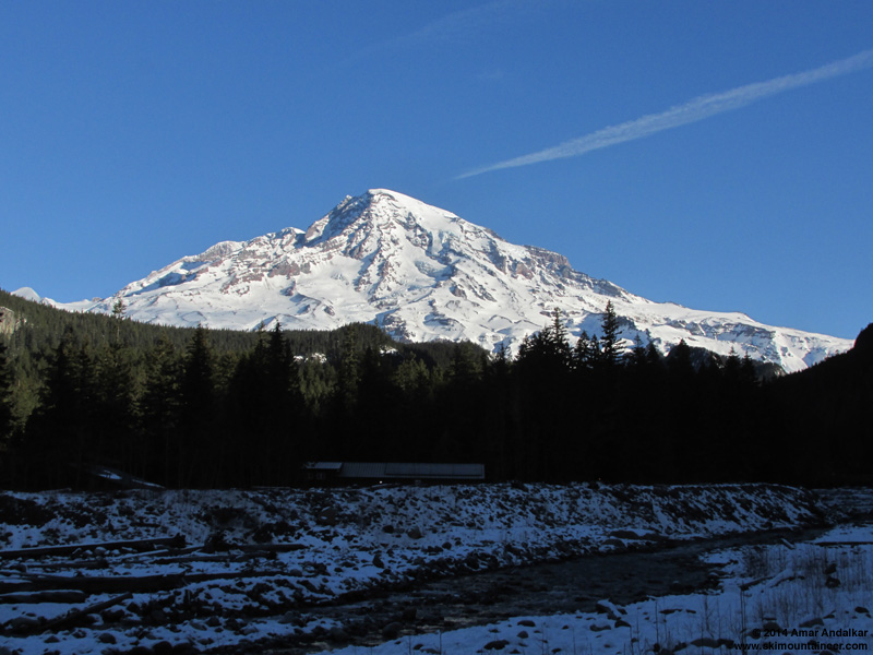
Morning view of the Mountain above the Nisqually River at Longmire, January 16.
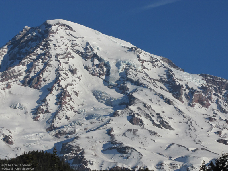
Zoomed view from Longmire, with the Van Trump Glaciers and Turtle at right center.
Met the group of 5 others (the Freebirds, shred, Rory, Jameson) at the Longmire gate just after its 9am opening the next morning, still planning to continue on to Hood solo that evening, and we set up the car shuttle: I convinced them to leave the extra car at Nisqually Bridge (3900 ft) instead of Christine Falls trailhead (3600 ft), since the snowpack in the steep woods above the trailhead looked much too thin (1-2 ft) for decent skiing, while the ski down to the bridge would be an easy cruise on 3-4 ft of well-consolidated continuous snow out in the open. I also knew a nice hidden exit route (one I'd last done 17 years earlier in May 1997) that would allow us to ski the south-facing Van Trump Glaciers from the 10000 ft level on the Turtle and still exit out to Nisqually Bridge via the moraine just west of the Nisqually Glacier terminus. This would be much better than having to ski the SE aspects along Wilson Glacier which we would ascend to reach the Turtle, as those would be out of the sun and re-freezing by the time we skied down in late afternoon.
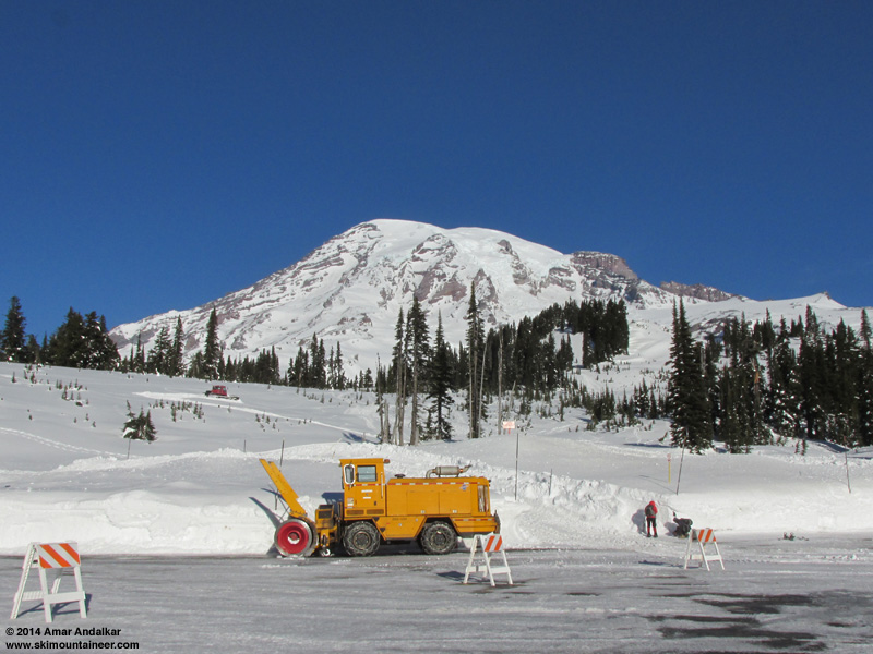
The park's snowcat begins constructing the snowplay area on the slope behind the snowblower -- the snowdepth at Paradise had finally reached the required 5 ft during the previous week's storm cycle.
Before the trip I hadn't been sure if the snow would be consolidated enough for good skiing, or perhaps an unconsolidated mess, given that the first major storm cycle of the 2013-14 season had just ended a few days earlier, bringing over 5 ft of new snow to Paradise and increasing the snow depth from 56" on January 7 (only 55% of normal for that date) to 106" on January 12 (100% of normal!), then settling to 98" by January 15 (88% of normal). But that turned out to be a non-issue: a solid surface wind-and-sun crust covered almost everything on all aspects, topped by a couple inches of windblown powder in spots, fully-supportive and edgeable on skis, but not really so on foot with deep postholing into 2 ft of partially-consolidated snow below the crust for those not on skis. Easy travel on skis and skins, but with ski crampons essential on most steeper or shadier aspects.
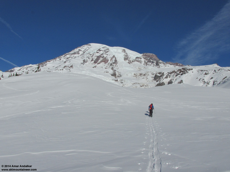
Leaving the Paradise stampede path and breaking our own trail in a new direction towards Glacier Vista.
We left Paradise a bit after 10am and skinned to Glacier Vista at 6350 ft, then ripped skins for the steep and frozen 150 ft descent down to the Nisqually Moraine -- unfortunately one of us took a slide without gloves on, bloodying a hand pretty well. That little slope is always dangerous in frozen morning conditions. From this point on, we would see no one else all day until reaching Longmire well after dark.
Four-shot panorama from Glacier Vista, showing the full sweep of our ascent route across the Nisqually and Wilson Glaciers and up to the Turtle at top center, with the Muir Snowfield and Nisqually Chute (the next day's objectives) at right. The steep debris funnel of the Fan is at left center. (click for double-size version)
Crossed the Nisqually Glacier near the 6400 ft level below an outcrop of icy spires not yet buried by winter snows, then up via the Wilson Gully from 6800-7400 ft. This portion is exposed to serac fall hazard from a small ice cliff looming overhead, with no real way to avoid this hazard (over the last 2-3 years) if you currently wish to do the route at all. The Fan, a distasteful gully to the left of the large vertical rock cliff, is steeper and exposed to cornice fall hazard, and also the only place that even had a chance of avalanche hazard this day -- large crowns from storm-slab avalanches a few days earlier were visible on the steep wind-loaded E and SE aspects at its top, too.
Three-shot panorama from the west edge of the Nisqually Glacier, looking up at Wilson Gully at left and the large jumble of seracs which marks the junction of the Wilson and Nisqually Glaciers at center. (click for double-size version)
Ski crampons became essential for the next portion of the route, a rising traverse left from the big plateau at 7400 ft up to the notch in the ridge near 7700 ft. This was the sketchiest part of the entire ascent, a 40-degree sidehill in firm conditions with ski edge penetration varying from a few inches to barely a few millimeters at times on firmer patches. Postholing deeply on foot would have been worse though, and we all made it up on skins with ski crampons -- thanks for the nice low-angle track, Jeff and Carl.
The next bit of ridge up to 8100 ft also featured some firm sketchy sidehill, on the left edges this time and already partially shaded by just after noon. I checked out the easier detour via the broad south-facing (sun-warmed!) bowl to the left of the ridge, but was unsure if that had enough snow at its top to connect (it does not yet this year) and so returned to the track on the firm shady side.
Skinning the firm NE-facing sidehill along the edge of Wilson Glacier near 7900 ft, with our ski descent onto the Nisqually Glacier visible above the jutting rock outcrop.
[img width=1000 height=600">http://www.skimountaineer.com/TR/Images2014/RainierVanTrumpWilsonGlacierPano2000-16Jan2014.jpg" />
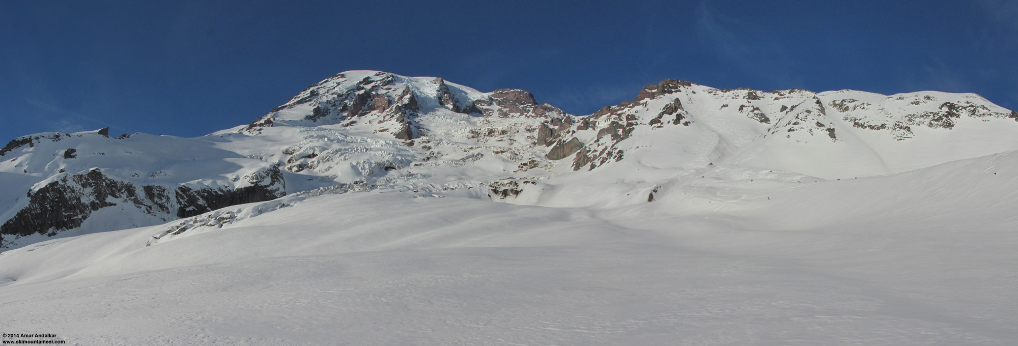
Two-shot panorama from the west edge of the Wilson Glacier at 8100 ft, looking up at the moraine crest which we would ascend, with the Van Trump Glaciers at left and the Turtle above at top center. (click for double-size version)
We took a lunch break atop a small outcrop near 8100 ft, and then enjoyed an easy cruise up the broad moraine crest beside Wilson Glacier which extends to 8600 ft. Another steeper set of switchbacks above that, but quite easy on nicely softened snow, and then angling sharply left around the large rock outcrops near the standard 9200 and 9400 ft campsite areas, staying on the sunny south aspects as much as possible and away from the steep shady SE slopes of the Wilson Glacier itself.
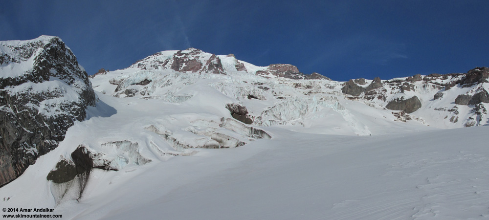
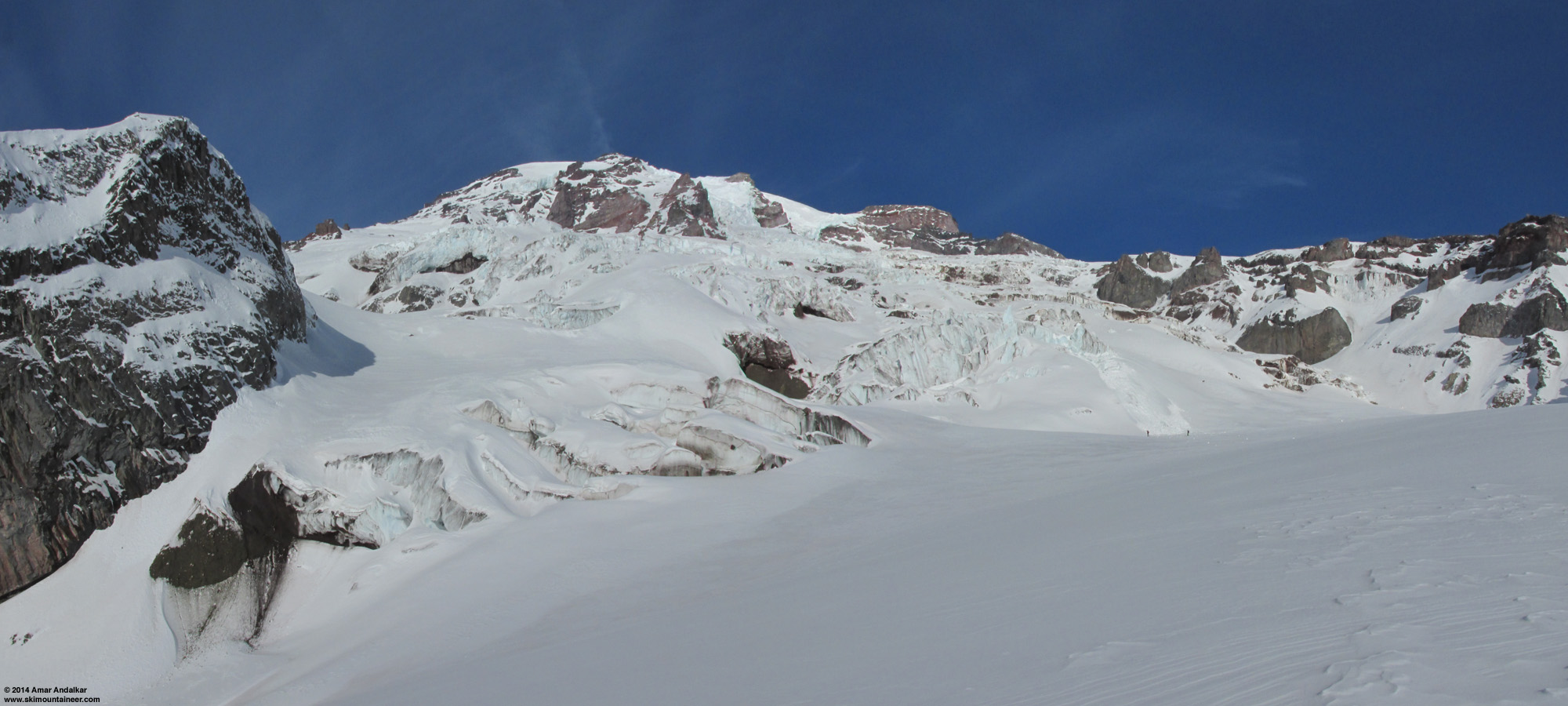
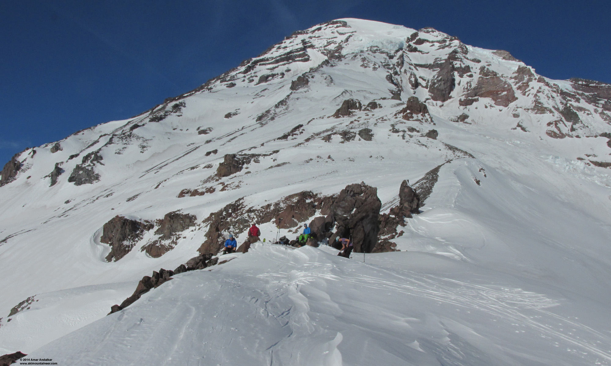
It was already 3pm by the time we reached the Turtle at its 9800 ft terminal moraine, and the sun was now barely warming this SSE aspect, glancing obliquely across it. The slope was steep, firm, and very sketchy to skin even with ski crampons.

The skins and ski crampons barely leave a mark on the steep firm snow of the Turtle, with the Kautz Ice Cliff looming overhead and the hidden gully of Fuhrer Thumb at right.
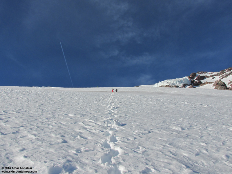
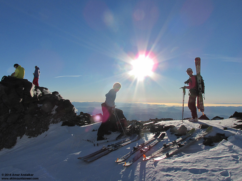
Half of us switched to booting with foot crampons at 10000 ft, but the others made it the whole way on ski crampons to our high point at 10500 ft at a flat spot on the ridge west of the Turtle. Winds were very light and variable, mostly 5-10 mph with some higher gusts, and temps were in the mid 30s °F.
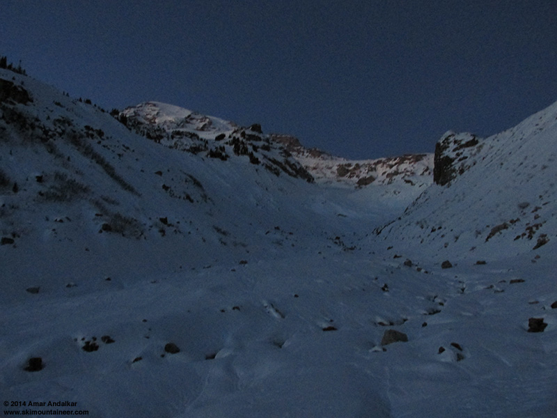
Skied down at 4:15 pm, 2 of us choosing the easy way via the Turtle, the other 4 traversing across 100 yards of loose scree to ski a south facing gully instead. Regardless, it was too late and too high on this day, and snow conditions were firm until we dropped below 9800 ft, at which point it was nicely corned if you stayed on the smoother and dustier aspects (which had absorbed the most sun).

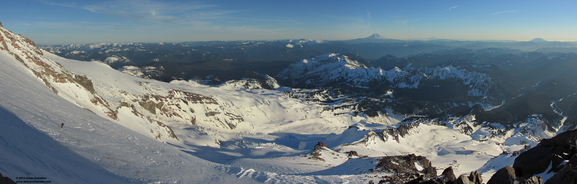
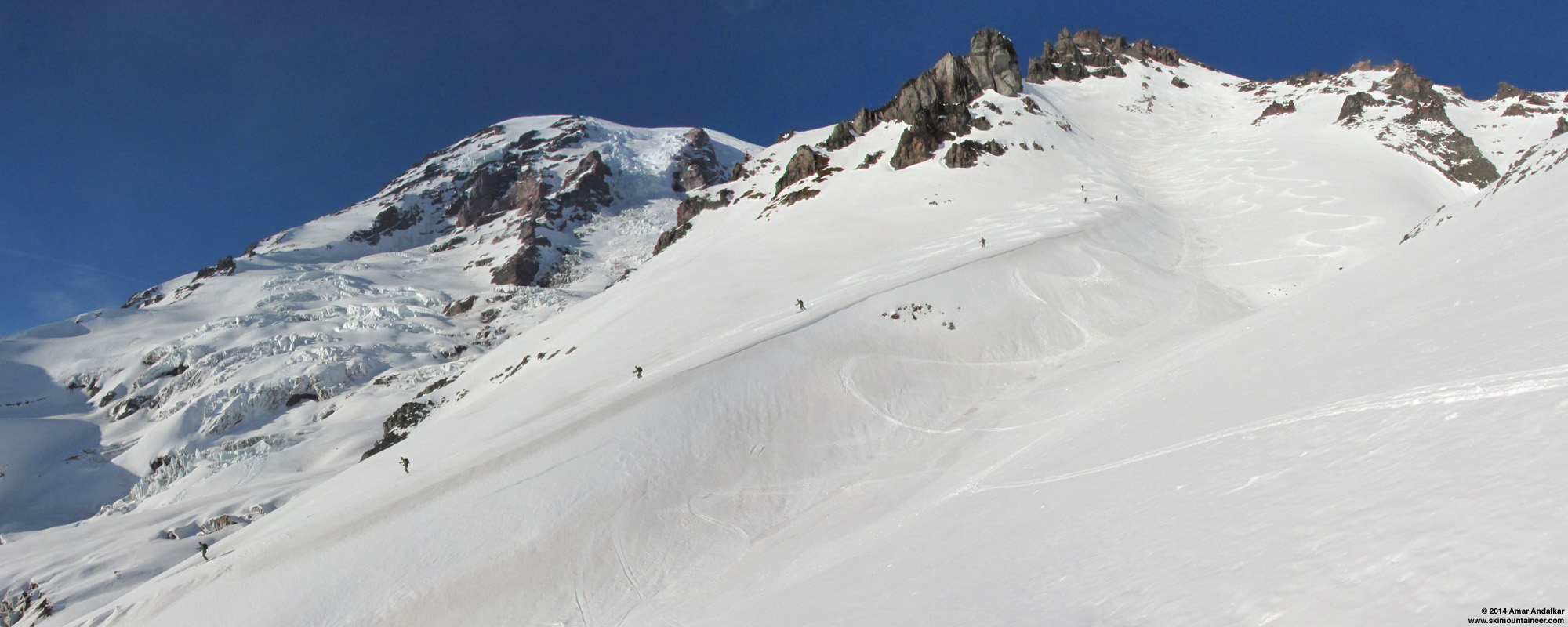
Four-shot panorama from our high point at 10500 ft, with Rory carving turns on the Turtle at left, and the Wilson, Nisqually, and Van Trump Glaciers all falling away below, with Goat Rocks and Mounts Adams, Hood, and Saint Helens on the horizon at upper right. (click for double-size version)
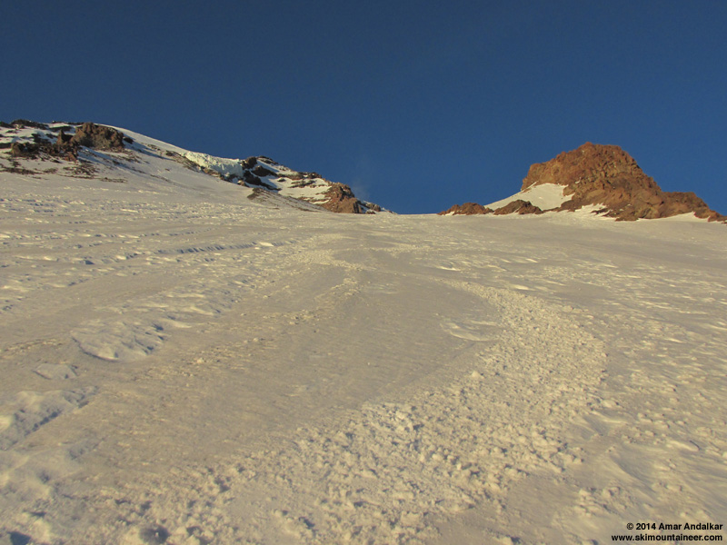
Smooth corn on the uppermost slopes of the Van Trump Glaciers near 9000 ft.
We skied the open bowls which hold various small remnants of the Van Trump Glaciers, and our descent routes reunited below 9000 ft.
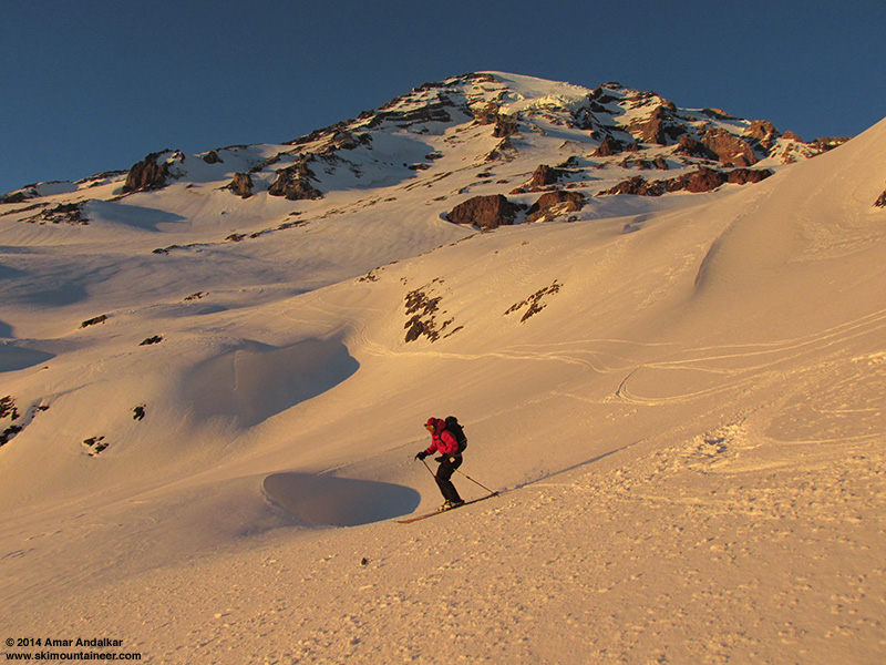
Skiing smooth corn at sunset on the Van Trump Glaciers.
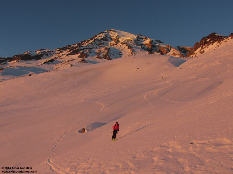
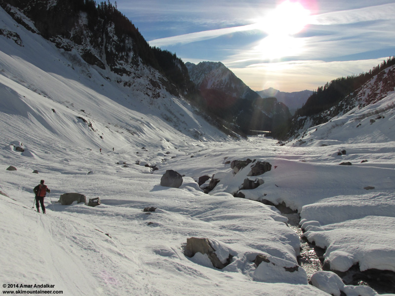
By staying on the most southwesterly aspects which were still getting direct sunlight, we enjoyed smooth corn almost the entire way down to treeline at 6200 ft by sunset (4:45pm this day). The lighting conditions were just as spectacular as the snow conditions, a golden glow slowly turning rosy on the upper Mountain.
It was now time to pull off the exit back into the Nisqually drainage, the goal being to end up at 5400 ft atop the moraine just west of the Nisqually Glacier terminus -- about 3/4 mile of traversing to do, with 800 vert to work with from 6200 ft. I took a quick look at the map and then navigated through the open subalpine forests by dead reckoning and my internal compass, along with faint memories of having gone roughly this way 17 years earlier -- however 1996-97 was a huge snow year, and snowdepth at Paradise was well over 200" in early May 1997, so things looked very different that time with a deep snowpack burying most terrain features.
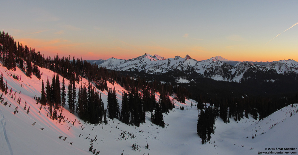
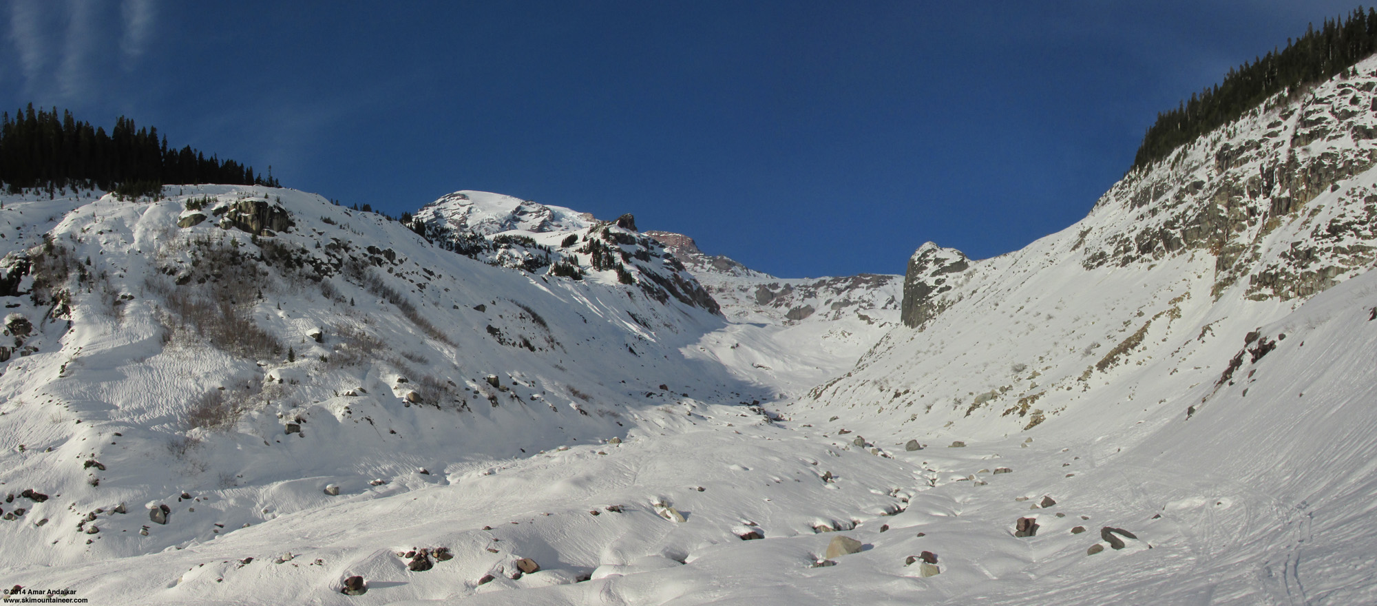
Two-shot panorama along the exit traverse from Van Trump back into the Nisqually drainage near 6000 ft, looking across at the sunset glow on the Tatoosh and Mount Adams. (click for double-size version)
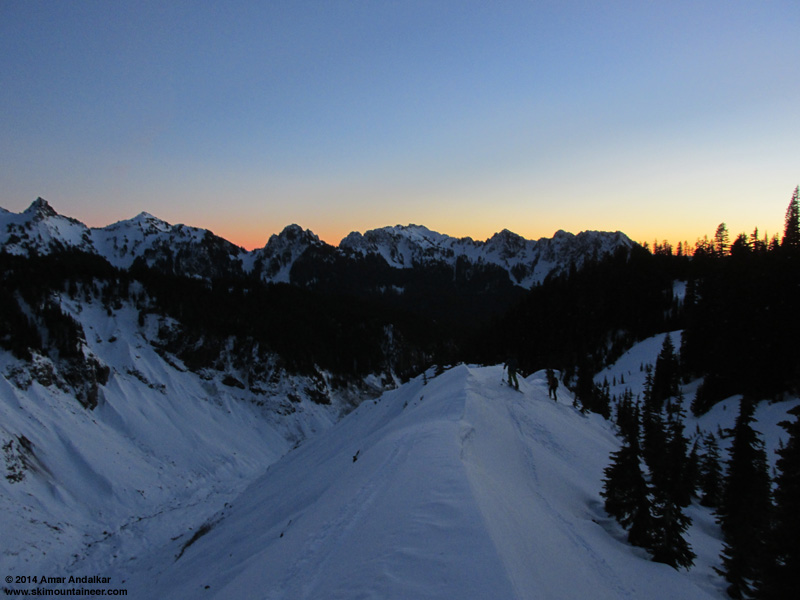
Lots of small gullies to cross this time, the route traverses left through a couple open bowls and across some semi-steep slopes, avoiding cliff bands both above and below at various points. Thankfully the routefinding worked great in the fading light, and we popped out at the upper end of the moraine near 5400 ft exactly as planned, a few minutes after 5pm. Yay!
Snow conditions had deteriorated severely in the twilight though, turning to a mix of supportive and breakable crust. The 600 ft ski descent from the moraine crest to the Nisqually River was not very good, requiring careful skiing to avoid knee injury. The snow improved nicely along the river though, well consolidated and supportive, and we quickly cruised down to the ramp at the east end of Nisqually bridge by 5:30pm as the last light faded away. The rising traverse through the slide alder to reach the road needed headlamps, and I should have put on skins to make it easier too, as the snow was firmly frozen and very slick without skins, while booting was nearly impossible due to thigh-deep postholing.
The vehicle we had left at the bridge parking lot had a warning notice on it, but our two other cars in the Paradise parking lot had none. Exiting the Longmire gate at 6:45pm was no problem, just go in the front desk of the Longmire Inn, enter your name, address, and vehicle info in the logbook, and the clerk walks all the way out to open the gate for you. Unfortunately the Copper Creek had just closed when we got there at 7pm, but we enjoyed a fine meal of burgers and fish&chips and salads at the Highlander in Ashford instead, along with $13 pitchers of Moose Drool. An outstanding day with a great group and truly fine skiing, 6600 vert in a single run from our high point to the bridge.
But I was beat, way too beat to even consider driving the 190 miles from Ashford to Timberline on Mount Hood -- the route from Paradise to the Turtle is always much more tiring and takes more effort than numbers alone would indicate. It would be much better to just stay somewhere nearby, and ski on Rainier again the next day. I had cell service in the Highlander parking lot, and tried to drum up some partners to meet me at the Longmire gate the next morning and repeat the car shuttle, this time intending to ski Muir and Nisqually Chute. Eventually I headed back to Longmire for the night, still unsure of partners for the next day, and spent the night in my car at the Eagle Peak trailhead with its spectacular view, mesmerized by the full moon's glow on the Mountain all night long through the windshield. Too bad that I didn't think to try some night photos using the mini-tripod (Ultrapod II) that I always carry, oh well, they might not have come out too great since I only had a compact ultrazoom camera (Canon SX160 IS) and not a DSLR.
[hr">[tt">MOUNT RAINIER RECREATIONAL FORECAST
NATIONAL WEATHER SERVICE SEATTLE WA
400 AM PST THU JAN 16 2014
SYNOPSIS...AN UPPER RIDGE WILL BRING DRY WEATHER THROUGH FRIDAY NIGHT AT LEAST. A WEAK FRONT MAY BRING A LITTLE PRECIPITATION TO MOUNT RAINIER NATIONAL PARK THIS WEEKEND. HIGH PRESSURE WILL STRENGTHEN AGAIN NEXT WEEK.
THURSDAY...SUNNY. FREEZING LEVEL NEAR 11000 FEET.
THURSDAY NIGHT...MOSTLY CLEAR. FREEZING LEVEL NEAR 10500 FEET.
FRIDAY...SUNNY. FREEZING LEVEL NEAR 11000 FEET.
FRIDAY NIGHT...PARTLY CLOUDY. FREEZING LEVEL NEAR 11500 FEET.
SATURDAY...PARTLY SUNNY. FREEZING LEVEL NEAR 10500 FEET.
TEMPERATURE AND WIND FORECASTS FOR SELECTED LOCATIONS.
THU THU FRI FRI SAT
NIGHT NIGHT
SUMMIT (14411 FT) 17 18 17 17 14
NW 40 NW 40 NW 30 SW 25 SW 40
CAMP MUIR(10188 FT) 36 38 39 38 32
NW 25 NW 30 NW 20 W 10 W 30
PARADISE (5420 FT) 43 39 55 34 46
NE 5 CALM CALM N 5 W 10
LONGMIRE (2700 FT) 50 38 57 36 49
CALM CALM CALM NE 5 N 5
++ TEMPERATURES AND WIND FOR THE SUMMIT AND CAMP MUIR ARE AVERAGE
CONDITIONS EXPECTED IN THE FREE AIR AT THOSE ELEVATIONS.
++ TEMPERATURES FOR PARADISE AND LONGMIRE ARE THE EXPECTED HIGHS AND
LOWS. WIND IS THE AVERAGE WIND EXPECTED DURING THAT PERIOD.
EXTENDED FORECAST...
SATURDAY NIGHT...MOSTLY CLOUDY WITH A CHANCE OF RAIN AND SNOW. SNOW LEVEL NEAR 7500 FEET.
SUNDAY...MOSTLY CLOUDY WITH A CHANCE OF RAIN AND SNOW. SNOW LEVEL NEAR 6500 FEET.
SUNDAY NIGHT...MOSTLY CLOUDY WITH A CHANCE OF RAIN AND SNOW. SNOW LEVEL NEAR 6000 FEET.
MARTIN LUTHER KING JR DAY...MOSTLY SUNNY. FREEZING LEVEL NEAR 8000 FEET.
MONDAY NIGHT...PARTLY CLOUDY. FREEZING LEVEL NEAR 10000 FEET.
TUESDAY...MOSTLY SUNNY. FREEZING LEVEL NEAR 9500 FEET.
TUESDAY NIGHT...MOSTLY CLOUDY. FREEZING LEVEL NEAR 8500 FEET.
WEDNESDAY...PARTLY SUNNY. FREEZING LEVEL NEAR 7500 FEET.
[/tt">
An exceptionally nice day with exceptionally good snow conditions, a pleasant surprise to find the snow surface already well-consolidated on all aspects and mostly smooth corn on steeper southerly aspects just 2 days after the major storm cycle ended. What a way to get Juneuary really rolling!
Morning view of the Mountain above the Nisqually River at Longmire, January 16.
Zoomed view from Longmire, with the Van Trump Glaciers and Turtle at right center.
Met the group of 5 others (the Freebirds, shred, Rory, Jameson) at the Longmire gate just after its 9am opening the next morning, still planning to continue on to Hood solo that evening, and we set up the car shuttle: I convinced them to leave the extra car at Nisqually Bridge (3900 ft) instead of Christine Falls trailhead (3600 ft), since the snowpack in the steep woods above the trailhead looked much too thin (1-2 ft) for decent skiing, while the ski down to the bridge would be an easy cruise on 3-4 ft of well-consolidated continuous snow out in the open. I also knew a nice hidden exit route (one I'd last done 17 years earlier in May 1997) that would allow us to ski the south-facing Van Trump Glaciers from the 10000 ft level on the Turtle and still exit out to Nisqually Bridge via the moraine just west of the Nisqually Glacier terminus. This would be much better than having to ski the SE aspects along Wilson Glacier which we would ascend to reach the Turtle, as those would be out of the sun and re-freezing by the time we skied down in late afternoon.
The park's snowcat begins constructing the snowplay area on the slope behind the snowblower -- the snowdepth at Paradise had finally reached the required 5 ft during the previous week's storm cycle.
Before the trip I hadn't been sure if the snow would be consolidated enough for good skiing, or perhaps an unconsolidated mess, given that the first major storm cycle of the 2013-14 season had just ended a few days earlier, bringing over 5 ft of new snow to Paradise and increasing the snow depth from 56" on January 7 (only 55% of normal for that date) to 106" on January 12 (100% of normal!), then settling to 98" by January 15 (88% of normal). But that turned out to be a non-issue: a solid surface wind-and-sun crust covered almost everything on all aspects, topped by a couple inches of windblown powder in spots, fully-supportive and edgeable on skis, but not really so on foot with deep postholing into 2 ft of partially-consolidated snow below the crust for those not on skis. Easy travel on skis and skins, but with ski crampons essential on most steeper or shadier aspects.
Leaving the Paradise stampede path and breaking our own trail in a new direction towards Glacier Vista.
We left Paradise a bit after 10am and skinned to Glacier Vista at 6350 ft, then ripped skins for the steep and frozen 150 ft descent down to the Nisqually Moraine -- unfortunately one of us took a slide without gloves on, bloodying a hand pretty well. That little slope is always dangerous in frozen morning conditions. From this point on, we would see no one else all day until reaching Longmire well after dark.

Four-shot panorama from Glacier Vista, showing the full sweep of our ascent route across the Nisqually and Wilson Glaciers and up to the Turtle at top center, with the Muir Snowfield and Nisqually Chute (the next day's objectives) at right. The steep debris funnel of the Fan is at left center. (click for double-size version)
Crossed the Nisqually Glacier near the 6400 ft level below an outcrop of icy spires not yet buried by winter snows, then up via the Wilson Gully from 6800-7400 ft. This portion is exposed to serac fall hazard from a small ice cliff looming overhead, with no real way to avoid this hazard (over the last 2-3 years) if you currently wish to do the route at all. The Fan, a distasteful gully to the left of the large vertical rock cliff, is steeper and exposed to cornice fall hazard, and also the only place that even had a chance of avalanche hazard this day -- large crowns from storm-slab avalanches a few days earlier were visible on the steep wind-loaded E and SE aspects at its top, too.
Three-shot panorama from the west edge of the Nisqually Glacier, looking up at Wilson Gully at left and the large jumble of seracs which marks the junction of the Wilson and Nisqually Glaciers at center. (click for double-size version)
Ski crampons became essential for the next portion of the route, a rising traverse left from the big plateau at 7400 ft up to the notch in the ridge near 7700 ft. This was the sketchiest part of the entire ascent, a 40-degree sidehill in firm conditions with ski edge penetration varying from a few inches to barely a few millimeters at times on firmer patches. Postholing deeply on foot would have been worse though, and we all made it up on skins with ski crampons -- thanks for the nice low-angle track, Jeff and Carl.
The next bit of ridge up to 8100 ft also featured some firm sketchy sidehill, on the left edges this time and already partially shaded by just after noon. I checked out the easier detour via the broad south-facing (sun-warmed!) bowl to the left of the ridge, but was unsure if that had enough snow at its top to connect (it does not yet this year) and so returned to the track on the firm shady side.
Skinning the firm NE-facing sidehill along the edge of Wilson Glacier near 7900 ft, with our ski descent onto the Nisqually Glacier visible above the jutting rock outcrop.
[img width=1000 height=600">http://www.skimountaineer.com/TR/Images2014/RainierVanTrumpWilsonGlacierPano2000-16Jan2014.jpg" />
Two-shot panorama from the west edge of the Wilson Glacier at 8100 ft, looking up at the moraine crest which we would ascend, with the Van Trump Glaciers at left and the Turtle above at top center. (click for double-size version)
We took a lunch break atop a small outcrop near 8100 ft, and then enjoyed an easy cruise up the broad moraine crest beside Wilson Glacier which extends to 8600 ft. Another steeper set of switchbacks above that, but quite easy on nicely softened snow, and then angling sharply left around the large rock outcrops near the standard 9200 and 9400 ft campsite areas, staying on the sunny south aspects as much as possible and away from the steep shady SE slopes of the Wilson Glacier itself.
It was already 3pm by the time we reached the Turtle at its 9800 ft terminal moraine, and the sun was now barely warming this SSE aspect, glancing obliquely across it. The slope was steep, firm, and very sketchy to skin even with ski crampons.
The skins and ski crampons barely leave a mark on the steep firm snow of the Turtle, with the Kautz Ice Cliff looming overhead and the hidden gully of Fuhrer Thumb at right.
Half of us switched to booting with foot crampons at 10000 ft, but the others made it the whole way on ski crampons to our high point at 10500 ft at a flat spot on the ridge west of the Turtle. Winds were very light and variable, mostly 5-10 mph with some higher gusts, and temps were in the mid 30s °F.
Skied down at 4:15 pm, 2 of us choosing the easy way via the Turtle, the other 4 traversing across 100 yards of loose scree to ski a south facing gully instead. Regardless, it was too late and too high on this day, and snow conditions were firm until we dropped below 9800 ft, at which point it was nicely corned if you stayed on the smoother and dustier aspects (which had absorbed the most sun).
Four-shot panorama from our high point at 10500 ft, with Rory carving turns on the Turtle at left, and the Wilson, Nisqually, and Van Trump Glaciers all falling away below, with Goat Rocks and Mounts Adams, Hood, and Saint Helens on the horizon at upper right. (click for double-size version)
Smooth corn on the uppermost slopes of the Van Trump Glaciers near 9000 ft.
We skied the open bowls which hold various small remnants of the Van Trump Glaciers, and our descent routes reunited below 9000 ft.
Skiing smooth corn at sunset on the Van Trump Glaciers.
By staying on the most southwesterly aspects which were still getting direct sunlight, we enjoyed smooth corn almost the entire way down to treeline at 6200 ft by sunset (4:45pm this day). The lighting conditions were just as spectacular as the snow conditions, a golden glow slowly turning rosy on the upper Mountain.
It was now time to pull off the exit back into the Nisqually drainage, the goal being to end up at 5400 ft atop the moraine just west of the Nisqually Glacier terminus -- about 3/4 mile of traversing to do, with 800 vert to work with from 6200 ft. I took a quick look at the map and then navigated through the open subalpine forests by dead reckoning and my internal compass, along with faint memories of having gone roughly this way 17 years earlier -- however 1996-97 was a huge snow year, and snowdepth at Paradise was well over 200" in early May 1997, so things looked very different that time with a deep snowpack burying most terrain features.
Two-shot panorama along the exit traverse from Van Trump back into the Nisqually drainage near 6000 ft, looking across at the sunset glow on the Tatoosh and Mount Adams. (click for double-size version)
Lots of small gullies to cross this time, the route traverses left through a couple open bowls and across some semi-steep slopes, avoiding cliff bands both above and below at various points. Thankfully the routefinding worked great in the fading light, and we popped out at the upper end of the moraine near 5400 ft exactly as planned, a few minutes after 5pm. Yay!
Snow conditions had deteriorated severely in the twilight though, turning to a mix of supportive and breakable crust. The 600 ft ski descent from the moraine crest to the Nisqually River was not very good, requiring careful skiing to avoid knee injury. The snow improved nicely along the river though, well consolidated and supportive, and we quickly cruised down to the ramp at the east end of Nisqually bridge by 5:30pm as the last light faded away. The rising traverse through the slide alder to reach the road needed headlamps, and I should have put on skins to make it easier too, as the snow was firmly frozen and very slick without skins, while booting was nearly impossible due to thigh-deep postholing.
The vehicle we had left at the bridge parking lot had a warning notice on it, but our two other cars in the Paradise parking lot had none. Exiting the Longmire gate at 6:45pm was no problem, just go in the front desk of the Longmire Inn, enter your name, address, and vehicle info in the logbook, and the clerk walks all the way out to open the gate for you. Unfortunately the Copper Creek had just closed when we got there at 7pm, but we enjoyed a fine meal of burgers and fish&chips and salads at the Highlander in Ashford instead, along with $13 pitchers of Moose Drool. An outstanding day with a great group and truly fine skiing, 6600 vert in a single run from our high point to the bridge.
But I was beat, way too beat to even consider driving the 190 miles from Ashford to Timberline on Mount Hood -- the route from Paradise to the Turtle is always much more tiring and takes more effort than numbers alone would indicate. It would be much better to just stay somewhere nearby, and ski on Rainier again the next day. I had cell service in the Highlander parking lot, and tried to drum up some partners to meet me at the Longmire gate the next morning and repeat the car shuttle, this time intending to ski Muir and Nisqually Chute. Eventually I headed back to Longmire for the night, still unsure of partners for the next day, and spent the night in my car at the Eagle Peak trailhead with its spectacular view, mesmerized by the full moon's glow on the Mountain all night long through the windshield. Too bad that I didn't think to try some night photos using the mini-tripod (Ultrapod II) that I always carry, oh well, they might not have come out too great since I only had a compact ultrazoom camera (Canon SX160 IS) and not a DSLR.
[hr">[tt">MOUNT RAINIER RECREATIONAL FORECAST
NATIONAL WEATHER SERVICE SEATTLE WA
400 AM PST THU JAN 16 2014
SYNOPSIS...AN UPPER RIDGE WILL BRING DRY WEATHER THROUGH FRIDAY NIGHT AT LEAST. A WEAK FRONT MAY BRING A LITTLE PRECIPITATION TO MOUNT RAINIER NATIONAL PARK THIS WEEKEND. HIGH PRESSURE WILL STRENGTHEN AGAIN NEXT WEEK.
THURSDAY...SUNNY. FREEZING LEVEL NEAR 11000 FEET.
THURSDAY NIGHT...MOSTLY CLEAR. FREEZING LEVEL NEAR 10500 FEET.
FRIDAY...SUNNY. FREEZING LEVEL NEAR 11000 FEET.
FRIDAY NIGHT...PARTLY CLOUDY. FREEZING LEVEL NEAR 11500 FEET.
SATURDAY...PARTLY SUNNY. FREEZING LEVEL NEAR 10500 FEET.
TEMPERATURE AND WIND FORECASTS FOR SELECTED LOCATIONS.
THU THU FRI FRI SAT
NIGHT NIGHT
SUMMIT (14411 FT) 17 18 17 17 14
NW 40 NW 40 NW 30 SW 25 SW 40
CAMP MUIR(10188 FT) 36 38 39 38 32
NW 25 NW 30 NW 20 W 10 W 30
PARADISE (5420 FT) 43 39 55 34 46
NE 5 CALM CALM N 5 W 10
LONGMIRE (2700 FT) 50 38 57 36 49
CALM CALM CALM NE 5 N 5
++ TEMPERATURES AND WIND FOR THE SUMMIT AND CAMP MUIR ARE AVERAGE
CONDITIONS EXPECTED IN THE FREE AIR AT THOSE ELEVATIONS.
++ TEMPERATURES FOR PARADISE AND LONGMIRE ARE THE EXPECTED HIGHS AND
LOWS. WIND IS THE AVERAGE WIND EXPECTED DURING THAT PERIOD.
EXTENDED FORECAST...
SATURDAY NIGHT...MOSTLY CLOUDY WITH A CHANCE OF RAIN AND SNOW. SNOW LEVEL NEAR 7500 FEET.
SUNDAY...MOSTLY CLOUDY WITH A CHANCE OF RAIN AND SNOW. SNOW LEVEL NEAR 6500 FEET.
SUNDAY NIGHT...MOSTLY CLOUDY WITH A CHANCE OF RAIN AND SNOW. SNOW LEVEL NEAR 6000 FEET.
MARTIN LUTHER KING JR DAY...MOSTLY SUNNY. FREEZING LEVEL NEAR 8000 FEET.
MONDAY NIGHT...PARTLY CLOUDY. FREEZING LEVEL NEAR 10000 FEET.
TUESDAY...MOSTLY SUNNY. FREEZING LEVEL NEAR 9500 FEET.
TUESDAY NIGHT...MOSTLY CLOUDY. FREEZING LEVEL NEAR 8500 FEET.
WEDNESDAY...PARTLY SUNNY. FREEZING LEVEL NEAR 7500 FEET.
[/tt">
Juneuary 17, 2014, Mount Rainier, Camp Muir to Nisqually Bridge via Nisqually Chute
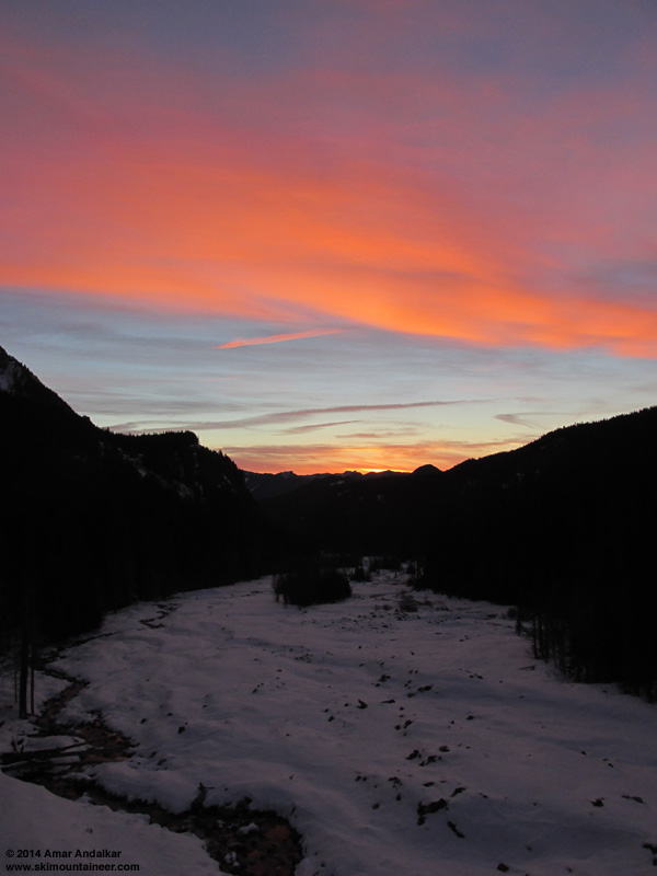
Enjoyed a glorious dawn and sunrise the next morning, standing and shivering and shooting photos on the bank of the Nisqually River for 20 minutes, before heading to the Longmire Inn for a nice breakfast omelet while I waited for the 9am gate opening.
Sunrise glow on the Mountain above the Nisqually River at Longmire, January 17.
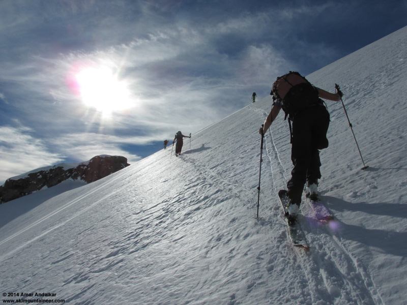
As I came back outside, I was glad to see that Kam had arrived to join me and set up another car shuttle (there's no cell service at all in Longmire, so I had not gotten his text reply). We dropped off a car at the bridge and skinned up from Paradise just before 10:30am, even though I was really slow getting ready and then really dragging after that, exhausted from 2 straight big days. The route up Panorama Face looked way too firm for easy skinning, everyone we could see was being forced to boot up it, so I suggested we head around to the right and ascend the south face of the SW ridge of Panorama Point, a standard winter variation which gets sun and softens at least 2-3 hours earlier than Pan Face does.
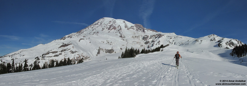
Three-shot panorama along the stampede path towards Panorama Point, with the highly preferable ski ascent route up the south face of the SW ridge visible at right, Nisqually Chute just above and left of Kam's head, and the Nisqually and Wilson Glaciers at center. (click for double-size version)
This worked out great, the snow was nicely softened although we used ski crampons anyway for insurance, and 4 quick switchbacks put us atop the ridge crest for an easy cruise the rest of the way up Pan Point. This also avoided the potentially serious hazard of falling bodies on Pan Face, which can be a significant risk on busy days with firm frozen conditions in the morning.
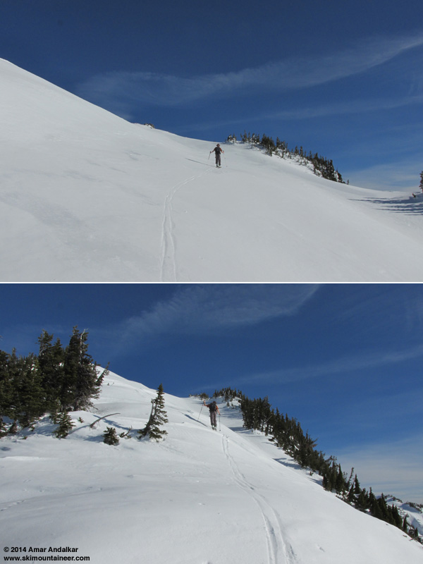
The excellent route up the the south face of the SW ridge of Panorama Point, no crowds, no hassle, and a nice clean skin track.
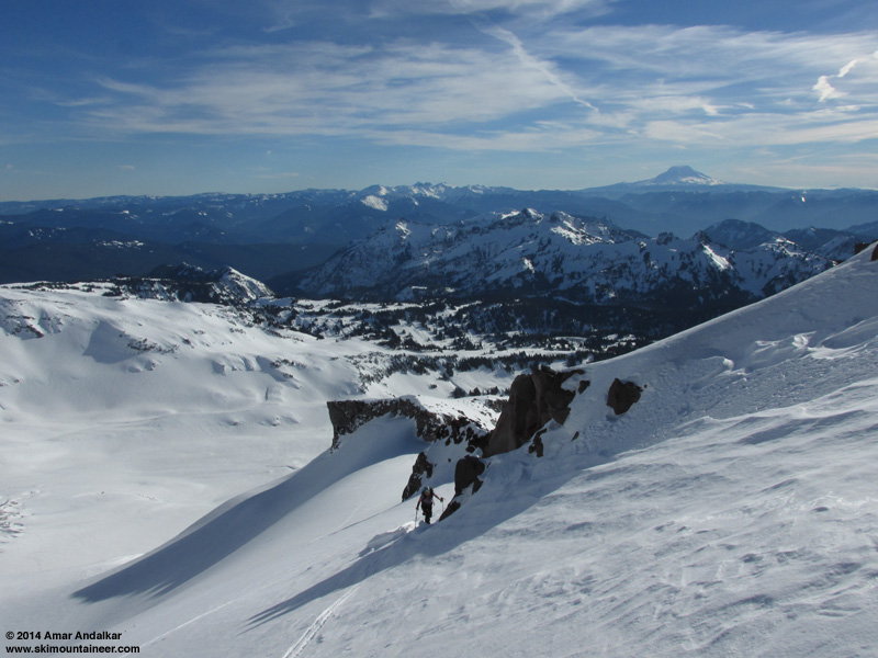
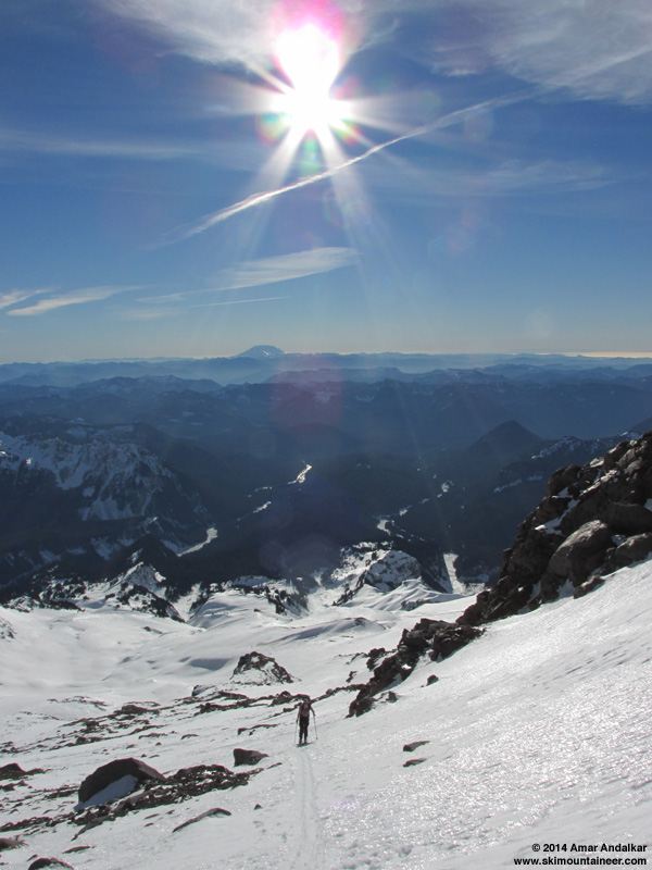
The steep rolls near 7000 ft were also nicely softened in the sun, and skinned easily too. The iciest part of the entire route was from about 7000-7200 ft, with large areas of hard water ice for about a 1/4 mile along the winter route, and isolated icy patches continued past McClure Rock and 7500 ft.
Two-shot panorama skinning along the winter route, with the Goat Rocks and Mounts Adams, Hood, and Saint Helens along the horizon. (click for double-size version)
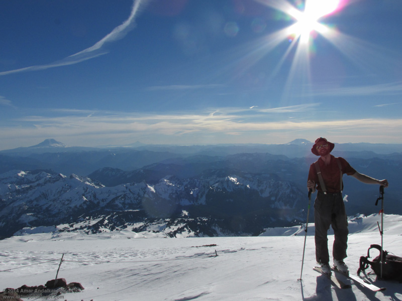
The ski crampons were not needed above 7700 ft, and the rest of the route was an easy cruise in gorgeous calm weather. We strolled into Camp Muir just after 2pm, just amazingly nice weather for January or June or anytime, over 40 °F and winds 0-5 mph.
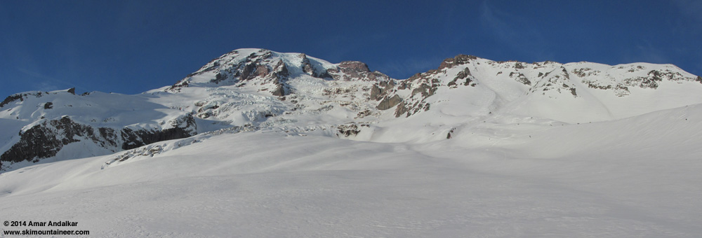
Met a few others up there who were interested in joining us for the run down to the bridge, especially given the offer of a car shuttle, and we skied down as a group of five around 2:45pm. Mostly smooth windpack on the upper snowfield, fairly good skiing, and very very nice compared to typical winter snow conditions up there.
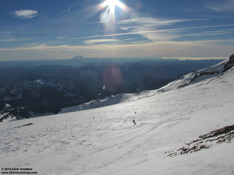
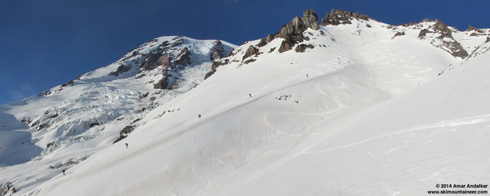
Below 9000 ft, steeper rolls were softened into good corn, and the well-corned rollover at 8400 ft above the entrance to Nisqually Chute made us confident that the entire Chute would be in prime shape. There were already a dozen or more tracks in the gut of the Chute, from earlier in the day and the previous 2 days, but the entire open slope to skier's left had not a single track on it yet.
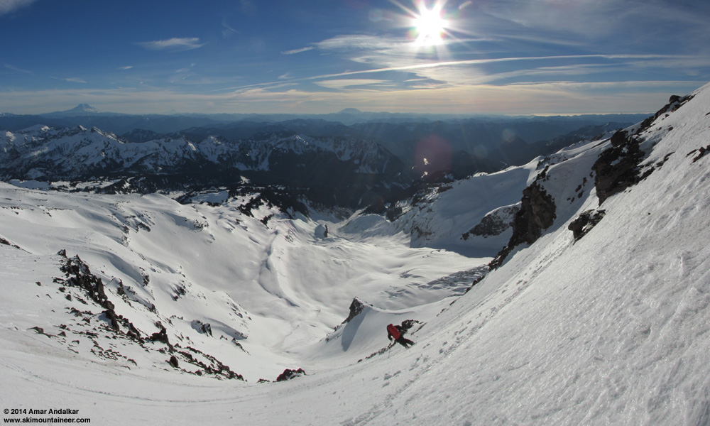
Three-shot vertical panorama from the entrance of Nisqually Chute. (click for double-size version)
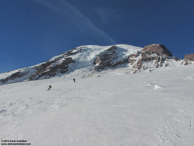
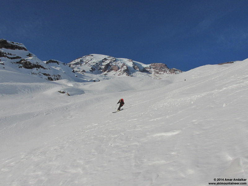
Just awesome smooth soft corn, perfect for carving big sweeping turns down the entire untracked face in a single shot.
[img width=521 height=800">http://www.skimountaineer.com/TR/Images2014/RainierNisquallyChuteCornSkiingAnimation-17Jan2014.gif" />
Five-shot animation of me skiing untracked corn down the skier's left side side of Nisqually Chute. (photos by kamtron, click for double-size version)
Six-shot panorama / multiple exposure of Kam skiing a line of untracked corn down the skier's right rib of Nisqually Chute. (click for double-size version)
The snow was perhaps a bit too soft on the lower half, an hour earlier might have been better, but it never got sticky or gloppy. The flattening angle near the bottom of the Chute made the snow near-perfect again, as we zoomed out onto the smooth surface of the Nisqually Glacier at high speed.
Three-shot panorama from Nisqually Glacier, with Nisqually Chute at right center with numerous tracks and several skiers. (click for double-size version)
The run down the glacier to its terminus was mostly great, lots of smooth corn with only a few over-softened parts that had not consolidated well yet.
We skied down the east side of the glacier terminus and then joined the fast track out along the river, now smoothed into a highway by dozens of skis.
Three-shot panorama from beside the Nisqually River, with its source from an ice cave at the Nisqually Glacier terminus visible at center, and the moraine we skied down the previous day after traversing out from Van Trump Glaciers at left. (click for double-size version)
Zoomed view from the edge of the alder, looking back at numerous ski tracks in Nisqually Chute and on the glacier below.
We made sure to use skins for the slide alder ramp leading up from the east side of the river to the bridge this time. It's always nice to enjoy a little flavor of the North Cascades at the end of a trip on Rainier.
We were out to the bridge before 4pm, comfortably well before dark unlike the previous day.
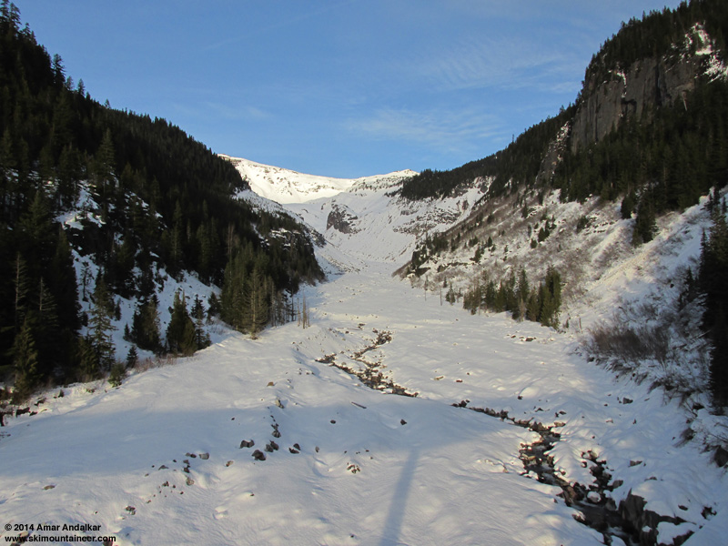
View from Nisqually Bridge looking back up the river, with Nisqually Chute visible in the bright sunlight at center.
Another run of over 6000 vert, two days in a row of epic corn conditions in mid-January! And a total of 13000 vert of skiing for only 10000 ft of gain, the car shuttle gaining us an extra 1500 vert each time. By the time we finished shuttling the cars, the glow of another awesome sunset was upon the Mountain again too.
Two-shot panorama from about 4100 ft on the Paradise Road at sunset on January 17, showing the Turtle and Van Trump Glaciers at center, with the Muir Snowfield, Nisqually Chute, and Nisqually Bridge at right, and Pyramid Peak at far left. (click for double-size version)
[hr">[tt">MOUNT RAINIER RECREATIONAL FORECAST
NATIONAL WEATHER SERVICE SEATTLE WA
400 AM PST FRI JAN 17 2014
SYNOPSIS...AN UPPER RIDGE WILL BRING SUNNY MILD WEATHER TO MOUNT RAINIER NATIONAL PARK FRIDAY. HIGH CLOUDS WILL INCREASE SATURDAY...AND SUNDAY SHOULD BE CLOUDY BUT REMAIN DRY AS THE REMAINS OF A WEAKENING FRONT MOVE THROUGH. THE UPPER RIDGE WILL STRENGTHEN AGAIN NEXT WEEK FOR MORE DRY WEATHER.
FRIDAY...SUNNY. FREEZING LEVEL NEAR 10500 FEET.
FRIDAY NIGHT...PARTLY CLOUDY. FREEZING LEVEL NEAR 11000 FEET.
SATURDAY...PARTLY SUNNY. FREEZING LEVEL NEAR 10000 FEET.
SATURDAY NIGHT...MOSTLY CLOUDY. FREEZING LEVEL NEAR 9000 FEET.
SUNDAY...CLOUDY. FREEZING LEVEL NEAR 8500 FEET.
TEMPERATURE AND WIND FORECASTS FOR SELECTED LOCATIONS.
FRI FRI SAT SAT SUN
NIGHT NIGHT
SUMMIT (14411 FT) 16 16 16 15 12
NW 30 SW 25 W 40 W 55 W 40
CAMP MUIR(10188 FT) 38 37 31 29 28
NW 25 W 15 SW 30 W 30 W 15
PARADISE (5420 FT) 60 35 46 31 43
NE 5 N 5 W 10 SW 5 SW 5
LONGMIRE (2700 FT) 55 37 49 36 47
NE 5 NE 5 NW 5 CALM CALM
++ TEMPERATURES AND WIND FOR THE SUMMIT AND CAMP MUIR ARE AVERAGE
CONDITIONS EXPECTED IN THE FREE AIR AT THOSE ELEVATIONS.
++ TEMPERATURES FOR PARADISE AND LONGMIRE ARE THE EXPECTED HIGHS AND
LOWS. WIND IS THE AVERAGE WIND EXPECTED DURING THAT PERIOD.
EXTENDED FORECAST...
SUNDAY NIGHT...MOSTLY CLOUDY. FREEZING LEVEL NEAR 8000 FEET.
MARTIN LUTHER KING JR DAY...PARTLY SUNNY. FREEZING LEVEL NEAR 8000 FEET.
MONDAY NIGHT...PARTLY CLOUDY. FREEZING LEVEL NEAR 10000 FEET.
TUESDAY...MOSTLY SUNNY. FREEZING LEVEL NEAR 9500 FEET.
TUESDAY NIGHT...PARTLY CLOUDY. FREEZING LEVEL NEAR 8500 FEET.
WEDNESDAY...MOSTLY SUNNY. FREEZING LEVEL NEAR 7500 FEET.
WEDNESDAY NIGHT...PARTLY CLOUDY. FREEZING LEVEL NEAR 8000 FEET.
THURSDAY...MOSTLY SUNNY. FREEZING LEVEL NEAR 7500 FEET.
[/tt">
Juneuary 18, 2014, Marmot Mountain Works: New Skis!
I really needed a rest day after 3 straight tiring days, and with winds forecast to increase substantially on Saturday the 18th, it seemed like a good day to rest, followed by a day of watching the AFC/NFC championships during even windier and cloudier weather on Sunday the 19th as a weak system brushed the northern edge of the upper level ridge of high pressure.
Trip reports from Saturday indicated strong winds which prevented the corn from softening nearly as nicely as the previous 2 days. The webcam showed a lenticular cloud above the summit and a stack of lenticular lee-wave clouds off to the east of the Mountain, indicative of the strong winds aloft:
[img width=1000 height=562">http://www.skimountaineer.com/TR/Images2014/mountain-2014Jan18-1120.jpg" />
Spent most of Saturday at Marmot Mountain Works during their going-out-of-business sale, thermofitting the new Scott Cosmos boots that I bought on the 14th, and also buying new skis which they mounted while I was there: the new 2014 Dynafit Cho Oyu (182 cm, 125-89-111), to replace the Volkl Amaruq (177 cm, 127-88-109) which has been my main ski mountaineering setup since my previous similar skis, the K2 Mount Baker Superlight, had a toepiece rip out at 13200 ft on Rainier in June 2011 (see TR). But the Amaruqs now have over 160 days of hard use primarily in spring and summer conditions and are quite thoroughly thrashed, with at least 6 separate cracks in the edges, and the Vertical FT bindings on them have over 310 days of similar hard use and abuse, with repeated exposure to volcanic ash and grit. Not a setup I could really trust anymore on steep exposed terrain or heavily crevassed glaciers, where one's life depends on the edges and bindings, so they're now my late-summer and early-autumn rock skis.
New skis: Dynafit Cho Oyu, 182 cm, 125-89-111, 3530 g (7 lbs 12 oz) with Radical ST bindings.
Old skis: Volkl Amaruq, 177 cm, 127-88-109, 4030 g (8 lbs 14 oz) with Vertical FT bindings.
The new setup is amazingly light: the Amaruq is a very lightweight ski (1400 g at 177 cm), but the Cho Oyu is truly ultralight at 1140 g for 174 cm or 1190 g for 182 cm (measured weights). The total weight of the new 182 cm Dynafit Cho Oyu setup with Radical ST bindings and leashes is 3530 g (7 lbs 12 oz), versus 4030 g (8 lbs 14 oz) for the Amaruqs with Vertical FT bindings and leashes -- a huge savings especially considering that the Amaruqs had already been 200 g (7 oz) lighter than the K2 Mount Baker Superlights they had replaced. I picked the 182 cm Cho Oyu over the 174 cm because of its rockered tip, which makes the running length somewhat shorter than the traditional-camber 177 cm Amaruq, and the tail-to-heelpiece distance (important for easily skinning switchbacks if you're not tall) ended up slightly less than the Amaruq also.
Just for fun, here's a look at my current quiver of touring skis, acquired slowly over a period of many years -- it's easy to build a nice quiver that covers a broad range of snow conditions and keep current with improving technology if you buy a new setup every few years. Surprisingly, the new Cho Oyu are even lighter than either of my two pairs of 70-mm-underfoot Volkl Mountain Norbert Joos, which was in its day (introduced 2004) considered an "ultralight", high-performance ski-mountaineering ski. Also included in the table ([color=gray">gray[/color">) are two non-Dynafit-binding setups which I now use only for lift skiing due to their unwieldy weight, and the other retired setups which I've used since I began ski mountaineering in 1996:
[tt">
Skis Length Tip Waist Tail Area Bindings Total Weight Date Purchased
(cm) (mm) (mm) (mm) (cm^2) (with brakes, + leashes on some)
---------------------------------------------------------------------------------------------------------------------------------------
Volkl Mountain N.Joos 177 104 70 92 1490 Dynafit Comfort 3770 g ( 8 lbs 5 oz) Feb 2008 (bindings Feb 2005)
Volkl Amaruq 177 127 88 109 1820 Dynafit Vertical FT 4030 g ( 8 lbs 14 oz) Jun 2011 (bindings Mar 2008)
Dynafit Cho Oyu 182 125 89 111 1880 Dynafit Radical ST 3530 g ( 7 lbs 12 oz) Jan 2014
Dynafit Stoke 182 130 106 122 2100 Dynafit Vertical ST 4420 g ( 9 lbs 5 oz) Apr 2010
[color=gray">Lifts Only:
K2 Mount Baker 174(=177) 120 88 108 1790 Fritschi Freeride 5530 g (12 lbs 3 oz) Jan 2006
Black Diamond Megawatt 188 153 125 130 2510 Marker Baron 7150 g (15 lbs 12 oz) May 2009
Retired:
Tua Excalibur 190 90 70 80 1470 Fritschi Diamir 5050 g (11 lbs 2 oz) Dec 1996 (bar broke, unmounted)
Tua Mito 185 98 70 88 1510 Fritschi Diamir 2 5100 g (11 lbs 4 oz) Aug 2000 (still usable)
Volkl Mountain N.Joos 177 104 70 92 1490 Dynafit Comfort 3600 g ( 7 lbs 15 oz) Feb 2005 (edge cracked, unmounted)
K2 Mount Baker SL 174(=177) 125 88 108 1810 Dynafit Vertical FT 4220 g ( 9 lbs 5 oz) Mar 2008 (toe ripped, unmounted)[/color">
---------------------------------------------------------------------------------------------------------------------------------------
[/tt">The listed "Area" is approximate, based on a simple 2-trapezoid formula, but gives a rough comparison of their flotation in powder.
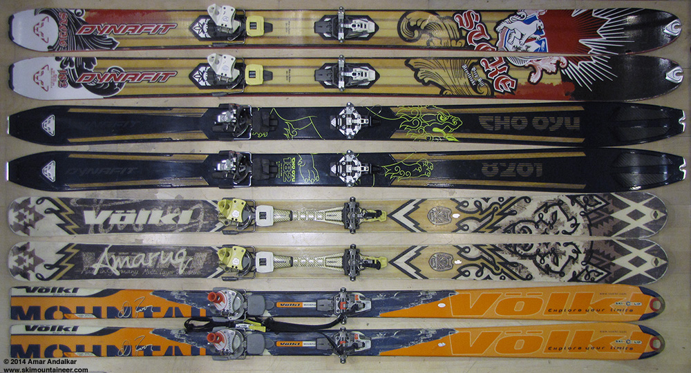
Dynafit Stoke, 182 cm, 130-106-122, 4420 g (9 lbs 5 oz) with Vertical ST bindings.
Dynafit Cho Oyu, 182 cm, 125-89-111, 3530 g (7 lbs 12 oz) with Radical ST bindings.
Volkl Amaruq, 177 cm, 127-88-109, 4030 g (8 lbs 14 oz) with Vertical FT bindings.
Volkl Mountain N.Joos, 177 cm, 104-70-92, 3770 g (8 lbs 5 oz) with Comfort bindings.
[hr">[tt">MOUNT RAINIER RECREATIONAL FORECAST
NATIONAL WEATHER SERVICE SEATTLE WA
400 AM PST SAT JAN 18 2014
SYNOPSIS...THE REMAINS OF A WEAKENING FRONT WILL BRING MID AND HIGH CLOUDS TO MOUNT RAINIER NATIONAL PARK TONIGHT AND SUNDAY...BUT NO PRECIPITATION IS EXPECTED. AN UPPER RIDGE OVER THE PACIFIC NORTHWEST WILL STRENGTHEN AGAIN NEXT WEEK FOR MORE DRY WEATHER AND MILD CONDITIONS.
SATURDAY...MOSTLY SUNNY. FREEZING LEVEL NEAR 11000 FEET.
SATURDAY NIGHT...MOSTLY CLOUDY. FREEZING LEVEL NEAR 10500 FEET.
SUNDAY...BREEZY. PARTLY SUNNY. FREEZING LEVEL NEAR 8000 FEET.
SUNDAY NIGHT...PARTLY CLOUDY IN THE EVENING THEN BECOMING MOSTLY CLOUDY. FREEZING LEVEL NEAR 8000 FEET.
MARTIN LUTHER KING JR DAY...PARTLY SUNNY. FREEZING LEVEL NEAR 10500 FEET.
TEMPERATURE AND WIND FORECASTS FOR SELECTED LOCATIONS.
SAT SAT SUN SUN MON
NIGHT NIGHT
SUMMIT (14411 FT) 16 16 14 14 16
W 40 W 45 W 55 NW 40 NW 20
CAMP MUIR(10188 FT) 33 30 27 29 33
SW 30 W 35 W 30 NW 20 NW 15
PARADISE (5420 FT) 50 35 44 33 45
W 15 W 15 W 20 NW 5 N 5
LONGMIRE (2700 FT) 48 36 48 34 46
NW 5 NW 5 W 5 CALM E 5
++ TEMPERATURES AND WIND FOR THE SUMMIT AND CAMP MUIR ARE AVERAGE
CONDITIONS EXPECTED IN THE FREE AIR AT THOSE ELEVATIONS.
++ TEMPERATURES FOR PARADISE AND LONGMIRE ARE THE EXPECTED HIGHS AND
LOWS. WIND IS THE AVERAGE WIND EXPECTED DURING THAT PERIOD.
EXTENDED FORECAST...
MONDAY NIGHT...PARTLY CLOUDY. FREEZING LEVEL NEAR 10500 FEET.
TUESDAY...MOSTLY SUNNY. FREEZING LEVEL NEAR 9000 FEET.
TUESDAY NIGHT...PARTLY CLOUDY. FREEZING LEVEL NEAR 9000 FEET.
WEDNESDAY...MOSTLY SUNNY. FREEZING LEVEL NEAR 8500 FEET.
WEDNESDAY NIGHT...PARTLY CLOUDY. FREEZING LEVEL NEAR 8500 FEET.
THURSDAY...MOSTLY SUNNY. FREEZING LEVEL NEAR 7500 FEET.
THURSDAY NIGHT...PARTLY CLOUDY. FREEZING LEVEL NEAR 8000 FEET.
FRIDAY...MOSTLY SUNNY. FREEZING LEVEL NEAR 7500 FEET.
[/tt">
Enjoyed a glorious dawn and sunrise the next morning, standing and shivering and shooting photos on the bank of the Nisqually River for 20 minutes, before heading to the Longmire Inn for a nice breakfast omelet while I waited for the 9am gate opening.
Sunrise glow on the Mountain above the Nisqually River at Longmire, January 17.
As I came back outside, I was glad to see that Kam had arrived to join me and set up another car shuttle (there's no cell service at all in Longmire, so I had not gotten his text reply). We dropped off a car at the bridge and skinned up from Paradise just before 10:30am, even though I was really slow getting ready and then really dragging after that, exhausted from 2 straight big days. The route up Panorama Face looked way too firm for easy skinning, everyone we could see was being forced to boot up it, so I suggested we head around to the right and ascend the south face of the SW ridge of Panorama Point, a standard winter variation which gets sun and softens at least 2-3 hours earlier than Pan Face does.
Three-shot panorama along the stampede path towards Panorama Point, with the highly preferable ski ascent route up the south face of the SW ridge visible at right, Nisqually Chute just above and left of Kam's head, and the Nisqually and Wilson Glaciers at center. (click for double-size version)
This worked out great, the snow was nicely softened although we used ski crampons anyway for insurance, and 4 quick switchbacks put us atop the ridge crest for an easy cruise the rest of the way up Pan Point. This also avoided the potentially serious hazard of falling bodies on Pan Face, which can be a significant risk on busy days with firm frozen conditions in the morning.
The excellent route up the the south face of the SW ridge of Panorama Point, no crowds, no hassle, and a nice clean skin track.
The steep rolls near 7000 ft were also nicely softened in the sun, and skinned easily too. The iciest part of the entire route was from about 7000-7200 ft, with large areas of hard water ice for about a 1/4 mile along the winter route, and isolated icy patches continued past McClure Rock and 7500 ft.

Two-shot panorama skinning along the winter route, with the Goat Rocks and Mounts Adams, Hood, and Saint Helens along the horizon. (click for double-size version)
The ski crampons were not needed above 7700 ft, and the rest of the route was an easy cruise in gorgeous calm weather. We strolled into Camp Muir just after 2pm, just amazingly nice weather for January or June or anytime, over 40 °F and winds 0-5 mph.
Met a few others up there who were interested in joining us for the run down to the bridge, especially given the offer of a car shuttle, and we skied down as a group of five around 2:45pm. Mostly smooth windpack on the upper snowfield, fairly good skiing, and very very nice compared to typical winter snow conditions up there.
Below 9000 ft, steeper rolls were softened into good corn, and the well-corned rollover at 8400 ft above the entrance to Nisqually Chute made us confident that the entire Chute would be in prime shape. There were already a dozen or more tracks in the gut of the Chute, from earlier in the day and the previous 2 days, but the entire open slope to skier's left had not a single track on it yet.

Three-shot vertical panorama from the entrance of Nisqually Chute. (click for double-size version)
Just awesome smooth soft corn, perfect for carving big sweeping turns down the entire untracked face in a single shot.
[img width=521 height=800">http://www.skimountaineer.com/TR/Images2014/RainierNisquallyChuteCornSkiingAnimation-17Jan2014.gif" />
Five-shot animation of me skiing untracked corn down the skier's left side side of Nisqually Chute. (photos by kamtron, click for double-size version)
Six-shot panorama / multiple exposure of Kam skiing a line of untracked corn down the skier's right rib of Nisqually Chute. (click for double-size version)
The snow was perhaps a bit too soft on the lower half, an hour earlier might have been better, but it never got sticky or gloppy. The flattening angle near the bottom of the Chute made the snow near-perfect again, as we zoomed out onto the smooth surface of the Nisqually Glacier at high speed.
Three-shot panorama from Nisqually Glacier, with Nisqually Chute at right center with numerous tracks and several skiers. (click for double-size version)
The run down the glacier to its terminus was mostly great, lots of smooth corn with only a few over-softened parts that had not consolidated well yet.
We skied down the east side of the glacier terminus and then joined the fast track out along the river, now smoothed into a highway by dozens of skis.
Three-shot panorama from beside the Nisqually River, with its source from an ice cave at the Nisqually Glacier terminus visible at center, and the moraine we skied down the previous day after traversing out from Van Trump Glaciers at left. (click for double-size version)
Zoomed view from the edge of the alder, looking back at numerous ski tracks in Nisqually Chute and on the glacier below.
We made sure to use skins for the slide alder ramp leading up from the east side of the river to the bridge this time. It's always nice to enjoy a little flavor of the North Cascades at the end of a trip on Rainier.
We were out to the bridge before 4pm, comfortably well before dark unlike the previous day.
View from Nisqually Bridge looking back up the river, with Nisqually Chute visible in the bright sunlight at center.
Another run of over 6000 vert, two days in a row of epic corn conditions in mid-January! And a total of 13000 vert of skiing for only 10000 ft of gain, the car shuttle gaining us an extra 1500 vert each time. By the time we finished shuttling the cars, the glow of another awesome sunset was upon the Mountain again too.
Two-shot panorama from about 4100 ft on the Paradise Road at sunset on January 17, showing the Turtle and Van Trump Glaciers at center, with the Muir Snowfield, Nisqually Chute, and Nisqually Bridge at right, and Pyramid Peak at far left. (click for double-size version)
[hr">[tt">MOUNT RAINIER RECREATIONAL FORECAST
NATIONAL WEATHER SERVICE SEATTLE WA
400 AM PST FRI JAN 17 2014
SYNOPSIS...AN UPPER RIDGE WILL BRING SUNNY MILD WEATHER TO MOUNT RAINIER NATIONAL PARK FRIDAY. HIGH CLOUDS WILL INCREASE SATURDAY...AND SUNDAY SHOULD BE CLOUDY BUT REMAIN DRY AS THE REMAINS OF A WEAKENING FRONT MOVE THROUGH. THE UPPER RIDGE WILL STRENGTHEN AGAIN NEXT WEEK FOR MORE DRY WEATHER.
FRIDAY...SUNNY. FREEZING LEVEL NEAR 10500 FEET.
FRIDAY NIGHT...PARTLY CLOUDY. FREEZING LEVEL NEAR 11000 FEET.
SATURDAY...PARTLY SUNNY. FREEZING LEVEL NEAR 10000 FEET.
SATURDAY NIGHT...MOSTLY CLOUDY. FREEZING LEVEL NEAR 9000 FEET.
SUNDAY...CLOUDY. FREEZING LEVEL NEAR 8500 FEET.
TEMPERATURE AND WIND FORECASTS FOR SELECTED LOCATIONS.
FRI FRI SAT SAT SUN
NIGHT NIGHT
SUMMIT (14411 FT) 16 16 16 15 12
NW 30 SW 25 W 40 W 55 W 40
CAMP MUIR(10188 FT) 38 37 31 29 28
NW 25 W 15 SW 30 W 30 W 15
PARADISE (5420 FT) 60 35 46 31 43
NE 5 N 5 W 10 SW 5 SW 5
LONGMIRE (2700 FT) 55 37 49 36 47
NE 5 NE 5 NW 5 CALM CALM
++ TEMPERATURES AND WIND FOR THE SUMMIT AND CAMP MUIR ARE AVERAGE
CONDITIONS EXPECTED IN THE FREE AIR AT THOSE ELEVATIONS.
++ TEMPERATURES FOR PARADISE AND LONGMIRE ARE THE EXPECTED HIGHS AND
LOWS. WIND IS THE AVERAGE WIND EXPECTED DURING THAT PERIOD.
EXTENDED FORECAST...
SUNDAY NIGHT...MOSTLY CLOUDY. FREEZING LEVEL NEAR 8000 FEET.
MARTIN LUTHER KING JR DAY...PARTLY SUNNY. FREEZING LEVEL NEAR 8000 FEET.
MONDAY NIGHT...PARTLY CLOUDY. FREEZING LEVEL NEAR 10000 FEET.
TUESDAY...MOSTLY SUNNY. FREEZING LEVEL NEAR 9500 FEET.
TUESDAY NIGHT...PARTLY CLOUDY. FREEZING LEVEL NEAR 8500 FEET.
WEDNESDAY...MOSTLY SUNNY. FREEZING LEVEL NEAR 7500 FEET.
WEDNESDAY NIGHT...PARTLY CLOUDY. FREEZING LEVEL NEAR 8000 FEET.
THURSDAY...MOSTLY SUNNY. FREEZING LEVEL NEAR 7500 FEET.
[/tt">
Juneuary 18, 2014, Marmot Mountain Works: New Skis!
I really needed a rest day after 3 straight tiring days, and with winds forecast to increase substantially on Saturday the 18th, it seemed like a good day to rest, followed by a day of watching the AFC/NFC championships during even windier and cloudier weather on Sunday the 19th as a weak system brushed the northern edge of the upper level ridge of high pressure.
Trip reports from Saturday indicated strong winds which prevented the corn from softening nearly as nicely as the previous 2 days. The webcam showed a lenticular cloud above the summit and a stack of lenticular lee-wave clouds off to the east of the Mountain, indicative of the strong winds aloft:
[img width=1000 height=562">http://www.skimountaineer.com/TR/Images2014/mountain-2014Jan18-1120.jpg" />
Spent most of Saturday at Marmot Mountain Works during their going-out-of-business sale, thermofitting the new Scott Cosmos boots that I bought on the 14th, and also buying new skis which they mounted while I was there: the new 2014 Dynafit Cho Oyu (182 cm, 125-89-111), to replace the Volkl Amaruq (177 cm, 127-88-109) which has been my main ski mountaineering setup since my previous similar skis, the K2 Mount Baker Superlight, had a toepiece rip out at 13200 ft on Rainier in June 2011 (see TR). But the Amaruqs now have over 160 days of hard use primarily in spring and summer conditions and are quite thoroughly thrashed, with at least 6 separate cracks in the edges, and the Vertical FT bindings on them have over 310 days of similar hard use and abuse, with repeated exposure to volcanic ash and grit. Not a setup I could really trust anymore on steep exposed terrain or heavily crevassed glaciers, where one's life depends on the edges and bindings, so they're now my late-summer and early-autumn rock skis.
New skis: Dynafit Cho Oyu, 182 cm, 125-89-111, 3530 g (7 lbs 12 oz) with Radical ST bindings.
Old skis: Volkl Amaruq, 177 cm, 127-88-109, 4030 g (8 lbs 14 oz) with Vertical FT bindings.
The new setup is amazingly light: the Amaruq is a very lightweight ski (1400 g at 177 cm), but the Cho Oyu is truly ultralight at 1140 g for 174 cm or 1190 g for 182 cm (measured weights). The total weight of the new 182 cm Dynafit Cho Oyu setup with Radical ST bindings and leashes is 3530 g (7 lbs 12 oz), versus 4030 g (8 lbs 14 oz) for the Amaruqs with Vertical FT bindings and leashes -- a huge savings especially considering that the Amaruqs had already been 200 g (7 oz) lighter than the K2 Mount Baker Superlights they had replaced. I picked the 182 cm Cho Oyu over the 174 cm because of its rockered tip, which makes the running length somewhat shorter than the traditional-camber 177 cm Amaruq, and the tail-to-heelpiece distance (important for easily skinning switchbacks if you're not tall) ended up slightly less than the Amaruq also.
Just for fun, here's a look at my current quiver of touring skis, acquired slowly over a period of many years -- it's easy to build a nice quiver that covers a broad range of snow conditions and keep current with improving technology if you buy a new setup every few years. Surprisingly, the new Cho Oyu are even lighter than either of my two pairs of 70-mm-underfoot Volkl Mountain Norbert Joos, which was in its day (introduced 2004) considered an "ultralight", high-performance ski-mountaineering ski. Also included in the table ([color=gray">gray[/color">) are two non-Dynafit-binding setups which I now use only for lift skiing due to their unwieldy weight, and the other retired setups which I've used since I began ski mountaineering in 1996:
[tt">
Skis Length Tip Waist Tail Area Bindings Total Weight Date Purchased
(cm) (mm) (mm) (mm) (cm^2) (with brakes, + leashes on some)
---------------------------------------------------------------------------------------------------------------------------------------
Volkl Mountain N.Joos 177 104 70 92 1490 Dynafit Comfort 3770 g ( 8 lbs 5 oz) Feb 2008 (bindings Feb 2005)
Volkl Amaruq 177 127 88 109 1820 Dynafit Vertical FT 4030 g ( 8 lbs 14 oz) Jun 2011 (bindings Mar 2008)
Dynafit Cho Oyu 182 125 89 111 1880 Dynafit Radical ST 3530 g ( 7 lbs 12 oz) Jan 2014
Dynafit Stoke 182 130 106 122 2100 Dynafit Vertical ST 4420 g ( 9 lbs 5 oz) Apr 2010
[color=gray">Lifts Only:
K2 Mount Baker 174(=177) 120 88 108 1790 Fritschi Freeride 5530 g (12 lbs 3 oz) Jan 2006
Black Diamond Megawatt 188 153 125 130 2510 Marker Baron 7150 g (15 lbs 12 oz) May 2009
Retired:
Tua Excalibur 190 90 70 80 1470 Fritschi Diamir 5050 g (11 lbs 2 oz) Dec 1996 (bar broke, unmounted)
Tua Mito 185 98 70 88 1510 Fritschi Diamir 2 5100 g (11 lbs 4 oz) Aug 2000 (still usable)
Volkl Mountain N.Joos 177 104 70 92 1490 Dynafit Comfort 3600 g ( 7 lbs 15 oz) Feb 2005 (edge cracked, unmounted)
K2 Mount Baker SL 174(=177) 125 88 108 1810 Dynafit Vertical FT 4220 g ( 9 lbs 5 oz) Mar 2008 (toe ripped, unmounted)[/color">
---------------------------------------------------------------------------------------------------------------------------------------
[/tt">The listed "Area" is approximate, based on a simple 2-trapezoid formula, but gives a rough comparison of their flotation in powder.
Dynafit Stoke, 182 cm, 130-106-122, 4420 g (9 lbs 5 oz) with Vertical ST bindings.
Dynafit Cho Oyu, 182 cm, 125-89-111, 3530 g (7 lbs 12 oz) with Radical ST bindings.
Volkl Amaruq, 177 cm, 127-88-109, 4030 g (8 lbs 14 oz) with Vertical FT bindings.
Volkl Mountain N.Joos, 177 cm, 104-70-92, 3770 g (8 lbs 5 oz) with Comfort bindings.
[hr">[tt">MOUNT RAINIER RECREATIONAL FORECAST
NATIONAL WEATHER SERVICE SEATTLE WA
400 AM PST SAT JAN 18 2014
SYNOPSIS...THE REMAINS OF A WEAKENING FRONT WILL BRING MID AND HIGH CLOUDS TO MOUNT RAINIER NATIONAL PARK TONIGHT AND SUNDAY...BUT NO PRECIPITATION IS EXPECTED. AN UPPER RIDGE OVER THE PACIFIC NORTHWEST WILL STRENGTHEN AGAIN NEXT WEEK FOR MORE DRY WEATHER AND MILD CONDITIONS.
SATURDAY...MOSTLY SUNNY. FREEZING LEVEL NEAR 11000 FEET.
SATURDAY NIGHT...MOSTLY CLOUDY. FREEZING LEVEL NEAR 10500 FEET.
SUNDAY...BREEZY. PARTLY SUNNY. FREEZING LEVEL NEAR 8000 FEET.
SUNDAY NIGHT...PARTLY CLOUDY IN THE EVENING THEN BECOMING MOSTLY CLOUDY. FREEZING LEVEL NEAR 8000 FEET.
MARTIN LUTHER KING JR DAY...PARTLY SUNNY. FREEZING LEVEL NEAR 10500 FEET.
TEMPERATURE AND WIND FORECASTS FOR SELECTED LOCATIONS.
SAT SAT SUN SUN MON
NIGHT NIGHT
SUMMIT (14411 FT) 16 16 14 14 16
W 40 W 45 W 55 NW 40 NW 20
CAMP MUIR(10188 FT) 33 30 27 29 33
SW 30 W 35 W 30 NW 20 NW 15
PARADISE (5420 FT) 50 35 44 33 45
W 15 W 15 W 20 NW 5 N 5
LONGMIRE (2700 FT) 48 36 48 34 46
NW 5 NW 5 W 5 CALM E 5
++ TEMPERATURES AND WIND FOR THE SUMMIT AND CAMP MUIR ARE AVERAGE
CONDITIONS EXPECTED IN THE FREE AIR AT THOSE ELEVATIONS.
++ TEMPERATURES FOR PARADISE AND LONGMIRE ARE THE EXPECTED HIGHS AND
LOWS. WIND IS THE AVERAGE WIND EXPECTED DURING THAT PERIOD.
EXTENDED FORECAST...
MONDAY NIGHT...PARTLY CLOUDY. FREEZING LEVEL NEAR 10500 FEET.
TUESDAY...MOSTLY SUNNY. FREEZING LEVEL NEAR 9000 FEET.
TUESDAY NIGHT...PARTLY CLOUDY. FREEZING LEVEL NEAR 9000 FEET.
WEDNESDAY...MOSTLY SUNNY. FREEZING LEVEL NEAR 8500 FEET.
WEDNESDAY NIGHT...PARTLY CLOUDY. FREEZING LEVEL NEAR 8500 FEET.
THURSDAY...MOSTLY SUNNY. FREEZING LEVEL NEAR 7500 FEET.
THURSDAY NIGHT...PARTLY CLOUDY. FREEZING LEVEL NEAR 8000 FEET.
FRIDAY...MOSTLY SUNNY. FREEZING LEVEL NEAR 7500 FEET.
[/tt">
Juneuary 19, 2014:
Sunday morning was mostly cloudy, but by early afternoon the clouds were mostly gone, leaving behind only a shape-shifting lenticular cap which eventually vanished entirely by mid-afternoon:
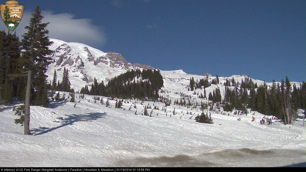
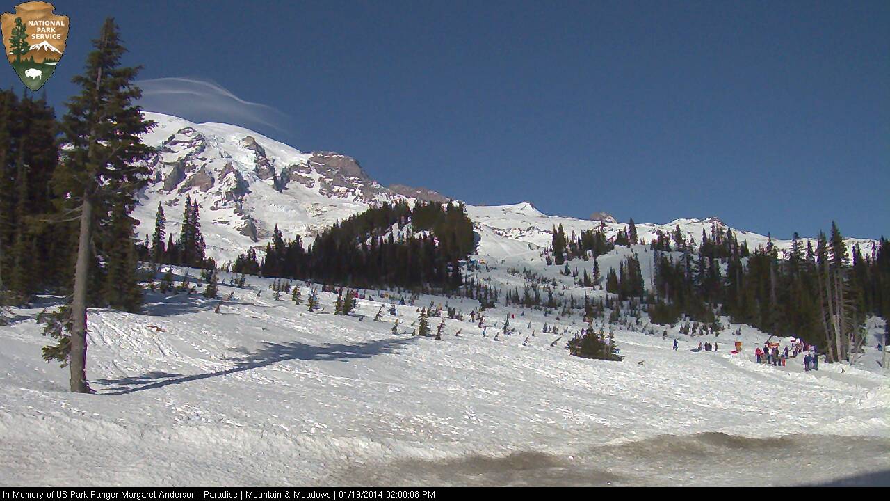
Time to get ready for another big trip and another big serving of summerlike corn on Martin Luther King Day.
Juneuary 20, 2014, Mount Rainier, The Turtle to Nisqually Bridge via Van Trump Glaciers
After the somewhat windier and cloudier weather over the weekend, the MLK holiday on Monday was forecast to be stellar once again, almost identical weather to January 16-17. Time to take my new skis out for a spin. Paresh and Kane were already heading to Rainier, planning to ski the Nisqually Chute to bridge car-shuttle, and they asked me to join them. I convinced them to ski the Turtle and Van Trump route instead, and it worked out great again.
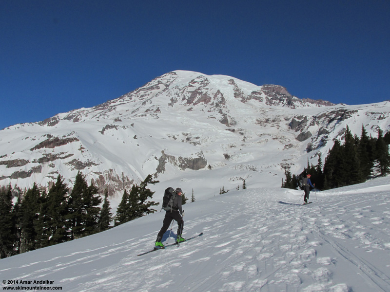
Snow conditions were very similar to 4 days earlier, but notably icier in some areas and softer in others. The snow on the Nisqually Glacier crossing in the morning was much firmer and icier after several more days of sun, and we all used ski crampons from 6800 ft at the base of Wilson Gully on up the rest of the day. The sketchy rising traverse from 7400-7700 ft on Wilson Glacier was icier too, and the previous skin track was partially filled with loose snow that had frozen in place, requiring the track to be re-stomped-in firmly with each step.
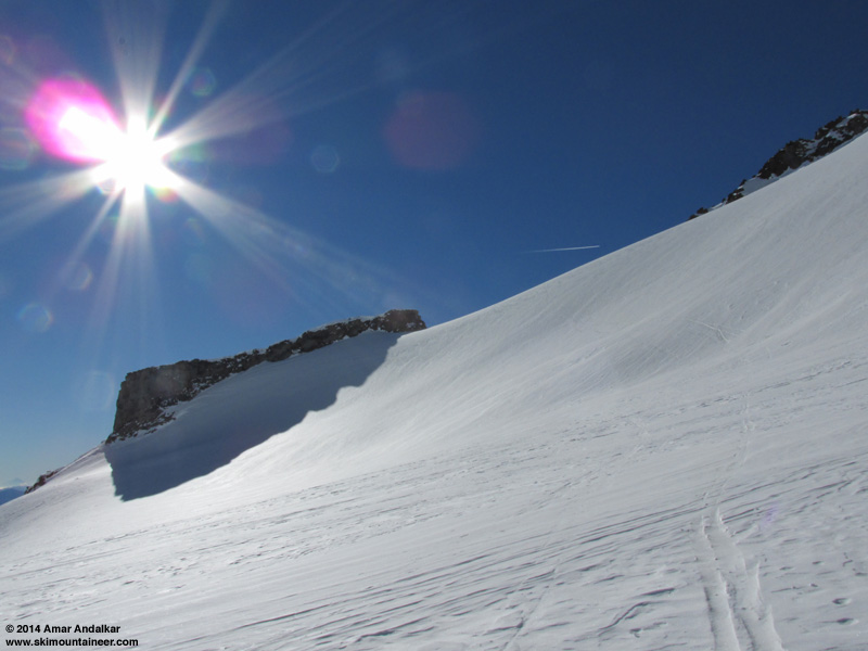
Higher up though, the skinning conditions were in general better, more sun-softened and grippier even at almost exactly the same time of day.
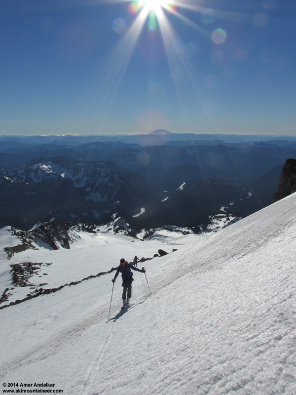
The skin up the Turtle from 9800 ft to the same 10500 ft spot was simple this time, not sketchy at all and fairly easy to put in a skin track like a highway in the well-softened corn at 3pm.
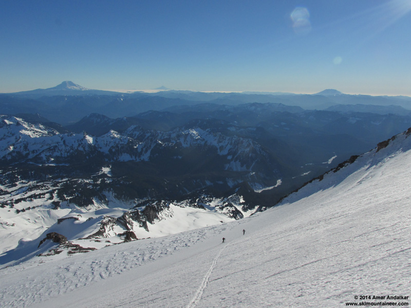
We topped out at 3:30pm, with temps in the mid 30s °F and a 10-15 mph westerly breeze on the ridge.
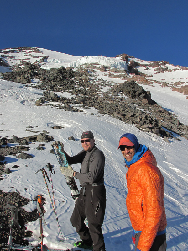
Skied down just before 4pm, this time enjoying corn right from 10500 ft on down, especially in the sun, but refreezing already in the shade.
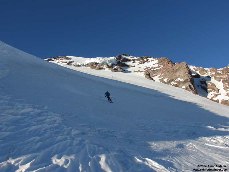
Just stellar conditions, getting better with each warm sunny day.
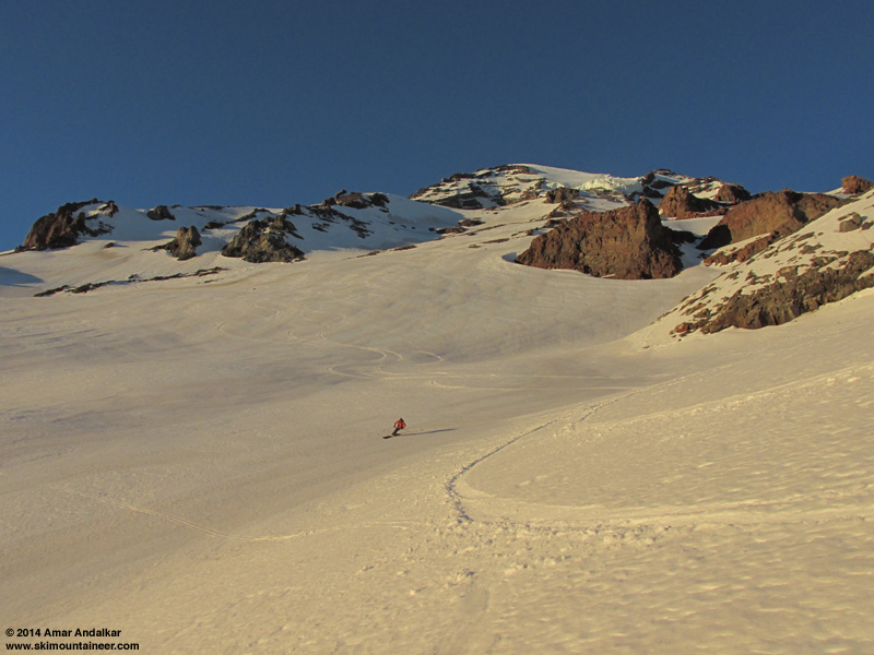
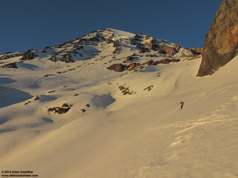
Once again we skied down in the golden glow of sunset, only a few minutes earlier than 4 days previously. It appeared that no one else had skied this route since my previous descent on Thursday.
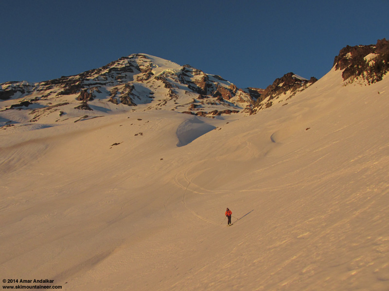
The exit was even easier this time given that we had Thursday's tracks to follow, although snow conditions below treeline were once again crusty after sunset (no surprise). The ski down from the crest of the moraine was quite a bit easier this time -- maybe it was the new skis and the rockered tip working better in those conditions? Overall, the new skis worked great this day, light on the feet and skiing really well throughout the descent.
Another quick schuss along the river, then skinning through the alders for a few minutes and back out to the bridge by headlamp once again, a bit after 5:30pm.
MOUNT RAINIER RECREATIONAL FORECAST
NATIONAL WEATHER SERVICE SEATTLE WA
400 AM PST MON JAN 20 2014
SYNOPSIS...AN UPPER RIDGE WILL REMAIN OVER THE AREA THIS WEEK...WITH THE EXCEPTION OF TUESDAY NIGHT AND WEDNESDAY WHEN A WEAK UPPER LOW WILL BRING A CHANCE OF LIGHT PRECIPITATION. OTHERWISE DRY WEATHER WILL CONTINUE WITH SOME DAYTIME SUNSHINE AND MILD CONDITIONS.
MONDAY...MOSTLY SUNNY. FREEZING LEVEL NEAR 10000 FEET.
MONDAY NIGHT...MOSTLY CLEAR. FREEZING LEVEL NEAR 10000 FEET.
TUESDAY...MOSTLY SUNNY. FREEZING LEVEL NEAR 10000 FEET.
TUESDAY NIGHT...MOSTLY CLOUDY. A CHANCE OF RAIN AND SNOW AFTER MIDNIGHT. SNOW LEVEL NEAR 5500 FEET AFTER MIDNIGHT. FREEZING LEVEL NEAR 8500 FEET IN THE EVENING.
WEDNESDAY...WINDY. MOSTLY CLOUDY. A CHANCE OF RAIN AND SNOW. SNOW LEVEL NEAR 4500 FEET.
TEMPERATURE AND WIND FORECASTS FOR SELECTED LOCATIONS.
MON MON TUE TUE WED
NIGHT NIGHT
SUMMIT (14411 FT) 18 15 12 5 12
W 10 SW 25 SW 35 W 75 N 50
CAMP MUIR(10188 FT) 34 33 29 18 25
W 5 SW 15 SW 25 W 40 N 25
PARADISE (5420 FT) 46 39 48 29 38
NE 10 NW 5 W 10 W 15 NW 10
LONGMIRE (2700 FT) 48 34 50 35 47
E 10 CALM N 5 NW 5 S 5
++ TEMPERATURES AND WIND FOR THE SUMMIT AND CAMP MUIR ARE AVERAGE
CONDITIONS EXPECTED IN THE FREE AIR AT THOSE ELEVATIONS.
++ TEMPERATURES FOR PARADISE AND LONGMIRE ARE THE EXPECTED HIGHS AND
LOWS. WIND IS THE AVERAGE WIND EXPECTED DURING THAT PERIOD.
EXTENDED FORECAST...
WEDNESDAY NIGHT...PARTLY CLOUDY. FREEZING LEVEL NEAR 5500 FEET.
THURSDAY...MOSTLY SUNNY. FREEZING LEVEL NEAR 7000 FEET.
THURSDAY NIGHT...PARTLY CLOUDY. FREEZING LEVEL NEAR 9000 FEET.
FRIDAY...MOSTLY SUNNY. FREEZING LEVEL NEAR 10000 FEET.
FRIDAY NIGHT...PARTLY CLOUDY. FREEZING LEVEL NEAR 10500 FEET.
SATURDAY...MOSTLY SUNNY. FREEZING LEVEL NEAR 10500 FEET.
SATURDAY NIGHT...PARTLY CLOUDY. FREEZING LEVEL NEAR 10500 FEET.
SUNDAY...MOSTLY SUNNY. FREEZING LEVEL NEAR 10500 FEET.
Interlude: Juneuary 21, 2014, Crystal Mountain
Ski testing...
The Cho Oyu has been great so far -- probably the best ski-mountaineering ski I've ever owned, given the combination of ultralight plus surprisingly good performance. I'm rarely this enthusiastic about any ski, but maybe they just suit my skiing style really well too. And SO light!
I've skied them 6 days so far during the first 8 days after I bought them, including 32,000 vert on 5 trips from Turtle or Muir to the bridge, plus taking them to Crystal and putting in 55,000 vert on the lifts to really get used to how they ski. Skied a wide range of conditions that day, mostly firm groomers and sun-softened ungroomed, plus some icy refreezing crust and other various bad snow that I sought out for testing in late afternoon as the shadows took over. They did well in all of that, edge hold was excellent and they'll carve a nice GS turn on firm groomers at 40-50 mph with no problem -- a real feat for such a featherweight ski, must be the carbon fiber in it. Really good torsional stiffness, but not very stiff flex overall. They do get deflected by frozen icy chunks, but that's inevitable given their lack of mass. They've handled the few icy sections encountered during the Rainier trips just fine too.
The rocker definitely makes them ski shorter than their overall length -- I'm glad I got the 182 instead of the 174, as the 182 has a much shorter running length than my 177 Volkl Amaraq (or any of my other several pairs of 177 skis). Despite almost identical tip-waist-tail dimensions to the Amaruq, they have more sidecut and a shorter radius due to their shape. Definitely noticeable while skiing, they carve a short radius turn much more easily than the Amaruqs will (I'm not a fan of short radius turns as you may know, I really prefer to make big sweeping turns, but it is nice to have the capability when needed in tight spots).
MOUNT RAINIER RECREATIONAL FORECAST
NATIONAL WEATHER SERVICE SEATTLE WA
405 AM PST TUE JAN 21 2014
SYNOPSIS...AN UPPER RIDGE OVER THE AREA WILL SHIFT EAST TUESDAY. A WEAKENING LOW PRESSURE TROUGH WILL CROSS THE REGION TUESDAY NIGHT. AN UPPER LEVEL RIDGE WILL REBUILD OFF THE COAST ON WEDNESDAY AND SHIFT OVER WESTERN WASHINGTON ON FRIDAY WITH LOW LEVEL OFFSHORE FLOW DEVELOPING. THE PATTERN WILL REMAIN LITTLE CHANGED THROUGH THE WEEKEND.
TUESDAY...MOSTLY SUNNY. FREEZING LEVEL NEAR 9000 FEET.
TUESDAY NIGHT...PARTLY CLOUDY IN THE EVENING...THEN MOSTLY CLOUDY WITH A CHANCE OF LIGHT RAIN OR SNOW AFTER MIDNIGHT. SNOW LEVEL LOWERING NEAR 5500 FEET AFTER MIDNIGHT.
WEDNESDAY...MOSTLY CLOUDY. A CHANCE OF LIGHT RAIN AND SNOW IN THE MORNING. SNOW LEVEL NEAR 4500 FEET.
WEDNESDAY NIGHT...PARTLY CLOUDY. FREEZING LEVEL NEAR 6500 FEET.
THURSDAY...SUNNY. FREEZING LEVEL NEAR 7500 FEET INCREASING TO 10000 FEET IN THE AFTERNOON.
TEMPERATURE AND WIND FORECASTS FOR SELECTED LOCATIONS.
TUE TUE WED WED THU
NIGHT NIGHT
SUMMIT (14411 FT) 12 6 12 10 15
SW 35 W 65 N 50 N 60 NE 45
CAMP MUIR(10188 FT) 31 20 26 24 32
W 25 W 35 N 20 N 25 E 30
PARADISE (5420 FT) 54 31 41 30 50
CALM W 10 CALM NE 10 NE 20
LONGMIRE (2700 FT) 54 34 44 33 46
CALM CALM CALM CALM CALM
++ TEMPERATURES AND WIND FOR THE SUMMIT AND CAMP MUIR ARE AVERAGE
CONDITIONS EXPECTED IN THE FREE AIR AT THOSE ELEVATIONS.
++ TEMPERATURES FOR PARADISE AND LONGMIRE ARE THE EXPECTED HIGHS AND
LOWS. WIND IS THE AVERAGE WIND EXPECTED DURING THAT PERIOD.
EXTENDED FORECAST...
THURSDAY NIGHT...MOSTLY CLEAR. FREEZING LEVEL NEAR 10500 FEET.
FRIDAY THROUGH SUNDAY...SUNNY DAYS AND MOSTLY CLEAR NIGHTS. FREEZING LEVEL NEAR 12000 FEET.
SUNDAY NIGHT...PARTLY CLOUDY. FREEZING LEVEL NEAR 11000 FEET.
MONDAY...MOSTLY CLOUDY. A CHANCE OF RAIN AND SNOW LATE. SNOW LEVEL NEAR 8500 FEET.
January 22, 2014, Mount Rainier, New Snow at Paradise
Wednesday, January 22, was forecast to be the worst weather day of the entire period of extended high pressure, as a small weak upper-level low fought through the persistent ridge and arced southeastward through the region, dropping snow levels to 4500 ft overnight into the morning, with mostly cloudy conditions and a chance of light snow. A good day for a rest day as Juneuary was rudely interrupted by a tiny bit of January.
No precipitation or snowfall was recorded at Paradise either on the NWAC telemetry or the NPS daily manual measurements, but webcam images of the Paradise parking lot reveal that about 1/2" of snow did fall sometime overnight prior to the morning of Wednesday, January 22, enough for the park to actually plow:
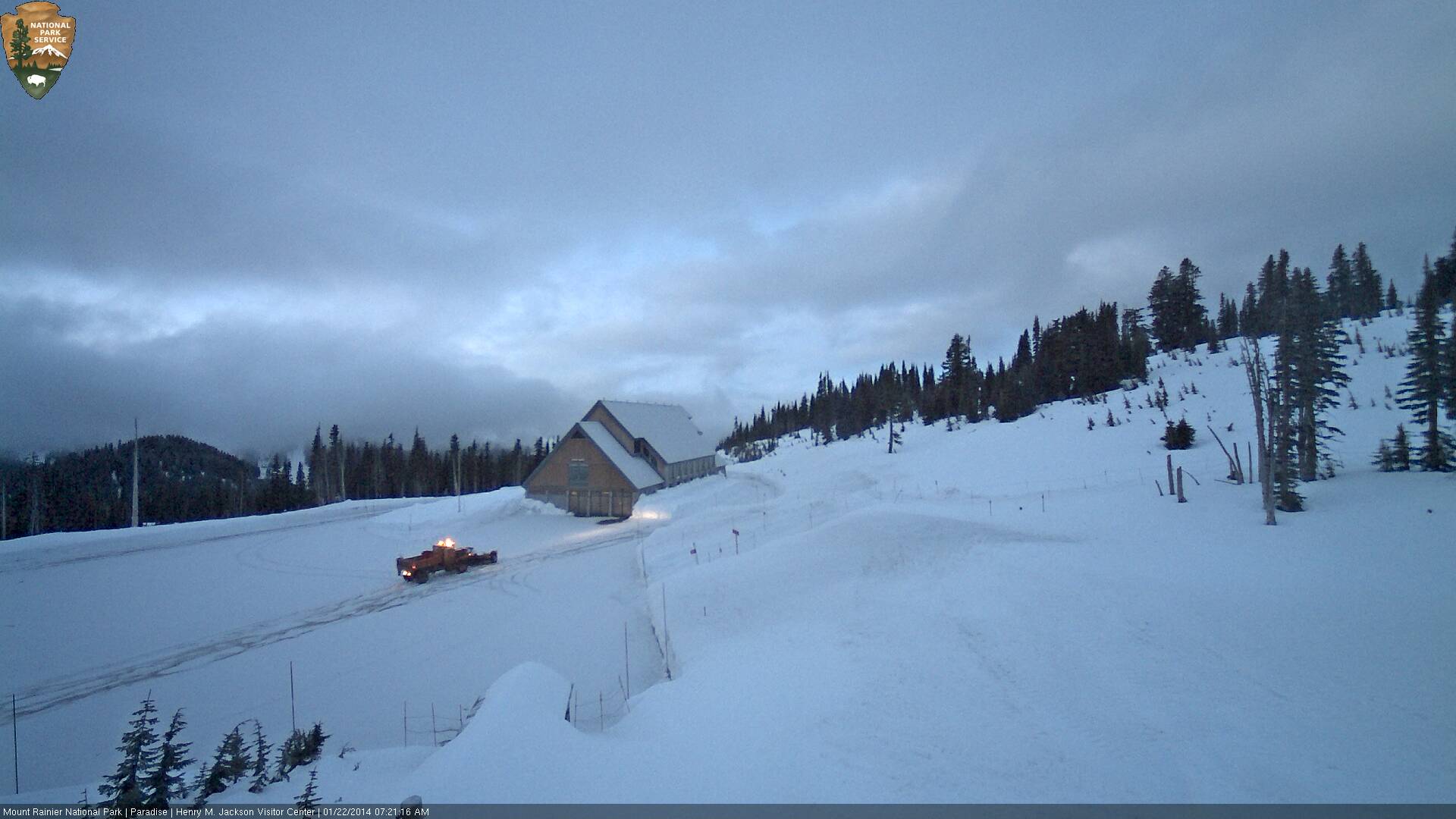
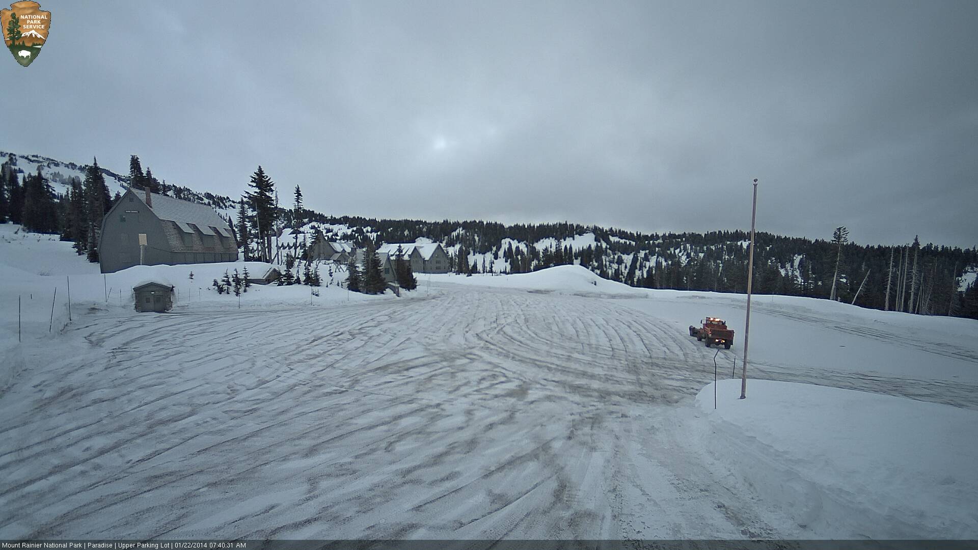
The ridge quickly took over again, and by mid-afternoon the clouds had vanished, not to be seen again for 5 days:
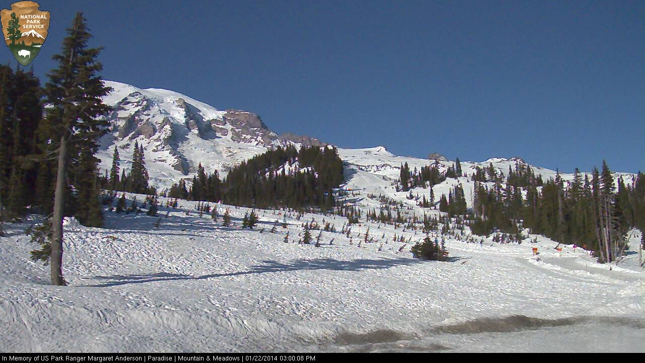
Sunday morning was mostly cloudy, but by early afternoon the clouds were mostly gone, leaving behind only a shape-shifting lenticular cap which eventually vanished entirely by mid-afternoon:
Time to get ready for another big trip and another big serving of summerlike corn on Martin Luther King Day.
Juneuary 20, 2014, Mount Rainier, The Turtle to Nisqually Bridge via Van Trump Glaciers
After the somewhat windier and cloudier weather over the weekend, the MLK holiday on Monday was forecast to be stellar once again, almost identical weather to January 16-17. Time to take my new skis out for a spin. Paresh and Kane were already heading to Rainier, planning to ski the Nisqually Chute to bridge car-shuttle, and they asked me to join them. I convinced them to ski the Turtle and Van Trump route instead, and it worked out great again.
Snow conditions were very similar to 4 days earlier, but notably icier in some areas and softer in others. The snow on the Nisqually Glacier crossing in the morning was much firmer and icier after several more days of sun, and we all used ski crampons from 6800 ft at the base of Wilson Gully on up the rest of the day. The sketchy rising traverse from 7400-7700 ft on Wilson Glacier was icier too, and the previous skin track was partially filled with loose snow that had frozen in place, requiring the track to be re-stomped-in firmly with each step.
Higher up though, the skinning conditions were in general better, more sun-softened and grippier even at almost exactly the same time of day.
The skin up the Turtle from 9800 ft to the same 10500 ft spot was simple this time, not sketchy at all and fairly easy to put in a skin track like a highway in the well-softened corn at 3pm.
We topped out at 3:30pm, with temps in the mid 30s °F and a 10-15 mph westerly breeze on the ridge.
Skied down just before 4pm, this time enjoying corn right from 10500 ft on down, especially in the sun, but refreezing already in the shade.
Just stellar conditions, getting better with each warm sunny day.
Once again we skied down in the golden glow of sunset, only a few minutes earlier than 4 days previously. It appeared that no one else had skied this route since my previous descent on Thursday.
The exit was even easier this time given that we had Thursday's tracks to follow, although snow conditions below treeline were once again crusty after sunset (no surprise). The ski down from the crest of the moraine was quite a bit easier this time -- maybe it was the new skis and the rockered tip working better in those conditions? Overall, the new skis worked great this day, light on the feet and skiing really well throughout the descent.
Another quick schuss along the river, then skinning through the alders for a few minutes and back out to the bridge by headlamp once again, a bit after 5:30pm.
MOUNT RAINIER RECREATIONAL FORECAST
NATIONAL WEATHER SERVICE SEATTLE WA
400 AM PST MON JAN 20 2014
SYNOPSIS...AN UPPER RIDGE WILL REMAIN OVER THE AREA THIS WEEK...WITH THE EXCEPTION OF TUESDAY NIGHT AND WEDNESDAY WHEN A WEAK UPPER LOW WILL BRING A CHANCE OF LIGHT PRECIPITATION. OTHERWISE DRY WEATHER WILL CONTINUE WITH SOME DAYTIME SUNSHINE AND MILD CONDITIONS.
MONDAY...MOSTLY SUNNY. FREEZING LEVEL NEAR 10000 FEET.
MONDAY NIGHT...MOSTLY CLEAR. FREEZING LEVEL NEAR 10000 FEET.
TUESDAY...MOSTLY SUNNY. FREEZING LEVEL NEAR 10000 FEET.
TUESDAY NIGHT...MOSTLY CLOUDY. A CHANCE OF RAIN AND SNOW AFTER MIDNIGHT. SNOW LEVEL NEAR 5500 FEET AFTER MIDNIGHT. FREEZING LEVEL NEAR 8500 FEET IN THE EVENING.
WEDNESDAY...WINDY. MOSTLY CLOUDY. A CHANCE OF RAIN AND SNOW. SNOW LEVEL NEAR 4500 FEET.
TEMPERATURE AND WIND FORECASTS FOR SELECTED LOCATIONS.
MON MON TUE TUE WED
NIGHT NIGHT
SUMMIT (14411 FT) 18 15 12 5 12
W 10 SW 25 SW 35 W 75 N 50
CAMP MUIR(10188 FT) 34 33 29 18 25
W 5 SW 15 SW 25 W 40 N 25
PARADISE (5420 FT) 46 39 48 29 38
NE 10 NW 5 W 10 W 15 NW 10
LONGMIRE (2700 FT) 48 34 50 35 47
E 10 CALM N 5 NW 5 S 5
++ TEMPERATURES AND WIND FOR THE SUMMIT AND CAMP MUIR ARE AVERAGE
CONDITIONS EXPECTED IN THE FREE AIR AT THOSE ELEVATIONS.
++ TEMPERATURES FOR PARADISE AND LONGMIRE ARE THE EXPECTED HIGHS AND
LOWS. WIND IS THE AVERAGE WIND EXPECTED DURING THAT PERIOD.
EXTENDED FORECAST...
WEDNESDAY NIGHT...PARTLY CLOUDY. FREEZING LEVEL NEAR 5500 FEET.
THURSDAY...MOSTLY SUNNY. FREEZING LEVEL NEAR 7000 FEET.
THURSDAY NIGHT...PARTLY CLOUDY. FREEZING LEVEL NEAR 9000 FEET.
FRIDAY...MOSTLY SUNNY. FREEZING LEVEL NEAR 10000 FEET.
FRIDAY NIGHT...PARTLY CLOUDY. FREEZING LEVEL NEAR 10500 FEET.
SATURDAY...MOSTLY SUNNY. FREEZING LEVEL NEAR 10500 FEET.
SATURDAY NIGHT...PARTLY CLOUDY. FREEZING LEVEL NEAR 10500 FEET.
SUNDAY...MOSTLY SUNNY. FREEZING LEVEL NEAR 10500 FEET.
Interlude: Juneuary 21, 2014, Crystal Mountain
Ski testing...
The Cho Oyu has been great so far -- probably the best ski-mountaineering ski I've ever owned, given the combination of ultralight plus surprisingly good performance. I'm rarely this enthusiastic about any ski, but maybe they just suit my skiing style really well too. And SO light!
I've skied them 6 days so far during the first 8 days after I bought them, including 32,000 vert on 5 trips from Turtle or Muir to the bridge, plus taking them to Crystal and putting in 55,000 vert on the lifts to really get used to how they ski. Skied a wide range of conditions that day, mostly firm groomers and sun-softened ungroomed, plus some icy refreezing crust and other various bad snow that I sought out for testing in late afternoon as the shadows took over. They did well in all of that, edge hold was excellent and they'll carve a nice GS turn on firm groomers at 40-50 mph with no problem -- a real feat for such a featherweight ski, must be the carbon fiber in it. Really good torsional stiffness, but not very stiff flex overall. They do get deflected by frozen icy chunks, but that's inevitable given their lack of mass. They've handled the few icy sections encountered during the Rainier trips just fine too.
The rocker definitely makes them ski shorter than their overall length -- I'm glad I got the 182 instead of the 174, as the 182 has a much shorter running length than my 177 Volkl Amaraq (or any of my other several pairs of 177 skis). Despite almost identical tip-waist-tail dimensions to the Amaruq, they have more sidecut and a shorter radius due to their shape. Definitely noticeable while skiing, they carve a short radius turn much more easily than the Amaruqs will (I'm not a fan of short radius turns as you may know, I really prefer to make big sweeping turns, but it is nice to have the capability when needed in tight spots).
MOUNT RAINIER RECREATIONAL FORECAST
NATIONAL WEATHER SERVICE SEATTLE WA
405 AM PST TUE JAN 21 2014
SYNOPSIS...AN UPPER RIDGE OVER THE AREA WILL SHIFT EAST TUESDAY. A WEAKENING LOW PRESSURE TROUGH WILL CROSS THE REGION TUESDAY NIGHT. AN UPPER LEVEL RIDGE WILL REBUILD OFF THE COAST ON WEDNESDAY AND SHIFT OVER WESTERN WASHINGTON ON FRIDAY WITH LOW LEVEL OFFSHORE FLOW DEVELOPING. THE PATTERN WILL REMAIN LITTLE CHANGED THROUGH THE WEEKEND.
TUESDAY...MOSTLY SUNNY. FREEZING LEVEL NEAR 9000 FEET.
TUESDAY NIGHT...PARTLY CLOUDY IN THE EVENING...THEN MOSTLY CLOUDY WITH A CHANCE OF LIGHT RAIN OR SNOW AFTER MIDNIGHT. SNOW LEVEL LOWERING NEAR 5500 FEET AFTER MIDNIGHT.
WEDNESDAY...MOSTLY CLOUDY. A CHANCE OF LIGHT RAIN AND SNOW IN THE MORNING. SNOW LEVEL NEAR 4500 FEET.
WEDNESDAY NIGHT...PARTLY CLOUDY. FREEZING LEVEL NEAR 6500 FEET.
THURSDAY...SUNNY. FREEZING LEVEL NEAR 7500 FEET INCREASING TO 10000 FEET IN THE AFTERNOON.
TEMPERATURE AND WIND FORECASTS FOR SELECTED LOCATIONS.
TUE TUE WED WED THU
NIGHT NIGHT
SUMMIT (14411 FT) 12 6 12 10 15
SW 35 W 65 N 50 N 60 NE 45
CAMP MUIR(10188 FT) 31 20 26 24 32
W 25 W 35 N 20 N 25 E 30
PARADISE (5420 FT) 54 31 41 30 50
CALM W 10 CALM NE 10 NE 20
LONGMIRE (2700 FT) 54 34 44 33 46
CALM CALM CALM CALM CALM
++ TEMPERATURES AND WIND FOR THE SUMMIT AND CAMP MUIR ARE AVERAGE
CONDITIONS EXPECTED IN THE FREE AIR AT THOSE ELEVATIONS.
++ TEMPERATURES FOR PARADISE AND LONGMIRE ARE THE EXPECTED HIGHS AND
LOWS. WIND IS THE AVERAGE WIND EXPECTED DURING THAT PERIOD.
EXTENDED FORECAST...
THURSDAY NIGHT...MOSTLY CLEAR. FREEZING LEVEL NEAR 10500 FEET.
FRIDAY THROUGH SUNDAY...SUNNY DAYS AND MOSTLY CLEAR NIGHTS. FREEZING LEVEL NEAR 12000 FEET.
SUNDAY NIGHT...PARTLY CLOUDY. FREEZING LEVEL NEAR 11000 FEET.
MONDAY...MOSTLY CLOUDY. A CHANCE OF RAIN AND SNOW LATE. SNOW LEVEL NEAR 8500 FEET.
January 22, 2014, Mount Rainier, New Snow at Paradise
Wednesday, January 22, was forecast to be the worst weather day of the entire period of extended high pressure, as a small weak upper-level low fought through the persistent ridge and arced southeastward through the region, dropping snow levels to 4500 ft overnight into the morning, with mostly cloudy conditions and a chance of light snow. A good day for a rest day as Juneuary was rudely interrupted by a tiny bit of January.
No precipitation or snowfall was recorded at Paradise either on the NWAC telemetry or the NPS daily manual measurements, but webcam images of the Paradise parking lot reveal that about 1/2" of snow did fall sometime overnight prior to the morning of Wednesday, January 22, enough for the park to actually plow:
The ridge quickly took over again, and by mid-afternoon the clouds had vanished, not to be seen again for 5 days:
Juneuary 23, 2014, Mount Rainier, Camp Muir to Nisqually Bridge via Pebble Creek Gully
Juneuary 24, 2014, Mount Rainier, Camp Muir to Nisqually Bridge via Nisqually Chute
Reports to be written, and posted soon...
Juneuary 24, 2014, Mount Rainier, Camp Muir to Nisqually Bridge via Nisqually Chute
Reports to be written, and posted soon...
Juneuary 25, 2014, Mount Rainier, Camp Muir to Nisqually Bridge via Nisqually Chute
Juneuary 26, 2014, Mount Rainier, Muir Rock to Nisqually Bridge via Nisqually Chute
Reports to be written, and posted soon...
Juneuary 26, 2014, Mount Rainier, Muir Rock to Nisqually Bridge via Nisqually Chute
Reports to be written, and posted soon...
Telemetry Data:
Northwest Avalanche Center Northwest Avalanche Center
Paradise, Mt Rainier National Park, Washington Camp Muir, Mt Rainier National Park, Washington
Wind speed not reliable and may record periodically Wind gages unheated and may rime
MM/DD Hour Temp RH Wind Wind Wind HourTotal 24HrTotalSolar MM/DD Hour Temp RH Wind Wind Wind Wind Solar
PST F % Avg Max Dir Prec Prec Snow Snow W/m2 PST F % Min Avg Max Dir W/m2
5400'5400'5380'5380'5380'5400'5400'5400'5400'5400' 10110'10110'10110'10110'10110'10110'10110'
------------------------------------------------------------ ----------------------------------------------------
1 27 2300 37 60 0 0 27 0 0 -0 86 0 1 27 2300 25 98 16 22 26 17 0
1 27 2200 37 59 0 0 29 0 0 -0 86 0 1 27 2200 23 98 13 22 27 19 0
1 27 2100 38 57 0 0 31 0 0 -0 86 0 1 27 2100 25 91 1 8 13 18 0
1 27 2000 37 55 0 0 31 0 0 -0 85 0 1 27 2000 25 81 2 17 24 18 0
1 27 1900 38 51 0 0 40 0 0 -0 86 0 1 27 1900 26 71 3 11 20 18 0
1 27 1800 38 51 0 0 43 0 0 -0 86 0 1 27 1800 26 57 0 3 8 18 0
1 27 1700 38 51 0 0 43 0 0 -0 86 11 1 27 1700 27 30 0 2 9 19 15
1 27 1600 37 61 0 0 63 0 0 -0 86 60 1 27 1600 28 35 0 2 7 18 66
1 27 1500 37 66 0 0 72 0 0 -0 85 123 1 27 1500 27 44 0 4 8 20 133
1 27 1400 37 65 0 0 75 0 0 -0 85 172 1 27 1400 29 40 0 2 6 20 187
1 27 1300 38 60 0 0 78 0 0 -0 86 245 1 27 1300 30 33 0 3 11 21 257
1 27 1200 39 56 0 0 74 0 0 -0 86 314 1 27 1200 31 33 0 1 4 18 309
1 27 1100 38 50 0 0 70 0 0 -0 86 175 1 27 1100 30 36 0 2 6 18 185
1 27 1000 39 46 0 0 75 0 0 -0 85 123 1 27 1000 29 33 0 2 8 18 127
1 27 900 39 46 0 0 59 0 0 -0 85 43 1 27 900 30 32 0 3 9 17 49
1 27 800 40 44 0 0 22 0 0 -0 85 3 1 27 800 28 35 0 5 10 17 6
1 27 700 40 40 0 0 15 0 0 -0 86 0 1 27 700 29 32 0 2 7 16 0
1 27 600 40 39 0 0 13 0 0 -0 86 0 1 27 600 28 36 0 4 9 16 0
1 27 500 39 43 0 0 16 0 0 -0 86 0 1 27 500 28 34 0 3 9 16 0
------------------------------------------------------------ ----------------------------------------------------
1 27 400 40 41 0 0 14 0 0 -0 86 0 (1 hour of missing data)
1 27 300 41 39 0 0 335 0 0 -0 86 0 1 27 300 29 34 0 5 14 16 0
1 27 200 41 41 0 0 338 0 0 -0 86 0 1 27 200 29 34 0 2 8 16 0
1 27 100 41 40 0 0 4 0 0 -0 86 0 1 27 100 28 44 0 4 10 16 0
1 27 0 42 38 0 0 346 0 0 -0 86 0 1 27 0 29 40 2 5 12 17 0
1 26 2300 41 39 0 0 340 0 0 -0 85 0 1 26 2300 31 34 4 13 23 16 0
1 26 2200 42 40 0 0 360 0 0 0 86 0 1 26 2200 30 27 2 5 15 16 0
1 26 2100 42 39 0 0 11 0 0 -0 86 0 1 26 2100 30 35 0 4 10 16 0
1 26 2000 42 41 0 0 17 0 0 -0 86 0 1 26 2000 30 32 0 3 12 16 0
1 26 1900 44 37 0 0 16 0 0 -0 86 0 1 26 1900 31 34 0 0 2 17 0
1 26 1800 44 39 0 0 12 0 0 -0 85 0 1 26 1800 30 42 0 0 3 19 1
1 26 1700 47 35 0 0 260 0 0 -0 86 66 1 26 1700 32 39 0 2 4 25 68
1 26 1600 54 28 0 0 264 0 0 -0 85 219 1 26 1600 38 31 0 2 7 11 207
1 26 1500 55 27 0 0 263 0 0 -1 84 354 1 26 1500 38 28 0 1 4 279 345
1 26 1400 56 23 0 0 257 0 0 -0 84 448 1 26 1400 38 35 0 1 3 2 443
1 26 1300 51 25 0 0 260 0 0 -0 85 491 1 26 1300 40 20 0 3 9 344 483
1 26 1200 50 26 0 0 245 0 0 -0 85 457 1 26 1200 42 23 0 1 4 24 463
1 26 1100 49 26 0 0 19 0 0 0 87 376 1 26 1100 37 19 0 4 7 21 259
1 26 1000 48 27 0 0 28 0 0 -0 86 255 1 26 1000 42 17 0 3 9 20 123
1 26 900 48 26 0 0 313 0 0 -0 86 113 1 26 900 35 22 1 6 10 17 130
1 26 800 41 31 0 0 354 0 0 -0 86 9 1 26 800 33 26 1 7 16 17 17
1 26 700 40 32 0 0 346 0 0 -0 86 0 1 26 700 34 25 2 7 19 18 0
1 26 600 42 30 0 0 295 0 0 -0 86 0 1 26 600 35 19 6 13 23 17 0
1 26 500 41 31 0 0 347 0 0 -0 86 0 1 26 500 33 24 7 15 22 17 0
------------------------------------------------------------ ----------------------------------------------------
1 26 400 42 30 0 0 354 0 0 -0 87 0 1 26 400 34 35 2 11 24 16 0
1 26 300 41 35 0 0 348 0 0 -0 87 0 1 26 300 33 31 3 8 17 17 0
1 26 200 41 35 0 0 14 0 0 -0 86 0 1 26 200 35 25 3 11 24 16 0
1 26 100 40 38 0 0 11 0 0 -0 86 0 1 26 100 34 27 4 12 24 17 0
1 26 0 43 34 0 0 9 0 0 -0 87 0 1 26 0 34 21 4 12 19 17 0
1 25 2300 40 38 0 0 15 0 0 -0 86 0 1 25 2300 33 23 4 13 22 15 0
1 25 2200 40 38 0 0 19 0 0 -0 86 0 1 25 2200 34 22 0 6 17 15 0
1 25 2100 40 37 0 0 21 0 0 -0 87 0 1 25 2100 34 20 1 5 10 16 0
1 25 2000 42 35 0 0 25 0 0 -0 87 0 1 25 2000 31 29 0 4 8 15 0
1 25 1900 42 35 0 0 18 0 0 -0 86 0 1 25 1900 32 24 2 4 9 16 0
1 25 1800 41 37 0 0 302 0 0 -0 86 0 1 25 1800 32 23 0 1 6 19 1
1 25 1700 43 42 0 0 258 0 0 -0 87 70 1 25 1700 34 13 0 1 4 340 68
1 25 1600 47 36 0 0 257 0 0 -0 86 215 1 25 1600 37 11 0 3 6 338 207
1 25 1500 51 29 0 0 258 0 0 -1 85 350 1 25 1500 35 10 0 3 5 312 345
1 25 1400 52 25 0 0 262 0 0 -0 86 446 1 25 1400 47 9 0 1 4 273 446
1 25 1300 47 26 0 0 263 0 0 -0 87 487 1 25 1300 42 10 0 1 3 0 490
1 25 1200 45 26 0 0 268 0 0 -0 87 468 1 25 1200 41 11 0 1 4 337 474
1 25 1100 45 23 0 0 268 0 0 -0 87 390 1 25 1100 38 15 0 2 5 21 212
1 25 1000 46 19 0 0 263 0 0 -0 88 265 1 25 1000 34 13 0 2 6 317 140
1 25 900 47 17 0 0 317 0 0 -0 88 118 1 25 900 36 10 7 11 16 275 135
1 25 800 40 23 0 0 316 0 0 -0 87 8 1 25 800 35 6 7 11 16 280 16
1 25 700 41 22 0 0 301 0 0 -0 88 0 1 25 700 34 8 5 9 14 280 0
1 25 600 42 22 0 0 312 0 0 -0 87 0 1 25 600 35 8 4 11 16 282 0
1 25 500 43 16 0 0 287 0 0 -0 88 0 1 25 500 33 6 5 11 16 282 0
------------------------------------------------------------ ----------------------------------------------------
1 25 400 45 12 0 0 290 0 0 -0 88 0 1 25 400 34 8 3 7 11 283 0
1 25 300 47 9 0 0 271 0 0 0 88 0 1 25 300 33 5 9 13 15 283 0
1 25 200 50 6 0 0 13 0 0 -0 87 0 1 25 200 32 5 11 16 23 282 0
1 25 100 49 7 0 0 5 0 0 -0 88 0 1 25 100 31 7 10 15 22 286 0
1 25 0 49 5 0 0 33 0 0 -0 87 0 1 25 0 33 5 4 8 14 282 0
1 24 2300 49 4 0 0 15 0 0 -0 88 0 1 24 2300 32 7 0 3 8 278 0
1 24 2200 49 6 0 0 32 0 0 -0 88 0 1 24 2200 33 11 0 3 9 280 0
1 24 2100 50 10 0 0 52 0 0 -0 88 0 1 24 2100 37 39 3 8 12 287 0
1 24 2000 51 7 0 0 43 0 0 -0 88 0 1 24 2000 36 18 3 5 7 276 0
1 24 1900 49 9 0 0 20 0 0 -0 87 0 1 24 1900 35 3 0 1 5 321 0
1 24 1800 50 7 0 0 313 0 0 -0 87 1 1 24 1800 35 13 0 4 9 6 2
1 24 1700 52 9 0 0 256 0 0 -0 87 72 1 24 1700 33 28 2 4 7 36 63
1 24 1600 59 8 0 0 260 0 0 -0 87 213 1 24 1600 36 9 2 4 7 49 195
1 24 1500 63 6 0 0 272 0 0 -1 86 345 1 24 1500 40 11 1 4 7 46 329
1 24 1400 61 7 0 0 247 0 0 -0 87 439 1 24 1400 39 12 0 2 5 291 433
1 24 1300 57 8 0 0 182 0 0 -0 87 471 1 24 1300 41 15 0 3 7 272 469
1 24 1200 57 10 0 0 104 0 0 -0 87 452 1 24 1200 40 21 1 3 5 281 459
1 24 1100 56 9 0 0 96 0 0 -0 88 379 1 24 1100 42 12 0 3 6 275 165
1 24 1000 55 6 0 0 61 0 0 -0 88 247 1 24 1000 39 18 2 4 6 292 131
1 24 900 54 7 0 0 61 0 0 -0 88 100 1 24 900 38 19 0 4 7 282 115
1 24 800 44 12 0 0 67 0 0 -0 88 8 1 24 800 34 17 2 4 6 274 15
1 24 700 43 13 0 0 72 0 0 -0 88 0 1 24 700 34 11 2 4 11 271 0
1 24 600 42 13 0 0 64 0 0 -0 88 0 1 24 600 34 29 0 1 5 182 0
1 24 500 43 12 0 0 50 0 0 -0 88 0 1 24 500 33 4 0 1 5 172 0
------------------------------------------------------------ ----------------------------------------------------
1 24 400 42 14 0 0 62 0 0 -0 89 0 1 24 400 34 3 0 1 4 244 0
1 24 300 45 11 0 0 69 0 0 -0 88 0 1 24 300 35 5 0 6 10 245 0
1 24 200 44 12 0 0 55 0 0 -0 88 0 1 24 200 32 9 1 6 10 250 0
1 24 100 46 7 0 0 44 0 0 -0 89 0 1 24 100 31 8 3 6 9 256 0
1 24 0 44 12 0 0 62 0 0 -0 89 0 1 24 0 31 7 2 4 6 246 0
1 23 2300 43 12 0 0 64 0 0 -0 89 0 1 23 2300 32 5 4 6 10 265 0
1 23 2200 45 13 0 0 47 0 0 -0 89 0 1 23 2200 29 9 2 5 10 283 0
1 23 2100 41 24 0 0 53 0 0 -0 88 0 1 23 2100 32 8 4 6 8 246 0
1 23 2000 40 32 0 0 63 0 0 0 89 0 1 23 2000 31 9 4 5 7 286 0
1 23 1900 42 27 0 0 66 0 0 0 89 0 1 23 1900 28 9 4 5 8 289 0
1 23 1800 42 34 0 0 62 0 0 -0 88 0 1 23 1800 28 11 3 7 12 292 1
1 23 1700 42 41 0 0 68 0 0 -0 88 68 1 23 1700 26 18 6 11 20 285 64
1 23 1600 45 32 0 0 76 0 0 -0 88 207 1 23 1600 30 16 7 16 23 294 200
1 23 1500 43 56 0 0 81 0 0 -0 88 337 1 23 1500 30 22 8 20 32 299 337
1 23 1400 43 56 0 0 91 0 0 -0 88 428 1 23 1400 31 27 12 21 33 293 436
1 23 1300 42 55 0 0 89 0 0 -0 88 466 1 23 1300 30 30 12 22 32 291 481
1 23 1200 38 65 0 0 83 0 0 0 89 463 1 23 1200 29 33 16 26 32 296 467
1 23 1100 36 71 0 0 90 0 0 -0 89 372 1 23 1100 29 31 16 27 36 296 108
1 23 1000 34 72 0 0 88 0 0 -0 89 249 1 23 1000 28 29 19 29 41 295 142
1 23 900 35 70 0 0 82 0 0 -0 88 108 1 23 900 28 30 14 27 37 301 129
1 23 800 33 74 0 0 86 0 0 -0 88 6 1 23 800 27 28 14 24 42 301 14
1 23 700 36 63 0 0 87 0 0 -0 89 0 1 23 700 26 29 16 28 36 298 0
1 23 600 33 71 0 0 87 0 0 0 89 0 1 23 600 26 31 20 29 34 299 0
1 23 500 33 73 0 0 90 0 0 -0 89 0 1 23 500 25 33 20 28 34 295 0
------------------------------------------------------------ ----------------------------------------------------
1 23 400 30 84 0 0 83 0 0 0 88 0 1 23 400 26 34 11 22 37 297 0
1 23 300 31 82 0 0 88 0 0 -0 88 0 1 23 300 26 40 11 21 28 293 0
1 23 200 32 77 0 0 86 0 0 -0 88 0 1 23 200 26 39 10 22 36 294 0
1 23 100 33 74 0 0 73 0 0 -0 89 0 1 23 100 26 49 10 20 28 273 0
1 23 0 33 72 0 0 81 0 0 -0 89 0 1 23 0 28 39 10 17 25 273 0
1 22 2300 32 75 0 0 78 0 0 -0 89 0 1 22 2300 27 39 9 19 29 277 0
1 22 2200 32 75 0 0 64 0 0 -0 89 0 1 22 2200 26 45 16 25 38 265 0
1 22 2100 35 67 0 0 83 0 0 -0 88 0 1 22 2100 25 50 18 28 42 282 0
1 22 2000 37 60 0 0 73 0 0 -0 89 0 1 22 2000 19 80 12 25 37 295 0
1 22 1900 36 60 0 0 81 0 0 -0 89 0 1 22 1900 19 71 16 27 47 290 0
1 22 1800 36 61 0 0 70 0 0 0 88 0 1 22 1800 18 70 11 22 36 298 1
1 22 1700 36 63 0 0 73 0 0 -0 89 56 1 22 1700 19 50 3 8 16 297 55
1 22 1600 40 65 0 0 240 0 0 -0 88 175 1 22 1600 23 43 2 5 10 286 195
1 22 1500 38 80 0 0 244 0 0 -0 88 212 1 22 1500 26 39 4 9 16 257 328
1 22 1400 36 79 0 0 262 0 0 -0 88 340 1 22 1400 30 31 3 6 16 135 428
1 22 1300 35 83 0 0 266 0 0 -0 87 310 1 22 1300 30 32 2 5 11 75 474
NOTE: 24 Hr Snow sensor was malfunctioning prior to this hour
1 22 1200 32 92 0 0 256 0 0 85 88 229 1 22 1200 33 24 2 6 13 265 460
1 22 1100 32 91 0 0 261 0 0 85 88 159 1 22 1100 30 21 5 12 19 257 193
1 22 1000 31 92 0 0 187 0 0 89 89 78 1 22 1000 30 18 6 14 25 279 143
1 22 900 30 94 0 0 7 0 0 91 89 29 1 22 900 27 22 8 23 34 219 119
1 22 800 30 96 0 0 9 0 0 88 88 2 1 22 800 23 30 18 25 39 213 13
1 22 700 30 95 0 0 85 0 0 92 89 0 1 22 700 22 41 15 25 38 223 0
1 22 600 30 95 0 0 46 0 0 90 89 0 1 22 600 23 48 13 24 41 221 0
1 22 500 30 98 0 0 317 0 0 97 88 0 1 22 500 21 30 6 17 29 249 0
------------------------------------------------------------ ----------------------------------------------------
1 22 400 30 98 0 0 281 0 0 87 89 0 1 22 400 22 32 2 9 27 339 0
1 22 300 29 99 0 0 289 0 0 80 89 0 1 22 300 22 22 1 6 14 315 0
1 22 200 28 92 0 0 276 0 0 75 90 0 1 22 200 21 24 2 8 17 148 0
1 22 100 28 95 0 0 274 0 0 81 90 0 1 22 100 21 54 6 17 29 152 0
1 22 0 33 66 0 0 270 0 0 83 90 0 1 22 0 22 88 11 19 35 152 0
1 21 2300 36 51 0 0 273 0 0 84 90 0 1 21 2300 22 80 15 35 49 146 0
1 21 2200 36 46 0 0 273 0 0 81 90 0 1 21 2200 23 71 20 41 58 139 0
1 21 2100 37 43 0 0 267 0 0 82 90 0 1 21 2100 24 61 18 31 51 145 0
1 21 2000 38 38 0 0 270 0 0 82 90 0 1 21 2000 23 25 16 33 58 146 0
1 21 1900 35 78 0 0 281 0 0 79 90 0 1 21 1900 26 42 18 35 52 144 0
1 21 1800 40 44 0 0 270 0 0 78 90 0 1 21 1800 27 33 23 38 61 140 1
1 21 1700 43 30 0 0 266 0 0 77 90 25 1 21 1700 29 29 18 37 55 130 22
1 21 1600 42 48 0 0 265 0 0 74 90 91 1 21 1600 24 37 28 42 54 133 97
1 21 1500 45 36 0 0 261 0 0 74 90 235 1 21 1500 28 27 18 31 44 137 238
1 21 1400 50 26 0 0 259 0 0 76 88 400 1 21 1400 28 33 17 33 43 128 414
1 21 1300 49 25 0 0 260 0 0 74 90 459 1 21 1300 33 31 22 30 36 135 428
(continued in next post)
[/size][/tt]
Northwest Avalanche Center Northwest Avalanche Center
Paradise, Mt Rainier National Park, Washington Camp Muir, Mt Rainier National Park, Washington
MM/DD Hour Temp RH Wind Wind Wind HourTotal 24HrTotalSolar MM/DD Hour Temp RH Wind Wind Wind Wind Solar
PST F % Avg Max Dir Prec Prec Snow Snow W/m2 PST F % Min Avg Max Dir W/m2
5400'5400'5380'5380'5380'5400'5400'5400'5400'5400' 10110'10110'10110'10110'10110'10110'10110'
------------------------------------------------------------ ----------------------------------------------------
1 21 1200 48 27 0 0 262 0 0 76 90 476 1 21 1200 33 35 19 34 41 132 459
1 21 1100 48 24 0 0 260 0 0 76 90 370 1 21 1100 33 42 22 29 42 131 231
1 21 1000 47 24 0 0 269 0 0 77 90 204 1 21 1000 32 56 16 23 27 140 87
1 21 900 47 25 0 0 294 0 0 79 90 92 1 21 900 31 51 10 17 23 143 93
1 21 800 44 38 0 0 260 0 0 79 91 7 1 21 800 33 39 2 5 14 146 11
1 21 700 44 44 0 0 264 0 0 81 90 0 1 21 700 32 40 0 2 5 204 0
1 21 600 45 55 0 0 254 0 0 79 91 0 1 21 600 31 34 0 9 23 171 0
1 21 500 44 45 0 0 230 0 0 78 90 0 1 21 500 33 32 4 15 28 147 0
------------------------------------------------------------ ----------------------------------------------------
1 21 400 44 41 0 0 218 0 0 77 91 0 1 21 400 32 33 10 21 27 142 0
1 21 300 44 41 0 0 217 0 0 79 91 0 1 21 300 33 30 2 13 25 148 0
1 21 200 45 40 0 0 215 0 0 79 90 0 1 21 200 34 26 0 4 13 133 0
1 21 100 45 42 0 0 210 0 0 78 91 0 1 21 100 34 23 4 9 17 148 0
1 21 0 45 38 0 0 205 0 0 78 91 0 1 21 0 34 24 5 12 21 146 0
1 20 2300 44 38 0 0 200 0 0 79 91 0 1 20 2300 34 27 3 11 18 148 0
1 20 2200 44 33 0 0 198 0 0 80 91 0 1 20 2200 34 25 2 9 14 147 0
1 20 2100 44 32 0 0 195 0 0 77 91 0 1 20 2100 36 22 4 9 14 147 0
1 20 2000 44 32 0 0 200 0 0 79 90 0 1 20 2000 34 28 8 12 16 151 0
1 20 1900 46 33 0 0 200 0 0 78 91 0 1 20 1900 35 25 0 3 9 140 0
1 20 1800 43 31 0 0 202 0 0 75 90 0 1 20 1800 32 41 0 3 6 130 1
1 20 1700 44 40 0 0 202 0 0 73 90 55 1 20 1700 35 33 0 3 7 143 53
1 20 1600 50 32 0 0 202 0 0 72 91 193 1 20 1600 40 27 0 3 6 151 185
1 20 1500 55 25 0 0 181 0 0 76 89 324 1 20 1500 35 40 5 10 17 153 319
1 20 1400 55 23 0 0 129 0 0 80 90 418 1 20 1400 33 45 8 13 17 155 419
1 20 1300 49 25 0 0 80 0 0 79 91 461 1 20 1300 34 43 9 15 19 150 465
1 20 1200 48 26 0 0 76 0 0 80 91 443 1 20 1200 35 32 10 15 18 146 451
1 20 1100 46 31 0 0 66 0 0 83 91 366 1 20 1100 36 29 6 13 16 142 226
1 20 1000 41 36 0 0 73 0 0 83 91 243 1 20 1000 33 34 7 12 16 151 103
1 20 900 39 36 0 0 73 0 0 83 92 103 1 20 900 34 30 4 8 12 149 121
1 20 800 36 39 0 0 76 0 0 83 91 5 1 20 800 33 31 4 6 10 150 11
1 20 700 38 39 0 0 66 0 0 83 91 0 1 20 700 32 33 5 6 8 148 0
1 20 600 38 42 0 0 69 0 0 83 91 0 1 20 600 32 34 4 6 9 149 0
1 20 500 37 44 0 0 75 0 0 83 91 0 1 20 500 31 39 7 10 12 154 0
------------------------------------------------------------ ----------------------------------------------------
1 20 400 36 49 0 0 75 0 0 83 91 0 1 20 400 31 39 6 8 10 149 0
1 20 300 36 53 0 0 73 0 0 83 91 0 1 20 300 30 42 7 9 11 151 0
1 20 200 36 57 0 0 73 0 0 78 91 0 1 20 200 30 44 4 7 9 148 0
1 20 100 36 67 0 0 63 0 0 84 91 0 1 20 100 30 43 0 2 7 152 0
1 20 0 36 66 0 0 70 0 0 82 91 0 1 20 0 29 42 0 3 7 215 0
1 19 2300 37 64 0 0 56 0 0 73 92 0 1 19 2300 26 48 2 6 11 301 0
1 19 2200 37 67 0 0 41 0 0 73 92 0 1 19 2200 28 48 0 3 11 273 0
1 19 2100 37 51 0 0 29 0 0 82 91 0 1 19 2100 29 49 0 4 8 148 0
1 19 2000 38 57 0 0 28 0 0 82 92 0 1 19 2000 30 47 2 3 6 158 0
1 19 1900 36 63 0 0 29 0 0 82 91 0 1 19 1900 30 47 0 3 8 153 0
1 19 1800 36 74 0 0 19 0 0 81 91 0 1 19 1800 27 48 0 5 15 112 1
1 19 1700 37 71 0 0 263 0 0 82 91 52 1 19 1700 30 39 0 1 7 192 49
1 19 1600 41 65 0 0 262 0 0 80 91 185 1 19 1600 33 37 0 4 9 251 177
1 19 1500 44 63 0 0 262 0 0 81 91 241 1 19 1500 38 40 3 8 16 156 311
1 19 1400 44 55 0 0 252 0 0 83 91 410 1 19 1400 35 32 3 11 24 145 411
1 19 1300 43 68 0 0 269 0 0 82 92 459 1 19 1300 35 17 4 11 19 159 465
1 19 1200 41 77 0 0 279 0 0 82 92 330 1 19 1200 36 12 2 10 24 150 412
1 19 1100 40 76 0 0 271 0 0 73 92 264 1 19 1100 35 18 7 26 47 147 287
1 19 1000 39 77 0 0 263 0 0 83 92 210 1 19 1000 34 14 10 26 44 144 158
1 19 900 39 80 0 0 267 0 0 75 92 50 1 19 900 34 10 16 28 52 145 74
1 19 800 37 83 0 0 268 0 0 75 92 3 1 19 800 32 10 10 24 45 152 6
1 19 700 37 76 0 0 265 0 0 74 92 0 1 19 700 32 11 12 24 41 148 0
1 19 600 36 62 0 0 269 0 0 73 92 0 1 19 600 33 8 15 25 43 147 0
1 19 500 38 77 0 0 261 0 0 73 93 0 1 19 500 32 9 20 34 45 145 0
------------------------------------------------------------ ----------------------------------------------------
1 19 400 39 82 0 0 266 0 0 72 93 0 1 19 400 32 9 12 23 41 145 0
1 19 300 41 83 0 0 275 0 0 71 92 0 1 19 300 30 11 9 18 26 147 0
1 19 200 42 83 0 0 272 0 0 73 92 0 1 19 200 32 8 4 14 29 128 0
1 19 100 41 75 0 0 269 0 0 72 92 0 1 19 100 30 11 1 8 21 168 0
1 19 0 41 61 0 0 272 0 0 73 93 0 1 19 0 30 12 3 19 31 124 0
1 18 2300 40 54 0 0 251 0 0 73 93 0 1 18 2300 38 5 22 39 55 134 0
1 18 2200 40 53 0 0 270 0 0 83 93 0 1 18 2200 38 5 25 38 63 146 0
1 18 2100 39 25 0 0 268 0 0 83 93 0 1 18 2100 37 6 33 47 61 142 0
1 18 2000 40 21 0 0 272 0 0 82 93 0 1 18 2000 34 13 12 22 41 146 0
1 18 1900 40 20 0 0 290 0 0 81 93 0 1 18 1900 34 10 9 19 35 152 0
1 18 1800 39 30 0 0 274 0 0 79 93 0 1 18 1800 33 19 10 17 25 151 0
1 18 1700 40 40 0 0 276 0 0 76 93 27 1 18 1700 33 16 13 21 34 147 28
1 18 1600 44 38 0 0 268 0 0 73 93 186 1 18 1600 35 32 15 31 49 150 178
1 18 1500 49 31 0 0 269 0 0 76 92 321 1 18 1500 35 25 12 23 35 142 314
1 18 1400 49 27 0 0 265 0 0 76 92 417 1 18 1400 35 15 16 29 48 143 414
1 18 1300 50 19 0 0 266 0 0 65 92 450 1 18 1300 33 12 19 42 60 145 459
1 18 1200 49 19 0 0 258 0 0 67 93 415 1 18 1200 34 14 35 51 62 135 419
1 18 1100 50 13 0 0 259 0 0 68 93 344 1 18 1100 34 24 34 50 65 130 228
1 18 1000 48 12 0 0 275 0 0 70 93 183 1 18 1000 34 29 37 52 62 136 85
1 18 900 46 13 0 0 291 0 0 67 94 43 1 18 900 33 31 29 44 57 139 41
1 18 800 45 20 0 0 285 0 0 70 94 5 1 18 800 34 24 24 35 55 148 12
1 18 700 45 20 0 0 272 0 0 70 94 0 1 18 700 37 8 26 42 54 144 0
1 18 600 45 21 0 0 274 0 0 69 94 0 1 18 600 36 8 18 35 52 144 0
1 18 500 46 20 0 0 273 0 0 78 94 0 1 18 500 36 8 19 26 35 139 0
------------------------------------------------------------ ----------------------------------------------------
1 18 400 48 17 0 0 283 0 0 77 94 0 1 18 400 36 8 14 20 31 144 0
1 18 300 49 10 0 0 289 0 0 75 94 0 1 18 300 37 7 10 19 26 145 0
1 18 200 49 8 0 0 325 0 0 75 94 0 1 18 200 36 7 7 15 21 142 0
1 18 100 51 9 0 0 338 0 0 64 94 0 1 18 100 37 7 1 7 16 151 0
1 18 0 52 8 0 0 2 0 0 64 94 0 1 18 0 37 6 0 2 6 178 0
1 17 2300 50 10 0 0 7 0 0 64 94 0 1 17 2300 36 8 0 1 4 213 0
1 17 2200 52 9 0 0 16 0 0 64 94 0 1 17 2200 37 6 0 2 6 229 0
1 17 2100 51 10 0 0 25 0 0 64 94 0 1 17 2100 36 6 0 3 7 232 0
1 17 2000 51 9 0 0 28 0 0 64 94 0 1 17 2000 39 7 2 6 11 203 0
1 17 1900 51 10 0 0 21 0 0 62 94 0 1 17 1900 38 6 2 6 9 204 0
1 17 1800 52 10 0 0 25 0 0 71 94 0 1 17 1800 38 6 4 9 16 200 0
1 17 1700 53 11 0 0 20 0 0 67 94 47 1 17 1700 39 7 5 11 17 223 42
1 17 1600 62 8 0 0 133 0 0 68 93 215 1 17 1600 40 8 6 11 16 215 181
1 17 1500 69 5 0 0 46 0 0 72 93 339 1 17 1500 43 9 0 7 16 154 338
1 17 1400 67 6 0 0 76 0 0 72 93 419 1 17 1400 43 8 1 6 13 143 426
1 17 1300 61 6 0 0 17 0 0 71 94 465 1 17 1300 41 8 2 7 17 195 474
1 17 1200 58 10 0 0 346 0 0 72 94 408 1 17 1200 41 10 7 14 19 229 423
1 17 1100 58 9 0 0 281 0 0 71 95 358 1 17 1100 40 12 9 15 21 230 243
1 17 1000 56 11 0 0 303 0 0 74 95 260 1 17 1000 39 10 11 21 26 232 165
1 17 900 55 8 0 0 352 0 0 68 96 90 1 17 900 38 12 14 22 28 230 101
1 17 800 50 8 0 0 353 0 0 78 96 3 1 17 800 37 10 14 19 24 230 9
1 17 700 49 9 0 0 16 0 0 76 95 0 1 17 700 37 10 14 20 23 226 0
1 17 600 48 11 0 0 17 0 0 75 95 0 1 17 600 37 12 16 22 28 233 0
1 17 500 50 10 0 0 28 0 0 76 95 0 1 17 500 36 12 12 16 21 218 0
------------------------------------------------------------ ----------------------------------------------------
1 17 400 49 12 0 0 30 0 0 76 95 0 1 17 400 39 7 7 12 20 217 0
1 17 300 48 13 0 0 20 0 0 77 96 0 1 17 300 39 9 3 9 18 205 0
1 17 200 47 14 0 0 16 0 0 77 95 0 1 17 200 39 7 4 10 26 208 0
1 17 100 47 18 0 0 19 0 0 77 95 0 1 17 100 37 7 3 9 24 196 0
1 17 0 47 18 0 0 16 0 0 77 95 0 1 17 0 38 7 2 9 20 206 0
1 16 2300 48 19 0 0 3 0 0 77 95 0 1 16 2300 37 10 3 9 17 218 0
1 16 2200 47 23 0 0 347 0 0 78 96 0 1 16 2200 38 9 4 11 23 194 0
1 16 2100 47 30 0 0 357 0 0 78 96 0 1 16 2100 39 10 5 14 25 217 0
1 16 2000 45 36 0 0 27 0 0 78 96 0 1 16 2000 39 9 13 16 22 218 0
1 16 1900 45 50 0 0 20 0 0 78 96 0 1 16 1900 38 10 11 18 23 228 0
1 16 1800 45 47 0 0 358 0 0 76 95 0 1 16 1800 37 6 13 19 24 223 0
1 16 1700 45 61 0 0 334 0 0 73 95 47 1 16 1700 37 10 7 14 23 220 46
1 16 1600 52 48 0 0 11 0 0 75 95 182 1 16 1600 38 9 10 19 31 228 180
1 16 1500 65 30 0 0 11 0 0 78 94 332 1 16 1500 40 8 9 17 22 225 353
1 16 1400 61 32 0 0 10 0 0 80 95 340 1 16 1400 40 7 8 14 19 221 333
1 16 1300 52 57 0 0 9 0 0 79 94 369 1 16 1300 43 7 4 9 23 190 436
1 16 1200 50 55 0 0 13 0 0 83 94 391 1 16 1200 42 9 1 6 16 230 423
1 16 1100 49 51 0 0 18 0 0 73 95 347 1 16 1100 38 26 0 2 6 178 205
1 16 1000 46 57 0 0 21 0 0 79 96 203 1 16 1000 38 19 0 2 6 164 92
1 16 900 41 59 0 0 20 0 0 80 95 59 1 16 900 36 21 0 3 9 179 74
1 16 800 40 59 0 0 18 0 0 83 96 4 1 16 800 35 22 0 5 16 146 9
1 16 700 39 60 0 0 12 0 0 85 96 0 1 16 700 34 26 2 9 16 231 0
1 16 600 39 66 0 0 338 0 0 87 96 0 1 16 600 37 22 13 17 21 241 0
1 16 500 41 50 0 0 337 0 0 88 97 0 1 16 500 39 18 8 14 18 238 0
------------------------------------------------------------ ----------------------------------------------------
1 16 400 40 66 0 0 338 0 .01 93 96 0 1 16 400 39 15 2 7 17 206 0
1 16 300 42 62 0 0 345 0 .01 97 95 0 1 16 300 36 29 0 3 8 169 0
1 16 200 40 72 0 0 346 0 .01 100 97 0 1 16 200 34 34 1 4 11 176 0
1 16 100 41 70 0 0 340 0 .01 104 93 0 1 16 100 36 30 0 6 13 174 0
1 16 0 39 70 0 0 20 0 .01 109 96 0 1 16 0 32 43 0 3 7 275 0
1 15 2300 38 74 0 0 28 0 .01 109 95 0 1 15 2300 33 39 0 3 7 216 0
1 15 2200 39 69 0 0 23 0 .01 107 96 0 1 15 2200 32 44 0 3 5 171 0
1 15 2100 38 69 0 0 19 0 .01 103 96 0 1 15 2100 31 45 0 1 6 175 0
1 15 2000 38 68 0 0 11 0 .01 100 96 0 1 15 2000 31 46 0 3 12 291 0
1 15 1900 35 81 0 0 25 0 .01 104 96 0 1 15 1900 30 51 2 7 20 200 0
1 15 1800 35 83 0 0 20 0 .01 102 97 0 1 15 1800 32 47 2 7 20 166 0
1 15 1700 34 91 0 0 21 0 .01 90 96 35 1 15 1700 32 46 3 8 15 212 31
1 15 1600 36 89 0 0 21 0 .01 68 96 145 1 15 1600 32 50 2 9 27 185 139
1 15 1500 38 90 0 0 6 0 .01 84 96 289 1 15 1500 33 49 6 14 31 169 267
1 15 1400 42 83 0 0 337 0 .01 86 95 335 1 15 1400 34 43 6 16 49 228 365
1 15 1300 37 86 0 0 297 0 .01 86 96 371 1 15 1300 35 47 4 15 32 223 365
1 15 1200 36 92 0 0 301 .01 .01 79 94 415 1 15 1200 36 46 5 17 34 247 441
1 15 1100 35 91 0 0 336 0 0 80 97 311 1 15 1100 35 27 7 18 32 242 242
1 15 1000 35 92 0 0 19 0 0 81 96 221 1 15 1000 35 47 8 16 25 240 145
1 15 900 35 91 0 0 36 0 0 88 97 106 1 15 900 33 22 12 22 31 208 127
1 15 800 30 92 0 0 32 0 0 90 97 1 1 15 800 29 27 12 22 37 194 2
1 15 700 28 93 0 0 38 0 0 90 98 0 1 15 700 31 13 13 21 31 183 0
1 15 600 28 92 0 0 23 0 0 90 98 0 1 15 600 28 14 16 24 37 200 0
1 15 500 28 95 0 0 333 0 0 89 98 0 1 15 500 29 16 17 25 34 187 0
------------------------------------------------------------ ----------------------------------------------------
MM/DD Hour Temp RH Wind Wind Wind HourTotal 24HrTotalSolar MM/DD Hour Temp RH Wind Wind Wind Wind Solar
PST F % Avg Max Dir Prec Prec Snow Snow W/m2 PST F % Min Avg Max Dir W/m2
5400'5400'5380'5380'5380'5400'5400'5400'5400'5400' 10110'10110'10110'10110'10110'10110'10110'
[/size][/tt]
Amar - I admit the skiing was quite decent, very nice corn the last two days I skied on the southerly type aspects. However, I am not going to rave about it since this is the time of the year when we should be ghost skiing, hat skiing or at least here in the Northwest getting the occasional face shot and building a decent snowpack for our water inventory.
The mountain looks like it normally does in September up high and the snow pack is a joke in most places here in the PNW. We are better than California, but that is about all we can say. This is the second worst ski season so far in my 50 years. Thankfully with the AT gear you can, like you say find nice turning snow.
It is what it is you just got to take what nature gives you and make the best of it, but there has been a huge change in the Januarys since I first started skiing in 1962. Even in big snow years January has not in recent years kicked out many big days. I would love to be in the trees any day dodging avalanches and working the white room in January rather than thinking I was at Mammoth Mountain in April. There is one big plus there were tons of ladies in halter tops climbing up Pan Point on their way to the Nisqually now that really adds to the scenery.....LOL.
Anyway keep posting your pictures are awesome!
you sure are getting after it Amar, love it !
Nice meeting you up there, Amar, and thanks for all of the pictures.
It was a terrific day to ski up there on Friday. I am glad I ran into you and the others. Thanks again for the car shuttle from the bridge.
author=Floater link=topic=30520.msg127688#msg127688 date=1390832396]
Amar - I admit the skiing was quite decent, very nice corn the last two days I skied on the southerly type aspects. However, I am not going to rave about it since this is the time of the year when we should be ghost skiing, hat skiing or at least here in the Northwest getting the occasional face shot and building a decent snowpack for our water inventory.
The mountain looks like it normally does in September up high and the snow pack is a joke in most places here in the PNW. We are better than California, but that is about all we can say. This is the second worst ski season so far in my 50 years. Thankfully with the AT gear you can, like you say find nice turning snow.
It is what it is you just got to take what nature gives you and make the best of it, but there has been a huge change in the Januarys since I first started skiing in 1962. Even in big snow years January has not in recent years kicked out many big days. I would love to be in the trees any day dodging avalanches and working the white room in January rather than thinking I was at Mammoth Mountain in April. There is one big plus there were tons of ladies in halter tops climbing up Pan Point on their way to the Nisqually now that really adds to the scenery.....LOL.
Anyway keep posting your pictures are awesome!
I agree with some of the sentiment here, but it does not diminish the fact that it has been absolutely spectacular on Rainier over the past week. I agree with Amar's assessment: June weather, but better and safer snow conditions. The only downside has been the short days and the 5pm gate closing. I skied Muir to Paradise via the Nisqually chutes last Monday and skied Van Trump yesterday under perfect conditions. Both tours were equal to or better than some of my best powder days.
What exactly is the 'turtle'? is that the aspect just east of Van Trump where one might slide right back into Nisqually?
Glad we could help with the shuttle, would have hated to break Amar's string. :) Actually, I'm sure he would have hitchhiked it knowing how great the conditions were.
I owe Amar (and Kamtron) thanks for the ride back to my rig at Paradise on Friday the 17th. My solo day was much improved by meeting you guys and skiing to the bridge!
Also, thanks for the photo credit above.
Here's another, but of Kamtron down below the terminus of the Nisqually that day:

-Scott
Also, thanks for the photo credit above.
Here's another, but of Kamtron down below the terminus of the Nisqually that day:
-Scott
Thanks for the pic, Norseman! I like that shot
I made a silly gif of Amar making turns down the chute that day.
http://students.washington.edu/kamdh/nolink/amar.gif
I made a silly gif of Amar making turns down the chute that day.
http://students.washington.edu/kamdh/nolink/amar.gif
author=kamtron link=topic=30520.msg127797#msg127797 date=1390942906]
I made a silly gif of Amar making turns down the chute that day.
http://students.washington.edu/kamdh/nolink/amar.gif
Thanks for the GIF, Kam. I smoothed it out using Photoshop (Auto-Align Layers is like magic) and re-exported to a new GIF:
http://www.skimountaineer.com/TR/Images2014/RainierNisquallyChuteCornSkiingAnimation-17Jan2014.gif
author=savegondor link=topic=30520.msg127718#msg127718 date=1390857422]
What exactly is the 'turtle'? is that the aspect just east of Van Trump where one might slide right back into Nisqually?
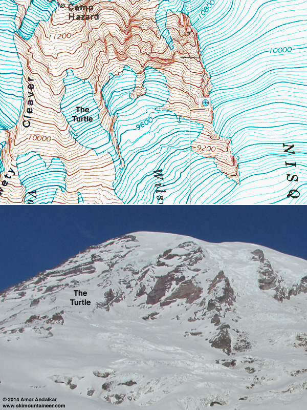
The Turtle is a glacial remnant above the Van Trump Glaciers, adjacent to Wilson Glacier, and below the Kautz Ice Cliff and Camp Hazard, extending from 9800 ft up to about 10800 ft. It's often mistakenly referred to as a snowfield, but is a real chunk of glacier with a few small crevasses when it melts out to bare blue glacial ice in the summer, just like the upper portion of the Muir "Snowfield" (which is also a glacier) does most years by September.
Thanks Amar. I've also often wondered if there are any approaches to the VanTrump area from the current Nisqually terminus area and below.
author=savegondor link=topic=30520.msg127937#msg127937 date=1391109667]
Thanks Amar. I've also often wondered if there are any approaches to the VanTrump area from the current Nisqually terminus area and below.
5800 feet? can i go up where you exited?
This also avoided the potentially serious hazard of falling bodies on Pan Face, which can be a significant risk on busy days with firm frozen conditions in the morning.
... this was after our close call with a snowshoer a few weeks before. Body traveling at terminal velocity, flailing ice axe, massive picket on pack---yikes!
Amar - Thanks for the fantastic photos and thorough detail on your TRs. They're a joy to read!
do you work? way to get some!
Reply to this TR
Please login first: