August 3-4, 2012, Mt Rainier, Winthrop Glacier
8/3/12
WA Cascades West Slopes South (Mt Rainier)
25547
20
Summary: An outstanding midsummer ski descent from the summit of Mount Rainier in excellent corn snow, down a variation of the Emmons-Winthrop route which is not commonly skied or climbed in most years: the Winthrop Glacier direct from Camp Schurman to the summit via Winthrop Corridor, a steeper and nicer ski line than the normal Emmons Corridor. But surprisingly as of a week ago, the Emmons-Winthrop was rerouted to go this way, and it is now the standard maintained summit path from Camp Schurman. Even more surprisingly, we had almost total solitude on the route this day, with only 2 other parties climbing on foot and no other skiers, on a sunny Saturday which was likely the single most perfect weather day of 2012 thus far on the summit of Rainier.
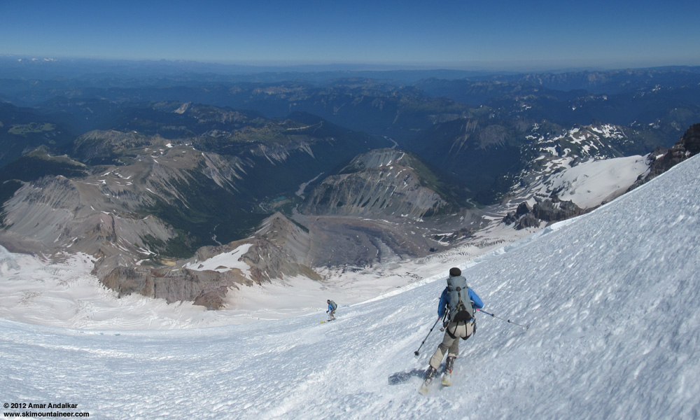
Two-shot panorama / multiple exposure of sweet corn turns down the Winthrop Glacier.
It was also the warmest day of the year so far with temperatures reaching 93 °F in Seattle and the freezing level over 15000 ft with very light winds. Ideal weather for skiing a moderately-steep NE-facing route at 14000+ ft. The route consisted almost entirely of various types of corn snow from the summit down to the end of continuous snow at 6600 ft below Inter Glacier, with only a few patches of moderate frozen sastrugi to cross above 14000 ft and no hazardous mushy conditions anywhere even in late afternoon, the benefit of midsummer consolidation. Smooth springlike corn up high above 12000 ft, well-consolidated summer corn in the mid-elevations to 9000 ft, and solidly-consolidated dirty corn on the Inter Glacier.
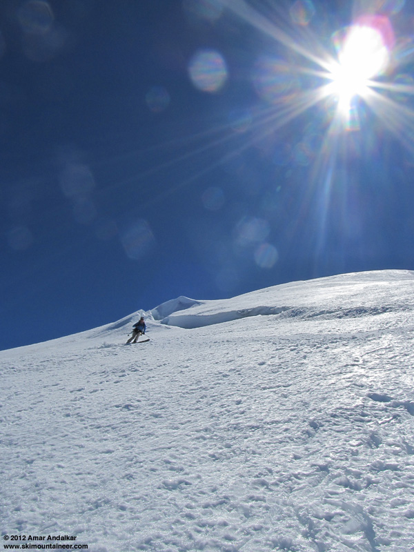
An amazing ski run, among the best and most memorable I've ever had considering the snow conditions, uncommon route, and time of year. Just stunning to be able to ski this line, one which I've wanted to ski for over a decade but had never done, in excellent conditions in August!

(photo by HC)
Details: The Winthrop Corridor is a smooth mostly-uncrevassed ramp amidst the heavily-crevassed chaos of the Emmons-Winthrop Glaciers, a broad unbroken shoulder of snow extending from the edge of the summit dome near 14000 ft down below 10000 ft, at a pitch of 35-40 degrees. Just perfect ski terrain and always visible in plain sight from Camp Schurman, with a minor problem which keeps it from being a standard summit route: the toe of the Corridor near 10000 ft is heavily crevassed, usually preventing easy access from Camp Schurman without considerable crevasse navigation and hazard.
It has been several years since the Winthrop Glacier direct route was in good shape for access at the toe of Winthrop Corridor during the normal June-July ski season on the Emmons-Winthrop, perhaps since 2006 (see e.g.
View of the Winthrop Corridor and Inter Glacier from beside the White River.
However, due to major crevasse problems and serac collapses this year at the top of the Emmons Corridor, the Emmons-Winthrop route was re-routed on July 26 (see the
Zoomed view of the Winthrop Corridor and route from beside the White River.
Unfortunately, finding partners proved to be difficult given that it's August and most of my regular partners were doing other things -- why do most skiers mistakenly think the ski season is long over? even the spring-summer ski mountaineering season? even in an unusually great snowpack year like 2012? It looked like I would have to solo the route if I wanted to do it at all, which is not something that I really felt comfortable doing this year, although I have solo-skied the Emmons-Winthrop a couple of times previously (early July of 2009 and 2010). Thankfully, just as I was about to drive down to Rainier alone on Friday morning, I convinced Hannah to join me, and we eventually got a late afternoon start, which helped us nicely avoid the heat on the hike in.
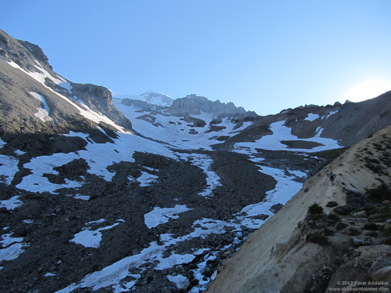
We left White River Campground at 4:45pm, and although there were a few snow patches on the trail near 5600 ft, we knew it would be all hiking well past Glacier Basin. No bugs at White River or along the trail, but a few mosquitos were biting during a brief food break at Glacier Basin. We reached skinnable snow in about 4 miles and 2 hours near 6800 ft in the gully of the Inter Fork below Inter Glacier, and decided to skin up the now-shaded and re-firming dirty corn.
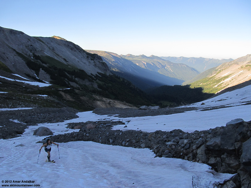
The snow was a bit too firm already for easy skinning, so Hannah switched back to booting on the steep section but I kept skinning the rest of the way up, to the usual bare crossover onto the Emmons at 9000 ft, which we reached right at sunset.
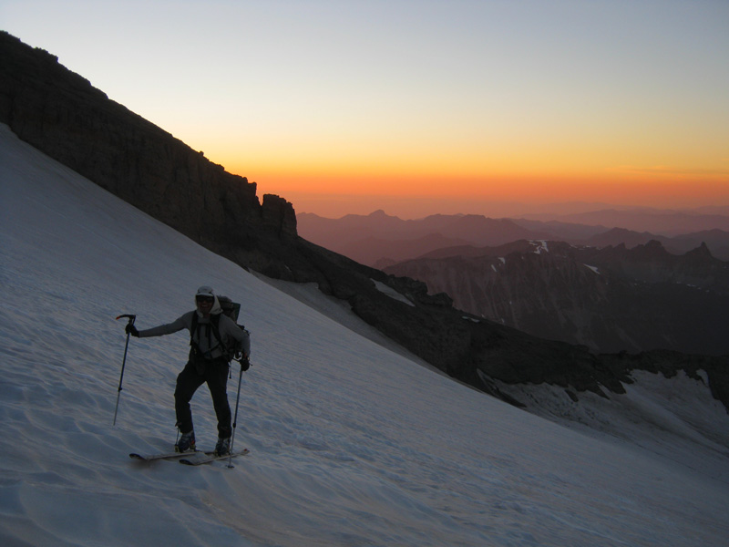
(photo by HC)
Unfortunately, I didn't realize until looking down from high above on the Winthrop the next day, that there was a perfect smooth ramp of snow connecting across from Camp Curtis near 8800 ft onto the Emmons, which would have allowed me to continue all the way to Camp Schurman on skis -- yes, there is still continuous skiable snow from the summit down to below 6600 ft via the Emmons-Winthrop and Inter Glaciers, highly unusual for August (or even July most years).
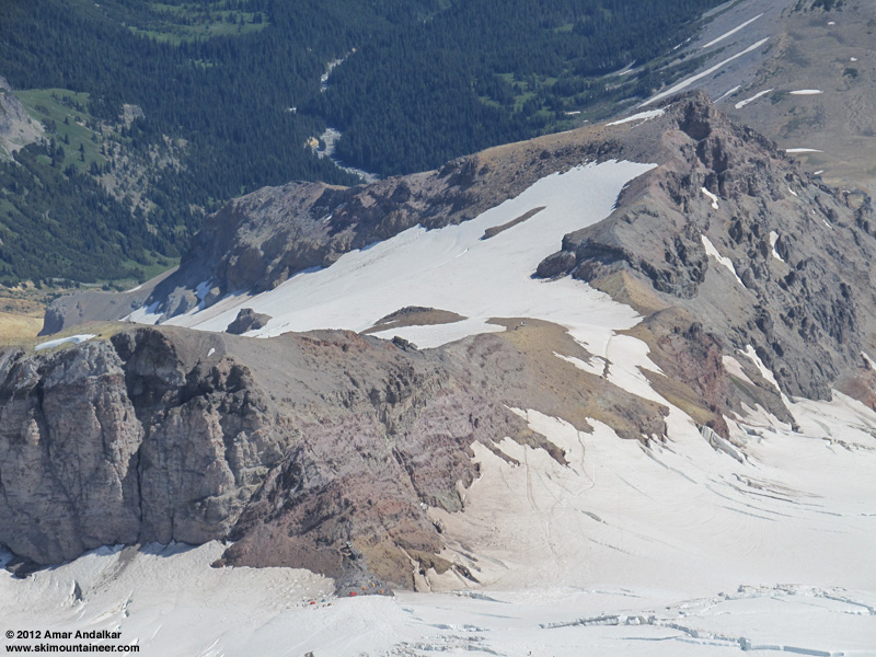
Zoomed view looking down on the Inter-Emmons crossing from high on the Winthrop Corridor.
So we booted down the crappy loose eroded path onto the Emmons, arriving just as the reddish near-full moon rose beyond the Emmons Glacier terminus at 9pm. The photo doesn't do justice to just how cool this moonrise was.
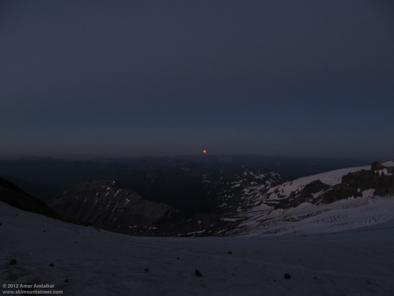
We reached Camp Schurman near 9:30pm, and spent the next hour eating dinner and melting 7 liters of water for the evening and the next day. Despite the 15000 ft freezing level, it was quite chilly at Schurman with a cool easterly breeze, and we were both wearing full down jackets. We planned a leisurely start on a skier's schedule the next morning, so the late arrival was no big deal. But the unexpectedly gusty wind and the usual scurrying mice (how do they survive the winter with no food at 9500 ft??) made getting to sleep difficult in our open bivy with sleeping bags and pads only, no tent.
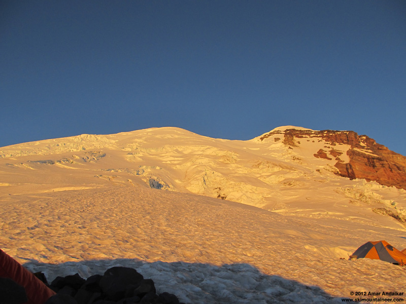
I awoke with a start at 6am, about 10 minutes after sunrise and annoyed to be too late to view the full glory of the dawn and sunrise colors (apparently the moon was setting over the summit just before sunrise, too). It was still quite chilly in the shaded portions of the camp until the run rose high enough to shine over the rocks, so we were not eager to get up until then.

We headed up just before 8am, cramponing on foot and roped up. The bootpack traverses west from Camp Schurman, going up to 9700 ft then losing perhaps 50 ft in a gentle traverse below a large serac-fall area, before beginning a series of switchbacks through crevasses up the toe of Winthrop Corridor. The crux was at 10200 ft, with a snow-block crevasse crossing and about 50 ft of semi-hard gray glacial ice, followed by an open crevasse with a 3 ft step needed to cross it, enough to give us a long pause for contemplation.
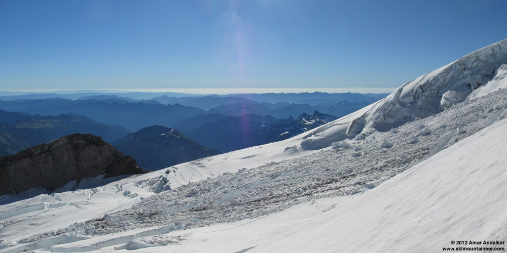
Two-shot panorama of the Winthrop Glacier just above the crux area.
The route weaves through a few more crevasses up to about 10600 ft, where it climbs directly over a large crack via some fallen blocks, which looked nasty but was easy to ascend -- skiing down across it would end up being a bit more difficult. Above that it was a cruise, a smooth ramp with almost no crevasse issues. Above 13000 ft, there were a handful of obvious sags and crevasses and the bootpack needlessly crossed three open crevasses which each had an easy end-run around to the right, which we decided to do in each case.
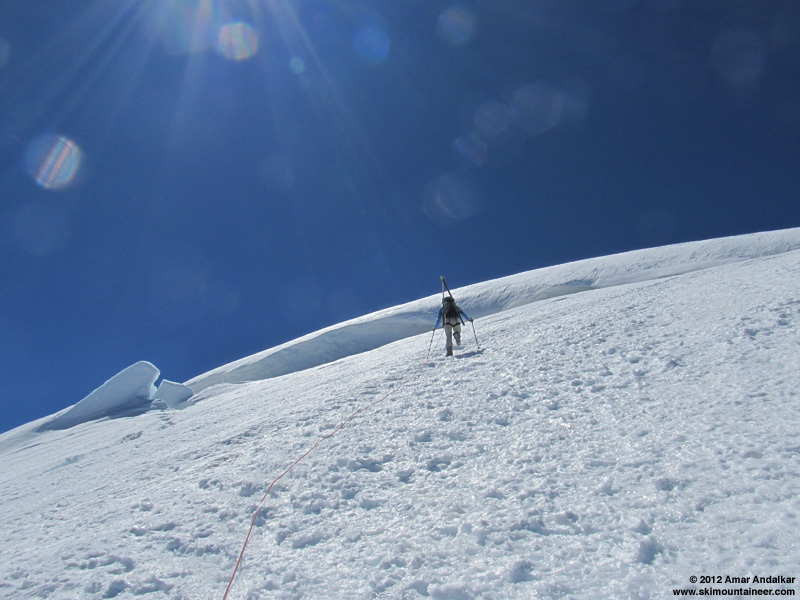
We unroped above the last crevasses at 14000 ft and stayed on snow up to the north side of the east crater rim near 14300 ft, then took the crampons off to hike the mostly-bare rim to the true summit, with a deep trench through the snow for the final yards.
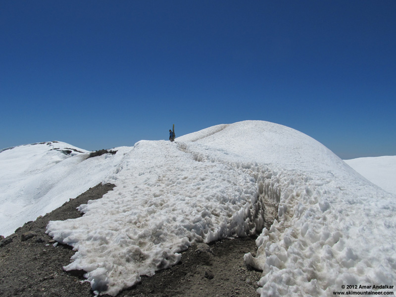
We topped out on Columbia Crest at 1:45pm, in total solitude and nearly calm winds, with a maximum wind gust of 10mph over several minutes. True air temperature in the shade was about 37 °F, but it felt much warmer with the bright sunshine and cloudless skies. Just an absolutely gorgeous day to be atop the highest point in the Cascade Range.
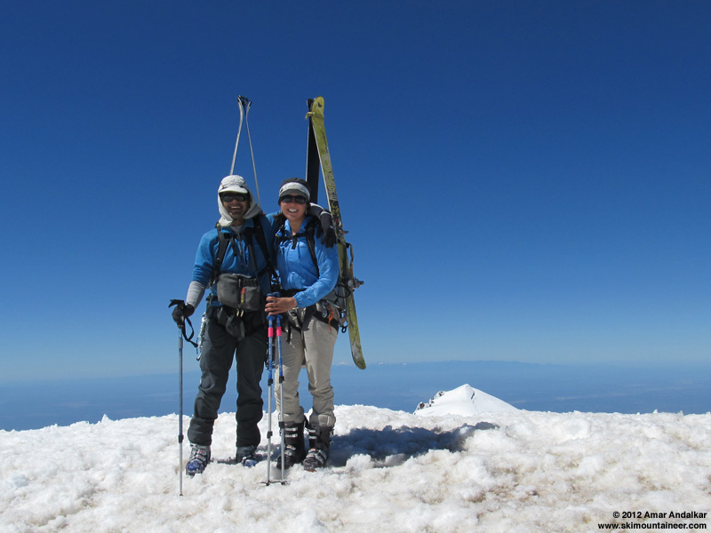
We skied down around 2:20pm, finding a large patch of smooth corn on a NW aspect just a few feet below the summit. A few short sections of sastrugi to bounce over as we traversed back east to rejoin the bootpack, but otherwise the snow was mostly smooth and mostly softened enough for good skiing.
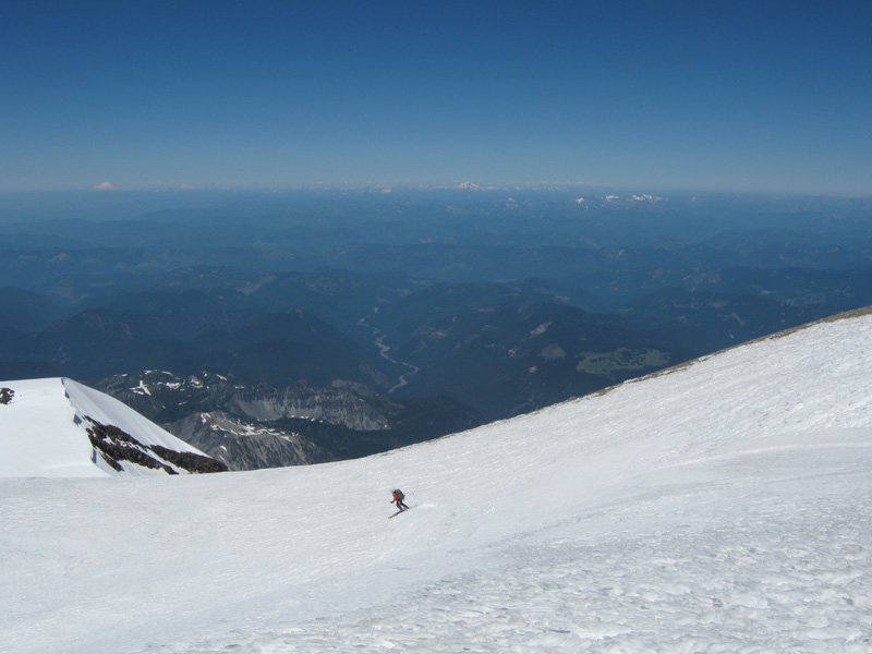
Skiing the patch of corn off of the NW side of Columbia Crest. (photo by HC)
The corn was just barely softened enough as we rolled over from the summit dome onto the steepest part of the Winthrop Corridor near 13800 ft, but it quickly became just right as we descended further.
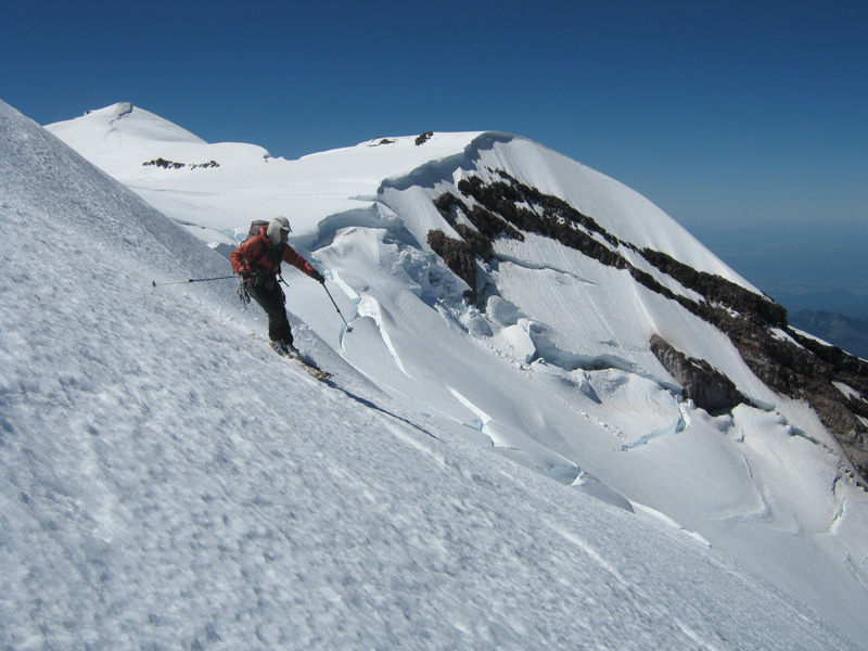
(photo by HC)
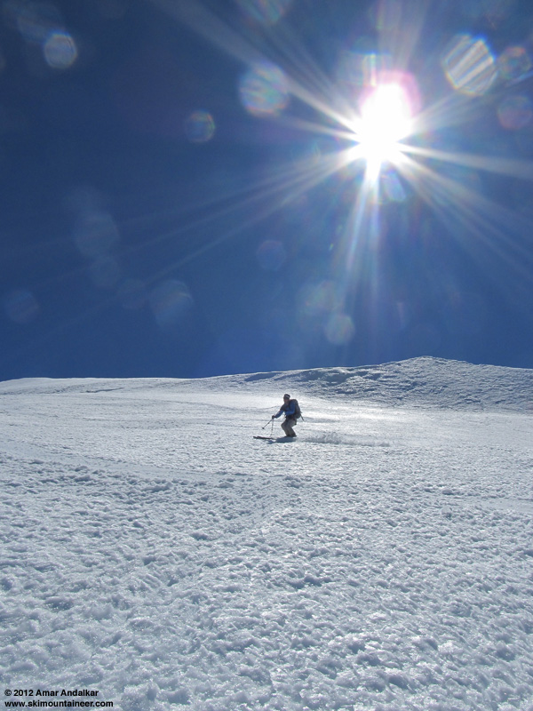
The Corridor narrows below 12000 ft, and so there are more crevasses near the route, but it was easy to make turns on smooth snow just off to either side of the bootpack while staying safely away from the cracks.
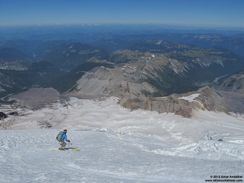
The crevasse at 10600 ft required either a small jump, or a down-climb of about 5 ft across the blocks wedged in its opening, and then it was a series of cautious turns staying close to the switchbacking bootpack through the crevasses below that.
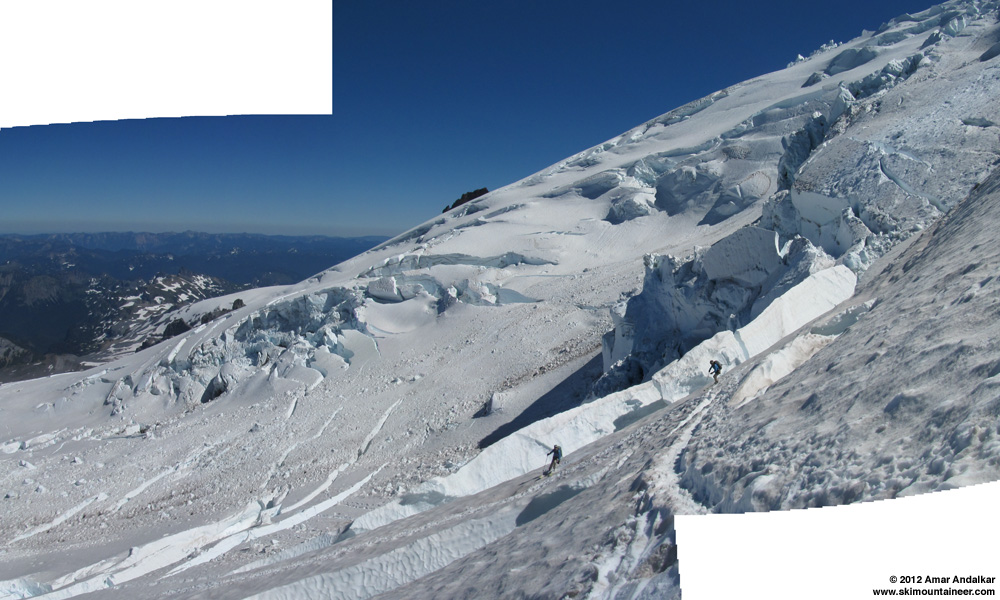
Two-shot panorama / multiple exposure of turns through the crevasses near the toe of the Winthrop Corridor.
We skied the entire route except for about 50 vertical feet at the crux crevasse near 10200 ft, where we stepped across the 3 ft gap and downclimbed the bare glacial ice in crampons. Actually, it turns out that this entire crux area could have been easily bypassed by traversing around to its east, and we found out when we got back to camp that the climbing rangers were planning to reroute this section the next day. It's too bad that I didn't think to look at my zoomed photos from Camp Schurman, but the thought never crossed my mind to do so as we skied down to the crux.

Zoomed view of the crevasses at the toe of the Winthrop Corridor, showing a possible route around the bare glacial ice and open crevasse near 10200 ft.
Below the crux, the rest of the ski was a cruise except the uphill portion of the traverse, which was a bit of work to shuffle-step up without skins (we'd left the skins at camp). The snow conditions were still good all the way down to Camp Schurman. A large number of parties had arrived and the camp was much more crowded than the night before -- clearly there would be a lot more than 2 parties climbing the route on Sunday, but we saw no other skiers there. Several people told us that they had enjoyed watching our ski descent of the route from camp.
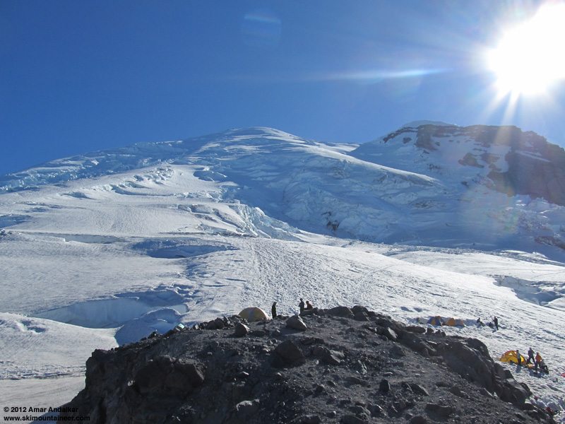
We packed up our minimal campsite, chatted with the climbing rangers for a while, and skied down the short section of the Emmons Glacier at 5:30pm. The snow was surprisingly nice, mostly smooth soft corn and totally uncrevassed to skier's right (east) of the bootpack.
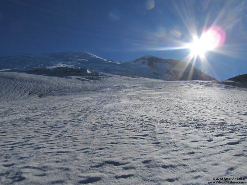
We took the skis off at the glacier's edge, climbed a short bit to the flat traverse trail towards Camp Curtis, and then rejoined the snow ramp which provided a skiable traverse right to site #1 at the camp (see photo above, looking down from the Winthrop). This would have been a fine way to go on the ascent to Schurman, as the crevasses near and below the snow ramp were not very threatening, and easily passable on skis.
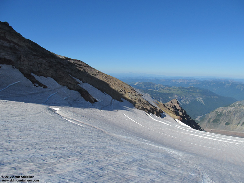
Even on the Inter Glacier, the snow skied much better than expected and better than it looked (rough, bumpy, suncupped). It was still well softened in the sun at 6pm, and the various ridges and bumps could be carved over and through easily. There are a number of large open crevasses and sags on various parts of the glacier, more than I've seen on any previous ski trip (although I've only skied it this late in the year once before, following a summit ski via the standard Emmons route on August 1, 2011). We saw a couple of fresh ski tracks from earlier in the day, but for me the Inter Glacier would no longer be a worthwhile destination on its own for turns this summer -- there are much better options on Rainier (e.g. Paradise or Fryingpan Glaciers) or Baker with a lot more skiing and less hiking.
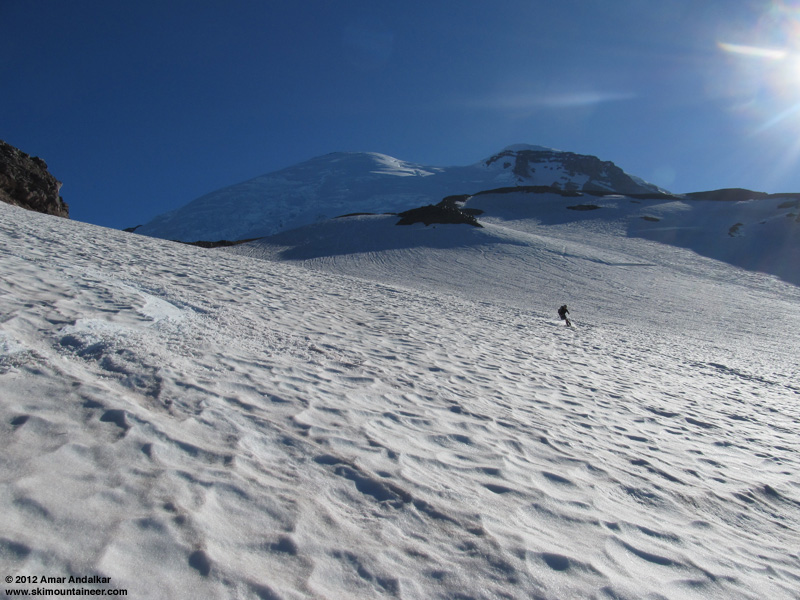
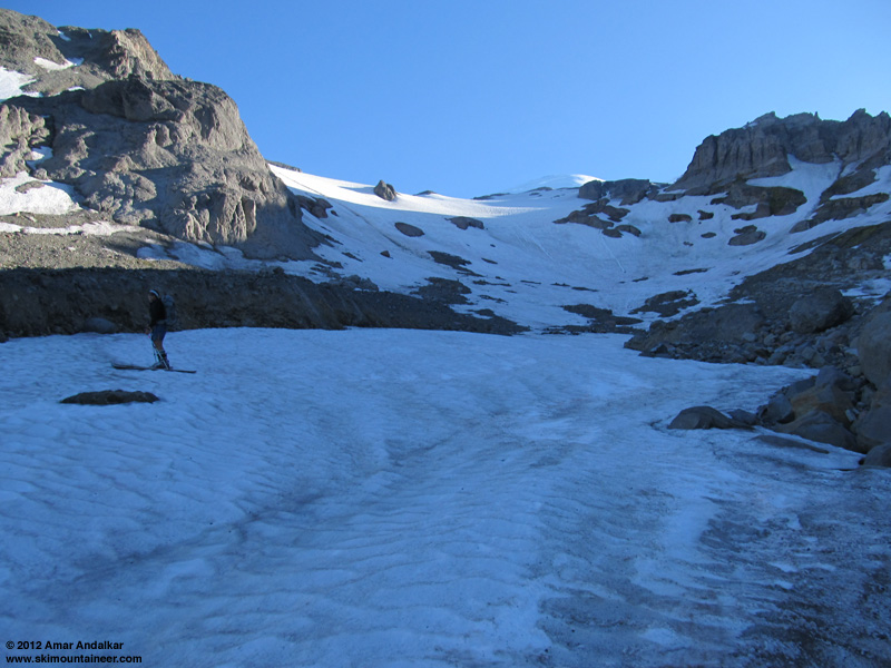
Below 7500 ft, the steep slope at the Inter Glacier's terminus is very dirty and strewn with large numbers of fallen rocks. Still skiable and even fun with caution, and below it we followed the cleaner snow-filled gully of the Inter Fork down to 6600 ft.
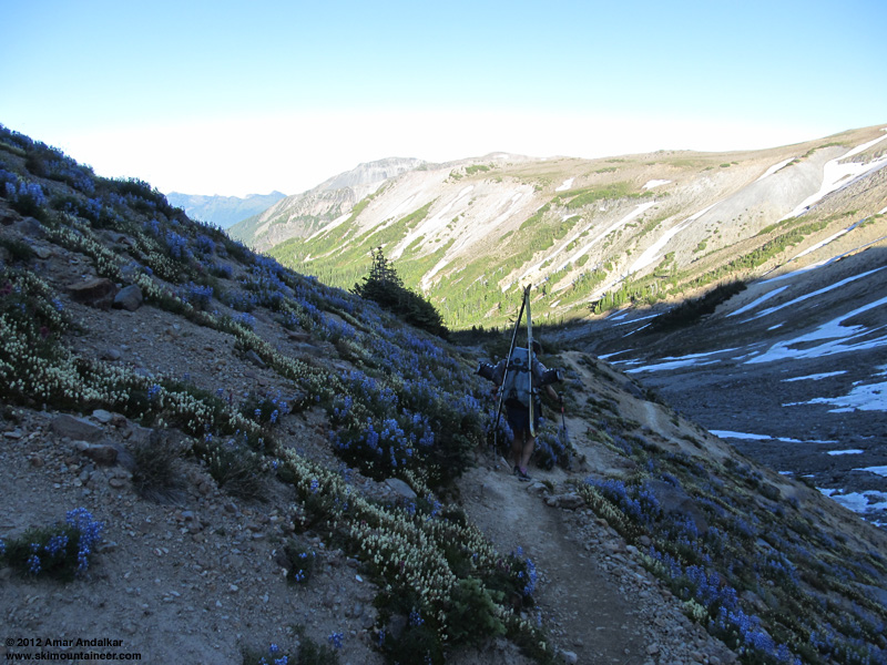
We switched back to shoes and with a short cross-country traverse, we were back on the trail. The steep moraine portion of the trail was miserable as usual, but at least there was a profusion of wildflowers to enjoy and it had cooled down in the evening from the near-record highs of the day. We were back to the car by 8:30pm with plenty of daylight to spare, tired but not exhausted, and stoked to have skied the Winthrop Corridor in amazing conditions.
I've had a lot of great volcano ski trips since mid-May this year, mostly in prime corn snow conditions (Rainier 3x, Little Tahoma, Shasta 4x, Adams, Baker, South Sister 3x, Middle Sister 2x, Lassen 2x, among others). But this one feels like the climax of an outstanding 2012 spring-summer ski season, finally skiing a long-sought route on the great Mountain in excellent conditions, in August no less! About 10400 ft of total ascent for 7800 vert of mostly good to great skiing, much of it on nice corn, and all of it in solitude. Especially nice to spend part of the warmest day of the year at the coolest spot in Washington and probably the entire lower 48, fully 56 °F cooler than Seattle was on this day. I can't believe nobody else was up there skiing it and avoiding the heat! The route probably will be good for another week or two at most, as summer warmth is expected to continue.

Two-shot panorama / multiple exposure of sweet corn turns down the Winthrop Glacier.
It was also the warmest day of the year so far with temperatures reaching 93 °F in Seattle and the freezing level over 15000 ft with very light winds. Ideal weather for skiing a moderately-steep NE-facing route at 14000+ ft. The route consisted almost entirely of various types of corn snow from the summit down to the end of continuous snow at 6600 ft below Inter Glacier, with only a few patches of moderate frozen sastrugi to cross above 14000 ft and no hazardous mushy conditions anywhere even in late afternoon, the benefit of midsummer consolidation. Smooth springlike corn up high above 12000 ft, well-consolidated summer corn in the mid-elevations to 9000 ft, and solidly-consolidated dirty corn on the Inter Glacier.

An amazing ski run, among the best and most memorable I've ever had considering the snow conditions, uncommon route, and time of year. Just stunning to be able to ski this line, one which I've wanted to ski for over a decade but had never done, in excellent conditions in August!

(photo by HC)
Details: The Winthrop Corridor is a smooth mostly-uncrevassed ramp amidst the heavily-crevassed chaos of the Emmons-Winthrop Glaciers, a broad unbroken shoulder of snow extending from the edge of the summit dome near 14000 ft down below 10000 ft, at a pitch of 35-40 degrees. Just perfect ski terrain and always visible in plain sight from Camp Schurman, with a minor problem which keeps it from being a standard summit route: the toe of the Corridor near 10000 ft is heavily crevassed, usually preventing easy access from Camp Schurman without considerable crevasse navigation and hazard.
It has been several years since the Winthrop Glacier direct route was in good shape for access at the toe of Winthrop Corridor during the normal June-July ski season on the Emmons-Winthrop, perhaps since 2006 (see e.g.
View of the Winthrop Corridor and Inter Glacier from beside the White River.
However, due to major crevasse problems and serac collapses this year at the top of the Emmons Corridor, the Emmons-Winthrop route was re-routed on July 26 (see the
Zoomed view of the Winthrop Corridor and route from beside the White River.
Unfortunately, finding partners proved to be difficult given that it's August and most of my regular partners were doing other things -- why do most skiers mistakenly think the ski season is long over? even the spring-summer ski mountaineering season? even in an unusually great snowpack year like 2012? It looked like I would have to solo the route if I wanted to do it at all, which is not something that I really felt comfortable doing this year, although I have solo-skied the Emmons-Winthrop a couple of times previously (early July of 2009 and 2010). Thankfully, just as I was about to drive down to Rainier alone on Friday morning, I convinced Hannah to join me, and we eventually got a late afternoon start, which helped us nicely avoid the heat on the hike in.

We left White River Campground at 4:45pm, and although there were a few snow patches on the trail near 5600 ft, we knew it would be all hiking well past Glacier Basin. No bugs at White River or along the trail, but a few mosquitos were biting during a brief food break at Glacier Basin. We reached skinnable snow in about 4 miles and 2 hours near 6800 ft in the gully of the Inter Fork below Inter Glacier, and decided to skin up the now-shaded and re-firming dirty corn.

The snow was a bit too firm already for easy skinning, so Hannah switched back to booting on the steep section but I kept skinning the rest of the way up, to the usual bare crossover onto the Emmons at 9000 ft, which we reached right at sunset.

(photo by HC)
Unfortunately, I didn't realize until looking down from high above on the Winthrop the next day, that there was a perfect smooth ramp of snow connecting across from Camp Curtis near 8800 ft onto the Emmons, which would have allowed me to continue all the way to Camp Schurman on skis -- yes, there is still continuous skiable snow from the summit down to below 6600 ft via the Emmons-Winthrop and Inter Glaciers, highly unusual for August (or even July most years).

Zoomed view looking down on the Inter-Emmons crossing from high on the Winthrop Corridor.
So we booted down the crappy loose eroded path onto the Emmons, arriving just as the reddish near-full moon rose beyond the Emmons Glacier terminus at 9pm. The photo doesn't do justice to just how cool this moonrise was.

We reached Camp Schurman near 9:30pm, and spent the next hour eating dinner and melting 7 liters of water for the evening and the next day. Despite the 15000 ft freezing level, it was quite chilly at Schurman with a cool easterly breeze, and we were both wearing full down jackets. We planned a leisurely start on a skier's schedule the next morning, so the late arrival was no big deal. But the unexpectedly gusty wind and the usual scurrying mice (how do they survive the winter with no food at 9500 ft??) made getting to sleep difficult in our open bivy with sleeping bags and pads only, no tent.

I awoke with a start at 6am, about 10 minutes after sunrise and annoyed to be too late to view the full glory of the dawn and sunrise colors (apparently the moon was setting over the summit just before sunrise, too). It was still quite chilly in the shaded portions of the camp until the run rose high enough to shine over the rocks, so we were not eager to get up until then.

We headed up just before 8am, cramponing on foot and roped up. The bootpack traverses west from Camp Schurman, going up to 9700 ft then losing perhaps 50 ft in a gentle traverse below a large serac-fall area, before beginning a series of switchbacks through crevasses up the toe of Winthrop Corridor. The crux was at 10200 ft, with a snow-block crevasse crossing and about 50 ft of semi-hard gray glacial ice, followed by an open crevasse with a 3 ft step needed to cross it, enough to give us a long pause for contemplation.

Two-shot panorama of the Winthrop Glacier just above the crux area.
The route weaves through a few more crevasses up to about 10600 ft, where it climbs directly over a large crack via some fallen blocks, which looked nasty but was easy to ascend -- skiing down across it would end up being a bit more difficult. Above that it was a cruise, a smooth ramp with almost no crevasse issues. Above 13000 ft, there were a handful of obvious sags and crevasses and the bootpack needlessly crossed three open crevasses which each had an easy end-run around to the right, which we decided to do in each case.

We unroped above the last crevasses at 14000 ft and stayed on snow up to the north side of the east crater rim near 14300 ft, then took the crampons off to hike the mostly-bare rim to the true summit, with a deep trench through the snow for the final yards.

We topped out on Columbia Crest at 1:45pm, in total solitude and nearly calm winds, with a maximum wind gust of 10mph over several minutes. True air temperature in the shade was about 37 °F, but it felt much warmer with the bright sunshine and cloudless skies. Just an absolutely gorgeous day to be atop the highest point in the Cascade Range.

We skied down around 2:20pm, finding a large patch of smooth corn on a NW aspect just a few feet below the summit. A few short sections of sastrugi to bounce over as we traversed back east to rejoin the bootpack, but otherwise the snow was mostly smooth and mostly softened enough for good skiing.

Skiing the patch of corn off of the NW side of Columbia Crest. (photo by HC)
The corn was just barely softened enough as we rolled over from the summit dome onto the steepest part of the Winthrop Corridor near 13800 ft, but it quickly became just right as we descended further.

(photo by HC)

The Corridor narrows below 12000 ft, and so there are more crevasses near the route, but it was easy to make turns on smooth snow just off to either side of the bootpack while staying safely away from the cracks.

The crevasse at 10600 ft required either a small jump, or a down-climb of about 5 ft across the blocks wedged in its opening, and then it was a series of cautious turns staying close to the switchbacking bootpack through the crevasses below that.

Two-shot panorama / multiple exposure of turns through the crevasses near the toe of the Winthrop Corridor.
We skied the entire route except for about 50 vertical feet at the crux crevasse near 10200 ft, where we stepped across the 3 ft gap and downclimbed the bare glacial ice in crampons. Actually, it turns out that this entire crux area could have been easily bypassed by traversing around to its east, and we found out when we got back to camp that the climbing rangers were planning to reroute this section the next day. It's too bad that I didn't think to look at my zoomed photos from Camp Schurman, but the thought never crossed my mind to do so as we skied down to the crux.

Zoomed view of the crevasses at the toe of the Winthrop Corridor, showing a possible route around the bare glacial ice and open crevasse near 10200 ft.
Below the crux, the rest of the ski was a cruise except the uphill portion of the traverse, which was a bit of work to shuffle-step up without skins (we'd left the skins at camp). The snow conditions were still good all the way down to Camp Schurman. A large number of parties had arrived and the camp was much more crowded than the night before -- clearly there would be a lot more than 2 parties climbing the route on Sunday, but we saw no other skiers there. Several people told us that they had enjoyed watching our ski descent of the route from camp.

We packed up our minimal campsite, chatted with the climbing rangers for a while, and skied down the short section of the Emmons Glacier at 5:30pm. The snow was surprisingly nice, mostly smooth soft corn and totally uncrevassed to skier's right (east) of the bootpack.

We took the skis off at the glacier's edge, climbed a short bit to the flat traverse trail towards Camp Curtis, and then rejoined the snow ramp which provided a skiable traverse right to site #1 at the camp (see photo above, looking down from the Winthrop). This would have been a fine way to go on the ascent to Schurman, as the crevasses near and below the snow ramp were not very threatening, and easily passable on skis.

Even on the Inter Glacier, the snow skied much better than expected and better than it looked (rough, bumpy, suncupped). It was still well softened in the sun at 6pm, and the various ridges and bumps could be carved over and through easily. There are a number of large open crevasses and sags on various parts of the glacier, more than I've seen on any previous ski trip (although I've only skied it this late in the year once before, following a summit ski via the standard Emmons route on August 1, 2011). We saw a couple of fresh ski tracks from earlier in the day, but for me the Inter Glacier would no longer be a worthwhile destination on its own for turns this summer -- there are much better options on Rainier (e.g. Paradise or Fryingpan Glaciers) or Baker with a lot more skiing and less hiking.

Below 7500 ft, the steep slope at the Inter Glacier's terminus is very dirty and strewn with large numbers of fallen rocks. Still skiable and even fun with caution, and below it we followed the cleaner snow-filled gully of the Inter Fork down to 6600 ft.

We switched back to shoes and with a short cross-country traverse, we were back on the trail. The steep moraine portion of the trail was miserable as usual, but at least there was a profusion of wildflowers to enjoy and it had cooled down in the evening from the near-record highs of the day. We were back to the car by 8:30pm with plenty of daylight to spare, tired but not exhausted, and stoked to have skied the Winthrop Corridor in amazing conditions.

I've had a lot of great volcano ski trips since mid-May this year, mostly in prime corn snow conditions (Rainier 3x, Little Tahoma, Shasta 4x, Adams, Baker, South Sister 3x, Middle Sister 2x, Lassen 2x, among others). But this one feels like the climax of an outstanding 2012 spring-summer ski season, finally skiing a long-sought route on the great Mountain in excellent conditions, in August no less! About 10400 ft of total ascent for 7800 vert of mostly good to great skiing, much of it on nice corn, and all of it in solitude. Especially nice to spend part of the warmest day of the year at the coolest spot in Washington and probably the entire lower 48, fully 56 °F cooler than Seattle was on this day. I can't believe nobody else was up there skiing it and avoiding the heat! The route probably will be good for another week or two at most, as summer warmth is expected to continue.
For future reference, here is the Rainier forecast and the telemetry from Camp Muir on the opposite side of the Mountain during the weekend of this trip, which brought record heat to the lowlands of Western Washington. Seattle (SeaTac Airport) reached a high of 93 °F on both Saturday and Sunday, August 4-5, with Sunday's value setting a new record for the date. Very interesting to see the overnight lows at Camp Muir not drop below about 50 °F. Despite the warm temperatures, radiational cooling during the very clear evenings and nights allowed the snowpack to freeze solidly overnight down to the end of the continuous snow near 6600 ft, well over 8000 ft below the free-air freezing levels of 15000+ ft. The unexpectedly breezy winds on Friday evening and overnight are also evident, as are the nearly calm winds during the day on Saturday.
MOUNT RAINIER RECREATIONAL FORECAST
NATIONAL WEATHER SERVICE SEATTLE WA
403 AM PDT FRI AUG 3 2012
...WARMEST WEATHER SO FAR THIS YEAR EXPECTED THIS WEEKEND...
SYNOPSIS...HIGH PRESSURE ALOFT WILL PREVAIL OVER THE REGION THROUGH THIS WEEKEND FOR MUCH WARM WEATHER.
TODAY...MOSTLY SUNNY. FREEZING LEVEL 14500 FEET.
TONIGHT THROUGH SATURDAY NIGHT...CLEAR. FREEZING LEVEL ABOVE 15000 FEET.
SUNDAY...MOSTLY SUNNY. FREEZING LEVEL ABOVE 15000 FEET.
SUNDAY NIGHT...PARTLY CLOUDY WITH A SLIGHT CHANCE OF THUNDERSTORMS. SNOW LEVEL 14500 FEET.
MONDAY...PARTLY SUNNY. A SLIGHT CHANCE OF MORNING THUNDERSTORMS. SNOW LEVEL 12500 FEET.
MONDAY NIGHT AND TUESDAY...MOSTLY CLEAR. FREEZING LEVEL 13500 FEET.
TUESDAY NIGHT...PARTLY CLOUDY. FREEZING LEVEL 13000 FEET.
WEDNESDAY...PARTLY SUNNY. FREEZING LEVEL 12500 FEET.
WEDNESDAY NIGHT...PARTLY CLOUDY. FREEZING LEVEL 13500 FEET.
THURSDAY...MOSTLY SUNNY. FREEZING LEVEL 13500 FEET.
TEMPERATURE AND WIND FORECASTS FOR SELECTED LOCATIONS.
TODAY TONIGHT SAT SAT SUN
NIGHT
SUMMIT (14411 FT) 32 32 32 33 32
N 21 N 9 NW 4 W 12 W 10
CAMP MUIR(10188 FT) 44 48 49 52 51
NE 5 E 4 SE 4 SW 6 SW 7
PARADISE (5420 FT) 70 55 80 59 79
NE 6 NE 10 NE 8 NE 4 W 3
LONGMIRE (2700 FT) 81 51 91 54 91
CALM CALM CALM CALM CALM
Northwest Weather and Avalanche Center
Camp Muir, Mt Rainier National Park, Washington
Wind gages unheated and may rime
ATRH sensor replaced and working--0800_6-28-12
MM/DD Hour Temp RH Wind Wind Wind Wind Solar
PST F % Min Avg Max Dir W/m2
10110' 10110' 10110' 10110' 10110' 10110' 10110'
---------------------------------------------------------------
8 3 0 44 13 0 2 8 342 0
8 3 100 42 18 0 2 5 327 0
8 3 200 43 14 0 4 9 274 0
8 3 300 44 13 0 2 6 269 0
8 3 400 43 15 0 1 4 334 0
8 3 500 44 16 0 1 5 275 4
8 3 600 43 17 0 1 4 292 81
8 3 700 44 23 0 2 6 244 249
8 3 800 44 21 0 4 8 257 458
8 3 900 49 23 1 4 8 244 661
8 3 1000 50 20 2 5 8 236 836
8 3 1100 51 19 2 6 12 71 966
8 3 1200 49 14 3 13 23 66 1042
8 3 1300 48 21 11 16 24 62 1056
8 3 1400 49 19 12 18 24 57 1007
8 3 1500 45 61 9 18 23 60 904
8 3 1600 47 34 6 14 21 58 744
8 3 1700 44 72 4 16 21 57 555
8 3 1800 45 68 3 8 14 53 266
8 3 1900 51 34 4 9 20 60 18
8 3 2000 52 34 5 14 21 52 7
8 3 2100 52 35 8 15 22 54 0
8 3 2200 51 17 8 13 20 50 0
8 3 2300 46 26 6 14 26 58 0
---------------------------------------------------------------
8 4 0 missing data
8 4 100 missing data
8 4 200 missing data
8 4 300 missing data
8 4 400 missing data
8 4 500 52 37 5 10 18 48 4
8 4 600 53 35 7 12 16 48 75
8 4 700 54 34 5 10 16 59 241
8 4 800 53 39 3 6 13 55 448
8 4 900 50 48 2 5 10 36 650
8 4 1000 55 35 3 7 12 69 823
8 4 1100 58 30 1 4 10 53 958
8 4 1200 57 33 2 4 7 36 1035
8 4 1300 58 33 0 2 4 30 1052
8 4 1400 59 30 0 3 5 242 1003
8 4 1500 57 33 1 2 4 225 901
8 4 1600 55 39 0 2 6 19 743
8 4 1700 54 46 1 2 6 26 553
8 4 1800 50 53 1 3 6 22 263
8 4 1900 49 56 1 3 6 30 18
8 4 2000 53 34 0 3 4 301 6
8 4 2100 54 32 0 2 7 10 0
8 4 2200 55 27 0 2 10 306 0
8 4 2300 54 30 3 6 12 263 0
---------------------------------------------------------------
8 5 0 54 28 0 3 7 255 0
8 5 100 54 30 0 2 7 342 0
8 5 200 54 26 0 0 2 280 0
8 5 300 54 26 0 1 6 300 0
8 5 400 53 28 0 2 5 335 0
8 5 500 54 25 0 1 4 358 4
8 5 600 56 24 0 1 2 302 69
8 5 700 56 27 0 0 2 284 240
8 5 800 59 21 0 1 4 243 450
8 5 900 56 23 1 5 7 259 653
8 5 1000 57 27 3 4 6 250 829
8 5 1100 58 13 0 3 7 224 956
8 5 1200 62 21 2 5 7 249 1026
8 5 1300 56 52 0 3 8 268 1044
8 5 1400 60 42 1 3 7 321 1001
8 5 1500 56 63 0 2 7 272 901
8 5 1600 55 50 1 4 10 17 741
8 5 1700 56 49 1 3 8 334 447
8 5 1800 55 56 0 2 4 250 260
8 5 1900 53 56 0 2 7 320 67
8 5 2000 53 60 1 3 5 279 5
8 5 2100 52 54 2 5 11 251 0
8 5 2200 52 50 7 11 16 265 0
8 5 2300 52 35 9 12 17 260 0
---------------------------------------------------------------
[/tt]
[img width=941 height=800]http://www.skimountaineer.com/TR/Images2012/osomur-30Jul-06Aug2012.png[/img]
What a great report. Congratulations to you and your partner Amar.
How many times have you climbed Mt. Rainier?
How many times have you climbed Mt. Rainier?
Looks wonderful! Congrats Amar :)
Really wish I could have cloned myself this weekend! Damn nice trip you two.
Very impressive work, Amar and Pandora.
Way to work the mountain and stay safe.
Way to work the mountain and stay safe.
Great report, great photos!
Thanks everyone for the kind words.
This was my 26th Rainier summit, and 22nd ski descent, via the 10th different route that I've skied or climbed. My first climb on foot was in August 1998 via the DC, and first ski descent was in July 1999 via the Emmons-Winthrop. Most of my summits and ski descents have come since 2007, I've been fortunate enough to summit 3-5 times in each year since 2007. My partner on this trip is ahead of me by a long shot though: it was her 52nd Rainier summit (by about 22 different routes) since 2001, including over 15 ski descents. She had also climbed the Winthrop Glacier direct route once before on foot, in September of 2005 or 2006.
In the interest of full disclosure, 23 of my 26 summits have been to the true summit of Columbia Crest (14411 ft), as have 18 of my 22 ski descents, while the other 4 descents have started from various points on the crater rim or summit dome (14100-14300 ft) due to strong winds, incoming weather, or circumstances such as a pulled-out toepiece last June while skinning up the Emmons. I've summited Liberty Cap (14112 ft) once and Point Success (14158 ft) twice, but also reached Columbia Crest on the same trip each of those times.
See this thread (Accuracy in reporting) for more discussion of what counts as a summit on Rainier (and other WA volcanoes), my post is reply #10.
author=JibberD link=topic=25483.msg107669#msg107669 date=1344263376">
What a great report. Congratulations to you and your partner Amar.
How many times have you climbed Mt. Rainier?
This was my 26th Rainier summit, and 22nd ski descent, via the 10th different route that I've skied or climbed. My first climb on foot was in August 1998 via the DC, and first ski descent was in July 1999 via the Emmons-Winthrop. Most of my summits and ski descents have come since 2007, I've been fortunate enough to summit 3-5 times in each year since 2007. My partner on this trip is ahead of me by a long shot though: it was her 52nd Rainier summit (by about 22 different routes) since 2001, including over 15 ski descents. She had also climbed the Winthrop Glacier direct route once before on foot, in September of 2005 or 2006.
In the interest of full disclosure, 23 of my 26 summits have been to the true summit of Columbia Crest (14411 ft), as have 18 of my 22 ski descents, while the other 4 descents have started from various points on the crater rim or summit dome (14100-14300 ft) due to strong winds, incoming weather, or circumstances such as a pulled-out toepiece last June while skinning up the Emmons. I've summited Liberty Cap (14112 ft) once and Point Success (14158 ft) twice, but also reached Columbia Crest on the same trip each of those times.
See this thread (Accuracy in reporting) for more discussion of what counts as a summit on Rainier (and other WA volcanoes), my post is reply #10.
author=Amar Andalkar link=topic=25483.msg107675#msg107675 date=1344274112">
Thanks everyone for the kind words.
This was my 26th Rainier summit, and 22nd ski descent, via the 10th different route that I've skied or climbed.
See this thread (Accuracy in reporting) for more discussion of what counts as a summit on Rainier (and other WA volcanoes), my post is reply #10.
That's an impressive track record Amar. I've enjoyed reading about these over the past several years. The most memorable one was when you spent the night in a steam vent on the summit. That is quite a story. Better get crackin' on the procreation because this is the kind of stuff that mesmerizes grandchildren.
Agreed on the summit issues. I've been to the top once and made darned sure to hike about and tag every high spot in sight... just in case. We then had our photo taken at the "summit" with the camera facing due south and there is a bump over our shoulders that looks higher than the spot we are standing on. Sure enough, 9 out of 10 people comment on it not looking like we actually went all the way up.
Looks like another wonderful trip, Amar! Wish I hadn't been moving, I would have loved to join you two.
Very nice adventure, Amar and Hanna. Really inspiring!
Thanks for another great TR!
Very good work! I like the clear descriptions and lots of photos. Very inspiring report
Your patience and persistence concerning that route have now payed dividends to you, your partner and even the rest of us who are ogling the photos.
Thanks for the excellent TR Amar.
Thanks for the excellent TR Amar.
Another great one Hannah and Amar !
jtack and I pondered your route from the summit of Ingalls Peak today as we had an excellent view of the mountain from the East. We thought maybe it was the crevasse free line just south of the prow above inter glacier, and then we though maybe it was the crevasse free line just north of the prow (from our vantage point). Anyway, we had a lengthy summit conversation about the patience it took for you to get to ski that line and we also were able to admire the length of it from afar. It added value to our view of Rainier to think about your trip report which we had both read separately, but had not yet discussed. Thanks Amar, I enjoy your reports.
Nice work! We were the party of three descending from the summit, we passed as you were ascending.
Strong work climbing up that face in the sun--it was hot for us even going down.
It is cool to find this TR with excellent pics of such a great day (and the night before climbing up by moonlight was really great too)
Anyway cheers and congratulations on your successful descents!
Strong work climbing up that face in the sun--it was hot for us even going down.
It is cool to find this TR with excellent pics of such a great day (and the night before climbing up by moonlight was really great too)
Anyway cheers and congratulations on your successful descents!
Eight skiers descended on the Winthrop Gl. last wk-end to see if Amar's promisses still held true.
It was a fun route. Sam the Man and Pete? showed the way down this wk-end. Ice and my curved tele skis don't go well together, so I walked down the upper half.
The crevasses are twice what they were reported from the wk previous. Suncups and ice runnels/ rime nodules were beggining to be an issue. I actually thought that some of the better skiing was to be had on the Interglacier - consistent dirty corn.
Excelent skiable route finding arround the slots by Sam and Co. Brian L. and I followed those tracks as they smothed out the suncups and gave an indication of the temperment of the snow.
I see now why folks hike in just for the Interglacier. I'll be watching the gate openings next year!
p.s. One ranger got me thinking - a traverse of the mountain. p.m. if interested.
I like how you compare the temperature to the icy conditions; and how it is safer to ski when it is not in hard conditions. I still have a photocopy of the Emmons/ Winthrop you did about 5 yrs ago. Have you skied Mt Mc Kinley before. The snowboarder Steve Koch did. -thanks
author=jhamaker link=topic=25483.msg107827#msg107827 date=1344916382]
Sam the Man and Pete? showed the way down this wk-end.
Not quite James... you and I first met once skiing with Sam but it was Tom B and I that you are thinking of.
Anyway, it was good to run into you and we were glad to watch you make use of our exit route as we packed up at Camp Sherman. Who would have thought that we would ski the entire decent with only one short downclimb? I thought that was pretty cool. ;D
I wonder how the group of four fared. We watched them for a minute when we were passing through Camp Curtis and they were still very high on the mountain. Perhaps their patience paid off with some softening on the upper mountain but it didn't seem to me like it was ever going to happen that day despite the warm temps.
All in all a great route and the Interglacier was the icing on the cake.
author=jhamaker link=topic=25483.msg107827#msg107827 date=1344916382]
Eight skiers descended on the Winthrop Gl. last wk-end to see if Amar's promisses still held true.
Thanks for the updated report from the following weekend, it's interesting to see how the route held up and also how conditions changed. By the way, I make no promises in my trip reports -- I just try to report current conditions as accurately as possible, and evaluate the merits of a route as objectively as I can. Obviously conditions can change rapidly, especially so on Rainier during an extended period of warm summery weather, and a route that I think is outstanding may not be so for others.
Regarding the snow not softening all the way to the summit, the one key difference between August 4 and 12 is the wind: it was significantly windier on August 12, with a NWS forecast wind of 20 mph at the summit, versus the stunningly low wind forecast of only 4 mph on August 4 (among the handful of calmest days at the summit all year). The telemetry from Camp Muir confirms higher winds on August 12 even at elevations down to 10000 ft, with winds up to 20 mph during that afternoon, versus winds under 5 mph at Muir on the afternoon of August 4.
So despite freezing levels being over 15000 ft on both weekends, the snow could not soften nearly as much on August 12 due to the higher winds. On a fairly steep north or NE-facing route like Winthrop Glacier, the sun is hitting the snow at quite a shallow angle even at midday, which reduces the power per unit area received by the snow surface roughly by a factor of a half, compared to a south side route where the sun hits directly closer to perpendicular for many hours. Thus the north-facing snow needs all the help it can get in order to properly soften, and any wind is definitely not helping. The wind removes the thin layer of sun-warmed air just above the snow surface, thus reducing the rate of snow-softening relative to a calm day. This puts the snow surface closer to the threshold of just barely remaining frozen as it did on August 12, even with air temperatures well above freezing.
The Rainier forecast and telemetry from Camp Muir for August 3-5 are posted above in reply #1, while the ones for August 10-13 are below.
MOUNT RAINIER RECREATIONAL FORECAST
NATIONAL WEATHER SERVICE SEATTLE WA
338 AM PDT SAT AUG 11 2012
SYNOPSIS...AN UPPER LEVEL RIDGE WILL SLOWLY BUILD OVER THE AREA TODAY THROUGH SUNDAY. SKIES WILL BE MAINLY CLEAR AND DAYTIME HIGHS WILL BE WARM. ONSHORE FLOW WILL INCREASE SUNDAY NIGHT THROUGH TUESDAY FOR SOME COOLING AND AN INCREASE IN NIGHT AND MORNING CLOUDS. A STRONG RIDGE OF HIGH PRESSURE ALOFT COMBINED WITH LOW LEVEL OFFSHORE FLOW WILL GIVE SUNNY WEATHER LATE IN THE WEEK.
SATURDAY...SUNNY. FREEZING LEVEL 14500 FEET.
SATURDAY NIGHT...CLEAR. FREEZING LEVEL ABOVE 15000 FEET.
SUNDAY...SUNNY. FREEZING LEVEL ABOVE 15000 FEET.
SUNDAY NIGHT...CLEAR. FREEZING LEVEL ABOVE 15000 FEET.
MONDAY...SUNNY. FREEZING LEVEL ABOVE 15000 FEET.
MONDAY NIGHT THROUGH TUESDAY NIGHT...MOSTLY CLEAR. FREEZING LEVEL ABOVE 15000 FEET.
WEDNESDAY...SUNNY. FREEZING LEVEL 14500 FEET.
WEDNESDAY NIGHT AND THURSDAY...MOSTLY CLEAR. FREEZING LEVEL ABOVE 15000 FEET.
THURSDAY NIGHT AND FRIDAY...MOSTLY CLEAR. FREEZING LEVEL ABOVE 15000 FEET.
TEMPERATURE AND WIND FORECASTS FOR SELECTED LOCATIONS.
SAT SAT SUN SUN MON
NIGHT NIGHT
SUMMIT (14411 FT) 29 30 30 31 32
W 18 W 17 SW 20 W 21 W 21
CAMP MUIR(10188 FT) 47 49 49 50 49
W 4 SW 5 SW 8 W 11 W 14
PARADISE (5420 FT) 73 58 76 58 69
N 4 NW 4 W 4 W 8 S 2
LONGMIRE (2700 FT) 83 50 86 50 80
NE 4 NW 4 NW 5 W 8 NE 1
Northwest Weather and Avalanche Center
Camp Muir, Mt Rainier National Park, Washington
Wind gages unheated and may rime
ATRH sensor replaced and working--0800_6-28-12
MM/DD Hour Temp RH Wind Wind Wind Wind Solar
PST F % Min Avg Max Dir W/m2
10110' 10110' 10110' 10110' 10110' 10110' 10110'
---------------------------------------------------------------
8 10 500 44 28 0 2 6 20 2
8 10 600 45 29 0 3 6 30 46
8 10 700 48 25 0 1 4 305 145
8 10 800 46 29 0 6 14 15 429
8 10 900 46 31 3 7 11 21 632
8 10 1000 46 32 7 12 16 21 810
8 10 1100 46 35 9 12 15 22 936
8 10 1200 48 45 8 10 13 24 1016
8 10 1300 49 62 4 7 10 25 1028
8 10 1400 54 66 2 5 8 27 980
8 10 1500 58 36 0 2 4 29 883
8 10 1600 56 30 0 2 6 31 724
8 10 1700 52 30 0 2 5 32 534
8 10 1800 50 29 0 1 4 30 244
8 10 1900 -39 20 0 4 7 25 20 Note: The temperature data
8 10 2000 -39 17 0 3 8 21 5 appears to be unreliable
8 10 2100 -39 16 0 3 8 20 0 from this point onward.
8 10 2200 198 100 0 1 4 19 0
8 10 2300 117 60 0 2 6 19 0
---------------------------------------------------------------
8 11 0 206 98 0 1 6 19 0
8 11 100 -39 11 0 1 4 19 0
8 11 200 -39 13 0 7 13 19 0
8 11 300 -39 14 6 9 11 19 0
8 11 400 -39 15 7 10 12 20 0
8 11 500 -39 13 4 7 9 19 1
8 11 600 -39 13 1 6 8 19 32
8 11 700 -39 15 0 1 2 19 175
8 11 800 -39 0 0 1 4 20 429
8 11 900 -39 0 0 2 3 21 634
8 11 1000 -39 0 0 1 4 22 812
8 11 1100 -39 0 0 2 5 25 942
8 11 1200 54 19 0 1 3 27 1018
8 11 1300 59 20 0 1 4 30 1032
8 11 1400 56 65 0 3 7 31 979
8 11 1500 52 97 1 4 11 31 875
8 11 1600 51 85 1 3 9 32 715
8 11 1700 53 69 2 5 10 31 523
8 11 1800 61 68 3 5 9 29 233
8 11 1900 65 65 0 4 6 24 18
8 11 2000 65 64 1 5 7 21 4
8 11 2100 64 67 1 3 5 19 0
8 11 2200 64 61 1 2 5 19 0
8 11 2300 69 45 0 2 5 18 0
---------------------------------------------------------------
8 12 0 67 53 6 8 12 20 0
8 12 100 67 51 0 7 14 20 0
8 12 200 65 53 0 2 8 21 0
8 12 300 64 57 3 5 9 18 0
8 12 400 63 53 1 6 11 18 0
8 12 500 63 58 3 6 9 18 1
8 12 600 66 47 0 4 9 18 31
8 12 700 60 40 0 1 4 19 170
8 12 800 56 16 0 1 4 19 434
8 12 900 57 14 0 1 4 21 642
8 12 1000 13 48 1 8 11 23 819
8 12 1100 85 59 9 11 13 24 953
8 12 1200 52 69 5 9 11 26 1030
8 12 1300 135 93 7 12 19 27 1035
8 12 1400 51 76 11 14 18 27 959
8 12 1500 93 82 12 17 22 27 852
8 12 1600 42 98 14 20 26 27 688
8 12 1700 76 80 9 14 16 26 485
8 12 1800 68 74 11 15 17 25 210
8 12 1900 69 69 14 19 25 23 22
8 12 2000 80 72 14 19 24 22 3
8 12 2100 95 70 1 12 19 21 0
8 12 2200 105 77 2 11 18 21 0
8 12 2300 89 60 4 11 13 21 0
---------------------------------------------------------------
8 13 0 73 53 0 4 12 20 0
8 13 100 32 49 0 1 4 20 0
8 13 200 69 49 0 2 4 20 0
8 13 300 69 48 0 3 7 20 0
8 13 400 69 48 0 4 9 20 0
8 13 500 68 50 1 3 6 19 1
8 13 600 69 49 0 2 6 19 24
8 13 700 70 31 0 1 4 20 164
8 13 800 70 22 0 1 4 20 426
8 13 900 74 20 0 1 3 22 603
8 13 1000 71 23 0 1 4 24 807
8 13 1100 73 70 0 2 4 26 937
8 13 1200 77 72 0 2 6 29 1005
8 13 1300 69 88 1 3 5 31 1029
8 13 1400 85 82 1 3 6 32 969
8 13 1500 83 87 0 2 7 34 864
8 13 1600 66 93 0 2 6 34 693
8 13 1700 14 84 0 2 5 34 506
8 13 1800 25 63 1 3 5 31 223
8 13 1900 65 53 0 2 6 27 20
8 13 2000 53 50 0 2 6 23 4
8 13 2100 56 53 0 3 9 22 0
8 13 2200 55 52 0 2 6 22 0
8 13 2300 52 51 0 2 6 22 0
---------------------------------------------------------------
[/tt]
Reply to this TR
Please login first:
