Dakobed (aka tacobell) Traverse
The lands of Dakobed (The Great Parent) encompass a range east of Glacier Peak in the central Cascades, and a set of high north-facing glaciers create a mighty fine line for a high ski traverse. These glaciers create the headwaters of the Napeequa (and thus Wenatchee) and Suiattle rivers, together providing water for a significant portion of Washington’s population. The range can be accessed by summer trails from either the East or West, however the ingress (and egress) are by no means straightforward, and while Boulder Pass and the White River get a fair bit of summer traffic as people march toward High Pass and the PCT, the rest of the range feels about as remote as you can get in the Cascades, particularly this time of year. Numerous false cols lie between big snowfields and glaciers, steep valleys and impenetrable bush make for an imposing exit, and the enormous (and possibly inescapable) Thunder Basin make for few, if any, reasonable bail points along the way. Growing up in the Wenatchee Valley, I spent plenty of time eyeing this range while backpacking and climbing in the area. Mt Maude and Carne High Traverse, Phelps Ridge, Red Mountain, and Mt David all provide good vantage, but I never made it far up White River. CJ, an old Montana friend with a keen eye for ski lines and recent Leavenworth transplant, had also been eyeing this little section of the Cascades. It would be a ‘return to the Cascades’ trip for me, after recently moving to Seattle to start medical residency, having spent the past four long years away in San Francisco. For CJ it would be a good way to get his feet wet (literally) in a new ‘home’ range.
We set out on the Dakobed May 29- June 1, with the intention of skiing Glacier along the way and hoping that our mediocre weather window would improve as things went along. We had the full spring gamut forecasted including some warm snow, a bit of rain, at least one day of full sun and unclear whether we’d get much refreezing at night (we did, but only once). It looked warm, but not too warm, and probably overcast for a portion of the trip (it was, very). It was also unclear how much of the approach we’d do on foot vs ski, and, the sentinel satellite images I checked out at 2a before we departed didn’t lie; there’s a lot of bush and not much snow on the south facing aspects of our egress from Lightning Creek…
Day 1
Both CJ and I have both been doing this for a couple decades now, despite being only in our early 30’s. When our beta told us we’d need about 8 hrs to complete the 8 miles and 5k to Boulder Pass, we figured 4-5 would be sufficient. We weren’t necessarily wrong but we also somehow managed to turn 8 miles into 20 miles pretty quickly- the White River road was only cleared to about a mile past Tall Timber, so another 2+ miles to the trailhead- no biggie. We made swift time and were about a half mile up the White River trail on the north side of the river when I realized that I’d lost my sunglasses somewhere along the way. We paused, and I figured they must have come over when we crawled over a large log just west of the parking lot. I dropped my pack and ran back but I couldn’t find them. We searched high and low along that ½ mile stretch of trail to no avail, and after burning an hour, we decided I’d run back to the car, get a second pair, and come back- 4 miles of flat running aint no thang. When I returned to CJ 40 min later I commented on how good the sandwiches that he’d left in the cooler were, and how nice it would be to have them when we came out 4 days later. It turns out the half sandwich I’d eaten was one of his four lunches, so he then ran back to the car to grab them… Another 40 min later we thought that we were finally good to go until we then realized that we’d also left a dinner bag… So this time we ran back to the car together. I swear we’ve done this before, and how CJ packed for 30-day trips into the Alaska Range at age 19 we will never know… Once we were finally rolling again at 1430 or so it was pretty cruiser terrain, following trail through the forest when it was obvious and looking for the signs of tread and cut logs when the ground was snow covered under the canopy. We also had an ungulate whos tracks acted as a nice guide through the most difficult spots (animal brethren like Forest Service trails too). We crossed a few impressive de-limbing events, either from wind events or powder clouds was unclear, but it was a good warmup to the bush that eventually would await us. We easily found the switchbacks toward Boulder Pass; they were in good shape, despite a few downed trees and some alder. There was zero sign of anyone else heading up that way this season. We put skis on around 3900ft, and had a slow moving slog up the valley toward Boulder Pass, easily crossing to the east side of the creek at a series of slide paths around 4200ft. The snow was completely isothermic below 6k, and it made for some very slow going under moderately heavy packs, particularly as we climbed the steep 1000ft to Boulder Pass. Turns out that we also are out of habit setting up a mid shelter, and the process, in the warm foggy weather took nearly an hour as we built deadmen and carved out a tub for our feet in advance of anticipated overnight wind and weather. A quick dinner and bed after a day that turned out to be way longer than our anticipated 4-5hrs…
Day 2
The meat of the traverse was set to come on day 2, and without a solid overnight freeze we knew that we were in for it. We woke up to a few cms of new snow, but warm temps and overcast. By 9a the long-wave radiation under the clouds had the thermostat on, and as we rounded the first really committing corner heading to the Clark Glacier we had to have a discussion about whether we were going to forge ahead. Most of the traverse stays above 7500ft, with a few dips into lower terrain on some of the long ski pitches. It was obvious that the skiing would be trash, so we decided to get high and stay high- if either of us felt like things were too dicey up high and we couldn’t stay protected, we’d either hunker down and wait for a freeze, or bail into the bush down below. We had the food and fitness, the only thing slowing us down was heavy packs and warm weather. So we moved along. The first part of the day crossing the Clark Glacier, and onto the Richardson and Pilz glaciers were mostly spent climbing into and descending out of the cloud ceiling at about 7500ft. We did some fly by iphone navigation at times, but we were able to find most of the weakness in the range without much difficulty. There were a few pitches of good skiing, notably the descent from the col West of Clark Mountain, onto the Richardson which held good overnight snow, and the descent from below Luahna peak onto the Pilz provided some steep fun turns as well. We stopped at the top of the latter pitch for lunch and to melt a bit of water, before skiing down, eyeing the final col up to the Butterfly Glacier. It was an easy short approach to the Butterfly but found ourselves more thickly enveloped by clouds than anywhere else, and it took about 30 min to descend about 300 ft, finding our way through the nauseating white-out by throwing one ski pole ahead and skiing along, instead of using the more time tested p-cord fishing approach. Effective nonetheless. Once we broke out of the ceiling, we were greeted to an incredible view of Glacier Peak, the Butterfly Glacier expanding beneath us. The flanks of Buck Mountain, Maude, Seven Finger Jack, and Fernow were sandwiched between valley fog at an 8k ceiling- it was a glorious mountain sandwich. We opted to stay high on the Butterfly, gaining the very aesthetic Dakobed backbone ridgeline- an exposed ridge 5k above the visible depths of Thunder Basin- and had a smooth traverse to the upper flanks of the Moth Glacier, accompanied by some more good (steep) south facing skiing (probably no-fall terrain). Once on the Moth we had an easy traverse to the shoulder just East of Tenpeak Mountain. The guidebook says to camp here, but we didn’t want to wake up to 2500ft of breakable crust skiing. We decided to ski that evening instead and set up camp near Moth lake instead. It would be a bit warmer at 6k for the guy (me) who just brought the elephant's-foot sleeping bag too… We had decent turns down the Moth and easily set up camp at treeline with a magnificent view of the eastern flanks of Glacier (a bit more quickly this time); a hard-to-come-by vantage. Dinner was spent under clearing skies on a nicely built bench- we had the good fortune of drying our feet and boots out a bit before bed, but still no promise of an overnight refreeze at our elevation.
Day 3
We woke on day 3 to mostly clear skies, no refreeze, and a timer that had already started on the massive Tenpeak Mountain avy paths. Unwilling to traverse at 6k underneath warming paths, we skied to about 5k in the basin beneath Tenpeak, and then climbed our way out to the toe of the Honeycomb Glacier. It was HOT; deadly hot- and as we walked up the broad, fat Honeycomb Glacier we watched faces on all aspects start to fall apart, well before noon. We felt plenty safe; our alpha angles were low, but it was a fierce reminder that the ceiling and overcast weather we had the day before might have been all the margin we really had- there’d have been no hope of making the traverse under full sun with the warm temps and it was a reminder of how delicately we sometime walk the line in the mountains. While CJ and I both felt good about the decisions we made the day prior, we had seen a few loose wets on lower slopes, and evidence that north facing had shed some of its winter coats as well. No doubt they were occurring on all aspects and at all elevations this particular day. We set up an early camp at just below 8k on the upper Honeycomb. Before establishing camp we probed for holes, finding about a meter of isothermic snow on top of 2+ meters of what felt like a winter snowpack. Our 300 and 320cm probes just barely could find what felt like firm glacial ice underneath it all. We relished finally drying out our feet (trying not to sunburn our toes along the way), boots, liners, wet tennis shoes, and sleeping bags, while basking in a glorious afternoon with views of the North Cascades expanding before us. It was truly an exceptional view, and we could now see the entire Dakobed to our East; Clark and Tenpeak both looking very proud. We watched a few small storm cells roll in from the Southeast, off the plateau, and rested after putting close to 40 miles and 15k of climbing under our skins, feet, and heavy packs in less than 48 hrs.
Day 4
We planned day 4 to include both a summit shot at Glacier and a speedy exit. We woke at 430 with the sun, catching an exceptional sunrise over the North Cascades along with coffee and breakfast. The air was cool-ish, and we were welcomed to clear skis and a moderate refreeze. The firm snow helped to get us down the Honeycomb, up the Suiattle and Cool glaciers all before 8a. The upper Cool Glacier was/is in fat conditions; a bit of glacial ice was protruding at the saddle between the Suiattle and Cool, but we saw no big cracks until the top, below Glacier’s southern ridge. We spent about 30 min hanging out on the saddle between the summit block and Disappointment peak in the fog, before deciding that the summit shroud wasn't lifting. We didn’t get eyes on the couloirs east of the summit because of the fog, but we could see a massive rockfall event near where the bergschrund would be on the northwest most portion of the Cool. I’ve skied off the top before and remember a lot of ryme, some nevé, and a bit of ice. It wasn't hard skiing, but also wasn't great, even in full sun when I’d last skied it. I imagined that skiing off the top in the pingpong ball over those surface conditions wouldn't really be worth the effort- and we’d already had loads of bad skiing on this trip. CJ agreed. We prioritized skiing morning corn on the Suiattle which was turning by 830a-9a. It was glorious, fast, and perfectly smooth. We were back to camp by 930, an easy 4k and 8ish miles in under 4hrs, and we were leaving camp by 10a. Snow conditions were already deteriorating significantly when we dropped into Lightning Creek, at 7800ft. We easily navigated south and west onto the ridge that separates the two creek beds, aiming for a high, obvious bench, right at treeline (about 6k). Staying high kept us from getting sucked down the many small rollers into an unappealing upper portion of Lightning Creek. From here we navigated down the ridge toward the 4600ft where we’d cross the eastern creek drainage, utilizing some large debris piles as snow bridges. It was on this portion of the descent we had two navy jets fly just over the ridge between us and Thunder Basin, what felt like only a thousand feet or so above us- it was incredible how loud they were- how close, and how they broke what had otherwise been a fairly quiet experience in the mountains over the past 4 days. We just missed the 4600ft bench, and, wisely, decided to climb briefly backup to it. I was a hundred feet or so above CJ and as I came around the corner to the bench, a wolverine trotted the opposite direction, only 20yds or so away from me, and into the timber. It eventually saw us when I shouted at CJ to look up, but took its time disappearing, choosing to watch us from a safe distance for a few moments. It was an incredible sight, and now the second that I’ve had on the remote drainages near Glacier Peak over the past couple years. We chose a high traverse to reach the southern slopes exciting lightning creek, instead of following the steep creek through patchy snow in a boulder field. This took us to clear, alder slopes but following the shoulder we easily followed a game trail down about 1000ft, until we again reached good snow coverage under the timber canopy. We reached another bench at about 3k and again, found a game trail heading east along a small shoulder, more or less down to the White River. A bit more dry alder on southern slopes here, and again, snow under the canopy on the forest floor. We toured for about 1.5 miles East, as best we could following the trail tread (although snow covered it was mostly easy to find), until the suncups and debris made touring difficult and went onto foot with skis on our back. We hit thunder creek, our last known consequential feature in the traverse, and found a good log crossing near its junction with the White River. We followed the trail as best we could from this crossing until we promptly hit an impenetrable 1.5miles of alder. We double checked our maps, sure there must be a trail through, but could find none nearby. We walked out onto a sandbar, weighing our options. We had a bit of cheese, a snickers bar, and some nuts between us- crossing this band of alder could take a day, easily. It was some of the thickest bush I’ve ever seen in 25 years scrambling around these mountains. On the bright side there was no obvious devils club, and it was not currently raining (it can always be worse in the cascades...). Together this made the prospect of crossing at least imaginable. We contemplated crossing the White River and instead walking the southern shoreline, hoping for more timbered terrain until hitting Indian Creek trail, but after wading in, we decided there was too much fast moving water and alder it would be. We sent inreach messages to our partners saying “delayed, but ok”, expecting that this might be our Waterloo. All this mucking around cost us an hour, but when we finally set out, CJ found a narrow opening in the alder upslope from where we’d previously been looking for trail, and quickly we encountered a few ragged pieces of flagging. This was a godsend. It was by no means easy going, but at least with a piece of tread to follow, we could bushwack with stable footing, our skis and poles in hand. Lots of over and under, but there was a trail, which at times disappeared only to reappear again and widen through a few little meadows and parks in the 1+ mile we covered as we came back to the Boulder Pass trail junction. We found an unused can of bear spray- someone else had at one point also army crawled along this trail- before hitting our ‘highway’ back to the car, rejoining our ungulate friend's tracks. In total it was a 25-ish mile day (21ish of which was in ski boots), with about 9k of descending- it took 14hrs total and probably a year off the life of my feet. Some sort of speedy exit indeed.
TLDR: The Dakobed is a remote, rewarding ski traverse, probably best done when you can ski from the car at Tall Timber- so think March/April. It's a committing line that requires you to navigate some very consequential terrain. It could enjoyably be done in 3 days with a strong team and no Glacier Peak day, but spending 4-5 days back there is well worth it, particularly if you have good weather. If you do decide to ski later in the season, be patient on your exit from Lightning Creek, take the snowbridges you’re given, and stay high as you hit the alder fields East of Thunder Creek. Keep your eyes out for wolverines and other critters- people don't come back here to disturb them very often.
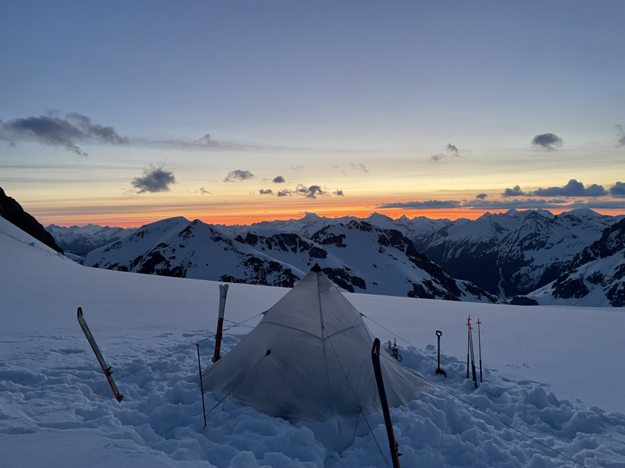
Waking up with the sun on Day 4
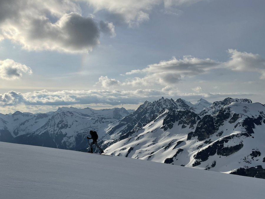
touring up the Suiattle with the Dakobed in the background
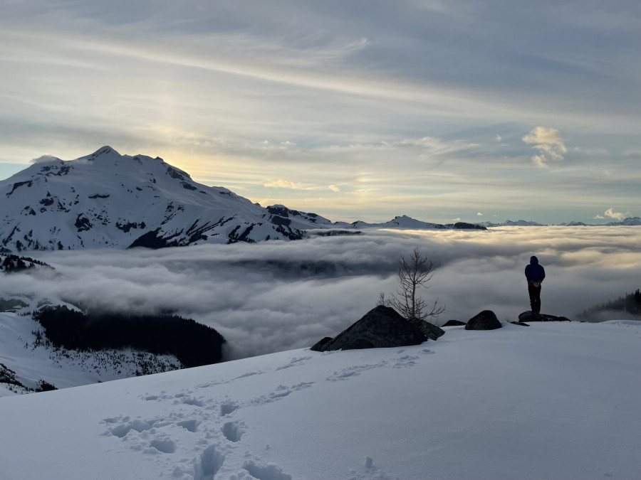
Day 2 camp, up above the clouds and deep in the North Cascades
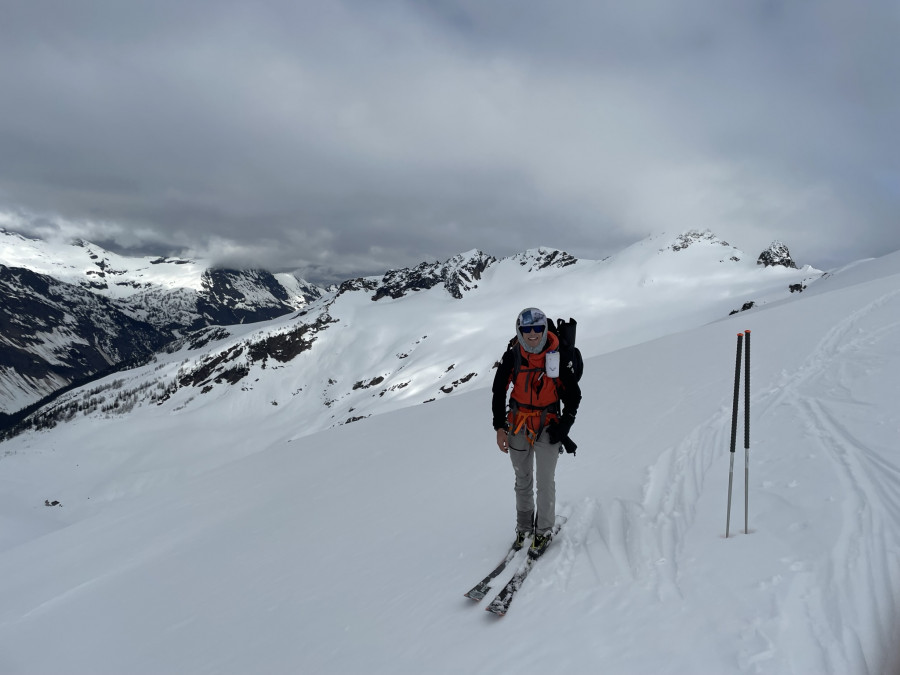
CJ before dropping into the Moth with the butterfly behind him
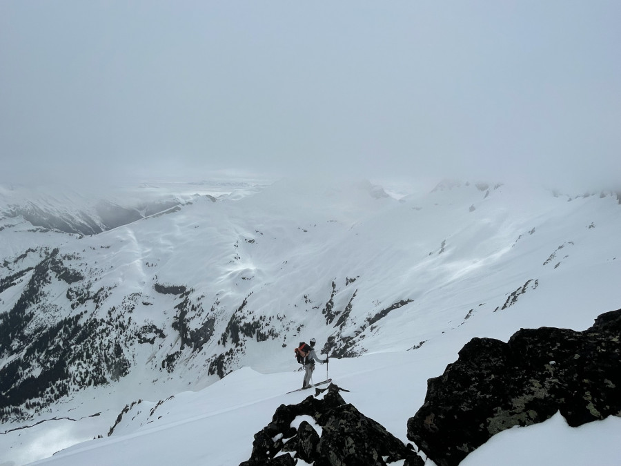
CJ high above Thunder Basin on Day 2, looking south
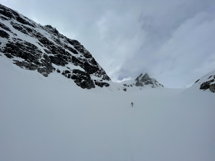
Walking up the Honeycomb with the west flanks of Tenpeak high above
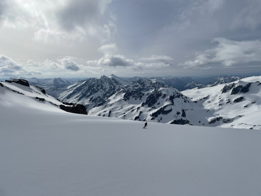
Skiing the Suiattle rarely disappoints
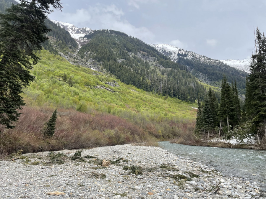
Boosh.
Crazy, amazing! Thanks
Great report - Thanks!
Rad, nice to see people sneaking a larger trip in a spring with so few windows.
Nice report! What shelter is that?
Thanks for the memories of that section of the White River "trail". Glad you made it and thanks for sharing the words and images!
Thank you for posting!
One of my favorite trips. However, we exited via Indian Creek which was relatively brush free about 10 years ago. This exit takes you through the White Chuck Glacier basin, over the ridge to White Pass, and then follows the PCT to Indian Creek.
@danthemtn-man its the hyperlite mid, using an old BD megamid carbon pole. Worked well!
@scottk, we looked at your old TR before going, thanks for sharing! We definitely had a much deeper snowpack that it sounds like your team did, but it sounds like you won the game on the snow/ski quality. I thought about exiting Indian creek when we hit the bush, but at that point the detour would have added an extra day to our trip as well. I also thought about trying to backtrack to the north fork of the Sauk (which is how I've entered the zone before), but we committed to the bush in white river and fortunately came out the other side relatively unscathed.
Old school TR! - loved the write up and pics.
You missed the trail after you crossed Thunder Cr. Where did you find that bear spray ? I had been through there a couple times and couldn't find it.
One should be careful about 11-year-old memories. I went back to my old trip report and decided I should be careful about overselling the Indian Creek exit. Travelling was great from White Pass to Reflection Lake, but we didn't enjoy the rest of the PCT to Indian Creek, or even the Indian Creek trail:
"This was the least fun section of the trip. It was steep traversing with hard sun-cupped snow, tight trees in places, a few patches of dry ground, and a couple incised gullies. It took us 2 hours to cover about 1 mile and I do not recommend it. We speculated that a better route would have involved skinning up the north facing slopes of the ridge coming down from Indian Head Peak to an elevation of about 6,400 ft and skiing down into Indian Creek on the other side. No one wants to climb 800 ft when the traverse looks so straightforward on the map, but it would have been more pleasant in retrospect.
The Skoog party was able to ski 3 miles down Indian Creek. We only got about 0.5 miles (to 4,500 feet) before we had to remove the skis and start walking. Finding the trail through the slide alder required some intricate GPS work and the next 5 miles or so was plagued with patchy snow, running water in the trail, avalanche debris, two shin-deep fords, and generally poor travelling conditions."
On the plus side, Lowell reports that the Reflection Lake to Indian Creek section was filled in and easy to travel when they did it and it was dry and presumably an easy carry when Jasen and Kyle did it with less snow. The transition period is always the worst. Even better, it looks like the Indian Creek Trail was recently brushed out by a WTA crew (https://www.wta.org/news/signpost/wtas-pro-crew-finishes-up-incredible-season)
@brad8379 yeah we initially missed it, but did eventually find the entrance into the alder on the west side of those slide paths. As I mentioned, we'd been relying on finding exposed, cut logs because the trail itself was still snow covered, and there is an old tread that is no longer maintained that we'd initially followed east after crossing thunder cr, but it just ends at the alder. There isn't any flagging on the thunder cr side of the maintained trail right now and all the downed alder pretty well obscured the trail. We found some bear spray maybe halfway through? Kinda hard saying really, just burried in the mud.
Reply to this TR
Please login first:
