May 24, 2011, Mt Rainier, Whitman Glacier
5/24/11
WA Cascades West Slopes South (Mt Rainier)
14914
11
May 24, 2011, Mt Rainier, Little Tahoma, Whitman Glacier from Paradise via Cowlitz Rocks
As has often happened during this exceptionally cool and wet Northwest spring, there was only a single day of decent weather forecast during the entire fourth week of May, with all other days expected to be cloudy and with precipitation. Even that one decent day, Tuesday, looked marginal at best: partly sunny with a chance of showers, snow level 5000 ft. However, the high-res UW weather model predicted that precip would end by early morning, cloud cover would dissipate by noon to sunny skies, and showed a true free-air freezing level of 8000 ft above an inversion layer. Four of us (Hannah, Jason, and Kyle) decided to head for the Mountain and aim in the direction of Little Tahoma, hoping to get above the clouds and ski some corn.
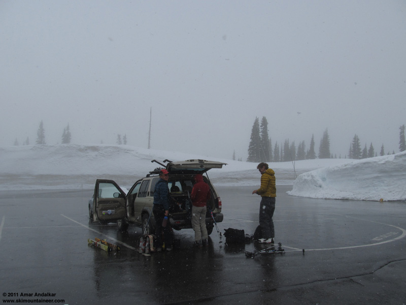
The drive from Seattle was mostly cloudy but featured a number of holes of blue sky, however as we neared the park the clouds thickened and rain was soon falling. That changed to snow by 4500 ft, and we arrived at Paradise to find 2" of new snow and continued steady snowfall. Much worse than expected based on any forecast, it looked miserable. We sat around in the car for a while, but a brief visit to the ranger station revealed some good news: the ranger had been on the radio with the climbing ranger at Camp Muir, who said it was sunny up there above the sea of clouds, and he could see the highest peaks of the Tatoosh (just under 7000 ft) occasionally as the clouds flowed by. Time to go -- we finally left Paradise well after 9am.
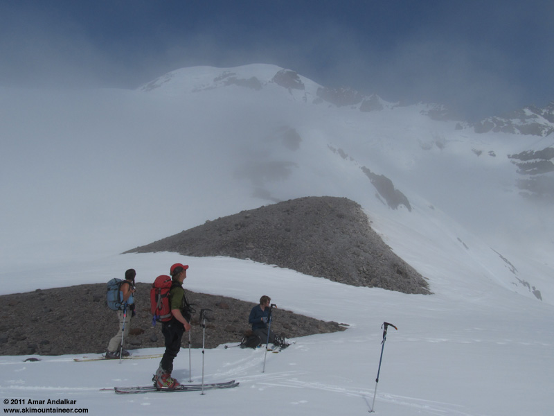
The Mountain unveiling itself as we reach the top of the cloud deck at the 7100 ft Cowlitz Rocks saddle.
We planned an unusual approach to the Little Tahoma area, forgoing the standard guidebook route from Paradise which crosses the Cowlitz and Ingraham Glaciers and their adjacent ridges between 8400 and 8800 ft to reach the Whitman Glacier. Instead, Jason suggested a route which he'd taken many years earlier, via Golden Gate to the toe of Paradise Glacier and the 7100 ft saddle just north of Cowlitz Rocks, then dropping down almost 1000 ft to the combined Cowlitz-Ingraham Glaciers and crossing to the moraine on the east side, then skinning up the prominent gully which leads to a bowl near 7600 ft just below the terminus of the Whitman Glacier, and following that glacier directly on up. This involves an extra descent and reascent of nearly 1000 ft (for a total gain of about 7700 ft from Paradise to the 11138 ft summit of Little Tahoma), but provides a much longer sustained ski descent of nearly 5000 vertical feet from the summit down to the Cowlitz-Ingraham. Moreover, the crevasse hazard is much less than the standard guidebook route, since the Cowlitz-Ingraham crossing near 6200 ft is nearly crevasse-free, very similar to crossing the Nisqually Glacier near that same elevation, while crossing those glaciers separately near 8400-8800 ft (above their major icefalls) involves much more exposure to huge gaping crevasses and smaller hidden ones. So the rope and glacier gear could stay at home without too much worry this time.
![]() http://www.skimountaineer.com/TR/Images2011/RainierCowlitzIngrahamPano2200-24May2011.jpg" />
http://www.skimountaineer.com/TR/Images2011/RainierCowlitzIngrahamPano2200-24May2011.jpg" />
(click to enlarge)
Four-shot panorama from the Cowlitz Rocks saddle, showing (left to right) Paradise Glacier, the summit, Cowlitz Glacier, Little Tahoma, Ingraham Glacier, the gully up the far side, the prominent eastern moraine, and the roughly 7000 ft cloud deck.
Progress hadn't been quick reaching the saddle, what with all the traversing, and it slowed even more after we descended to the Cowlitz-Ingraham and began skinning up past the moraine at noon. It was an oven down there, with intense heat reflecting off the snow and no wind, producing conditions far beyond what the modest actual air temperatures suggested -- one of our party said it felt as "hot as the surface of the sun", another said that it was "a million degrees". Eating large amounts of snow and stuffing it into our clothing provided only partial relief at most.
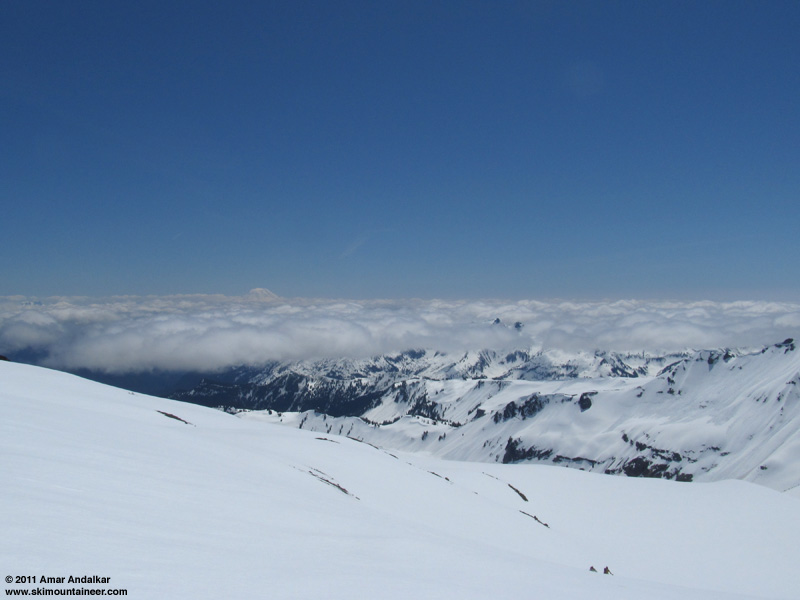
Skinning up the terminus of the Whitman Glacier near 7800 ft, with Mount Adams rising above the cloud deck in the distance.
It took a couple of hours to reach the terminus of the Whitman Glacier near 7800 ft, including a long break at 7300 ft to avoid heat stroke. The snow was extremely mushy from 6200-7800 ft, with much evidence of recent surface sluffs all around on steeper faces and rolls. Temps moderated above that point and a welcome breeze was blowing from the southwest, so progress quickened somewhat as snow conditions firmed up.
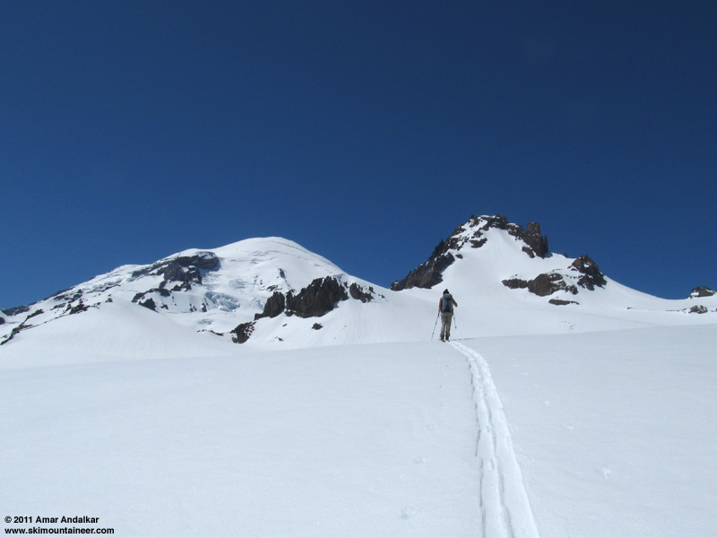
The summit dome and Little Tahoma rising above the Whitman Glacier.
Above 9000 ft, the breeze increased and grew quite cold, making it somewhat chilly all of the sudden. We skinned to 9500 ft by 3pm, where the slope steepened enough that it would be time to boot to ascend any higher. The snow surface was still soft, but quickly refreezing on this southeast aspect as the power and angle of the sun's rays had already begun to diminish. Hannah and I decided to ski down, hoping to catch the snow in decent shape before it soon became a horror show of icy breakable crust, while the other two were on a mission and determined to make the summit regardless of time or snow conditions.
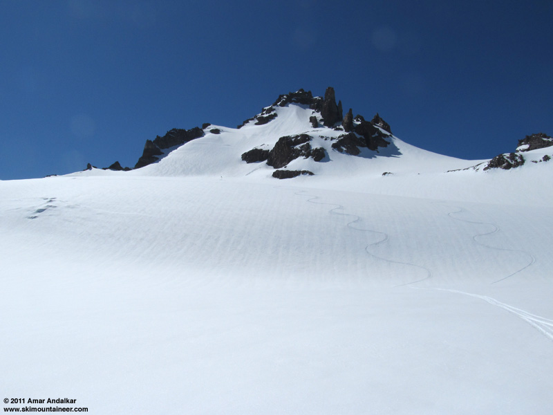
Our ski tracks on the Whitman Glacier below Little Tahoma.
We skied down at 3:30pm as the other two began the slow arduous bootpack upward, postholing deeply into the oversoftened snow. But the skiing was really good, much better than expected, soft consistent corn with no sticky sections, perfect for big GS turns on the gently rolling glacier.
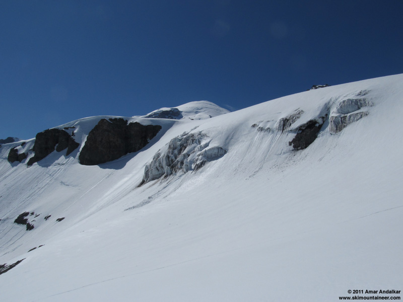
Ice cliffs near the terminus of Whitman Glacier, about 7800-8000 ft.
Snow stability was excellent except for the steeper bowl from 7500 down to 7000 ft, which had also been the hottest portion of the ascent. The uppermost 4-8" were moving easily here as we skied, setting off large slow-moving sluffs which joined older sluffs which had run a few days earlier before the previous night's light snowfall.
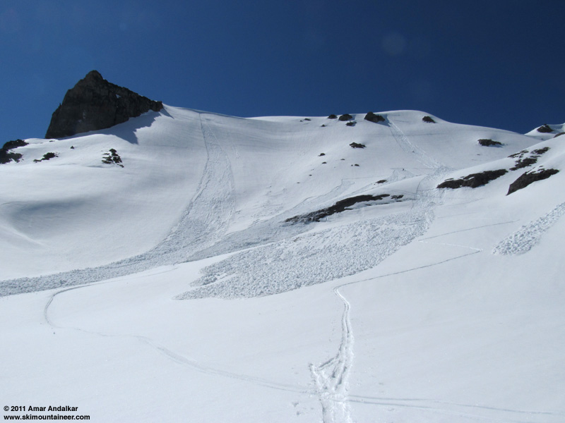
Sluffs just above 7000 ft, in the bowl below Whitman Glacier.
We reached the edge of the combined Cowlitz-Ingraham Glaciers by 4pm, and took an hour-long break on the flats, lying in the sun and melting some more water on the Jetboil. Looking up at the uppermost snowfield and summit ridge of Little Tahoma, we saw no sign of the other two even well after 5pm, using the 336mm zoom on my camera as an electronic telescope.
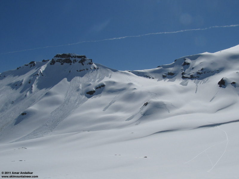
Our ski tracks from the morning from the saddle right of Cowlitz Rocks down to the combined Cowlitz-Ingraham Glaciers. All sluffs are older, not from this day.
This Cowlitz-Ingraham junction has been one of my favorite spots on Mount Rainier since I first visited it in September 2002. A grand cathedral of rock and ice towering above a sheltered plain, with great cliffs of layered lava flows, and the twin icefalls of the Cowlitz and Ingraham Glaciers pouring through the gaps they have carved to join into a single glacier filling the floor of the valley.
![]() http://www.skimountaineer.com/TR/Images2011/RainierCowlitzIngrahamLavaCliffPano2000-24May2011.jpg" />
http://www.skimountaineer.com/TR/Images2011/RainierCowlitzIngrahamLavaCliffPano2000-24May2011.jpg" />
(click to enlarge)
Three-shot panorama from the combined Cowlitz-Ingraham Glaciers near 6100 ft, showing (left to right) Anvil Rock, Cowlitz Glacier, the cliffy buttress at the end of Cathedral Rocks ridge, Ingraham Glacier, Little Tahoma, and a spectacular lava cliff with an avalanche pouring off it. Here the glacier has sliced deep into an ancient andesite lava flow, revealing the complicated columns and jointing within the core of the flow, formed only where the lava cooled slowly enough.
Soon the warm afternoon sunshine began to fade into evening, and it was time to put in a skin track back up to the Cowlitz Rocks saddle before the snow froze solid on this steeper northeast aspect. Easy going for the first part, then a bit more work as the slope steepened and the refreezing process was already well-advanced on the now-shadowed slope. We topped out on the saddle just after 6pm, back into the sunshine, now filtered by bands of high cirrus clouds moving in overhead. We finally caught a telescopic view of the other two on the summit ridge, it had taken them well over two-and-a-half hours to struggle the last 1600 vertical feet to the summit in difficult snow conditions. We were so glad that we had skied down when we did in good conditions, but also wishing that the whole group had left town about 2 hours earlier (I had awoken at "only" 4:30am this day, and left Seattle just after 5am) -- oh well, next time.
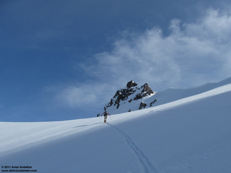
Skinning back up towards Cowlitz Rocks.
A quick cruise down the valley of the now-vanished lower Paradise Glacier, then a long and slightly rising traverse through the usual cornice and across to Golden Gate, just barely doable without skins in the slightly crusted and partially refrozen snow. More nice turns on the still-sunny southwest slopes into Edith Creek Basin, the corn just right in the second window of early evening, and we were back to Paradise by 7pm. It would be a long wait for the others, and luckily the Paradise Inn is now open for the season, so we could enjoy the cozy warmth and dinner inside instead of shivering in the car. They finally made it back just after 9pm in the fading twilight, having endured poor ski conditions just as expected, but with the reward of the summit and then skiing from just below it.
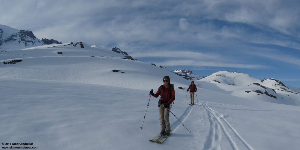
Two-shot panorama / multiple-exposure of Hannah skiing across Golden Gate.
It was a big day even for those who turned back, with 6100 ft of total gain, all of it skiable. This lower route to Whitman Glacier and Little Tahoma was fun to try, and I think I may prefer it to the high route (which I've only partially done). The low route offers much more fall-line skiing and even better scenery, at the cost of perhaps 1000-1500 ft of extra gain (depending on glacier conditions on the upper route, which affect how much up-down is needed to cross the Cowlitz near 8400 ft). The chance to visit the grand junction of the Cowlitz and Ingraham Glaciers is well worth it even without the fine ski terrain on the other side.
[hr][tt]MOUNT RAINIER RECREATIONAL FORECAST
NATIONAL WEATHER SERVICE SEATTLE WA
423 AM PDT TUE MAY 24 2011
SYNOPSIS...A WEAK UPPER LEVEL RIDGE WILL MOVE OVER THE REGION TODAY FOR NEAR NORMAL TEMPERATURES AND DRY CONDITIONS. RAIN WILL RETURN ON WEDNESDAY AS A FRONT MOVES INLAND. A LOW PRESSURE SYSTEM WILL KEEP THE WEATHER COOL AND SHOWERY INTO THE MEMORIAL HOLIDAY WEEKEND.
TUESDAY...PARTLY SUNNY WITH A CHANCE OF SHOWERS. SNOW LEVEL 5000 FEET.
TUESDAY NIGHT...MOSTLY CLOUDY. A CHANCE OF RAIN AND SNOW AFTER MIDNIGHT. SNOW LEVEL 7000 FEET.
WEDNESDAY...RAIN AND SNOW LIKELY. SNOW LEVEL 6500 FEET.
WEDNESDAY NIGHT...SHOWERS. SNOW LEVEL 5000 FEET.
THURSDAY...SHOWERS LIKELY. SNOW LEVEL 4500 FEET.
THURSDAY NIGHT AND FRIDAY...SHOWERS LIKELY. SNOW LEVEL 4500 FEET.
FRIDAY NIGHT...CLOUDY WITH A CHANCE OF SHOWERS. SNOW LEVEL 4000 FEET.
SATURDAY...SHOWERS LIKELY. SNOW LEVEL 3500 FEET.
SATURDAY NIGHT...CLOUDY WITH A CHANCE OF SHOWERS. SNOW LEVEL 4500 FEET.
SUNDAY AND SUNDAY NIGHT...CLOUDY WITH A CHANCE OF SHOWERS. SNOW LEVEL 5000 FEET.
MEMORIAL DAY...CLOUDY WITH A CHANCE OF SHOWERS. SNOW LEVEL 5000 FEET.
TEMPERATURE AND WIND FORECASTS FOR SELECTED LOCATIONS.
As has often happened during this exceptionally cool and wet Northwest spring, there was only a single day of decent weather forecast during the entire fourth week of May, with all other days expected to be cloudy and with precipitation. Even that one decent day, Tuesday, looked marginal at best: partly sunny with a chance of showers, snow level 5000 ft. However, the high-res UW weather model predicted that precip would end by early morning, cloud cover would dissipate by noon to sunny skies, and showed a true free-air freezing level of 8000 ft above an inversion layer. Four of us (Hannah, Jason, and Kyle) decided to head for the Mountain and aim in the direction of Little Tahoma, hoping to get above the clouds and ski some corn.

The drive from Seattle was mostly cloudy but featured a number of holes of blue sky, however as we neared the park the clouds thickened and rain was soon falling. That changed to snow by 4500 ft, and we arrived at Paradise to find 2" of new snow and continued steady snowfall. Much worse than expected based on any forecast, it looked miserable. We sat around in the car for a while, but a brief visit to the ranger station revealed some good news: the ranger had been on the radio with the climbing ranger at Camp Muir, who said it was sunny up there above the sea of clouds, and he could see the highest peaks of the Tatoosh (just under 7000 ft) occasionally as the clouds flowed by. Time to go -- we finally left Paradise well after 9am.

The Mountain unveiling itself as we reach the top of the cloud deck at the 7100 ft Cowlitz Rocks saddle.
We planned an unusual approach to the Little Tahoma area, forgoing the standard guidebook route from Paradise which crosses the Cowlitz and Ingraham Glaciers and their adjacent ridges between 8400 and 8800 ft to reach the Whitman Glacier. Instead, Jason suggested a route which he'd taken many years earlier, via Golden Gate to the toe of Paradise Glacier and the 7100 ft saddle just north of Cowlitz Rocks, then dropping down almost 1000 ft to the combined Cowlitz-Ingraham Glaciers and crossing to the moraine on the east side, then skinning up the prominent gully which leads to a bowl near 7600 ft just below the terminus of the Whitman Glacier, and following that glacier directly on up. This involves an extra descent and reascent of nearly 1000 ft (for a total gain of about 7700 ft from Paradise to the 11138 ft summit of Little Tahoma), but provides a much longer sustained ski descent of nearly 5000 vertical feet from the summit down to the Cowlitz-Ingraham. Moreover, the crevasse hazard is much less than the standard guidebook route, since the Cowlitz-Ingraham crossing near 6200 ft is nearly crevasse-free, very similar to crossing the Nisqually Glacier near that same elevation, while crossing those glaciers separately near 8400-8800 ft (above their major icefalls) involves much more exposure to huge gaping crevasses and smaller hidden ones. So the rope and glacier gear could stay at home without too much worry this time.
(click to enlarge)
Four-shot panorama from the Cowlitz Rocks saddle, showing (left to right) Paradise Glacier, the summit, Cowlitz Glacier, Little Tahoma, Ingraham Glacier, the gully up the far side, the prominent eastern moraine, and the roughly 7000 ft cloud deck.
Progress hadn't been quick reaching the saddle, what with all the traversing, and it slowed even more after we descended to the Cowlitz-Ingraham and began skinning up past the moraine at noon. It was an oven down there, with intense heat reflecting off the snow and no wind, producing conditions far beyond what the modest actual air temperatures suggested -- one of our party said it felt as "hot as the surface of the sun", another said that it was "a million degrees". Eating large amounts of snow and stuffing it into our clothing provided only partial relief at most.

Skinning up the terminus of the Whitman Glacier near 7800 ft, with Mount Adams rising above the cloud deck in the distance.
It took a couple of hours to reach the terminus of the Whitman Glacier near 7800 ft, including a long break at 7300 ft to avoid heat stroke. The snow was extremely mushy from 6200-7800 ft, with much evidence of recent surface sluffs all around on steeper faces and rolls. Temps moderated above that point and a welcome breeze was blowing from the southwest, so progress quickened somewhat as snow conditions firmed up.

The summit dome and Little Tahoma rising above the Whitman Glacier.
Above 9000 ft, the breeze increased and grew quite cold, making it somewhat chilly all of the sudden. We skinned to 9500 ft by 3pm, where the slope steepened enough that it would be time to boot to ascend any higher. The snow surface was still soft, but quickly refreezing on this southeast aspect as the power and angle of the sun's rays had already begun to diminish. Hannah and I decided to ski down, hoping to catch the snow in decent shape before it soon became a horror show of icy breakable crust, while the other two were on a mission and determined to make the summit regardless of time or snow conditions.

Our ski tracks on the Whitman Glacier below Little Tahoma.
We skied down at 3:30pm as the other two began the slow arduous bootpack upward, postholing deeply into the oversoftened snow. But the skiing was really good, much better than expected, soft consistent corn with no sticky sections, perfect for big GS turns on the gently rolling glacier.

Ice cliffs near the terminus of Whitman Glacier, about 7800-8000 ft.
Snow stability was excellent except for the steeper bowl from 7500 down to 7000 ft, which had also been the hottest portion of the ascent. The uppermost 4-8" were moving easily here as we skied, setting off large slow-moving sluffs which joined older sluffs which had run a few days earlier before the previous night's light snowfall.

Sluffs just above 7000 ft, in the bowl below Whitman Glacier.
We reached the edge of the combined Cowlitz-Ingraham Glaciers by 4pm, and took an hour-long break on the flats, lying in the sun and melting some more water on the Jetboil. Looking up at the uppermost snowfield and summit ridge of Little Tahoma, we saw no sign of the other two even well after 5pm, using the 336mm zoom on my camera as an electronic telescope.

Our ski tracks from the morning from the saddle right of Cowlitz Rocks down to the combined Cowlitz-Ingraham Glaciers. All sluffs are older, not from this day.
This Cowlitz-Ingraham junction has been one of my favorite spots on Mount Rainier since I first visited it in September 2002. A grand cathedral of rock and ice towering above a sheltered plain, with great cliffs of layered lava flows, and the twin icefalls of the Cowlitz and Ingraham Glaciers pouring through the gaps they have carved to join into a single glacier filling the floor of the valley.
(click to enlarge)
Three-shot panorama from the combined Cowlitz-Ingraham Glaciers near 6100 ft, showing (left to right) Anvil Rock, Cowlitz Glacier, the cliffy buttress at the end of Cathedral Rocks ridge, Ingraham Glacier, Little Tahoma, and a spectacular lava cliff with an avalanche pouring off it. Here the glacier has sliced deep into an ancient andesite lava flow, revealing the complicated columns and jointing within the core of the flow, formed only where the lava cooled slowly enough.
Soon the warm afternoon sunshine began to fade into evening, and it was time to put in a skin track back up to the Cowlitz Rocks saddle before the snow froze solid on this steeper northeast aspect. Easy going for the first part, then a bit more work as the slope steepened and the refreezing process was already well-advanced on the now-shadowed slope. We topped out on the saddle just after 6pm, back into the sunshine, now filtered by bands of high cirrus clouds moving in overhead. We finally caught a telescopic view of the other two on the summit ridge, it had taken them well over two-and-a-half hours to struggle the last 1600 vertical feet to the summit in difficult snow conditions. We were so glad that we had skied down when we did in good conditions, but also wishing that the whole group had left town about 2 hours earlier (I had awoken at "only" 4:30am this day, and left Seattle just after 5am) -- oh well, next time.

Skinning back up towards Cowlitz Rocks.
A quick cruise down the valley of the now-vanished lower Paradise Glacier, then a long and slightly rising traverse through the usual cornice and across to Golden Gate, just barely doable without skins in the slightly crusted and partially refrozen snow. More nice turns on the still-sunny southwest slopes into Edith Creek Basin, the corn just right in the second window of early evening, and we were back to Paradise by 7pm. It would be a long wait for the others, and luckily the Paradise Inn is now open for the season, so we could enjoy the cozy warmth and dinner inside instead of shivering in the car. They finally made it back just after 9pm in the fading twilight, having endured poor ski conditions just as expected, but with the reward of the summit and then skiing from just below it.

Two-shot panorama / multiple-exposure of Hannah skiing across Golden Gate.
It was a big day even for those who turned back, with 6100 ft of total gain, all of it skiable. This lower route to Whitman Glacier and Little Tahoma was fun to try, and I think I may prefer it to the high route (which I've only partially done). The low route offers much more fall-line skiing and even better scenery, at the cost of perhaps 1000-1500 ft of extra gain (depending on glacier conditions on the upper route, which affect how much up-down is needed to cross the Cowlitz near 8400 ft). The chance to visit the grand junction of the Cowlitz and Ingraham Glaciers is well worth it even without the fine ski terrain on the other side.
[hr][tt]MOUNT RAINIER RECREATIONAL FORECAST
NATIONAL WEATHER SERVICE SEATTLE WA
423 AM PDT TUE MAY 24 2011
SYNOPSIS...A WEAK UPPER LEVEL RIDGE WILL MOVE OVER THE REGION TODAY FOR NEAR NORMAL TEMPERATURES AND DRY CONDITIONS. RAIN WILL RETURN ON WEDNESDAY AS A FRONT MOVES INLAND. A LOW PRESSURE SYSTEM WILL KEEP THE WEATHER COOL AND SHOWERY INTO THE MEMORIAL HOLIDAY WEEKEND.
TUESDAY...PARTLY SUNNY WITH A CHANCE OF SHOWERS. SNOW LEVEL 5000 FEET.
TUESDAY NIGHT...MOSTLY CLOUDY. A CHANCE OF RAIN AND SNOW AFTER MIDNIGHT. SNOW LEVEL 7000 FEET.
WEDNESDAY...RAIN AND SNOW LIKELY. SNOW LEVEL 6500 FEET.
WEDNESDAY NIGHT...SHOWERS. SNOW LEVEL 5000 FEET.
THURSDAY...SHOWERS LIKELY. SNOW LEVEL 4500 FEET.
THURSDAY NIGHT AND FRIDAY...SHOWERS LIKELY. SNOW LEVEL 4500 FEET.
FRIDAY NIGHT...CLOUDY WITH A CHANCE OF SHOWERS. SNOW LEVEL 4000 FEET.
SATURDAY...SHOWERS LIKELY. SNOW LEVEL 3500 FEET.
SATURDAY NIGHT...CLOUDY WITH A CHANCE OF SHOWERS. SNOW LEVEL 4500 FEET.
SUNDAY AND SUNDAY NIGHT...CLOUDY WITH A CHANCE OF SHOWERS. SNOW LEVEL 5000 FEET.
MEMORIAL DAY...CLOUDY WITH A CHANCE OF SHOWERS. SNOW LEVEL 5000 FEET.
TEMPERATURE AND WIND FORECASTS FOR SELECTED LOCATIONS.
Nice report Amar very detailed. What a long ass walk. To bad White River was not open yet so you could make it a traverse. It is great to see all the snow that's in that area!
I agree that the Cowlitz area is especially nice for aesthetics.
It's amazing how hot it can get on snow, especially when we have been so shy of sun this spring. I remember putting piles of snow on my head held in place by the rim of my visor on one of those exhausting heat fests.
I agree that the Cowlitz area is especially nice for aesthetics.
It's amazing how hot it can get on snow, especially when we have been so shy of sun this spring. I remember putting piles of snow on my head held in place by the rim of my visor on one of those exhausting heat fests.
cool .. watched you guys on spot -- and the mountain cam (the morning soup looked ominous but then was glad to see it clear up) .. it was a loooong day, esp for kyle and jace .. but it looks gorgeous up there .. a sweet window ... nice reporting -- very informative as always
great day!
was jealous when I got home and was checking out the blue skys on the web cam.
was jealous when I got home and was checking out the blue skys on the web cam.
Sweet trip! It sure was a nice day up there Tuesday.
You find that the UW model works well? Obviously on that day they nailed it pretty well....Could you provide a link to where you are getting the info you quoted in the TR? I looked around the UW site and found some products but nothing that looked to give me cloud cover and FL for a selected area. Thanks!
Nice report ! That's my favorite area as well. were you able to keep skis on all the way up to the Whitman?
Joe is right on about a good traverse to White river rd. Gary Vogt has often tried to get me to do it.
Joe is right on about a good traverse to White river rd. Gary Vogt has often tried to get me to do it.
author=Robie link=topic=20954.msg89509#msg89509 date=1306470398]
Joe is right on about a good traverse to White river rd. Gary Vogt has often tried to get me to do it.
Well maybe this is the year. I can start on my side. You guys start on your side. Exchange keys in the middle and drive to a meeting spot in between.
author=JasonGriffith link=topic=20954.msg89508#msg89508 date=1306469860]
You find that the UW model works well? Obviously on that day they nailed it pretty well....Could you provide a link to where you are getting the info you quoted in the TR? I looked around the UW site and found some products but nothing that looked to give me cloud cover and FL for a selected area. Thanks!
Is this what your looking for? I've found it to be really accurate. I sure was glad to get above the clouds on Tuesday. By 12pm they had burned off.
http://www.atmos.washington.edu/data/rainier_report.html
author=Robie link=topic=20954.msg89509#msg89509 date=1306470398">
Nice report ! That's my favorite area as well. were you able to keep skis on all the way up to the Whitman?
Joe is right on about a good traverse to White river rd. Gary Vogt has often tried to get me to do it.
Skis were on all the way from Paradise up to 9500 ft on Whitman Glacier. Although it steepens significantly there, it would certainly have been possible to skin much higher by cutting lots of switchbacks. Some have gone nearly to the summit of Little Tahoma given good skinning conditions. From The Challenge of Rainier, p. 192: In April 1933, Paul Gilbreath and J. Wendell Trosper made a ski ascent and descent of the peak. According to Trosper, the two used skis to "within 8 feet of the top." The author notes that this was "a delicate feat considering the high angle of the upper several hundred feet of the peak."
author=JasonGriffith link=topic=20954.msg89508#msg89508 date=1306469860">
You find that the UW model works well? Obviously on that day they nailed it pretty well....Could you provide a link to where you are getting the info you quoted in the TR? I looked around the UW site and found some products but nothing that looked to give me cloud cover and FL for a selected area. Thanks!
Well, the UW model didn't nail the continuing precip in the morning very well, the timing was off by 3-6 hours -- but getting accurate timing and quantity of precip is very difficult. It did very well overall, and usually does so in general. It's far superior to any other available forecast tool for the Pacific Northwest mountains (that I know of).
All model output is linked from http://www.atmos.washington.edu/mm5rt/. It's intended for meteorologists and not very user-friendly for the general public, but the pages here http://www.atmos.washington.edu/mm5rt/descript/descript_main.html do explain what the graphics show. Over several years of use, I've only figured out how to use a few key things, and I'm probably still overlooking or unaware of much else that might be useful in self-forecasting mountain weather here.
Click on "Past runs" under WRF-GFS at upper left on the main page, to go to http://www.atmos.washington.edu/mm5rt/rt/otherdates.html, then choose the model run you want (the latest run may be incomplete, check run status on the main page). The entries under "Standard Page" link to almost all of the model output, but soundings are under a separate column.
On the standard page, scroll down to "12km Cloud" and "4km Cloud" to get predicted cloud cover, the "Column-integrated cloud water" gives total expected clouds at all levels.
The freezing levels can be read off from soundings near your intended location, or (much more useful) mentally calculated from the 12km 850 mb, 12km 700 mb, and 12km 500mb "heights, temperature, winds" graphics if you realize that every 2 °C contour is roughly equivalent to about 1000 ft difference of freezing level from the 500 mb (about 18000 ft), 700 mb (about 10000 ft), or 850 mb (about 5000 ft) pressure surface. So basically, taking the 700 mb graphics as an example, the 0 °C contour is roughly a contour of 10000 ft freezing level, the +2 °C contour is 11000 ft FL, -2 °C is 9000 ft FL, etc. The reason this works is that 2 °C = 3.6 °F, and the lapse rate in the standard atmosphere is 3.5 °F per 1000 ft, so it is fairly accurate, certainly within a few hundred ft -- by the time you get to contours more than 8 °C away from zero, it's best to switch to the next higher (500 mb) or lower (850 mb) plot to continue getting accurate values of the FL.
This procedure may be difficult at first, but eventually becomes easy and intuitive to do with practice. I use this method with the 700 mb graphics daily, occasionally checking the 500 mb or 850 mb as a supplement. These graphics also give the winds aloft, which are most critical to ski conditions and mountaineering success on high peaks in my experience.
Hope that's enough to get you started.
Nice TR, Amar, looks like it was a gorgeous day. I'm a grad student in the UW Atmospheric Science department, so if anyone's got questions regarding the model output or anything else that they'd like me to take a stab at answering, I'm always happy to do so.
Thanks for the weather links and explanation Amar! I think Cliff Mass is going to start doing some forecasts via youtube and, at least on the pilot one, he used some of the products found the UW site. Maybe he'll start to unlock some of the secrets, but until then you have given me a good start.
Reply to this TR
Please login first:
