Whistler to Garibaldi Ski Traverse
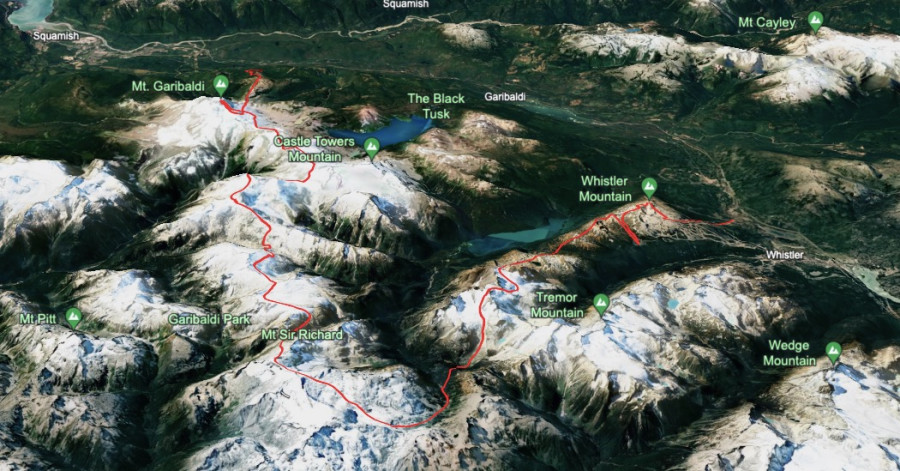
During an excellent stretch of weather in the British Columbia Coast Range last week, Manny Pacheco and I skied from the Whistler Ski Area to Brohm Ridge, close to Squamish. We made our traverse over the course of four days and three nights, hauling heavy packs across some incredible alpine terrain and a vast, remote wilderness. In total we traveled over 50 miles and 20,000 feet of elevation gain, crossing 15 named glaciers, borrowing sections of the Spearhead Traverse and McBride traverse and culminating in an ascent of Nch’Kay / Garibaldi.
On day one we left Bellingham, Washington at 6:00 AM in one car with skis, a bike and a creative plan for a car shuttle. We made good time across the border and the sometimes gridlocked highways of Vancouver, BC, and after a mandatory pre-trip Tim Hortons stop we were on the move from Squamish by 9:00. I was unsure which exit from the icefield would make the most sense to stash a car, and ultimately decided on Brohm ridge. Brohm was a failed ski resort development from the 1950s, and is seemingly again being proposed as a year round destination resort pending environmental assessment, permitting and funding. As it currently exists, it’s a maze of logging roads, trails and clear cuts, maintained by the Black Tusk Snowmobile Club during the winter months with groomed roads leading straight into the alpine. I envisioned skiing perfect cord all the way down to my car, a welcome change from a Cascadian jungle thrash exit. There were two possible road options, the Brohm Creek FSR and Brohm Ridge FSR, and after dropping Manny and our gear on the side of Highway 99 I chose to drive up the creek road, a decision that would prove significant a few days later…
The road up was steep and rocky, and at an especially rutted out section I found a group of skiers from Colorado whose car couldn’t drive any further. I told them to hop in, passing along the karma after getting a hitch up the Twin Peaks road a week prior. But after loading all their stuff we still got stopped by a thick snowbank a few minutes later, so I wished them good luck, parked my car at 2700’, and had a ripping bike ride back down to the highway. I hid my bike in the forest, locked it to a tree, and covered it up with moss and vegetation. Manny and I then intended to hitchhike to the lifts, and immediately got a hook as the second car we signaled pulled off. We had landed a friendly expat Kiwi working the winter as a bouncer at a club in Whistler, who was happy to share with us 30 minutes of stories mainly about the seedy underbelly of the nightlife scene. He told us all about how members of the Mexican Cartels love to visit Whistler, but they are usually on their best behavior on vacation and spend lavishly on bottle service. He dropped us off at Creekside village, and we hopped on the gondola and up the mountain. A nice gentleman on vacation from Dublin, Ireland was befuddled by our giant packs and plans to sleep out in the mountains, at one point asking us “if there were any piste to camp on” where we were headed. We rode Peak Chair to the top, getting eyes on swirling clouds on the mountains we intended to traverse with Garibaldi looming impossibly far in the distance.
We ripped a groomer down to Symphony, got our final free vertical boost up, and then the adventure had begun for real as we started to skin across the musical bumps around noon. Low angle refrozen chunder skied poorly down Flute and Oboe summits, and we climbed from Singing Pass stopping for a lunch break at the boujee Kees and Clare hut. Day one had a mixed weather forecast, and as we skinned up Whirland Col we found ourselves in a full white out. During a break in the clouds we skied some pow across the Overlord glacier, and skinned up the shockingly tracked out slopes from all the folks who had skied the Spearhead traverse recently. We topped out just below the summit of Mount Benvolio at 8500’, again getting an incredible view of the massive terrain still to come, as well as the 4000’ ski ahead of us down into the Cheakamus river. We dropped off onto the Diavolo glacier, skiing some wind affected snow down into the plateau where our path would diverge from the Spearhead.
I thought the ski down the icefall on the Diavolo was a possible crux of our route, with somewhat annoying detours possible around Iago or the apt-named detour ridge. Some tracks did lead down skiers left on the steep east facing slopes adjacent to the icefall, and we cautiously followed them down over the roll. In corn conditions this descent would have been great, but the cool temps and clouds that day left it firm and frightening to ski as we pieced our way down complex terrain laden with cliffs and avy debris. We made it down in one piece, and the tracks led us to a camp with four very friendly Aussies who were also skiing the McBride traverse, albeit at a much more reasonable pace over the course of 6 days. Jealous that they were enjoying a nice sunset dinner but knowing we had to continue on, we departed past the last humans or tracks we would see for days and made a short skin up before dropping into the valley and hastily setting up camp by the river at twilight. I discovered I had lost one of my down booties off my backpack, likely somewhere in the ski resort. Worked from our giant packs, frustrated by the poor snow conditions, intimidated by the distance to cover; morale was low as we wondered what the f*&% we had gotten ourselves into.
Day one stats: 5000’ climbed, 8000’ skied.
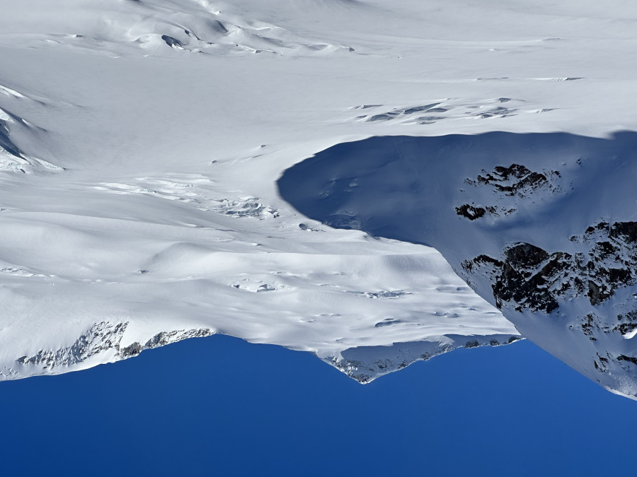
We woke up on day two in slightly better spirits, packed up camp and made quick work up the Cheakamus river valley. Even on a lower snow year the snowpack was still nicely filled in at this elevation in mid April, and we cruised up the flats skirting around the meandering river and some monstrous piles of avalanche debris from the slopes above. The Avalanche Canada forecast for the trip was low danger with no avalanche problems, and it was definitely a weight off to not have to worry much about snow sliding on me this trip. I was caught and carried in an avalanche in Canada two years ago, and I wouldn’t say it was a fun experience. A hazard we were more focused on this time around was glacier travel and crevasse rescue, especially as a team of two in such a remote place where we knew we had to be truly self-sufficient. At the head of the valley was the massive McBride Glacier, and we roped up at the moraine and began plodding up the low angle slopes finding a path around the crevasses. Coverage was good with slots well bridged, and we slogged our way up the 3000’ climb with no issues. From the shoulder the summit of Mount Sir Richards was not far off the route, and I had intended for this to be our first side mission to ski the West face, but the snow looked funky and we had a lot of ground left to cover so we opted to just eat a tasty snack and traverse out across the Ubyssey glacier.
After another short climb, we were treated to a fantastic run down to Wolverine pass. Junk snow up top quickly gave way to perfect corn, and the setting here was outrageous looking across expansive, remote icefields. One peak in particular caught my eye, Mount Pitts lay smack dab in the center of Garibaldi Provincial Park, many days of walking from the nearest road, with an incredible spine covered North face. Re-energized by actually enjoyable skiing in a magical place, we continued on with another short climb and ski over the pass, and then a long, gradual climb under some cliffs and up the flat Snow Bowl Glacier. With the perfect, windless weather, I suggested we stop for camp earlier than planned, high in the alpine. This would allow us to actually have some time to relax at camp and enjoy the views. We stopped for the day high on the ridge, smoked a joint, ate dinner, and enjoyed the sunset. Everything was great until it wasn’t; as soon as we laid down to sleep the winds picked up and the temps dropped. Manny was sleeping in a flimsy pyramid temp borrowed from our friend lil Will, and I was open bivvying on a tarp in a hole I dug in the snow. The wind blew around dry snow and caught the tent like a sail making a raucous all night, and I just hunkered deep into my sleeping bag and had a cold night high in the alpine.
Day two stats: 6500’ climbed, 3500’ skied
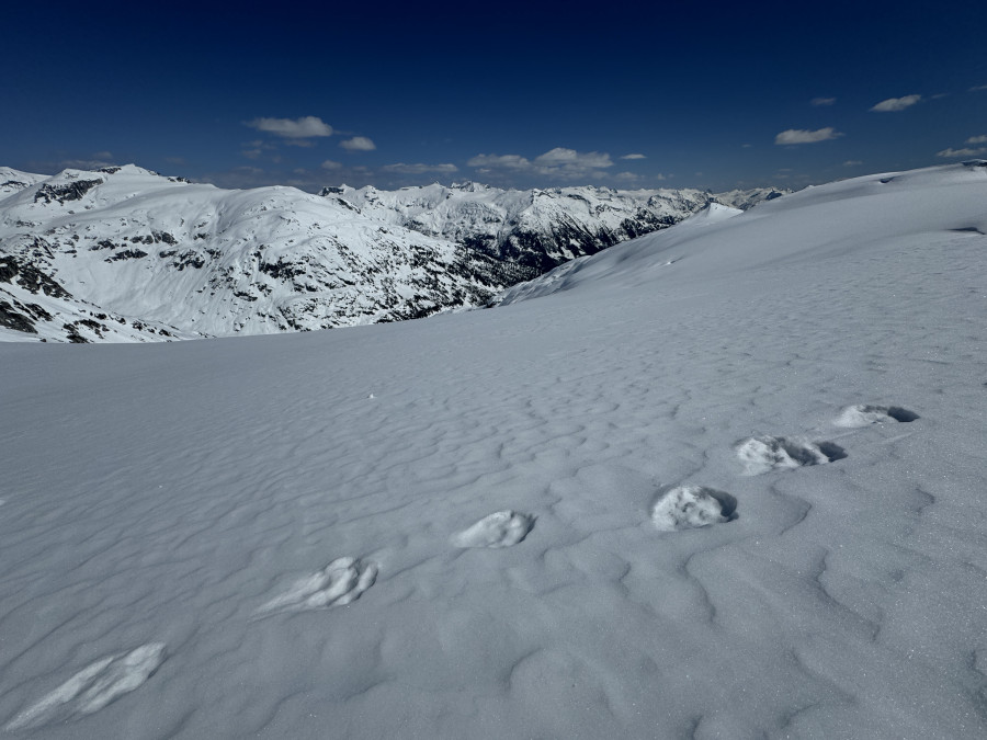
On day three the winds were still blowing in the morning, so we skipped making breakfast and skied down onto the Forger Glacier. This glacier was steep and heavily crevassed and reminded me of something you’d find around Cascade River Road. We roped up and climbed across the slope, and then skied a long, winding descent down nice north facing wind buff into some frozen west facing steeps into some rolling slopes above Drop Pass. At the pass we cooked up some breakfast and water and gave our next climb time to soften up. The traverse to Sinister Peak was not nearly as sinister as other trip reports had made it out to be, for us it was pretty easy skinning up. But it was definitely exposed, and after gaining the ridge there was an improbable path up and over a big cornice and a short but very steep chute which we skied in good corn conditions. From here we skinned around Hour peak, where we found a recent bear track heading in the same direction as us. The bear had even set a perfect skin track contouring around the glacier. Thanks Mr. Bear!
The walk around Hour Peak and Crosscut was extremely pleasant; the glaciers here were mellow and completely filled in, so we felt content walking unroped at our own pace, playing some music, enjoying the scenery. We looked out across golden light over the Salish Sea, Sky Pilot and the Mamquam Icefield, and to the South could see as far as the more familiar giants. I could faintly make out the Coleman Headwall on Kulshan and the North Face on Shuksan, two big lines that Manny and I had skied together this season. Pursuing big mountain backcountry skiing can be really dangerous and difficult at times, but in this moment it felt more zen and relaxed. The apprehension of the days prior faded away, as it felt like we had exposed ourselves to minimal risk this trip and were on our way to actually doing the whole thing. As we got closer and closer to the next giant on our list, the mighty Nch’Kay, I felt like I was exactly where I needed to be.
My sentimental reflection came to an abrupt end as we dropped into some heinous breakable crust past the notch, followed by a really unpleasant climb up the side of Mount Carr. Manny led us up some treacherous skinning, and we finally topped out at the Bookworms with a gorgeous view out across Garibaldi Lake and the Black Tusk. At this point we were racing daylight yet again, and a huge fall line descent straight to the Burton Hut looked really appealing. But we stuck to our plan to have enough time for a summit the next day, and traversed above some beautiful powder runs under the Sphinx to drop us just below Sphinx col. This felt like a waste, and ideally you would have time to ski a lap or even better summit Mount Carr or Castle Towers and ski a cool line over there. But we had places to be, and the ski down from the col was a bit too late to be glorious sunset corn and instead was more like a firm but smooth groomer. We set up our final camp on the Phoenix glacier and dug another open bivy, this one proving to be much more warm and protected from the wind than the night before. I slept like a rock.
Day three stats: 5500’ climbed, 7000’ skied
On day four we woke up to clear skies and no wind. This clear weather window had really delivered as forecasted. The final day of a bigger trip like this is always bittersweet, because on one hand you are relieved to have made it and are so close to nice things like sleeping in your own bed and pooping in a toilet (I actually never pooped on the traverse), but on the other hand the adventure is already coming to an end and you have to go back to the real world. Before all that we had a mountain to climb, and we packed up and skinned across the Phoenix and Sentinel glaciers around Glacier Pikes, and then skied down past the Neve traverse route and the first human tracks we had seen since the Diavolo. From here we skinned up the Warren glacier to the tracks from Brohm where we dug a small hole, filling it with our sleeping bags, stove, ect.. With our newly lightened backpacks and a skin track to follow, suddenly we could fly up the mountain. In no time at all we found ourselves approaching the Northeast headwall of Mount Garibaldi. As a quick aside, Giuseppe Garibaldi was an Italian war general from the 1800s who never stepped foot in Canada. I wasn’t quite sure what to call our route; it shares a lot of terrain of the McBride traverse, but the McBride usually starts at Blackcomb and ends at Rubble Creek. I wanted to call it Whistler to Squamish, but we didn’t quite make it all the way to Squam. The massive standalone volcano at the end is the grand finale, but again it’s named after some random Italian dude. I settled on the mountain is Nch’Kay, the local name, and I’m calling my route Whistler to Garibaldi because it traverses all across the beautiful park of the same name. Now we just had to stand on the summit.
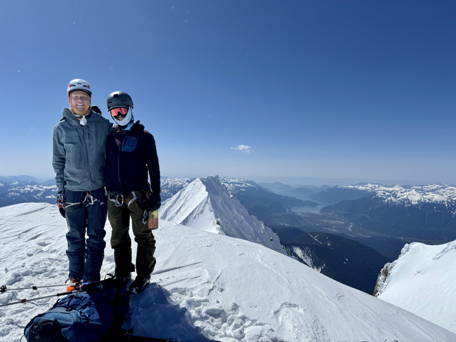
It was a busy day out and several parties were also gunning for the top. We passed several people on the skin up the headwall and then switched to booting, where we followed some Squamish locals straight to the top. The view was absolutely stunning. A sea of peaks and ice in all directions, and the ocean directly below. The Sea to Sky is still one of the absolute coolest places I’ve ever been, and it felt pretty special to see it from the top for the first time via such a long approach. Atwell Peak stole the show with its Alaskan spines and terrifying ‘Siberian Express’ ski line, and we could spot highpoints from our whole traverse in the distance. After chilling on the summit for awhile it was time to click into our skis and head home. We skied a couloir variation off the lookers right of the summit, which was initially icy and exposed but then opened up to glorious, untracked, sunny powder on the right side of the face. We made huge GS turns all the way down, until the aspect changed and the snow turned back into crust, but within a few minutes we were back at our gear cache. Success! We repacked and skinned out towards the ridge, where we made a series of traversing descents and short climbs across Brohm ridge. The ridge was covered with snowmobile tracks, and the views were still outstanding with the Tantalus range now right in front of us. I led us down a subridge to what I thought would be a groomed road, where things went to shit.
As it turns out, the left branch of the Brohm Creek FSR where our car was parked has another fork and the side I was taking us down had not been maintained in many years. So where my map showed a road, there was in fact thick slide alder and other vegetation. Our options here were grim, we could either bushwack down several miles of that or skin 1500’ back up to the correct road, adding another climb at the end of what had already been a marathon of marathons. I felt especially bad because Manny had a 4:00 AM wake up the next morning for a BoeAlps trip, and had asked to try to get home at a semi-reasonable time. It was now 4:00 pm, and we were totally stranded due to my poor beta. Both options were terrible and our trip was in shambles right at the end. We instead chose a third option, which was to ski down a mountain bike trail called ‘Alpine Capone’ which thankfully had just enough snow on it to get us down 1000’ and onto the Cheekye FSR. Phew. We skied road and then walked road and then before you knew it we were at my car and the trip was over. I drove down, had a poop, grabbed my bike, and went straight back for another Tim Hortons visit. What an epic trip.
Day four stats: 4000’ climbed, 7000’ skied
The Whistler to Garibaldi traverse is not for everyone, and it was definitely a lot of work for not that much good skiing. But it's also a grand adventure through untouched wilderness with mind melting views and minimal objective hazards when the route is in good condition. So would I recommend it? Absolutely. Our timeline of four days felt a little rushed, and if you want to tack on some side trips I would definitely budget a bit more time. If you’re a real sicko I could maybe imagine doing it in a single push, but that’s not for me. And to get the full full value you should ski all the way from Pemberton to Squamish. But all in all, I’m proud of what we did, and the style we did it in, and more than anything grateful to have experienced it. Trips like this stick with you longer, and I’m certain this one will be with me for the rest of my life.
Video: https://drive.google.com/file/d/1aKez2rsXgnfxWmas0La41guTzmhnV3ct/view?usp=sharing
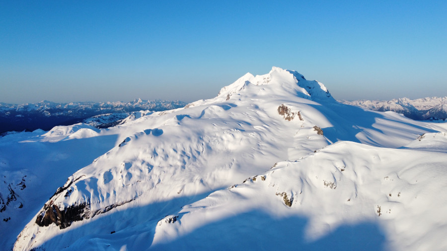
Nch'Kay
The McBride Glacier
Bear tracks on the glacier
Camp 2 sunset

Summit pic
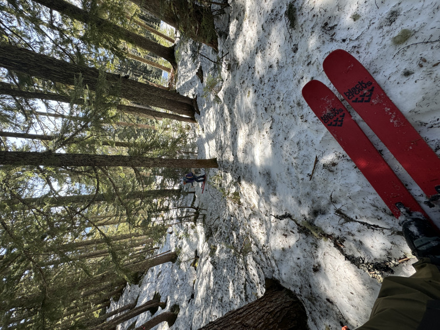
Forest skiing
The route
Nice job and great write up. There is obviously lots more to do besides the big traverse underneath all that overhead danger. I should go out next year a few times and see where I can get on some out and backs. Do you think the ski down towards Cheakamus Lake would be worthwhile very often? I’m a sucker for long descents!
Hi Ava, skiing down all the way to Cheakamus Lake would probably only make sense mid-winter on a massive season. But I did spot some incredible and likely very rarely skied lines off the back of Whirlwind, Angelo and Cheakamus Mountain. There’s definitely some huge descents and lots of adventure to be had in the zone!
Reply to this TR
Please login first:
