Tatoosh Traverse
My wife Madelynn will be working for the next 5 weekends, which we realized late last week, so I got Monday off of work and we made plans to do a two day ski traverse Sunday-Monday.
We got reports that skiing conditions were poor on Saturday, so we settled on the Tatoosh because we had both wanted to spend more time in the range after skiing the Zipper and Fly a year ago. We also figured that it would be a nice area to get out and poke around in, even if the skiing was doo-doo.
We decided to try and generally follow the route outlined in the orange book, with one major exception in that we didn't want to do a car shuttle. We like driving together, and she had to work at 5pm on Monday, so we needed to be quick getting back to Seattle. Our tour plan was to hit the summit of Wapenayo and then somehow make our way back to the Narada Falls lot... we weren't really sure how this would work out because it looked like there were a lot of trees that would surely slow travel.
On Sunday, we got to Longmire around 830am, stole some TP from the bathroom, and picked up blue bags and our permit from the ranger. I guess you're supposed to have a bear canister in the zone we wanted to camp in... the ranger guy let it slide but regardless we were surprised. We have only camped on the glaciers and didn't knew the rules for elsewhere.
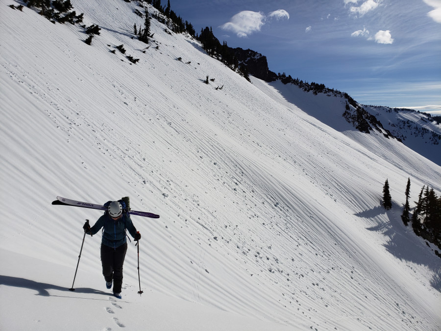
We started skinning the road just before 930am by which time the lot was mostly full with lots of folks gearing up for various activities. As we skinned past Bench Lake towards the obvious gully, we reflected on how much simpler travel in this area was compared to how it had felt this past summer. Particularly, the loose gully was a cruiser booter and much more enjoyable than chossy scrambling. The only major challenge of travel though this zone was a number of avy debris piles still frozen and difficult to skin across.
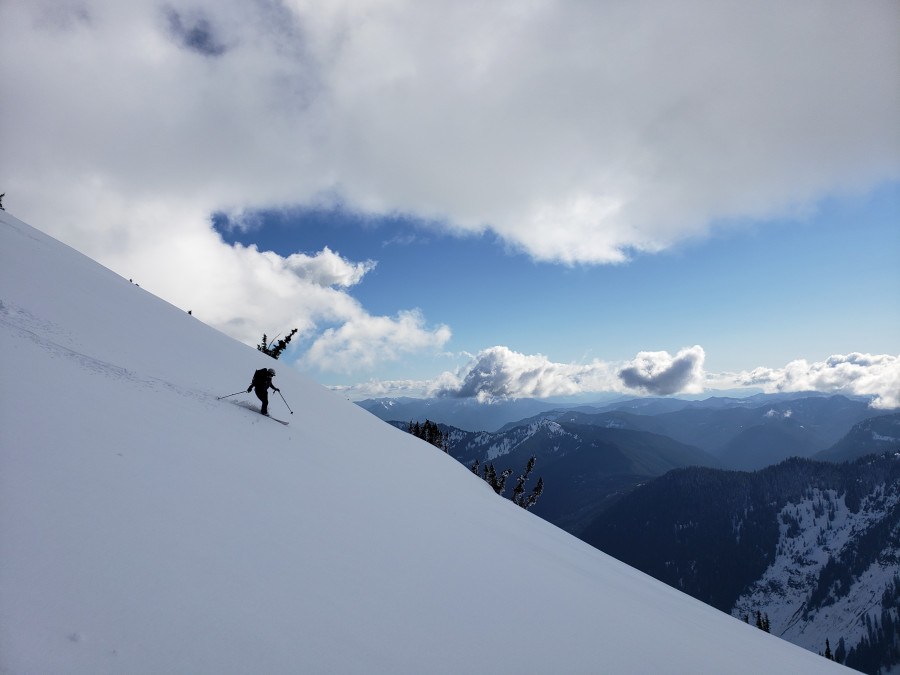
We made a number of other variations to the orange book's route. Generally, the skiing was crap, so we tried to be peakbaggers instead of skiers. We skinned and then booted up the South ridge to tag Foss Peak, before skiing down towards Castle, where we intended to camp. This descent would have been psuedo-corn, but clouds had rolled in so it was partially refrozen. Once on the wide saddle just East of Castle, I took a quick 500' lap off the North side to see how N aspects were skiing. I found settled powder over a stout, uneven crust that I usually bottomed out on each turn. Once back at the saddle, we set up camp and then tried to scramble Castle. I'd say scrambling in ski boots is not our thing and we didn't quite get to the summit.
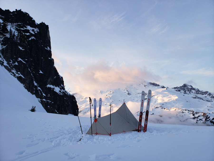
The sunset was the highlight of the trip for both of us. Just incredible. Made all the bad skiing worth it, for sure.
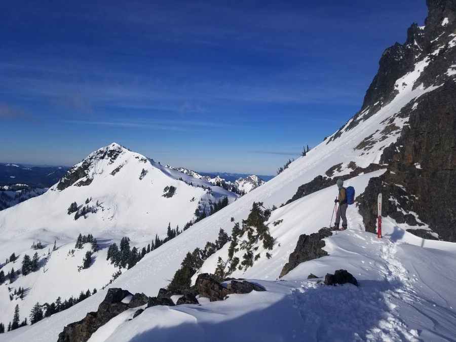
The next morning we woke with the sun, packed camp, and descended North to circle around and ascend back to the Castle-Pinnacle col. From there we skied ice down to a flatish spot where we booted and skinned to the top of Plummer. Descending Plummer, we found like 100 feet of good skiing! After this, we booted the South ridge of Denman and then skied all the way down to the tiny lake at the base of the NE ridge of Wapenayo. The sun was out in full force and the snow was mashed potatoes. At this point, we decided to cut our original plan short due to a number of factors. For one, Madelynn correctly pointed out that if we continued our tour, she would be extremely late to work and that was probably a bad idea.
We skinned back up to the wide saddle between Lane and Denman, expecting a simple ski down the the base of Lane. LOL! After skiing avy debris, we got cliffed out pretty bad following tight trees skiers right. We booted back up and found a nice gully skiers left. Whoops! Now we know for next time.
Crossing the creek was a pain - we followed two old skin tracks that dead-ended, finally finding a dinky log to walk across. We skinned up to the road pretty quick and were back to the car in 30 mins.
17 miles, ~6100'. Honestly I am not sure how this was 6k, it felt like way more!
Booting up the gully out of Bench Lake

M descending Foss

Camp!

Castle-Pinnacle Col

Booting up towards Plummer

Descending the gully next to Lane

Not a proper tour until you scramble some trees

Nice work. Isn't it awesome to have a partner for such tours. Thanks for the great report!
Excellent adventure. Nice to see the pictures!
wats the 'orange book'?
"Backcountry Ski & Snowboard Routes Washington" by Martin Volken
Reply to this TR
Please login first:
