Pinner Couloir, CA
Higley and I made a last minute decision to head south to ski whatever seemed reasonable. We both needed a break from Washington's El Nino winter. I had the week off from my studies in graduate school, and he had never been to the Eastern Sierra. So off we drove with a car full of ski gear. We took two days to drive south, splitting the drive up from Bellingham to Convict Lake with a lap on Worm Flows off of Mt. St Helens. The summit was made in a whiteout, the ski was uneventfully pleasant, and we drove out feeling pleased to stretch the legs.
Higley and I are obsessed with reading forecasts even though we hold every weather model's predictions with a grain of salt. Most of the models were pointing at a high pressure window for the Convict Lake area between Monday and Wednesday, with a second storm coming in hot Thursday morning. In contrast, Washington was due to experience a storm that had a freezing level of ~4000', right after a large storm that was followed by rapid warming. It was a good enough reason as any other to drive South. On the drive down, we decide on two objectives that we have dreamed of skiing for so long and never imagined we would be skiing it together: Pinner and Bloody.
We arrived at the famous hot springs across from Convict Lake just in time for the blizzard to clear up and reveal a waxing moon. These were the first Eastern Sierra hot springs I had ever been to over a decade ago when climbing was my focal point. What a treat to return as such a different person, grown in so many ways.
The next morning at 4 am, I hit the snooze button on the alarm and waited until 5 am to get out of the sleeping bag. The car registered temps of 12 F so we waited for our toes to warm up a bit in the car before heading for the trailhead towards the north end of Convict Lake.
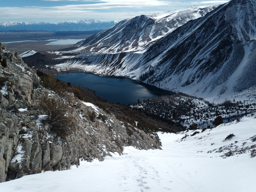
The trail was mostly bare with small patches of firm snow. We walked this rocky but well-maintained trail in ski boots. We did not start skinning until we nearly reached the bottom of the Mendenhall, but the skis were only on our feet for just a minute. The southern aspect of Laurel Mountain's NE ridge was barren with just strips of snow filling half of the gully we needed for the approach. We deliberated (but not for too long) before we silently agreed that it was better to keep going instead of give up. We trudged up a steep rocky sage-covered lateral moraine until we could skin up the gully on snow. After a few switchbacks, the gully became too steep (and too firm) to skin, so we boot packed the last 700' in snow to the ridge. The sun was harsh, but a bitter wind kept us cool. The snow from last night's blizzard was slowly thawing out in the sun. I was surprised to see the storm's graupel snow had maintained its shape, and I felt as if I were walking in a sea of Dip and Dots.
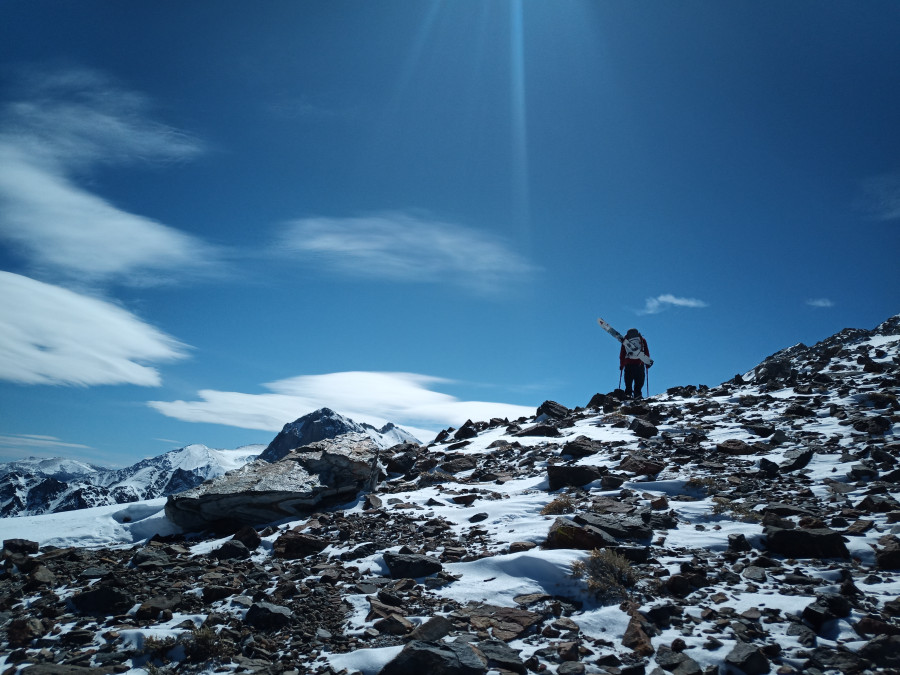
Once we reached the NE ridge, we carefully walked the rocky ridge (it's slate and limestone/marble!) that was covered in a couple inches of fresh snow. We then crossed the east face of Laurel Peak which was a large and loose talus field covered in 2-6 inches of fresh snow. Higley was cognizant to provide words of encouragement as he sensed my waning energy due to elevation, being a sea-level lady of the hills. (Also, I was periodically looking for fossils and any cool meta-sedimentary rocks but all were too large to take with me).
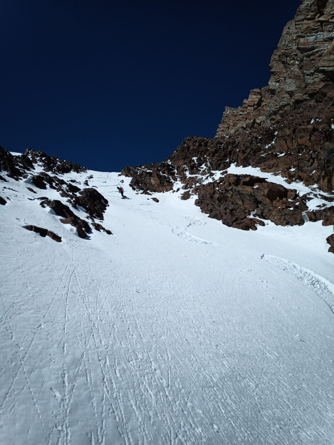
We summited by 12:30 pm and reached the couloir's entrance by 1:07 pm. We had packed a 30 m RAD line with us along with gear for a belayed ski cut, but we were very confident in the stability of the snow given how firm and thin things were. So Higley drops in first to investigate the situation and it's suddenly clear how firm it is beneath a thin cover of cold snow. The entrance is nearly 35-40 degrees and dog legs a bit to the left. A right turn drops over a cliff. Good thing the snow was a bit edge able...
While he's skiing down to the first "safety spot", I notice that there was not much snow on the cliffs overhanging the couloir. The snow had either blown down into the couloir, or melted off in the mid-day sun. This was good news because we were worried about overhead hazards.
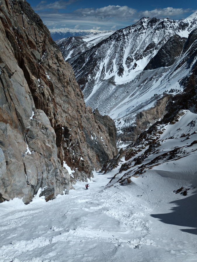
I led the second pitch and, wow that snow was good so I opened it up a little bit. Down the couloir we skied, leading it in long pitches as the walls closed in as narrow as 15 feet wide. The snow was variable but in all the most pleasurable ways, everything from cold snow to a bit of cornish-slush. Before the last pitch into the basin below, the couloir widens up a little bit and I took a long moment to stare straight up the couloir's wall of a nearly vertical bed of limestone. There's a huge fold somewhere near here so it is unclear to me if I am skiing forwards or backwards in geologic time as we are passing rock records- but I appreciate the opportunity to float through time either way. After a long 3500' descent, we hobbled down the rocky summer trail in our ski boots to return to the car feeling really good about the day. Now for a soak in the hot springs...
Gully bootpack

A rocky NE Laurel ridge

A firm and steep entrance

Truly the best line I've ever skied

Best lines ever skied are a thing. Congrats!
I love the geological narration in this TR.
Reply to this TR
Please login first:
