May 1, 2010, University Pass, Eastern Sierra
5/1/10
US elsewhere
1737
4
We spent the morning checking out touring options near Glacier Lodge which is west of the town of Big Pine. Kid Mt. looked brushy down low. I found it unappealing to hike on dirt past the cabins to look up into the Palisades. We then drove to the town of Independence at 3900, and started the long serpentine drive west up the Onion Valley
Road to 9200. We just love to drive to high elevation trailheads in the Eastern Sierra and find snow at the campers doorstep. There were no tracks in Independence Peaks east avalanche gulley which Jill and I skied a few years ago. Jill has been experiencing shooting pain in her right leg, so shes hanging out at the trailhead chatting with the backcountry folks and gathering conditions data.
I started skinning about 2pm, which may seem late, but the aspect and snow conditions were ideal. The approach climbs to a bench up Robinson Creek for 500vf and provides access to the beautiful northeast gulley of University Peak which we skied April 13, 2008 (see TAY TR). I then followed the wide open, lightly treed terrain towards Robinson Lake. After 1000vf the terrain opens to large glacial cirques to the east and a series of steep benches and bowls towards University Pass. The first 800vf was perfect Sierra corn, then around 10,000 the snow with a north aspect was dense powder from the April 29 storm. After 2000vf, I reached my turn around time and enjoyed the upper powder and lower corn. This is a great tour for varying ability groups due to the variety of terrain accessible. There is a beautiful, steep southeast facing couloir that would excite the sporty folks, plus open bowls and rock lined faces. From the trailhead its not possible to see all of the terrain possibilities, but trust me it is a wonderful tour. For folks waiting for the Sierra Corn Harvesting Season, things are starting and the upcoming weather forecast is perfect for corn development. We drove the camper down to 7100 and parked for the night with views of the town of Independence down in the valley, Independence Peak to the southwest, and Kearsarge Peak to the northwest. What a wonderful day. Just wish my ski buddy could have been with me for the tour.
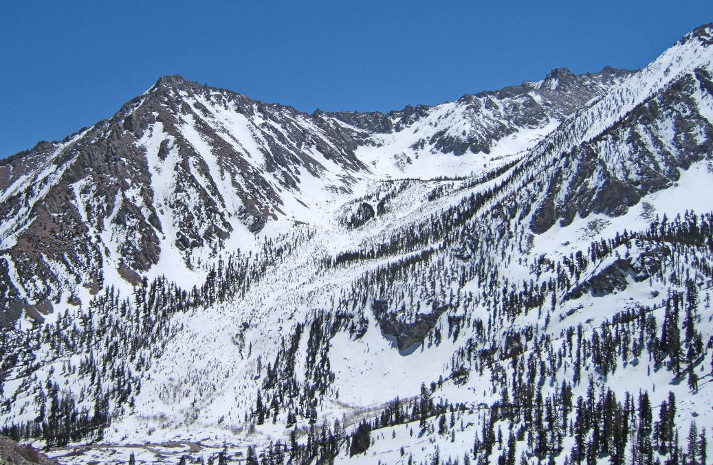
Photo 1: View from Waterfall at Gloden Trout Creek at Eastern Portion of University Pass area
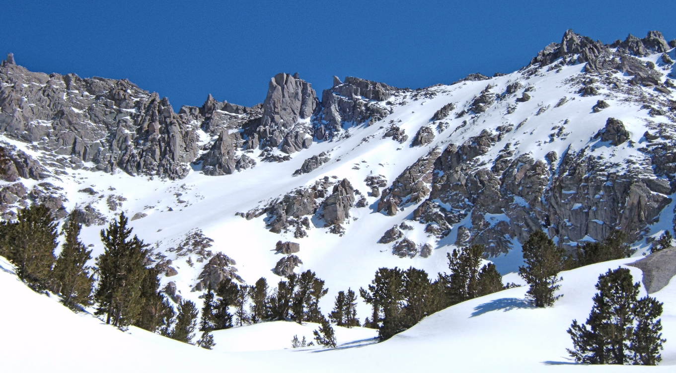
Photo 2: Closeup view of Eastern Portion of University Pass area
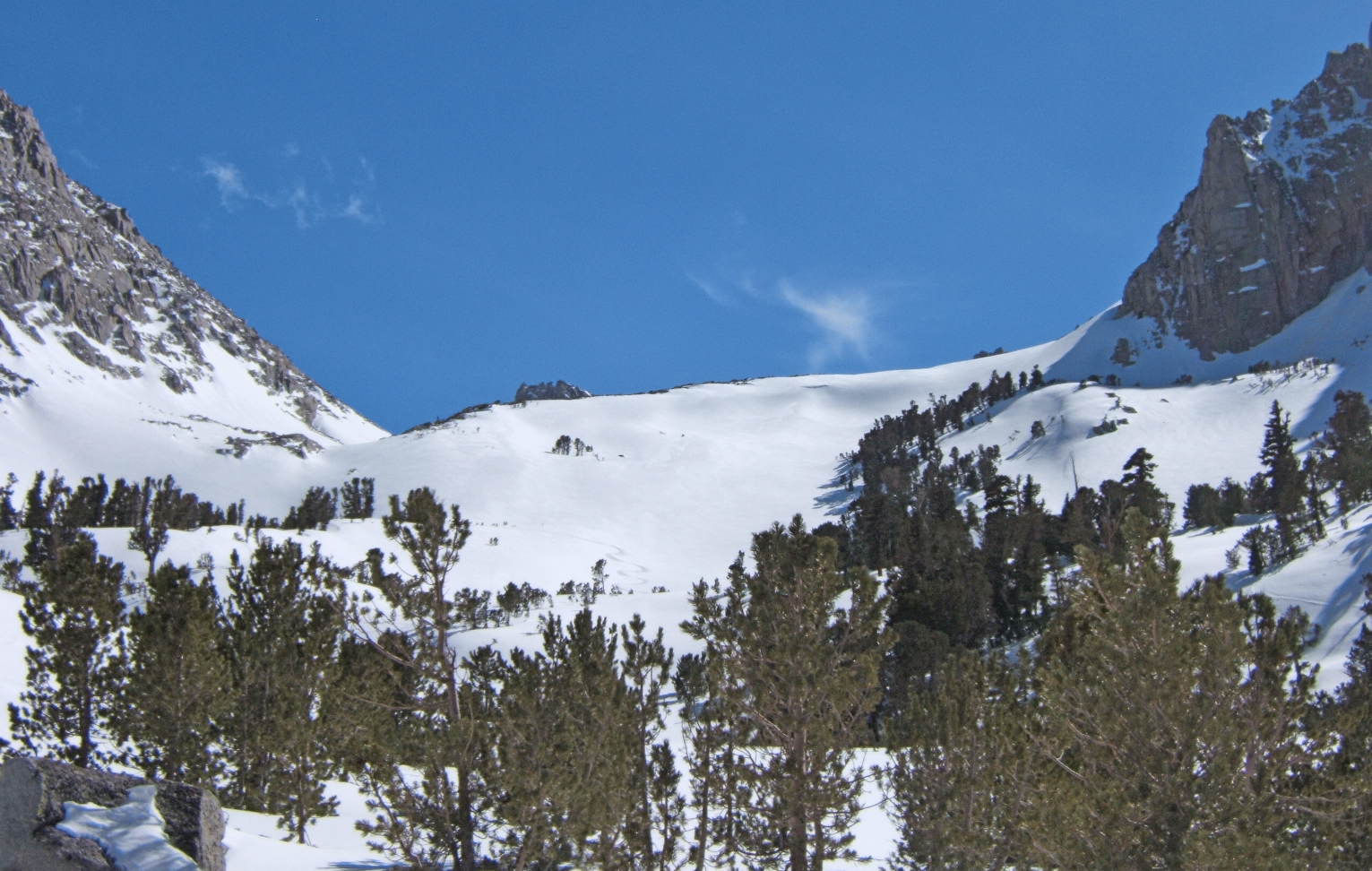
Photo 3: View of Western Portion Of University Pass area
Road to 9200. We just love to drive to high elevation trailheads in the Eastern Sierra and find snow at the campers doorstep. There were no tracks in Independence Peaks east avalanche gulley which Jill and I skied a few years ago. Jill has been experiencing shooting pain in her right leg, so shes hanging out at the trailhead chatting with the backcountry folks and gathering conditions data.
I started skinning about 2pm, which may seem late, but the aspect and snow conditions were ideal. The approach climbs to a bench up Robinson Creek for 500vf and provides access to the beautiful northeast gulley of University Peak which we skied April 13, 2008 (see TAY TR). I then followed the wide open, lightly treed terrain towards Robinson Lake. After 1000vf the terrain opens to large glacial cirques to the east and a series of steep benches and bowls towards University Pass. The first 800vf was perfect Sierra corn, then around 10,000 the snow with a north aspect was dense powder from the April 29 storm. After 2000vf, I reached my turn around time and enjoyed the upper powder and lower corn. This is a great tour for varying ability groups due to the variety of terrain accessible. There is a beautiful, steep southeast facing couloir that would excite the sporty folks, plus open bowls and rock lined faces. From the trailhead its not possible to see all of the terrain possibilities, but trust me it is a wonderful tour. For folks waiting for the Sierra Corn Harvesting Season, things are starting and the upcoming weather forecast is perfect for corn development. We drove the camper down to 7100 and parked for the night with views of the town of Independence down in the valley, Independence Peak to the southwest, and Kearsarge Peak to the northwest. What a wonderful day. Just wish my ski buddy could have been with me for the tour.
Photo 1: View from Waterfall at Gloden Trout Creek at Eastern Portion of University Pass area
Photo 2: Closeup view of Eastern Portion of University Pass area
Photo 3: View of Western Portion Of University Pass area
What amazing terrain.
Hope your ski buddy gets better.
Hope your ski buddy gets better.
Beautiful pictures Zap - did a lot of climbing in that area when I lived in California - brings back some fond memories!
Virginia Lks is "all good" whatever you like. Dunderberg East has seen little traffic the past wk. Mt Olsen (South Pk) is a choice. Black and...well you get the idea. Oh yaa (anytime of day, due to parking at 9,900 ft) - Sierra ski-bum. hope ya heal up ( try, Keough )
author=all mtn link=topic=16564.msg69379#msg69379 date=1273105427]
Virginia Lks is "all good" whatever you like. Dunderberg East has seen little traffic the past wk. Mt Olsen (South Pk) is a choice. Black and...well you get the idea. Oh yaa (anytime of day, due to parking at 9,900 ft) - Sierra ski-bum. hope ya heal up ( try, Keough )
Yes, it is good at Virginia Lakes and we did a little soak at Keough outlet too. ;)
Reply to this TR
Please login first: